Deep Moss

Downs, Moorland in Yorkshire Craven

England

Deep Moss

Knotteranum Gritstone rocks
Knotteranum Credit: Ian Taylor

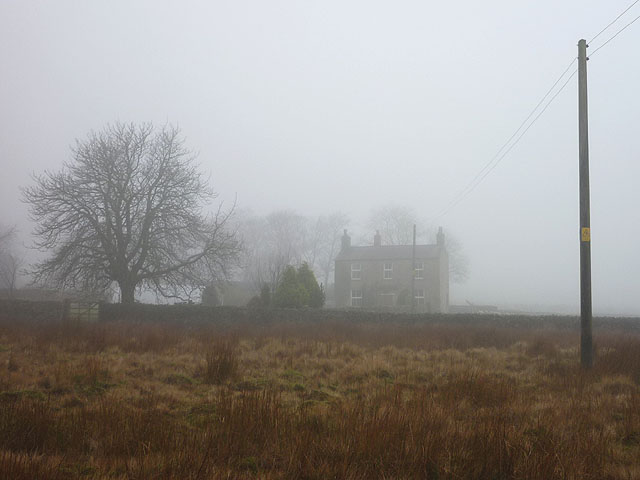
Deep Moss, Yorkshire, is a picturesque region located in the northern part of England, specifically in the county of Yorkshire. It is renowned for its stunning landscape, characterized by rolling hills, vast moorland, and beautiful downs. This area is known for its rich biodiversity and is home to a wide range of plant and animal species.

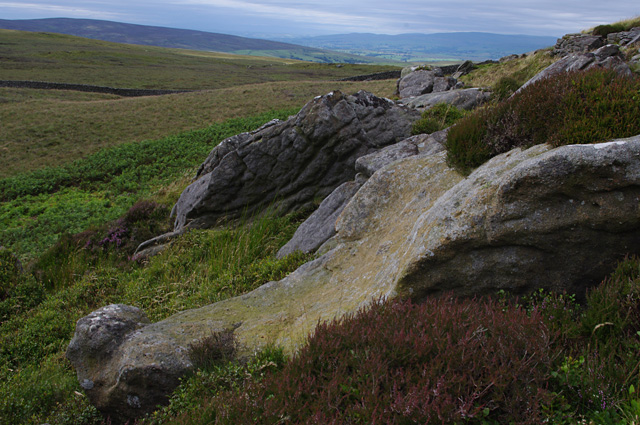
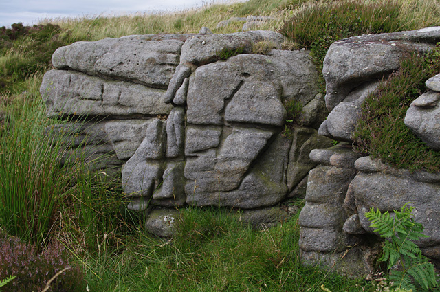
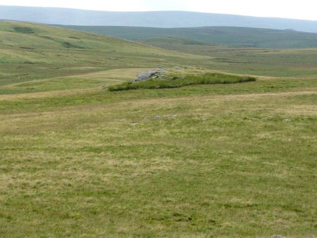
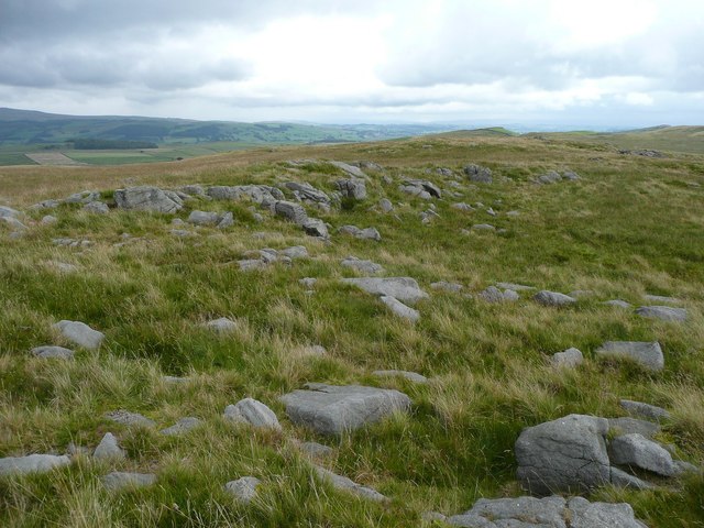
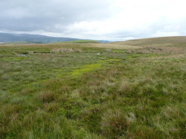
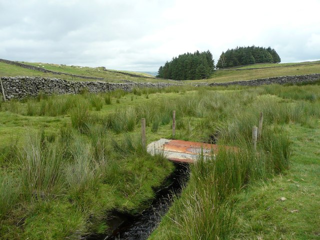
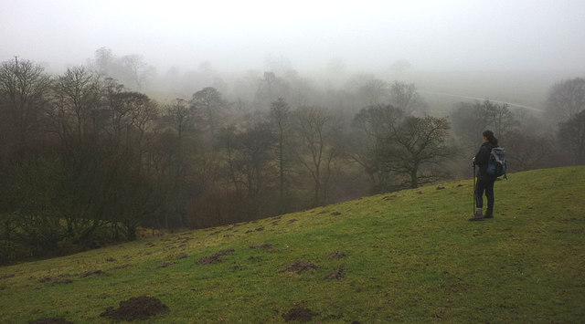
The moorland of Deep Moss is an expansive area covered in heather, cotton grass, and various types of moss. This unique vegetation creates a vibrant, colorful carpet that stretches as far as the eye can see. The moorland is interspersed with patches of deep peat bogs, which provide a habitat for rare and endangered wildlife, including birds such as the curlew and golden plover.

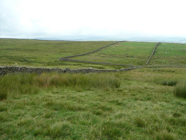
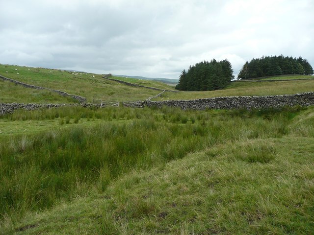
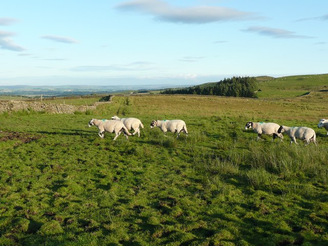
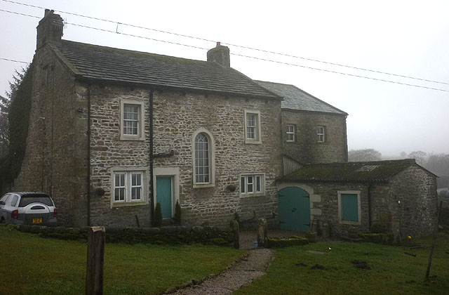
The downs of Deep Moss offer breathtaking views, with their gently sloping hills and lush greenery. These hills are often grazed by sheep, adding to the bucolic charm of the area. The landscape is dotted with quaint villages and farms, adding to the rural character of the region.

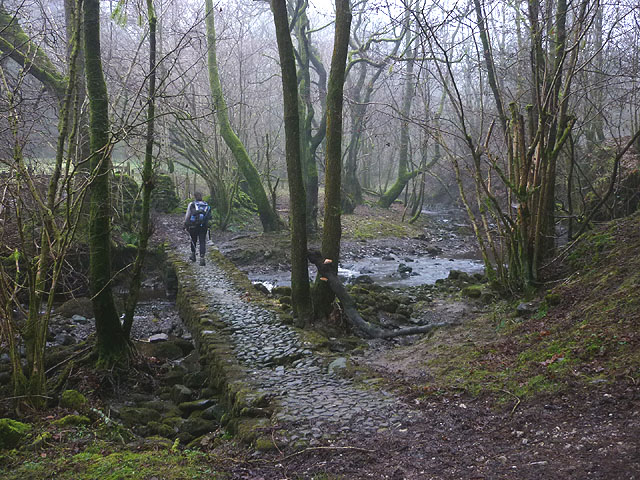
Deep Moss is a popular destination for nature lovers and outdoor enthusiasts. Visitors can enjoy a variety of activities, including hiking, birdwatching, and photography. The region also offers a network of walking trails that allow visitors to explore the stunning scenery and discover hidden gems.

In summary, Deep Moss, Yorkshire, is a captivating region known for its moorland, downs, and natural beauty. With its diverse flora and fauna, it offers a serene and tranquil environment that attracts visitors from near and far.

If you have any feedback on the listing, please let us know in the comments section below.

Deep Moss Images

Images are sourced within 2km of 54.053575/-2.3846765 or Grid Reference SD7462. Thanks to Geograph Open Source API. All images are credited.

Knotteranum Gritstone rocks
Knotteranum
Gritstone rocks
Knotteranum A gritstone outcrop
Knotteranum
A gritstone outcrop
Foxholes Crag As seen, with zoom, from Big Hill.
Foxholes Crag
As seen, with zoom, from Big Hill.
Summit of Big Hill A scatter of rocks, one of which is the summit, 317m.
Summit of Big Hill
A scatter of rocks, one of which is the summit, 317m.
Shallow valley at the foot of Big Hill So shallow that it does not show up in the contours on the OS map, but very wet all the same. If you want to keep your feet dry, wear willies, otherwise I would suggest pumps without socks in warm weather.
Shallow valley at the foot of Big Hill
So shallow that it does not show up in the contours on the OS map, but very wet all the same. If you want to keep your feet dry, wear willies, otherwise I would suggest pumps without socks in warm weather.
Footbridge over Sandford Beck Made from steel plates.
Footbridge over Sandford Beck
Made from steel plates.
Approaching Sandford Beck from Big Hill The foreground and the area to the left are access land, but the fields straight ahead are not. There isn’t a stile in the wall on the left, but there is a place where stones stick out a little on both sides so that the wall can be climbed.
Approaching Sandford Beck from Big Hill
The foreground and the area to the left are access land, but the fields straight ahead are not. There isn’t a stile in the wall on the left, but there is a place where stones stick out a little on both sides so that the wall can be climbed.
The valley of Sandford Beck A typical broad expanse of rushes, amongst which the beck runs. Fortunately there is a footbridge a little way upstream: <a href="https://www.geograph.org.uk/photo/3080942">SD7662 : Footbridge over Sandford Beck</a>.
The valley of Sandford Beck
A typical broad expanse of rushes, amongst which the beck runs. Fortunately there is a footbridge a little way upstream: SD7662 : Footbridge over Sandford Beck.
Track across field This starts off as an enclosed lane at Sandford Farm
Track across field
This starts off as an enclosed lane at Sandford Farm
Knotteranum From the wall on Green Knotts. 
The sheep didn't hang around when I climbed over the wall.
Knotteranum
From the wall on Green Knotts. The sheep didn't hang around when I climbed over the wall.
Gritstone rocks, Knotteranum
Stone wall, Knotteranum The wall takes advantage of the natural boulder. 
Ingleborough is in the distance on the right.
Stone wall, Knotteranum
The wall takes advantage of the natural boulder. Ingleborough is in the distance on the right.
Cobbled footbridge over Kettles Beck On the footpath between High and East Kettlesbeck. There is a standard council wooden footbridge immediately downstream - this bridge would appear to be used to allow the owners' horses to cross to and from the field beyond.
Cobbled footbridge over Kettles Beck
On the footpath between High and East Kettlesbeck. There is a standard council wooden footbridge immediately downstream - this bridge would appear to be used to allow the owners' horses to cross to and from the field beyond.
Mist in the valley of Kettles Beck A brief clearing in the general fog.
Mist in the valley of Kettles Beck
A brief clearing in the general fog.
Israel Farm Apparently, the odd name is a corruption of 'Jeerawhill' (in 1707 it was referred to as Joe Raw Hill). It is Grade II listed <span class="nowrap"><a title="http://www.britishlistedbuildings.co.uk/en-324189-israel-farmhouse-lawkland-north-yorkshir" rel="nofollow ugc noopener" href="http://www.britishlistedbuildings.co.uk/en-324189-israel-farmhouse-lawkland-north-yorkshir">Link</a><img style="margin-left:2px;" alt="External link" title="External link - shift click to open in new window" src="https://s1.geograph.org.uk/img/external.png" width="10" height="10"/></span>
Israel Farm
Apparently, the odd name is a corruption of 'Jeerawhill' (in 1707 it was referred to as Joe Raw Hill). It is Grade II listed LinkExternal link
Rough moorland at Chapman Bank A wedge of uncultivated moorland extends north between the farms and pastureland of Chapman Bank (seen through the mist) and Ravenshaw. It is CRoW access land.
Rough moorland at Chapman Bank
A wedge of uncultivated moorland extends north between the farms and pastureland of Chapman Bank (seen through the mist) and Ravenshaw. It is CRoW access land.
Wide Grass Track leading onto Giggleswick Common Almost a long thin enclosure, rather than a track, leading onto the moorland of Giggleswick Common
Wide Grass Track leading onto Giggleswick Common
Almost a long thin enclosure, rather than a track, leading onto the moorland of Giggleswick Common
Part of Abandoned Enclosure on Water Garth Part of a circular dry stone wall enclosure slowly falling into disrepair.
Part of Abandoned Enclosure on Water Garth
Part of a circular dry stone wall enclosure slowly falling into disrepair.
Show me another place!

Deep Moss is located at Grid Ref: SD7462 (Lat: 54.053575, Lng: -2.3846765)

Division: West Riding

Administrative County: North Yorkshire

District: Craven

Police Authority: North Yorkshire

What 3 Words

///cried.passports.utensil. Near Settle, North Yorkshire

Related Wikis

Eldroth

Eldroth is a village in North Yorkshire, England. It is in the civil parish of Lawkland, part of the former Craven District, some 3.25 miles (5.23 km)...

Lawkland

Lawkland is a civil parish in North Yorkshire, England, near the A65 and 4 miles (6.4 km) west of Settle. It lies within the Forest of Bowland Area of...

Keasden

Keasden is a hamlet in the civil parish of Clapham-cum-Newby, in the Craven district of the county of North Yorkshire, in the north-western England. It...

Giggleswick railway station

Giggleswick is a railway station on the Bentham Line, which runs between Leeds and Morecambe via Skipton. The station, situated 41+1⁄4 miles (66 km) north...

Nearby Amenities

Located within 500m of 54.053575,-2.3846765
Ingleby House
Historic: ruins
Image: https://www.geograph.org.uk/photo/140658
Lat/Long: 54.054544/-2.3880164
The data included in this document is from www.openstreetmap.org. The data is made available under ODbL.

Have you been to Deep Moss?

Leave your review of Deep Moss below (or comments, questions and feedback).