Leigh Common

Downs, Moorland in Somerset South Somerset

England

Leigh Common

Old Milestone by road, Leigh Common; 20m East entrance Leigh Farm The Milestone is located in tarmac in front of disused building on verge on the North of the road.  Parish of Pen Selwood (South Somerset District). Metal plate attached to stone post, Wincanton iron plate design, erected by the Wincanton turnpike trust in the 19th Century, 12cm stump only. An earlier photograph can be found here: <a title="https://www.geograph.org.uk/photo/6102803" href="https://www.geograph.org.uk/photo/6102803">Link</a> 

Inscription reads:-   
(Wincanton / 2 / Hindon / 12 /) 

Milestone Society National ID: SO_WCHD02
Old Milestone by road, Leigh Common; 20m East entrance Leigh Farm Credit: Janet Dowding

Leigh Common is a picturesque natural area located in Somerset, England. Covering an area of approximately 150 acres, it is characterized by its diverse landscape, encompassing downs and moorland.

The downs of Leigh Common are rolling hills covered in lush green grass and scattered with wildflowers. These hills provide breathtaking views of the surrounding countryside, making it a popular spot for outdoor activities such as hiking and picnicking. The downs are also home to a variety of wildlife, including rabbits, deer, and various bird species.

In contrast to the downs, the moorland of Leigh Common is a unique and captivating sight. It consists of open expanses of heather and gorse, interspersed with small pools of water and patches of dense vegetation. This moorland habitat supports a diverse range of flora and fauna, including rare species such as the Exmoor pony and heath fritillary butterfly.

Leigh Common is also known for its archaeological significance. The area has been inhabited since prehistoric times, and evidence of ancient settlements, burial mounds, and stone circles can still be found here. These archaeological sites are a testament to the rich history of the area and provide insights into the lives of the people who lived here thousands of years ago.

Overall, Leigh Common is a stunning natural area that offers visitors the opportunity to immerse themselves in the beauty of the Somerset countryside. With its diverse landscape, abundant wildlife, and fascinating history, it is a must-visit destination for nature enthusiasts and history buffs alike.

If you have any feedback on the listing, please let us know in the comments section below.
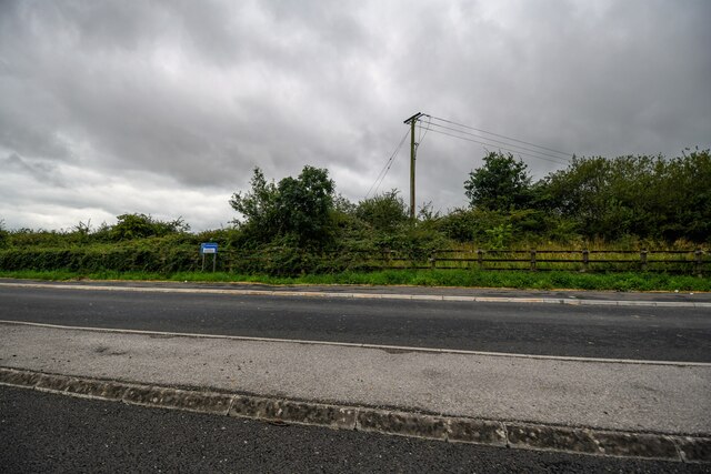
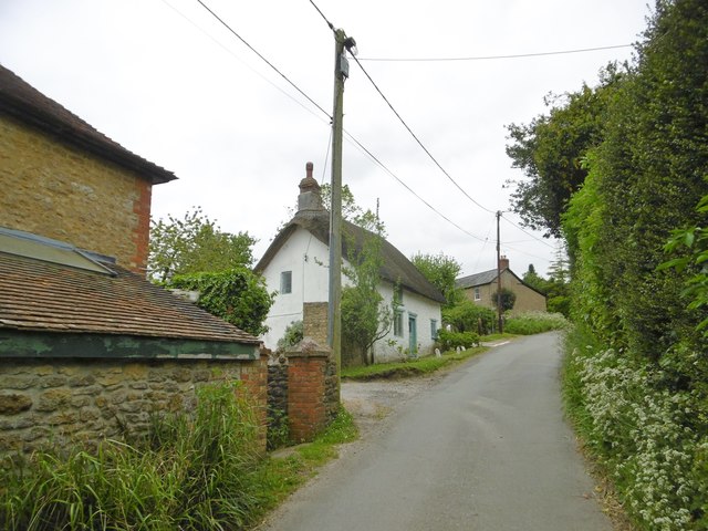
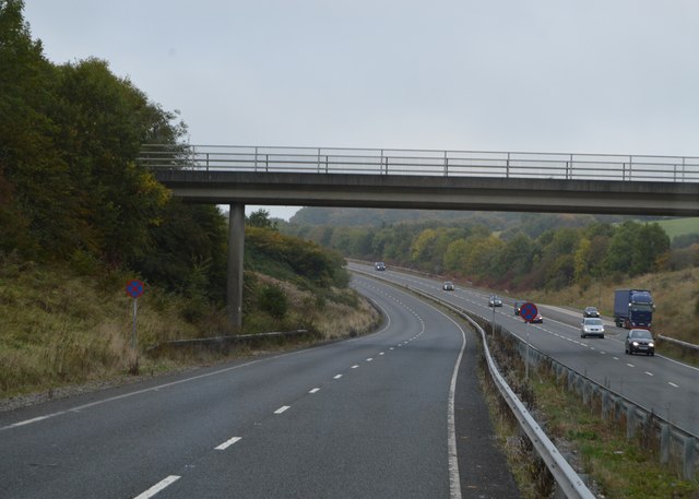
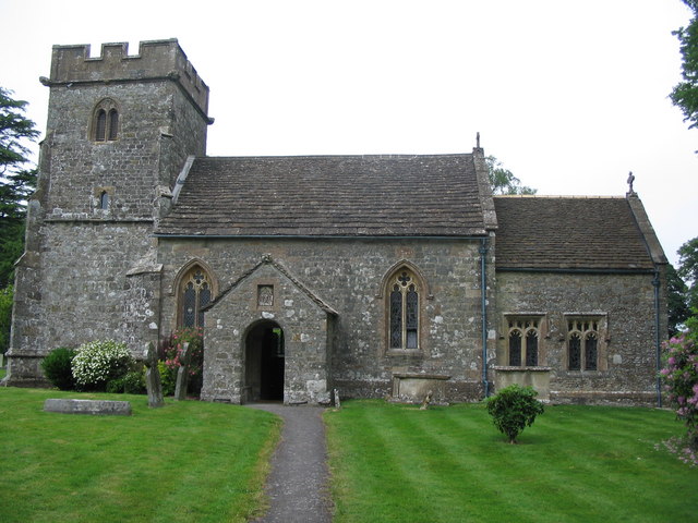
Leigh Common Images

Images are sourced within 2km of 51.066631/-2.3616111 or Grid Reference ST7429. Thanks to Geograph Open Source API. All images are credited.

Old Milestone by road, Leigh Common; 20m East entrance Leigh Farm The Milestone is located in tarmac in front of disused building on verge on the North of the road.  Parish of Pen Selwood (South Somerset District). Metal plate attached to stone post, Wincanton iron plate design, erected by the Wincanton turnpike trust in the 19th Century, 12cm stump only. An earlier photograph can be found here: <a title="https://www.geograph.org.uk/photo/6102803" href="https://www.geograph.org.uk/photo/6102803">Link</a> 

Inscription reads:-   
(Wincanton / 2 / Hindon / 12 /) 

Milestone Society National ID: SO_WCHD02
Old Milestone by road, Leigh Common; 20m East entrance Leigh Farm
The Milestone is located in tarmac in front of disused building on verge on the North of the road.  Parish of Pen Selwood (South Somerset District). Metal plate attached to stone post, Wincanton iron plate design, erected by the Wincanton turnpike trust in the 19th Century, 12cm stump only. An earlier photograph can be found here: Link  Inscription reads:- (Wincanton / 2 / Hindon / 12 /) Milestone Society National ID: SO_WCHD02
Bourton : A303 Looking along the A303.
Bourton : A303
Looking along the A303.
Bourton : A303 Looking along the A303.
Bourton : A303
Looking along the A303.
Bourton : A303 Layby A layby alongside the A303.
Bourton : A303 Layby
A layby alongside the A303.
A303, eastbound The A303 is a main trunk road running 92 miles between Basingstoke and Honiton. Along with the A30 and M3 it forms a major route between London and the South West. Much of the road is dual carriageway, but some stretches remain single and prone to congestion.

Wikipedia: <span class="nowrap"><a title="http://en.wikipedia.org/wiki/A303_road" rel="nofollow ugc noopener" href="http://en.wikipedia.org/wiki/A303_road">Link</a><img style="margin-left:2px;" alt="External link" title="External link - shift click to open in new window" src="https://s1.geograph.org.uk/img/external.png" width="10" height="10"/></span>
A303, eastbound
The A303 is a main trunk road running 92 miles between Basingstoke and Honiton. Along with the A30 and M3 it forms a major route between London and the South West. Much of the road is dual carriageway, but some stretches remain single and prone to congestion. Wikipedia: LinkExternal link
Stoke Trister, Church Farm On Bayford Lane, near St. Andrew's.
Stoke Trister, Church Farm
On Bayford Lane, near St. Andrew's.
Stoke Trister, St. Andrew's Parish church on Bayford Lane, built 1841 and listed by Historic England (Grade II): <span class="nowrap"><a title="http://www.imagesofengland.org.uk/Details/Default.aspx?id=415943&mode=adv" rel="nofollow ugc noopener" href="http://www.imagesofengland.org.uk/Details/Default.aspx?id=415943&mode=adv">Link</a><img style="margin-left:2px;" alt="External link" title="External link - shift click to open in new window" src="https://s1.geograph.org.uk/img/external.png" width="10" height="10"/></span>
Stoke Trister, St. Andrew's
Parish church on Bayford Lane, built 1841 and listed by Historic England (Grade II): LinkExternal link
Stoke Trister, Courtfield C18 cottage on Bayford Lane; listed by Historic England: <span class="nowrap"><a title="http://www.imagesofengland.org.uk/Details/Default.aspx?id=415945&mode=adv" rel="nofollow ugc noopener" href="http://www.imagesofengland.org.uk/Details/Default.aspx?id=415945&mode=adv">Link</a><img style="margin-left:2px;" alt="External link" title="External link - shift click to open in new window" src="https://s1.geograph.org.uk/img/external.png" width="10" height="10"/></span>
Stoke Trister, Courtfield
C18 cottage on Bayford Lane; listed by Historic England: LinkExternal link
Stoke Trister, Wayside Thatch C18 thatched cottage on Bayford Lane; listed by Historic England (Grade II): <span class="nowrap"><a title="http://www.imagesofengland.org.uk/Details/Default.aspx?id=415946&mode=adv" rel="nofollow ugc noopener" href="http://www.imagesofengland.org.uk/Details/Default.aspx?id=415946&mode=adv">Link</a><img style="margin-left:2px;" alt="External link" title="External link - shift click to open in new window" src="https://s1.geograph.org.uk/img/external.png" width="10" height="10"/></span>
Stoke Trister, Wayside Thatch
C18 thatched cottage on Bayford Lane; listed by Historic England (Grade II): LinkExternal link
Footbridge, A303 The A303 is a main trunk road running 92 miles between Basingstoke and Honiton. Along with the A30 and M3 it forms a major route between London and the South West. Much of the road is dual carriageway, but some stretches remain single and prone to congestion.

Wikipedia: <span class="nowrap"><a title="http://en.wikipedia.org/wiki/A303_road" rel="nofollow ugc noopener" href="http://en.wikipedia.org/wiki/A303_road">Link</a><img style="margin-left:2px;" alt="External link" title="External link - shift click to open in new window" src="https://s1.geograph.org.uk/img/external.png" width="10" height="10"/></span>
Footbridge, A303
The A303 is a main trunk road running 92 miles between Basingstoke and Honiton. Along with the A30 and M3 it forms a major route between London and the South West. Much of the road is dual carriageway, but some stretches remain single and prone to congestion. Wikipedia: LinkExternal link
Entering Somerset, A303 The A303 is a main trunk road running 92 miles between Basingstoke and Honiton. Along with the A30 and M3 it forms a major route between London and the South West. Much of the road is dual carriageway, but some stretches remain single and prone to congestion.

Wikipedia: <span class="nowrap"><a title="http://en.wikipedia.org/wiki/A303_road" rel="nofollow ugc noopener" href="http://en.wikipedia.org/wiki/A303_road">Link</a><img style="margin-left:2px;" alt="External link" title="External link - shift click to open in new window" src="https://s1.geograph.org.uk/img/external.png" width="10" height="10"/></span>
Entering Somerset, A303
The A303 is a main trunk road running 92 miles between Basingstoke and Honiton. Along with the A30 and M3 it forms a major route between London and the South West. Much of the road is dual carriageway, but some stretches remain single and prone to congestion. Wikipedia: LinkExternal link
B3081 off the A303 The A303 is a main trunk road running 92 miles between Basingstoke and Honiton. Along with the A30 and M3 it forms a major route between London and the South West. Much of the road is dual carriageway, but some stretches remain single and prone to congestion.

Wikipedia: <span class="nowrap"><a title="http://en.wikipedia.org/wiki/A303_road" rel="nofollow ugc noopener" href="http://en.wikipedia.org/wiki/A303_road">Link</a><img style="margin-left:2px;" alt="External link" title="External link - shift click to open in new window" src="https://s1.geograph.org.uk/img/external.png" width="10" height="10"/></span>
B3081 off the A303
The A303 is a main trunk road running 92 miles between Basingstoke and Honiton. Along with the A30 and M3 it forms a major route between London and the South West. Much of the road is dual carriageway, but some stretches remain single and prone to congestion. Wikipedia: LinkExternal link
A303, Leigh Common The A303 is a main trunk road running 92 miles between Basingstoke and Honiton. Along with the A30 and M3 it forms a major route between London and the South West. Much of the road is dual carriageway, but some stretches remain single and prone to congestion.

Wikipedia: <span class="nowrap"><a title="http://en.wikipedia.org/wiki/A303_road" rel="nofollow ugc noopener" href="http://en.wikipedia.org/wiki/A303_road">Link</a><img style="margin-left:2px;" alt="External link" title="External link - shift click to open in new window" src="https://s1.geograph.org.uk/img/external.png" width="10" height="10"/></span>
A303, Leigh Common
The A303 is a main trunk road running 92 miles between Basingstoke and Honiton. Along with the A30 and M3 it forms a major route between London and the South West. Much of the road is dual carriageway, but some stretches remain single and prone to congestion. Wikipedia: LinkExternal link
Layby, A303 The A303 is a main trunk road running 92 miles between Basingstoke and Honiton. Along with the A30 and M3 it forms a major route between London and the South West. Much of the road is dual carriageway, but some stretches remain single and prone to congestion.

Wikipedia: <span class="nowrap"><a title="http://en.wikipedia.org/wiki/A303_road" rel="nofollow ugc noopener" href="http://en.wikipedia.org/wiki/A303_road">Link</a><img style="margin-left:2px;" alt="External link" title="External link - shift click to open in new window" src="https://s1.geograph.org.uk/img/external.png" width="10" height="10"/></span>
Layby, A303
The A303 is a main trunk road running 92 miles between Basingstoke and Honiton. Along with the A30 and M3 it forms a major route between London and the South West. Much of the road is dual carriageway, but some stretches remain single and prone to congestion. Wikipedia: LinkExternal link
A303, westbound The A303 is a main trunk road running 92 miles between Basingstoke and Honiton. Along with the A30 and M3 it forms a major route between London and the South West. Much of the road is dual carriageway, but some stretches remain single and prone to congestion.

Wikipedia: <span class="nowrap"><a title="http://en.wikipedia.org/wiki/A303_road" rel="nofollow ugc noopener" href="http://en.wikipedia.org/wiki/A303_road">Link</a><img style="margin-left:2px;" alt="External link" title="External link - shift click to open in new window" src="https://s1.geograph.org.uk/img/external.png" width="10" height="10"/></span>
A303, westbound
The A303 is a main trunk road running 92 miles between Basingstoke and Honiton. Along with the A30 and M3 it forms a major route between London and the South West. Much of the road is dual carriageway, but some stretches remain single and prone to congestion. Wikipedia: LinkExternal link
A wet entry to Wiltshire, A303 The A303 is a main trunk road running 92 miles between Basingstoke and Honiton. Along with the A30 and M3 it forms a major route between London and the South West. Much of the road is dual carriageway, but some stretches remain single and prone to congestion.

Wikipedia: <span class="nowrap"><a title="http://en.wikipedia.org/wiki/A303_road" rel="nofollow ugc noopener" href="http://en.wikipedia.org/wiki/A303_road">Link</a><img style="margin-left:2px;" alt="External link" title="External link - shift click to open in new window" src="https://s1.geograph.org.uk/img/external.png" width="10" height="10"/></span>
A wet entry to Wiltshire, A303
The A303 is a main trunk road running 92 miles between Basingstoke and Honiton. Along with the A30 and M3 it forms a major route between London and the South West. Much of the road is dual carriageway, but some stretches remain single and prone to congestion. Wikipedia: LinkExternal link
Old Milestone by the B3081, west of West Bourton Carved stone post by the B3081, plate missing, in parish of BOURTON (NORTH DORSET District), between Tinkers Lane and road to West Bourton, by the road, on South side of road. Dorset 1 (limestone), erected by the Shaftesbury & New Road to Blandford turnpike trust in the 19th century. 

Inscription once read:-
: (BOURTON) : : (Wincanton 3½) : : (Shaftesbury 8) : : (BOURTON) : 
Carved benchmark at bottom of front face.

Milestone Society National ID: DO_SHWC08.
Old Milestone by the B3081, west of West Bourton
Carved stone post by the B3081, plate missing, in parish of BOURTON (NORTH DORSET District), between Tinkers Lane and road to West Bourton, by the road, on South side of road. Dorset 1 (limestone), erected by the Shaftesbury & New Road to Blandford turnpike trust in the 19th century. Inscription once read:- : (BOURTON) : : (Wincanton 3½) : : (Shaftesbury 8) : : (BOURTON) : Carved benchmark at bottom of front face. Milestone Society National ID: DO_SHWC08.
B3081 heading north-west Towards the A303 and some way beyond, Bruton.
B3081 heading north-west
Towards the A303 and some way beyond, Bruton.
Show me another place!

Leigh Common is located at Grid Ref: ST7429 (Lat: 51.066631, Lng: -2.3616111)

Administrative County: Somerset

District: South Somerset

Police Authority: Avon and Somerset

What 3 Words

///glades.conforms.avid. Near Bourton, Dorset

Related Wikis

Ballands Castle

Ballands Castle was a castle near the village of Penselwood, Somerset, England. == History == Balland Castle was a motte and bailey castle, probably built...

Stoke Trister

Stoke Trister is a village and civil parish 2 miles (3 km) south-east of Wincanton and 5 miles (8 km) north-west of Gillingham close to the Dorset border...

Church of St Michael and All Angels, Penselwood

The Anglican Church of St Michael and All Angels in Penselwood, Somerset, England was built in the 15th century. It is a Grade II* listed building. �...

Penselwood

Penselwood is a village and civil parish in the English county of Somerset. It is located 4 miles (6.4 km) north east of Wincanton, 4 miles (6.4 km) south...

Church of St Lawrence, Cucklington

The Anglican Church of St Lawrence in Cucklington, Somerset, England, was built in the 13th century. It is a Grade II* listed building. == History == The...

Bourton, Dorset

Bourton is a village and civil parish in north Dorset, England, situated north of the A303 road on the border with Somerset and Wiltshire between Mere...

Cucklington

Cucklington is a village and parish in Somerset, England, situated on a hill 3 miles (4.8 km) south east of Wincanton and 4 miles (6.4 km) north west of...

Cockroad Wood Castle

Cockroad Wood Castle was a castle near Wincanton but now in the parish of Charlton Musgrove, Somerset, England. == History == Cockroad Wood Castle was...

Nearby Amenities

Located within 500m of 51.066631,-2.3616111
Power: pole
Lat/Long: 51.0672491/-2.3565079
Power: pole
Lat/Long: 51.0667712/-2.3573666
Power: pole
Lat/Long: 51.0657102/-2.3592187
Power: pole
Lat/Long: 51.064688/-2.3609944
Power: pole
Lat/Long: 51.0639197/-2.3623371
Power: pole
Lat/Long: 51.0628357/-2.3642256
Give Way
Lat/Long: 51.0686735/-2.3552957
Give Way
Lat/Long: 51.0684004/-2.3571572
Give Way
Lat/Long: 51.0687443/-2.3562586
Give Way
Lat/Long: 51.0673263/-2.3686277
Barrier: stile
Lat/Long: 51.0667379/-2.3597561
Barrier: stile
Lat/Long: 51.0667795/-2.3598329
The data included in this document is from www.openstreetmap.org. The data is made available under ODbL.

Have you been to Leigh Common?

Leave your review of Leigh Common below (or comments, questions and feedback).