Hurnel Moss

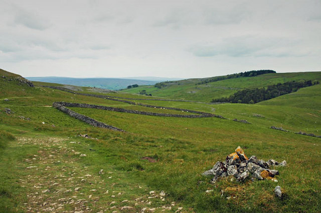
Downs, Moorland in Yorkshire Craven

England

Hurnel Moss

Flooded shake hole on Ingleborough South of the summit plateau, on the Little Ingleborough spur.
Flooded shake hole on Ingleborough Credit: Ian Taylor

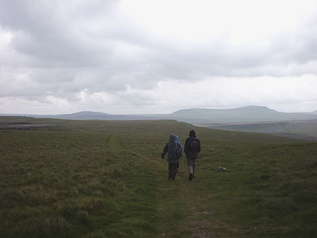
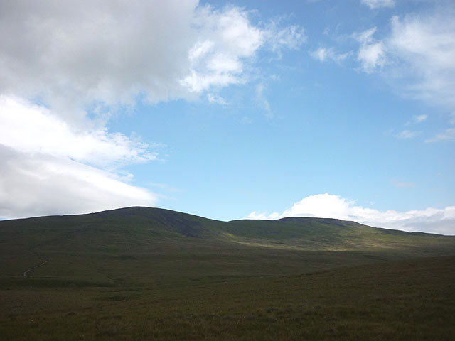
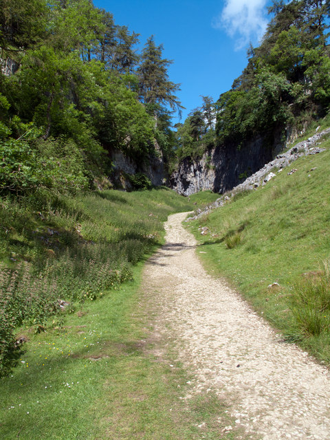
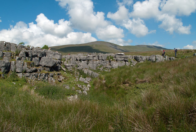
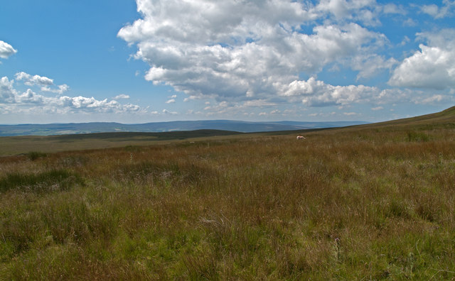
Hurnel Moss is a picturesque area located in the county of Yorkshire, England. Nestled amidst the rolling hills of the Yorkshire Downs and sprawling moorland, this idyllic landscape offers breathtaking views and a tranquil atmosphere.

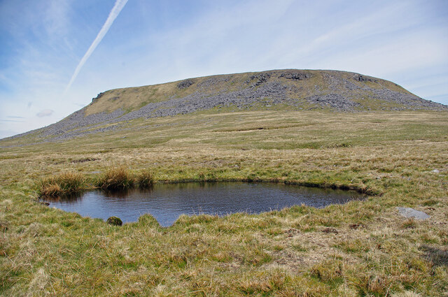
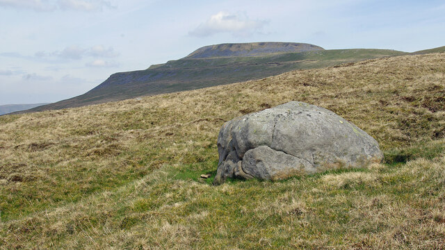
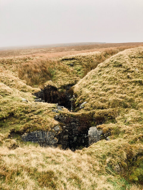
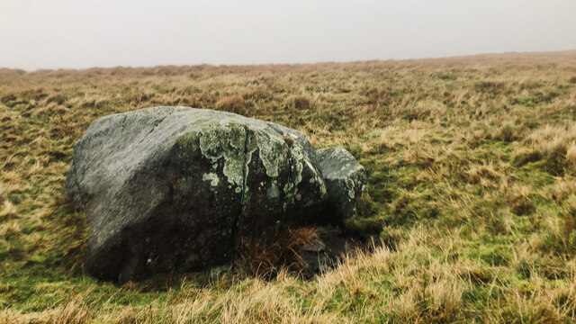
The region is characterized by its extensive mossy terrain, which is covered in a thick carpet of vibrant green mosses, heather, and grasses. These mosses, along with the unique ecosystem they support, contribute to the area's distinct charm and ecological importance.

Hurnel Moss is a haven for nature enthusiasts and wildlife lovers. The moorland is home to a variety of bird species, including curlews, lapwings, and golden plovers, which can often be seen soaring through the skies or nesting in the surrounding vegetation. Other creatures that inhabit the area include hares, voles, and various species of insects.

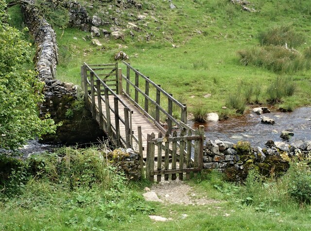
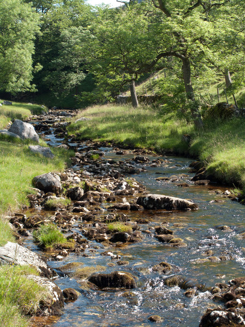
The landscape of Hurnel Moss is further enhanced by the presence of several picturesque streams and small rivers that meander through the area, providing a serene backdrop for visitors. The clear, babbling waters attract a range of aquatic life, such as trout and other fish species, making it a popular spot for fishing enthusiasts.

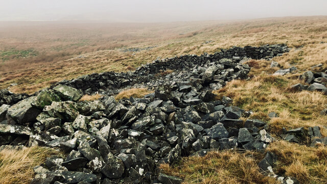
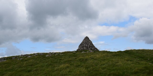
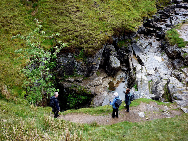
In addition to its natural beauty, Hurnel Moss also boasts historical significance. The area is dotted with ancient burial mounds, stone circles, and remnants of old settlements, offering a glimpse into the region's rich and intriguing past.

Overall, Hurnel Moss is a place of incredible natural beauty, teeming with diverse wildlife and steeped in history. Whether it's exploring the mossy terrain, observing the abundant birdlife, or simply enjoying the tranquility of the surroundings, this Yorkshire gem offers an unforgettable experience for visitors.

If you have any feedback on the listing, please let us know in the comments section below.

Hurnel Moss Images

Images are sourced within 2km of 54.14646/-2.3879258 or Grid Reference SD7472. Thanks to Geograph Open Source API. All images are credited.

Flooded shake hole on Ingleborough South of the summit plateau, on the Little Ingleborough spur.
Flooded shake hole on Ingleborough
South of the summit plateau, on the Little Ingleborough spur.
Cloven Stone, Ingleborough Common Ingleborough is in the background. See <a href="https://www.geograph.org.uk/photo/2509839">SD7373 : Cloven Stone</a> & <a href="https://www.geograph.org.uk/photo/157297">SD7373 : Boulder on Ingleborough Common</a> for other views.
Cloven Stone, Ingleborough Common
Ingleborough is in the background. See SD7373 : Cloven Stone & SD7373 : Boulder on Ingleborough Common for other views.
The Grotto, Clapdale Drive The Grotto is a late-nineteenth century folly commissioned by the Farrer family as a place to sit and enjoy the views of Thwaite Scars. It was constructed of large pieces of limestone set back against the steep hillside.

Although it has become rather dilapidated, it is still a useful place to shelter when caught out by the weather.
The Grotto, Clapdale Drive
The Grotto is a late-nineteenth century folly commissioned by the Farrer family as a place to sit and enjoy the views of Thwaite Scars. It was constructed of large pieces of limestone set back against the steep hillside. Although it has become rather dilapidated, it is still a useful place to shelter when caught out by the weather.
Ingleborough Estate Trail, Clapdale Drive Clapdale Drive is a wide track that passes along the western side of the lake and above Clapham Beck as it climbs from Clapham village, through Clapdale Wood towards Ingleborough Cave.
Ingleborough Estate Trail, Clapdale Drive
Clapdale Drive is a wide track that passes along the western side of the lake and above Clapham Beck as it climbs from Clapham village, through Clapdale Wood towards Ingleborough Cave.
Boggarts Roaring Holes
Ruined sheepfold, Dowlass Moss
Cloven Stone
Cloven Stone
Cairn on Long Scar Quite impressive.
Cairn on Long Scar
Quite impressive.
Footbridge over Clapham Beck Footbridge looking over from the Ingleborough Nature Trail path. A view of the footbridge from the opposite side of the Beck can be seen here  - <a title="https://www.geograph.org.uk/photo/1813070" href="https://www.geograph.org.uk/photo/1813070">Link</a>
Footbridge over Clapham Beck
Footbridge looking over from the Ingleborough Nature Trail path. A view of the footbridge from the opposite side of the Beck can be seen here - Link
On the bridleway, Long Scar Looking to Penyghent beyond Crummackdale.
On the bridleway, Long Scar
Looking to Penyghent beyond Crummackdale.
On Bottoms Rigg A nondescript patch of wet moorland close to the famous Gaping Gill. The curlews like it though judging by the numbers calling. Looking towards Ingleborough and its prominent southern spur, Little Ingleborough.
On Bottoms Rigg
A nondescript patch of wet moorland close to the famous Gaping Gill. The curlews like it though judging by the numbers calling. Looking towards Ingleborough and its prominent southern spur, Little Ingleborough.
Gaping Gill swallows Fell Beck Yorkshire's deepest shaft (110m) first descended in 1895 by Edouard Albert Martel (a Frenchman much to the chagrin of Yorkshire pride!). He was preceded by local man John Birkbeck some time in the 1840s but he 'only' succeeded in reaching a large ledge 58m down. Martel (the world's first professional cave explorer) only had time to make a brief exploration of the Main Chamber before cold forced him to return up his ladders. Water had penetrated his telephone and it was only by shouts and pulling on his lifeline that he managed to get his surface team to start taking in the slack - then his feet hardly touched the rungs! He was just in time as a thunderstorm broke over Ingleborough shortly afterwards which would have been bad news indeed for the brave Frenchman.
Gaping Gill swallows Fell Beck
Yorkshire's deepest shaft (110m) first descended in 1895 by Edouard Albert Martel (a Frenchman much to the chagrin of Yorkshire pride!). He was preceded by local man John Birkbeck some time in the 1840s but he 'only' succeeded in reaching a large ledge 58m down. Martel (the world's first professional cave explorer) only had time to make a brief exploration of the Main Chamber before cold forced him to return up his ladders. Water had penetrated his telephone and it was only by shouts and pulling on his lifeline that he managed to get his surface team to start taking in the slack - then his feet hardly touched the rungs! He was just in time as a thunderstorm broke over Ingleborough shortly afterwards which would have been bad news indeed for the brave Frenchman.
Waiting for Ingleborough Cave .... or is it an ice cream? I first visited the cave as a boy in 1968 and the showcave had no electricity. Visitors carried tilley lamps - it was fantastic, inspiring me to take up caving as a teenager which I kept up for some decades.
Waiting for Ingleborough Cave
.... or is it an ice cream? I first visited the cave as a boy in 1968 and the showcave had no electricity. Visitors carried tilley lamps - it was fantastic, inspiring me to take up caving as a teenager which I kept up for some decades.
Descent from Long Scar
Clapham Beck from Clapdale Drive Clapham Beck is seen from the access road for Ingleborough Cave and Cafe.
Clapham Beck from Clapdale Drive
Clapham Beck is seen from the access road for Ingleborough Cave and Cafe.
Approaching Trow Gill Trow Gill is a narrow rock walled section of the valley of Clapham Beck, though no water flows there now. The water that becomes Clapham Beck drops into Gaping Gill as Fell Beck, to emerge into the valley behind the camera from Ingleborough Cave.
Approaching Trow Gill
Trow Gill is a narrow rock walled section of the valley of Clapham Beck, though no water flows there now. The water that becomes Clapham Beck drops into Gaping Gill as Fell Beck, to emerge into the valley behind the camera from Ingleborough Cave.
Rocks at Bar Pot Bar Pot is close to the famous pot hole of Gaping Gill and another means of entering that cave's underground system. The mountain beyond is Ingleborough.
Rocks at Bar Pot
Bar Pot is close to the famous pot hole of Gaping Gill and another means of entering that cave's underground system. The mountain beyond is Ingleborough.
Grassy moorland south of Ingleborough Bland slopes of grass clothe the southern slopes of Ingleborough and are seen in this view from the main path to the hill from Clapham. The distant range is the Forest of Bowland.
Grassy moorland south of Ingleborough
Bland slopes of grass clothe the southern slopes of Ingleborough and are seen in this view from the main path to the hill from Clapham. The distant range is the Forest of Bowland.
Show me another place!

Hurnel Moss is located at Grid Ref: SD7472 (Lat: 54.14646, Lng: -2.3879258)

Division: West Riding

Administrative County: North Yorkshire

District: Craven

Police Authority: North Yorkshire

What 3 Words

///stealthier.totally.fairway. Near Ingleton, North Yorkshire

Nearby Locations

Hurnel Moss

Related Wikis

Stream Passage Pot

Stream Passage Pot is one of the entrances to the Gaping Gill system being located about 320 metres (350 yd) ESE of Gaping Gill Main Shaft. It is a popular...

Disappointment Pot

Disappointment Pot is one of the entrances to the Gaping Gill cave system, located in a steep grassy shakehole some 120 metres (130 yd) south-east of Gaping...

Flood Entrance Pot

Flood Entrance Pot (sometimes known as Flood Exit Pot) is one of the entrances to the Gaping Gill cave system located about 300 metres (330 yd) south of...

Bar Pot

Bar Pot is one of the entrances to the Gaping Gill cave system being located about 340 metres (370 yd) south of Gaping Gill Main Shaft, on Ingleborough...

Fell Beck

Fell Beck is a stream near the foot of Ingleborough, in the Yorkshire Dales National Park. It is notable for running into Gaping Gill, the second-largest...

Jib Tunnel

Jib Tunnel, also known as Lateral Passage is one of the entrances into the Gaping Gill cave system, located behind a large boulder in the north bank of...
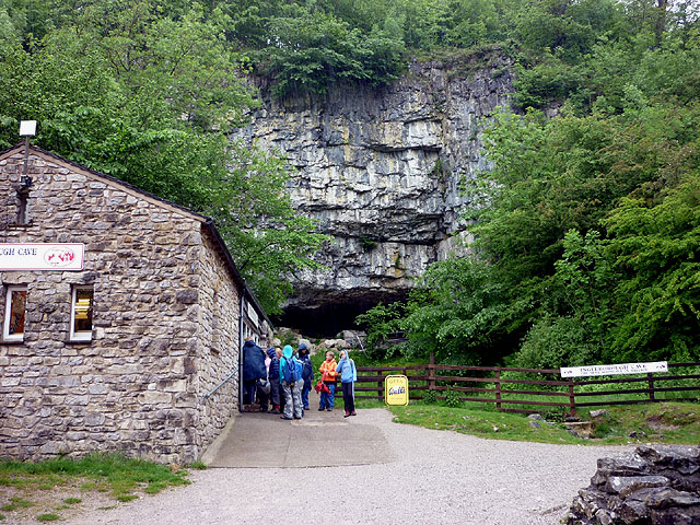
Gaping Gill

Gaping Gill (also known as Gaping Ghyll) is a natural cave in North Yorkshire, England. It is one of the unmistakable landmarks on the southern slopes...

Rat Hole, Gaping Gill

Rat Hole is one of the entrances to the Gaping Gill cave system, located in the north bank of Fell Beck 30 metres (33 yd) upstream of Gaping Gill Main...

Nearby Amenities

Located within 500m of 54.14646,-2.3879258
Gaping Gill
Image: https://www.geograph.org.uk/photo/858920
Natural: cave_entrance
Tourism: attraction
Wikidata: Q1493828
Wikipedia: en:Gaping Gill
Lat/Long: 54.1494349/-2.3825764
Bar Pot
Image: https://www.geograph.org.uk/photo/546909
Natural: cave_entrance
Wikidata: Q16245912
Wikipedia: en:Bar Pot
Lat/Long: 54.1462876/-2.3815665
Hurnel Moss
Place: locality
Wetland: marsh
Lat/Long: 54.1466458/-2.3878648
Flood Entrance Pot
Natural: cave_entrance
Source: survey
Wikidata: Q16246477
Wikipedia: en:Flood Entrance Pot
Lat/Long: 54.14695/-2.382111
Stream Passage Pot
Natural: cave_entrance
Source: survey
Wikidata: Q16248218
Lat/Long: 54.1478971/-2.3866581
Barrier: stile
Material: stone
Stile: stepover
Lat/Long: 54.1462329/-2.380743
Newby Moss Cave
Natural: cave_entrance
Source: survey
Lat/Long: 54.1464253/-2.3939789
Hurnel Moss Pot
Natural: cave_entrance
Source: survey
Lat/Long: 54.1468023/-2.3918331
Disappointment Pot
Natural: cave_entrance
Source: bing
Wikidata: Q16246327
Wikipedia: en:Disappointment Pot
Lat/Long: 54.1487173/-2.383497
Small Mammal Pot
Natural: cave_entrance
Website: https://cncc.org.uk/cave/small-mammal-pot
Lat/Long: 54.1461929/-2.3811404
Stile Pot
Natural: cave_entrance
Lat/Long: 54.1459297/-2.3810672
The data included in this document is from www.openstreetmap.org. The data is made available under ODbL.

Have you been to Hurnel Moss?

Leave your review of Hurnel Moss below (or comments, questions and feedback).