Bottom of the Rough

Downs, Moorland in Lancashire Rossendale

England

Bottom of the Rough

Rossendale Way descending into Deep Clough After a long level stretch the Rossendale Way descends into the clough, to immediately climb up the other side.
Rossendale Way descending into Deep Clough Credit: Chris Heaton

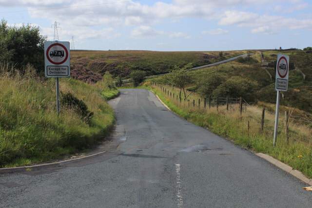
Bottom of the Rough is a picturesque and serene area located in the county of Lancashire, England. Situated amidst the stunning natural beauty of the Downs and Moorland, this location offers a tranquil escape from the hustle and bustle of city life.

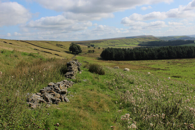
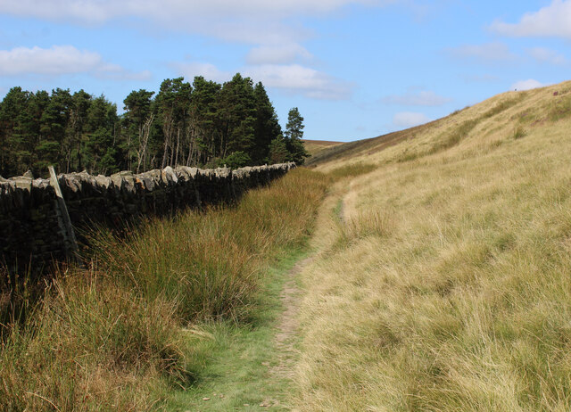
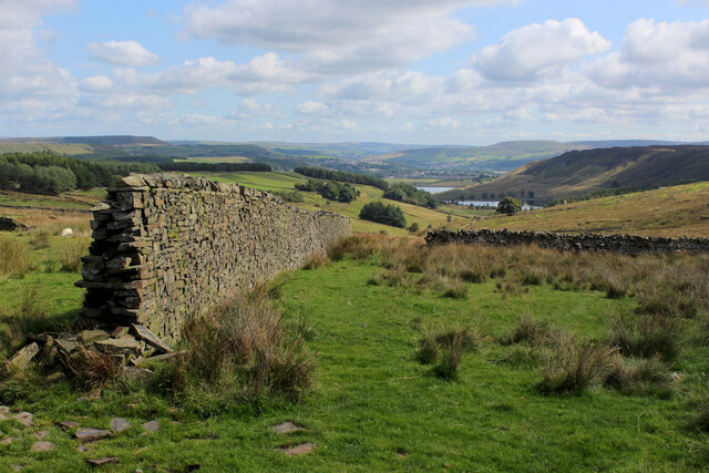
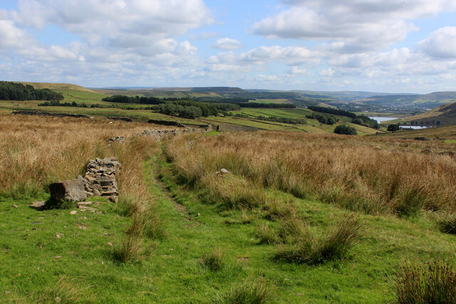
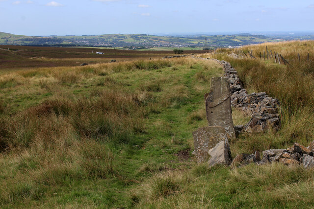
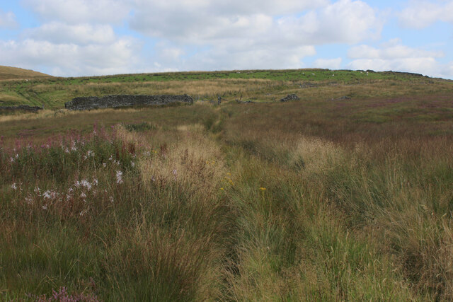
Characterized by its rolling hills, lush green fields, and vast open spaces, Bottom of the Rough is a haven for nature enthusiasts and outdoor adventurers. The area is known for its diverse and breathtaking landscapes, ranging from rugged moorlands to gentle slopes, making it a paradise for hikers, cyclists, and nature lovers alike.

The Downs, with their wide expanse of grassy slopes, provide an ideal setting for peaceful walks and picnics, offering panoramic views of the surrounding countryside. The moorland, on the other hand, boasts a unique ecosystem with its heather-covered hills, scattered with rocky outcrops. This terrain is home to a variety of wildlife, including birds, rabbits, and even the occasional deer.

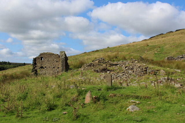
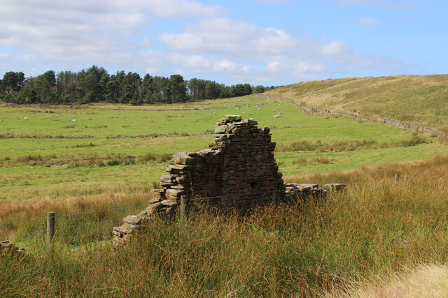
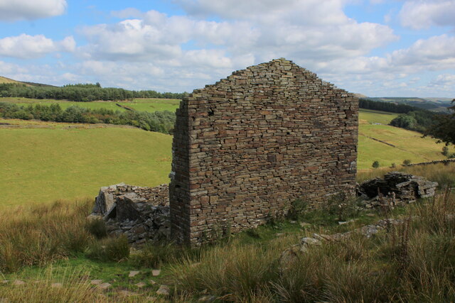
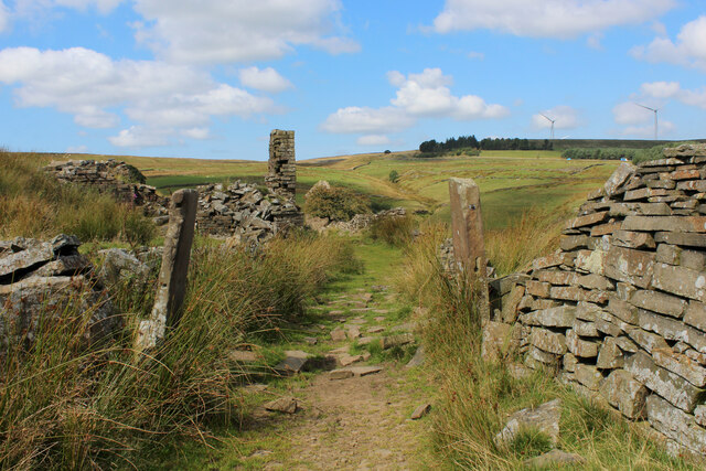
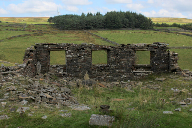
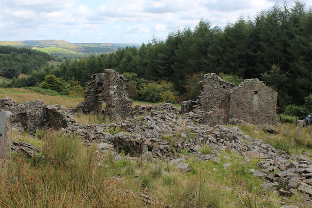
Bottom of the Rough is not only renowned for its natural beauty but also for its historical significance. The area is dotted with remnants of old stone walls and ancient settlements, serving as a reminder of its rich heritage.

Visitors to Bottom of the Rough can enjoy the simple pleasures of exploring the countryside, taking in the fresh air, and immersing themselves in the tranquility of nature. Whether it's a leisurely stroll along the Downs or a more challenging hike through the Moorland, this idyllic location offers something for everyone seeking a peaceful retreat in the heart of Lancashire.

If you have any feedback on the listing, please let us know in the comments section below.

Bottom of the Rough Images

Images are sourced within 2km of 53.701857/-2.3940774 or Grid Reference SD7422. Thanks to Geograph Open Source API. All images are credited.

Rossendale Way descending into Deep Clough After a long level stretch the Rossendale Way descends into the clough, to immediately climb up the other side.
Rossendale Way descending into Deep Clough
After a long level stretch the Rossendale Way descends into the clough, to immediately climb up the other side.
Deep Clough Short watercourse smothered in vegetation, draining off Haslingden Moor into Jamestone Quarry and onto Ogden Reservoir
Deep Clough
Short watercourse smothered in vegetation, draining off Haslingden Moor into Jamestone Quarry and onto Ogden Reservoir
Rossendale Way passing a Ruined Farmhouse The upper reaches of the Ogden Valley is littered with the ruins of many buildings.
Rossendale Way passing a Ruined Farmhouse
The upper reaches of the Ogden Valley is littered with the ruins of many buildings.
Rossendale Way below Nab Hill A 41 mile circular high level route that roughly follows the boundary of Rossendale Borough.
Yellow indicators stamped with an "RW" logo in green leads the walker around the environs of Bacup, Rawtenstall, Haslingden and Whitworth.
Rossendale Way below Nab Hill
A 41 mile circular high level route that roughly follows the boundary of Rossendale Borough. Yellow indicators stamped with an "RW" logo in green leads the walker around the environs of Bacup, Rawtenstall, Haslingden and Whitworth.
Approaching Plantation below Nab Hill Following the Rossendale Way long distance footpath westwards in the upper reaches of Grane Valley.
Approaching Plantation below Nab Hill
Following the Rossendale Way long distance footpath westwards in the upper reaches of Grane Valley.
Ruin in the Upper Grane Valley One of many ruins that dot the landscape that constitutes the upper reaches of the River Ogden - very little left of this one.
Ruin in the Upper Grane Valley
One of many ruins that dot the landscape that constitutes the upper reaches of the River Ogden - very little left of this one.
Heading down Jackson Height Following an indistinct footpath over rough ground towards Pickup Bank
Heading down Jackson Height
Following an indistinct footpath over rough ground towards Pickup Bank
Footpath leading away from the Grane Road Very faint footpath, heavily incumbered by reeds heading towards Pickup Bank
Footpath leading away from the Grane Road
Very faint footpath, heavily incumbered by reeds heading towards Pickup Bank
On Jackson Height
On Jackson Height
Long Hey Lane Descending to cross Mean Brook
Long Hey Lane
Descending to cross Mean Brook
Descending into the Grane Valley (1) Public footpath follows the substantial wall into the head of the Grane Valley - which contains the River Ogden.
Descending into the Grane Valley (1)
Public footpath follows the substantial wall into the head of the Grane Valley - which contains the River Ogden.
Descending into the Grane Valley (2) Footpath descending into the head of the Grane Valley, although it is not visible on the ground - so attention needs to be concentrated on the map.
Descending into the Grane Valley (2)
Footpath descending into the head of the Grane Valley, although it is not visible on the ground - so attention needs to be concentrated on the map.
Footpath heading towards Broadhead Road
Track leading away from Broadhead Road The public footpath concealed and smothered by vegetation
Track leading away from Broadhead Road
The public footpath concealed and smothered by vegetation
Ruins of Peak House, Haslingden Grane Part of Grane Village, once a thriving community of over a thousand souls involved with farming, quarrying and illicit whisky distillation.
The construction of the 3 reservoirs sounded the death knell, depopulating the valley and leaving behind many ruined buildings
Ruins of Peak House, Haslingden Grane
Part of Grane Village, once a thriving community of over a thousand souls involved with farming, quarrying and illicit whisky distillation. The construction of the 3 reservoirs sounded the death knell, depopulating the valley and leaving behind many ruined buildings
Rossendale Way in Haslingden Grane The long distance footpath in the deserted ruins of Grane Village, a once thriving community depopulated after the construction of the three reservoirs.
Rossendale Way in Haslingden Grane
The long distance footpath in the deserted ruins of Grane Village, a once thriving community depopulated after the construction of the three reservoirs.
Ruins of Close Bottom, Haslingden Grane One of many ruins dotted hereabouts, that once made up the community of Grane Village.
Now abandoned and deserted, after the construction of 3 reservoirs along the River Ogden.
Ruins of Close Bottom, Haslingden Grane
One of many ruins dotted hereabouts, that once made up the community of Grane Village. Now abandoned and deserted, after the construction of 3 reservoirs along the River Ogden.
Ruins of Top o' th' Knoll, Haslingden Grane (1) Once substantial premises in the now abandoned Grane Village, passed by on the Rossendale Way.
Ruins of Top o' th' Knoll, Haslingden Grane (1)
Once substantial premises in the now abandoned Grane Village, passed by on the Rossendale Way.
Show me another place!

Bottom of the Rough is located at Grid Ref: SD7422 (Lat: 53.701857, Lng: -2.3940774)

Administrative County: Lancashire

District: Rossendale

Police Authority: Lancashire

What 3 Words

///kennels.relatives.dusted. Near Haslingden, Lancashire

Related Wikis

Yate and Pickup Bank

Yate and Pickup Bank is a civil parish in the borough of Blackburn with Darwen, Lancashire, England. The population of the civil parish taken at the census...

Calf Hey Reservoir

Calf Hey Reservoir is a reservoir in Haslingden Grane, close to the town of Haslingden, in the Borough of Rossendale, England. It was the first of three...

Haslingden Grane

Haslingden Grane is the glaciated upper portion of the valley of the River Ogden, which lies west of Haslingden and is in the north east section of the...

Bank Fold

Bank Fold is a hamlet near Belthorn in Lancashire, England.

Have you been to Bottom of the Rough?

Leave your review of Bottom of the Rough below (or comments, questions and feedback).