Black Shiver Moss

Downs, Moorland in Yorkshire Craven

England

Black Shiver Moss

Looking towards Whernside from Southerscales, Ingleborough
Looking towards Whernside from Southerscales, Ingleborough Credit: habiloid

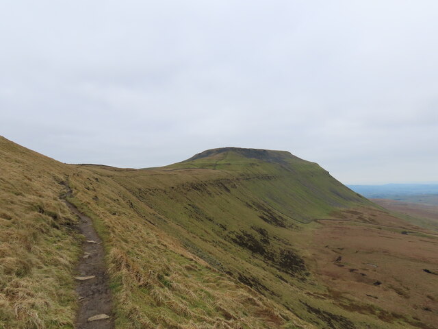
Black Shiver Moss, located in Yorkshire, England, is a diverse and captivating natural area that encompasses both downs and moorland landscapes. Spanning over a significant area, it offers an abundance of unique geological features, flora, and fauna.

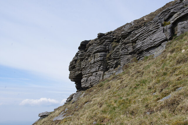
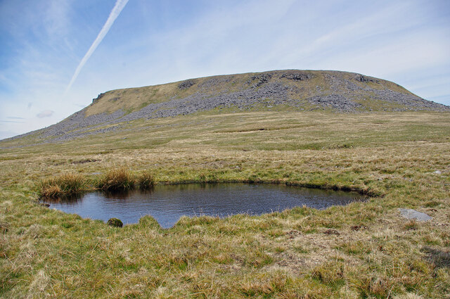
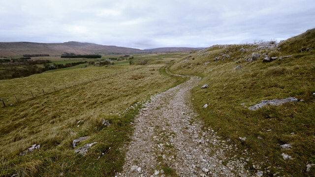
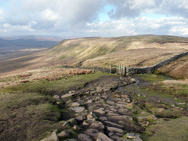
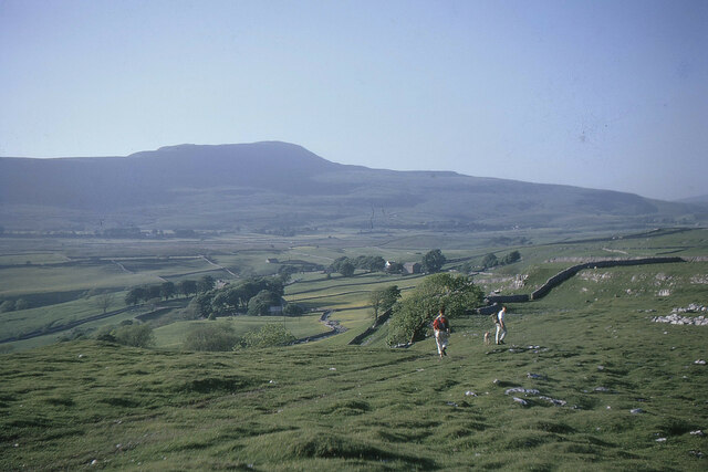
The downs of Black Shiver Moss are characterized by rolling hills covered in lush grasses and dotted with vibrant wildflowers. These downs provide a picturesque backdrop and offer stunning views of the surrounding countryside. The area is also home to various species of birds, including skylarks and meadow pipits, making it a popular spot for birdwatching enthusiasts.

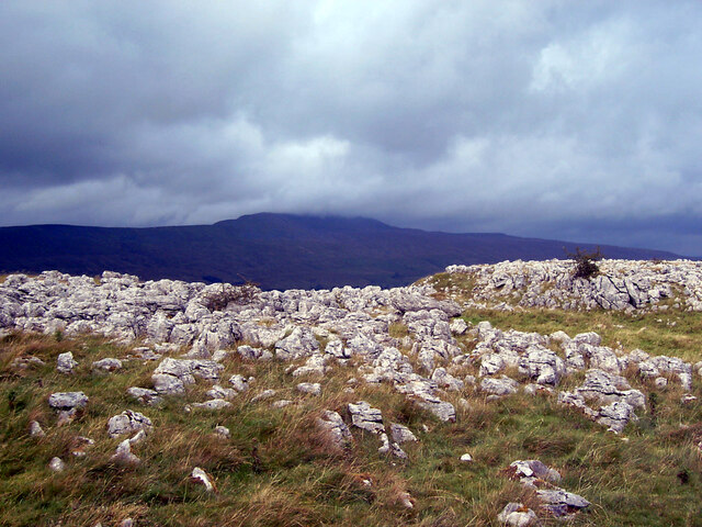
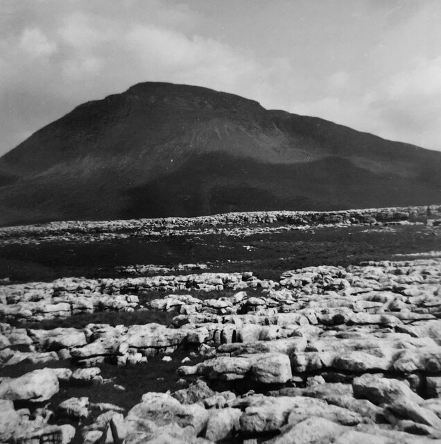
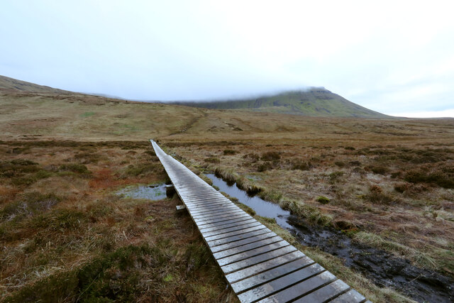
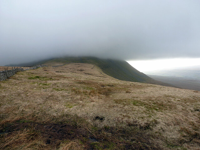
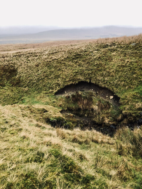
The moorland section of Black Shiver Moss showcases a different side of the landscape, with vast expanses of heather-covered moors stretching as far as the eye can see. This heather moorland is not only visually striking but also serves as an important habitat for a range of wildlife, including red grouse, curlews, and adders.

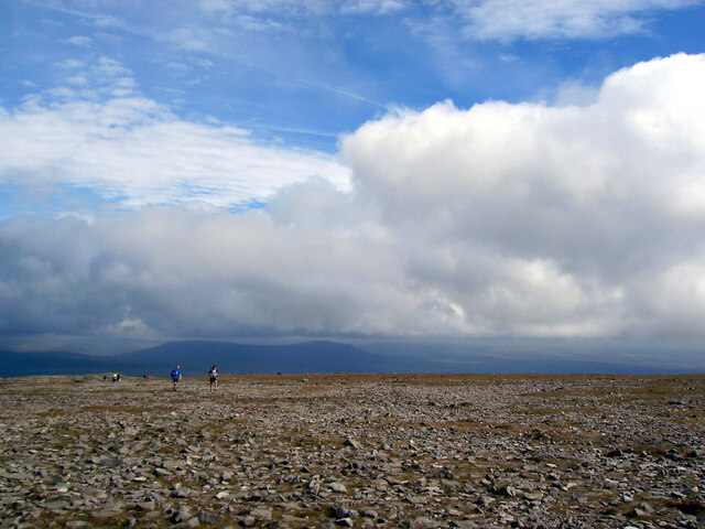
Visitors to Black Shiver Moss can enjoy a plethora of outdoor activities, such as hiking, cycling, and nature walks. There are well-maintained trails that meander through the downs and moorland, allowing visitors to explore the area at their own pace. Additionally, the expansive open spaces make it an ideal location for picnicking and enjoying the peacefulness of the countryside.

Black Shiver Moss, with its combination of downs and moorland, offers a diverse and captivating natural environment for outdoor enthusiasts and nature lovers alike. Its scenic beauty and rich biodiversity make it a must-visit destination for those seeking to immerse themselves in the stunning landscapes of Yorkshire.

If you have any feedback on the listing, please let us know in the comments section below.

Black Shiver Moss Images

Images are sourced within 2km of 54.172772/-2.399845 or Grid Reference SD7375. Thanks to Geograph Open Source API. All images are credited.

Looking towards Whernside from Southerscales, Ingleborough
Ingleborough Summit
Ingleborough Summit
Ingleborough across the limestone pavement
Gritstone outcrop on Ingleborough On the SW side of the summit plateau, near the southern point.
Gritstone outcrop on Ingleborough
On the SW side of the summit plateau, near the southern point.
Flooded shake hole on Ingleborough South of the summit plateau, on the Little Ingleborough spur.
Flooded shake hole on Ingleborough
South of the summit plateau, on the Little Ingleborough spur.
St Leonard's Church, Chapel-le-Dale The Church of St Leonard. It was used as a burial plot for the navvies, and their family members, who died whilst constructing the nearby Ribblehead Viaduct between 1869 and 1876. In all, over 200 people died during the construction from accidents and outbreaks of smallpox. 

<span class="nowrap"><a title="https://en.wikipedia.org/wiki/Chapel-le-Dale" rel="nofollow ugc noopener" href="https://en.wikipedia.org/wiki/Chapel-le-Dale">Link</a><img style="margin-left:2px;" alt="External link" title="External link - shift click to open in new window" src="https://s1.geograph.org.uk/img/external.png" width="10" height="10"/></span>
St Leonard's Church, Chapel-le-Dale
The Church of St Leonard. It was used as a burial plot for the navvies, and their family members, who died whilst constructing the nearby Ribblehead Viaduct between 1869 and 1876. In all, over 200 people died during the construction from accidents and outbreaks of smallpox. LinkExternal link
St. Leonard's Church Sign, Chapel-le-Dale
Wooden Ladder Stile & Finger Post at Chapel le Dale This was on the B6255 Low Sleights Road, almost opposite the end of Roman Road which leads to St. Leonard's Church. This image was taken in April 2010. Google Street View from April 2011 shows the stile still there, but it had been replaced with a stone stile by August 2016. The finger post points to Ingleborough 2 miles.
Wooden Ladder Stile & Finger Post at Chapel le Dale
This was on the B6255 Low Sleights Road, almost opposite the end of Roman Road which leads to St. Leonard's Church. This image was taken in April 2010. Google Street View from April 2011 shows the stile still there, but it had been replaced with a stone stile by August 2016. The finger post points to Ingleborough 2 miles.
Old milestone Another of the West Riding CC milestones set up in 1893/94 on this section of the Lancaster to Richmond route which was in the West Riding prior to 1974.   It has succumbed to the Pennine weather and, although not Listed, it deserves repainting.   The foundry name is in the long rectangle on the bevel.   William Towler, Globe Foundry, Leeds.
Old milestone
Another of the West Riding CC milestones set up in 1893/94 on this section of the Lancaster to Richmond route which was in the West Riding prior to 1974. It has succumbed to the Pennine weather and, although not Listed, it deserves repainting. The foundry name is in the long rectangle on the bevel. William Towler, Globe Foundry, Leeds.
Causeway to the Arks across Humphrey Bottom Humphrey Bottom is pretty boggy for a lot of the year, so repeated use by hikers heading up or down Ingleborough via the Arks (an unpleasantly steep section heading into the cloud in this view) was causing too much damage to the fragile vegetation and peat, so, whilst ugly, this long causeway was an inevitable response (adding stone to make a solid path would have been vastly expensive and done nothing to help the drainage).
Causeway to the Arks across Humphrey Bottom
Humphrey Bottom is pretty boggy for a lot of the year, so repeated use by hikers heading up or down Ingleborough via the Arks (an unpleasantly steep section heading into the cloud in this view) was causing too much damage to the fragile vegetation and peat, so, whilst ugly, this long causeway was an inevitable response (adding stone to make a solid path would have been vastly expensive and done nothing to help the drainage).
Heading down the Southerscales track Familiar to many cavers as the route to and from Meregill Hole, Black Shiver Pot, Roaring Hole and several other potholes, the track gives easy going for walkers, and somewhat more challenging progress for a Cave Rescue Landrover (usually in the dark with heavy rain - and after the pub). By the time you are here on the way down, the difficulties are largely behind you.
Heading down the Southerscales track
Familiar to many cavers as the route to and from Meregill Hole, Black Shiver Pot, Roaring Hole and several other potholes, the track gives easy going for walkers, and somewhat more challenging progress for a Cave Rescue Landrover (usually in the dark with heavy rain - and after the pub). By the time you are here on the way down, the difficulties are largely behind you.
Ingleborough from Weets Hill Ingleborough is 32km (20 miles) north-north-west from Weets Hill, and seen here rising above low cloud that filled Ribblesdale on this cold day.
Ingleborough from Weets Hill
Ingleborough is 32km (20 miles) north-north-west from Weets Hill, and seen here rising above low cloud that filled Ribblesdale on this cold day.
Souther Scales Fell The escarpment of Simon Fell, viewed from Swine Tail beneath Ingleborough summit.
Souther Scales Fell
The escarpment of Simon Fell, viewed from Swine Tail beneath Ingleborough summit.
Ingleborough top hidden in cloud Viewed from Simon Fell.
Ingleborough top hidden in cloud
Viewed from Simon Fell.
Tatham Wife Hole
Tatham Wife Hole
Whernside from Souther Scales, 1967 Descending from Ingleborough towards the Hill Inn on a fine day for the Three Peaks walk.
Whernside from Souther Scales, 1967
Descending from Ingleborough towards the Hill Inn on a fine day for the Three Peaks walk.
Lych gate at St. Leonard's Church The gate with gravestones and a path leading to St. Leonard's Church in Chapel-le-Dale.
Lych gate at St. Leonard's Church
The gate with gravestones and a path leading to St. Leonard's Church in Chapel-le-Dale.
Path to Ingleborough
Show me another place!

Black Shiver Moss is located at Grid Ref: SD7375 (Lat: 54.172772, Lng: -2.399845)

Division: West Riding

Administrative County: North Yorkshire

District: Craven

Police Authority: North Yorkshire

What 3 Words

///muddle.whisk.laces. Near Ingleton, North Yorkshire

Related Wikis

Ingleborough

Ingleborough (723 m or 2,372 ft) is the second-highest mountain in the Yorkshire Dales, England. It is one of the Yorkshire Three Peaks (the other two...

Yorkshire Three Peaks

The mountains of Whernside (736 m or 2,415 ft), Ingleborough (723 m or 2,372 ft) and Pen-y-ghent (694 m or 2,277 ft) are collectively known as the Three...

Simon Fell (Yorkshire Dales)

Simon Fell is a subsidiary summit on the north east ridge of Ingleborough, a mountain in the Yorkshire Dales in Northern England. With a height of 650...
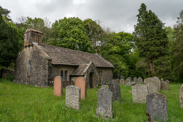
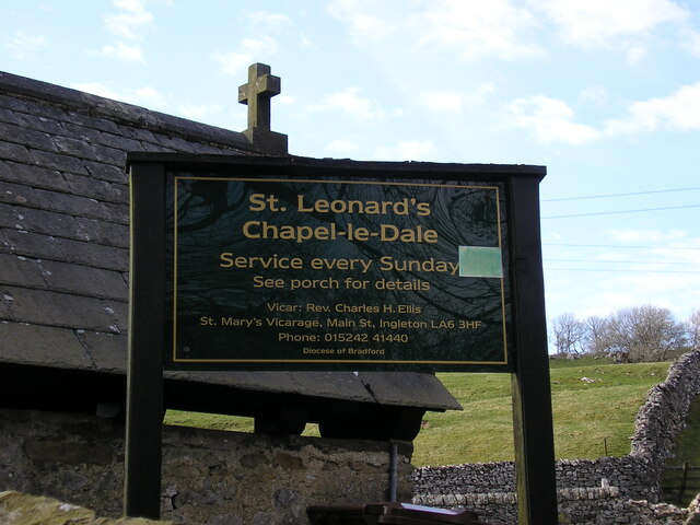
Chapel-le-Dale

Chapel-le-Dale is a hamlet in the civil parish of Ingleton, North Yorkshire, England. It is in the Yorkshire Dales National Park in a valley of the same...

Nearby Amenities

Located within 500m of 54.172772,-2.399845
Black Shiver Moss
Natural: wetland
Wetland: marsh
Lat/Long: 54.174035/-2.4021986
Meregill Hole
Natural: cave_entrance
Source: OS 1:25k
Lat/Long: 54.1766932/-2.3994436
Black Shiver Pot
Natural: cave_entrance
Source: survey
Lat/Long: 54.173956/-2.404436
Barrier: stile
Material: wood
Stile: ladder
Lat/Long: 54.1766845/-2.3991722
Meregill Hole Aven Entrance
Natural: cave_entrance
Lat/Long: 54.176604/-2.3988902
The data included in this document is from www.openstreetmap.org. The data is made available under ODbL.

Have you been to Black Shiver Moss?

Leave your review of Black Shiver Moss below (or comments, questions and feedback).