Plenmeller Common

Downs, Moorland in Northumberland

England

Plenmeller Common

Silvery highland cattle on Plenmeller Common
Silvery highland cattle on Plenmeller Common Credit: Mike Quinn

Plenmeller Common, located in Northumberland, England, is a stunning expanse of downs and moorland that encompasses an area of approximately 5 square kilometers. Situated near the village of Haltwhistle, it is part of the North Pennines Area of Outstanding Natural Beauty.

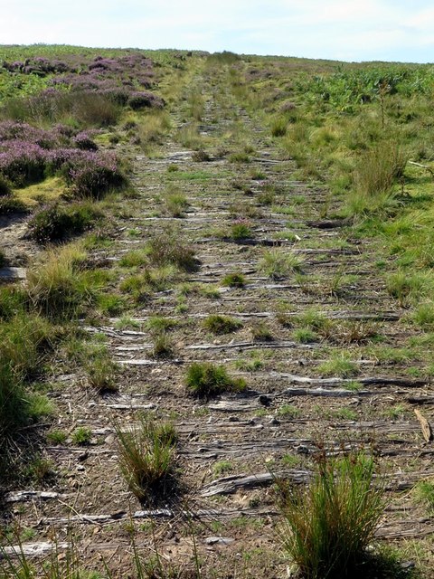
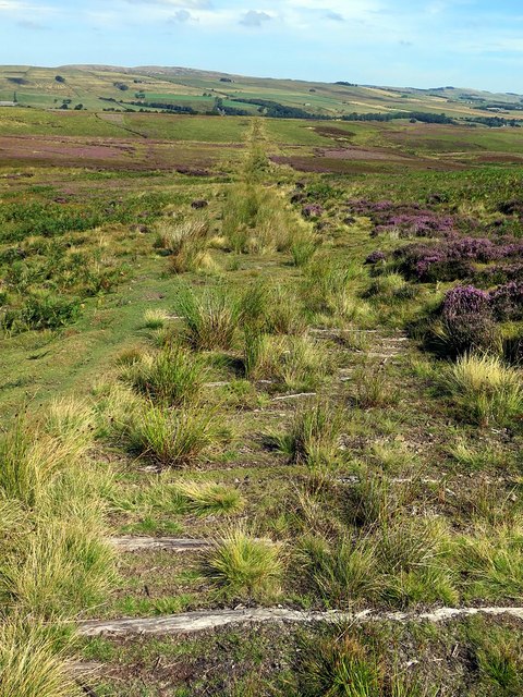
The common is characterized by its rolling hills, open grassland, and heather-covered moors. The landscape is dotted with scattered trees and crisscrossed by dry stone walls, adding to its rustic charm. Plenmeller Common offers breathtaking panoramic views of the surrounding countryside, with the distant Cheviot Hills visible on clear days.

Rich in biodiversity, the common is home to a variety of flora and fauna. Heather dominates the moorland, painting the landscape in vibrant shades of purple during the summer months. The grasslands support a diverse range of plant species, including wildflowers such as harebell and cowslip. The common also provides a habitat for various bird species, including skylarks, curlews, and meadow pipits.

The area is popular with hikers and nature enthusiasts, offering a network of footpaths and bridleways that allow visitors to explore its natural beauty. The common's peaceful and tranquil atmosphere provides an ideal escape from the hustle and bustle of daily life.

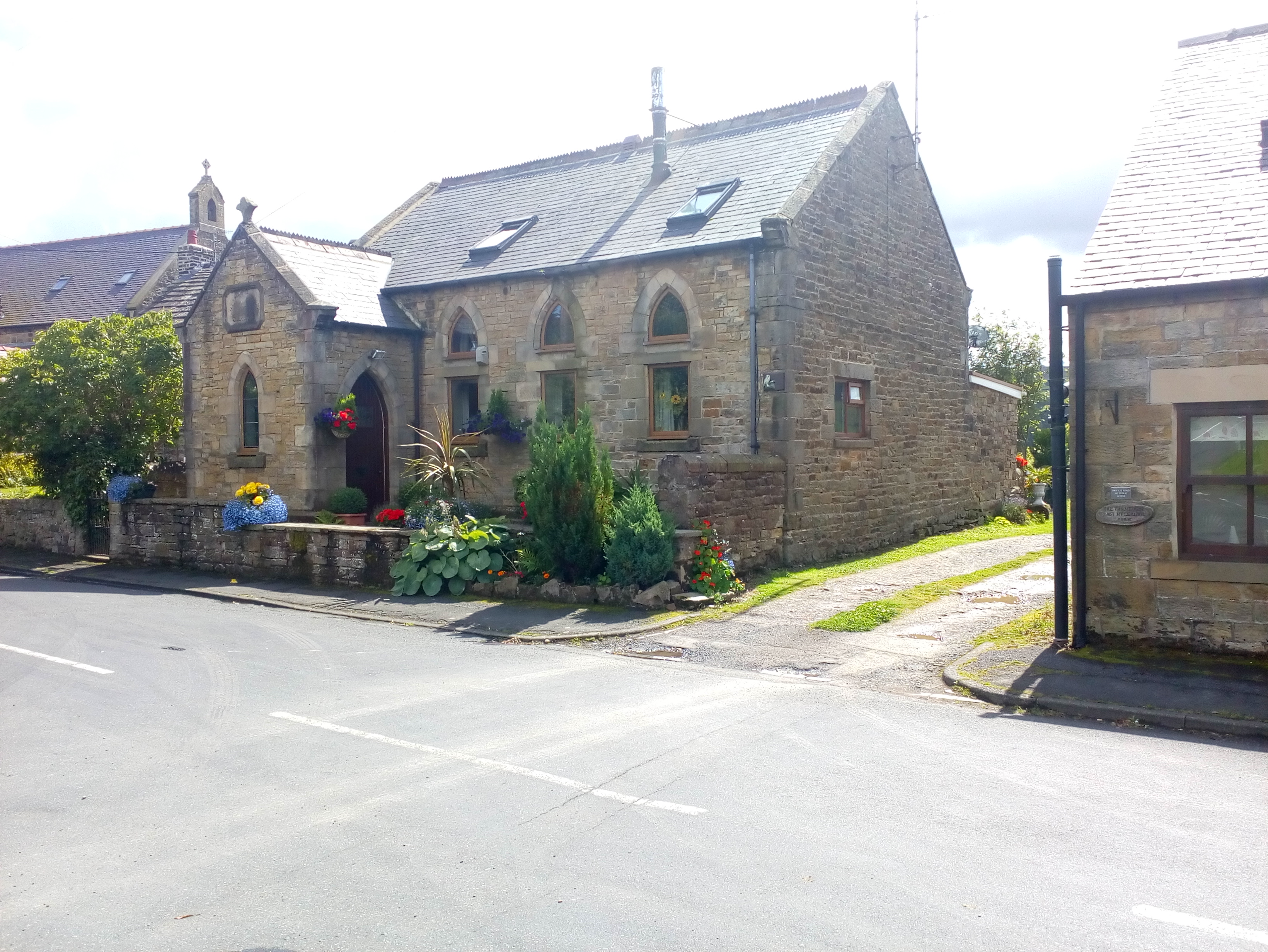
Plenmeller Common is not only a haven for wildlife and a scenic retreat, but it also holds historical significance. The remains of ancient settlements, stone circles, and burial grounds can be found, hinting at a rich human history dating back thousands of years.

Overall, Plenmeller Common is a captivating landscape that showcases the natural beauty and cultural heritage of Northumberland. Its diverse ecosystems, breathtaking views, and historical importance make it a must-visit destination for nature lovers and history enthusiasts alike.

If you have any feedback on the listing, please let us know in the comments section below.

Plenmeller Common Images

Images are sourced within 2km of 54.943527/-2.4147989 or Grid Reference NY7361. Thanks to Geograph Open Source API. All images are credited.

Silvery highland cattle on Plenmeller Common
Pond on Limestones Fell
Pond near Limestones
Sheep at Low Todhillwood An ill-defined public footpath leads across the rough grazing ahead.
Sheep at Low Todhillwood
An ill-defined public footpath leads across the rough grazing ahead.
Low Todhillwood A derelict farm on the edge of Plenmeller Common.
Low Todhillwood
A derelict farm on the edge of Plenmeller Common.
Barn and bales at High Todhillwood Fawrm
Track on Plenmeller Common near Howden Burn The ruin of Hillside (originally Wagtail Hall) is above left <a href="https://www.geograph.org.uk/photo/4345700">NY7462 : Hillside</a>
Track on Plenmeller Common near Howden Burn
The ruin of Hillside (originally Wagtail Hall) is above left NY7462 : Hillside
Plenmeller Common at Howden Burn
Grouse butt near Howden Burn
Banks of enclosure on Plenmeller Common A large roughly rectangular earthwork enclosure stands at this site, on a heather and bracken covered, north facing slope above the Howden Burn. A smaller square enclosure lies inside it, towards the south-east corner. The age and purpose of the enclosures is unknown.
<span class="nowrap"><a title="http://www.keystothepast.info/article/10339/Site-Details?PRN=N6694" rel="nofollow ugc noopener" href="http://www.keystothepast.info/article/10339/Site-Details?PRN=N6694">Link</a><img style="margin-left:2px;" alt="External link" title="External link - shift click to open in new window" src="https://s1.geograph.org.uk/img/external.png" width="10" height="10"/></span>
Banks of enclosure on Plenmeller Common
A large roughly rectangular earthwork enclosure stands at this site, on a heather and bracken covered, north facing slope above the Howden Burn. A smaller square enclosure lies inside it, towards the south-east corner. The age and purpose of the enclosures is unknown. LinkExternal link
Earthbank of inner enclosure, Plenmeller Common
Site of Hobby's Well, Plenmeller Common Start of a small stream which flows into Howden Burn.
Site of Hobby's Well, Plenmeller Common
Start of a small stream which flows into Howden Burn.
Track on Plenmeller Common Looking like an old waggonway, the very straight track has been closely paved with narrow, rough, wooden 'sleepers'.

It is actually the former route of the over-land conveyor which brought coal down from the Plenmeller opencast coal mine between 1991 and 2000 <a href="https://www.geograph.org.uk/photo/3516914">NY7460 : Plaques on Plenmeller Common</a>. It ran for over a mile from a site near The Beacon <a href="https://www.geograph.org.uk/photo/1247436">NY7260 : The Beacon</a>, north-east down the hillside of Plenmeller Common and Howden Rigg, then adjacent to the west side of Heron Wood, passing under the Plenmeller-Unthank Road via a tunnel. It surfaced to cross the River South Tyne to the railway line on the north side where there was a rapid loading bunker with associated railway sidings <a href="https://www.geograph.org.uk/photo/296955">NY7363 : Railway lines</a>. Around 1.8 million tonnes of coal left Plenmeller via this route.

There photo in the opposite direction here <a href="https://www.geograph.org.uk/photo/5867388">NY7362 : Track on Plenmeller Common</a>
Track on Plenmeller Common
Looking like an old waggonway, the very straight track has been closely paved with narrow, rough, wooden 'sleepers'. It is actually the former route of the over-land conveyor which brought coal down from the Plenmeller opencast coal mine between 1991 and 2000 NY7460 : Plaques on Plenmeller Common. It ran for over a mile from a site near The Beacon NY7260 : The Beacon, north-east down the hillside of Plenmeller Common and Howden Rigg, then adjacent to the west side of Heron Wood, passing under the Plenmeller-Unthank Road via a tunnel. It surfaced to cross the River South Tyne to the railway line on the north side where there was a rapid loading bunker with associated railway sidings NY7363 : Railway lines. Around 1.8 million tonnes of coal left Plenmeller via this route. There photo in the opposite direction here NY7362 : Track on Plenmeller Common
Track on Plenmeller Common See description here <a href="https://www.geograph.org.uk/photo/5867276">NY7362 : Track on Plenmeller Common</a>
Track on Plenmeller Common
Road to Haltwhistle Hay wagon.  To the left you can see a bale of hay.  We assumed the load had been spilled which could have been serious if a vehicle had been passing.
Road to Haltwhistle
Hay wagon. To the left you can see a bale of hay. We assumed the load had been spilled which could have been serious if a vehicle had been passing.
Linn Burn
Linn Burn
Footpath leading to Mill Dam
Footpath and Grouse Butts, Maul Rigg
Show me another place!

Plenmeller Common is located at Grid Ref: NY7361 (Lat: 54.943527, Lng: -2.4147989)

Unitary Authority: Northumberland

Police Authority: Northumbria

What 3 Words

///coining.releasing.crash. Near Haltwhistle, Northumberland

Nearby Locations

Plenmeller Common

Related Wikis

Unthank, Haltwhistle

Unthank is a village near Haltwhistle in Northumberland, England. It is first mentioned in writing as Unthanc around 1200. == Governance == Unthank is...

Unthank Hall

Unthank Hall is a Grade II listed property now serving as commercial offices, situated on the southern bank of the River South Tyne east of Plenmeller...

Melkridge

Melkridge is a village and civil parish in Northumberland, England, on the river South Tyne. The village of Melkridge is in the south of the parish, and...

Plenmeller

Plenmeller is a village and former civil parish, now in the parish of Plenmeller with Whitfield, in Northumberland, England about a mile (1½ km) southeast...

Have you been to Plenmeller Common?

Leave your review of Plenmeller Common below (or comments, questions and feedback).