New Pasture

Downs, Moorland in Yorkshire Craven

England

New Pasture

Looking towards Whernside from Southerscales, Ingleborough
Looking towards Whernside from Southerscales, Ingleborough Credit: habiloid

New Pasture, located in the heart of Yorkshire, is a picturesque countryside region renowned for its stunning landscape comprising of downs, moorland, and sprawling pastures. Situated in the northern part of England, this area offers a tranquil escape from the bustling city life.

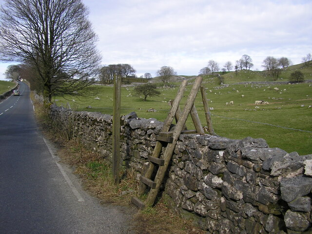
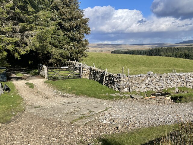
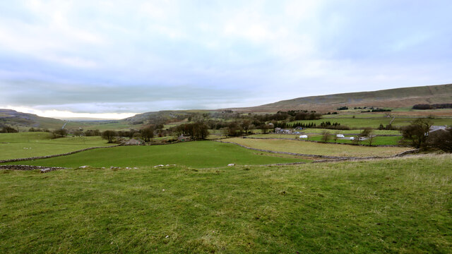
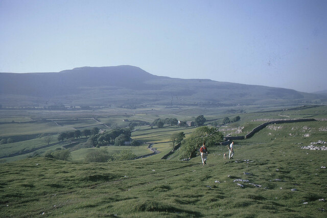
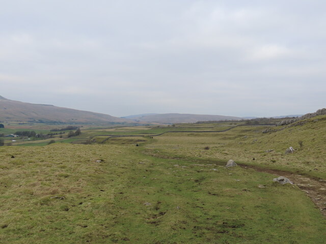
The downs of New Pasture are characterized by rolling hills and expansive meadows, creating an idyllic setting for farmers and nature enthusiasts alike. The fertile land supports a thriving agricultural industry, with sheep farming being particularly prominent. Visitors can witness flocks of sheep grazing peacefully, lending an authentic rural charm to the region.

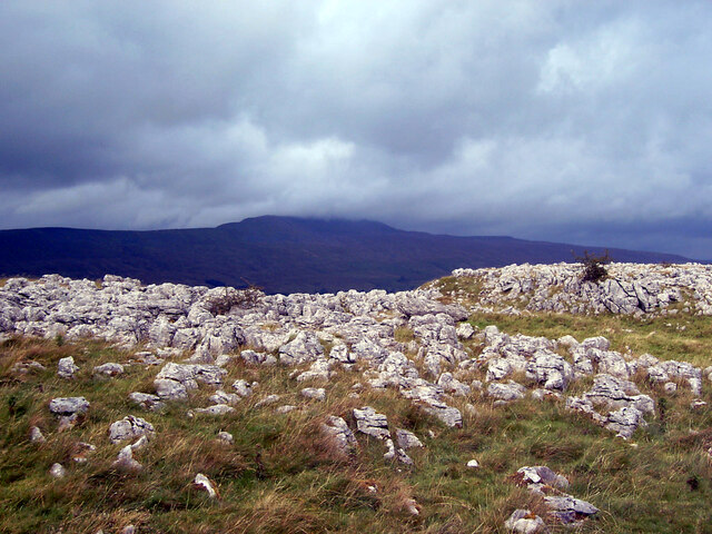
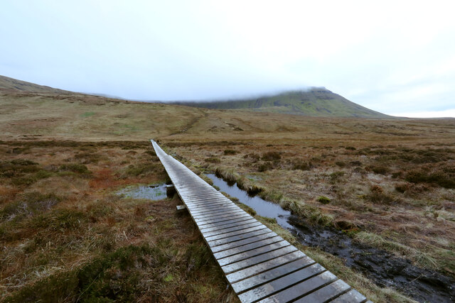
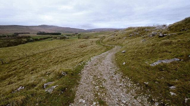
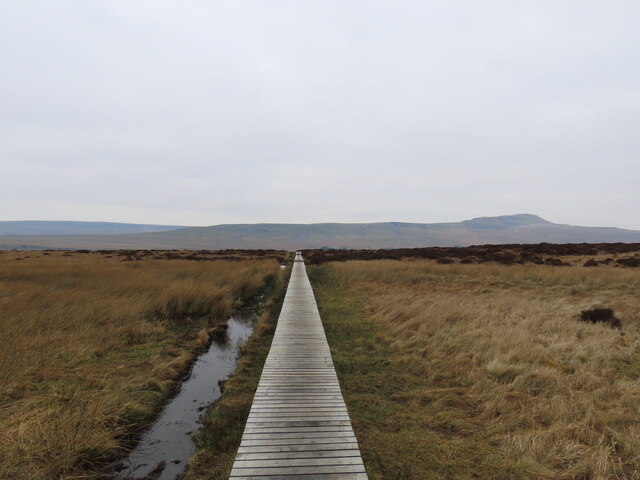
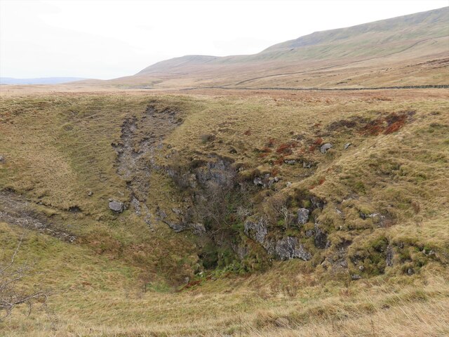
The moorland in New Pasture presents a striking contrast to the downs, with its rugged terrain and heather-covered hillsides. This unique ecosystem is home to diverse wildlife, including birds of prey such as kestrels and buzzards. Hikers and nature lovers can explore the vast network of walking trails that wind through the moorland, offering breathtaking views of the surrounding countryside.

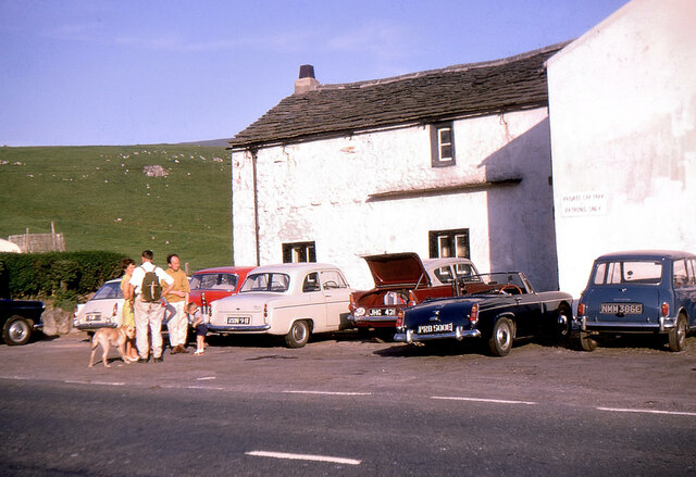
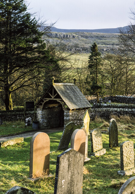
In addition to its natural beauty, New Pasture boasts several quaint villages and towns that dot the landscape. These charming settlements offer a glimpse into the region's rich history and cultural heritage, with their well-preserved architecture and traditional cottages. Visitors can enjoy local cuisine in cozy pubs, browse through artisan shops, or simply soak in the peaceful ambiance of these rural communities.

Overall, New Pasture in Yorkshire is a haven for those seeking a tranquil getaway amidst stunning natural scenery. Its downs, moorland, and pastoral landscapes, combined with the warmth and charm of its local communities, make it a must-visit destination for nature enthusiasts and history buffs alike.

If you have any feedback on the listing, please let us know in the comments section below.

New Pasture Images

Images are sourced within 2km of 54.186257/-2.4145635 or Grid Reference SD7376. Thanks to Geograph Open Source API. All images are credited.

Looking towards Whernside from Southerscales, Ingleborough
St Leonard's Church, Chapel-le-Dale The Church of St Leonard. It was used as a burial plot for the navvies, and their family members, who died whilst constructing the nearby Ribblehead Viaduct between 1869 and 1876. In all, over 200 people died during the construction from accidents and outbreaks of smallpox. 

<span class="nowrap"><a title="https://en.wikipedia.org/wiki/Chapel-le-Dale" rel="nofollow ugc noopener" href="https://en.wikipedia.org/wiki/Chapel-le-Dale">Link</a><img style="margin-left:2px;" alt="External link" title="External link - shift click to open in new window" src="https://s1.geograph.org.uk/img/external.png" width="10" height="10"/></span>
St Leonard's Church, Chapel-le-Dale
The Church of St Leonard. It was used as a burial plot for the navvies, and their family members, who died whilst constructing the nearby Ribblehead Viaduct between 1869 and 1876. In all, over 200 people died during the construction from accidents and outbreaks of smallpox. LinkExternal link
St. Leonard's Church Sign, Chapel-le-Dale
Wooden Ladder Stile & Finger Post at Chapel le Dale This was on the B6255 Low Sleights Road, almost opposite the end of Roman Road which leads to St. Leonard's Church. This image was taken in April 2010. Google Street View from April 2011 shows the stile still there, but it had been replaced with a stone stile by August 2016. The finger post points to Ingleborough 2 miles.
Wooden Ladder Stile & Finger Post at Chapel le Dale
This was on the B6255 Low Sleights Road, almost opposite the end of Roman Road which leads to St. Leonard's Church. This image was taken in April 2010. Google Street View from April 2011 shows the stile still there, but it had been replaced with a stone stile by August 2016. The finger post points to Ingleborough 2 miles.
Old milestone Another of the West Riding CC milestones set up in 1893/94 on this section of the Lancaster to Richmond route which was in the West Riding prior to 1974.   It has succumbed to the Pennine weather and, although not Listed, it deserves repainting.   The foundry name is in the long rectangle on the bevel.   William Towler, Globe Foundry, Leeds.
Old milestone
Another of the West Riding CC milestones set up in 1893/94 on this section of the Lancaster to Richmond route which was in the West Riding prior to 1974. It has succumbed to the Pennine weather and, although not Listed, it deserves repainting. The foundry name is in the long rectangle on the bevel. William Towler, Globe Foundry, Leeds.
Ellerbeck Ford This ford is found at Ellerbeck looking towards Ribblehead Viaduct.
Ellerbeck Ford
This ford is found at Ellerbeck looking towards Ribblehead Viaduct.
Towards Chapel-le-Dale from the Southerscales track The track to Southerscales leaves the B6255 at the top of a limestone bench, and remains level as it heads southwest. The edge of the bench forms an elvated viewpoint above Chapel-le-Dale, with the distant view extending to the southern end of Scales Moor.
Towards Chapel-le-Dale from the Southerscales track
The track to Southerscales leaves the B6255 at the top of a limestone bench, and remains level as it heads southwest. The edge of the bench forms an elvated viewpoint above Chapel-le-Dale, with the distant view extending to the southern end of Scales Moor.
Causeway to the Arks across Humphrey Bottom Humphrey Bottom is pretty boggy for a lot of the year, so repeated use by hikers heading up or down Ingleborough via the Arks (an unpleasantly steep section heading into the cloud in this view) was causing too much damage to the fragile vegetation and peat, so, whilst ugly, this long causeway was an inevitable response (adding stone to make a solid path would have been vastly expensive and done nothing to help the drainage).
Causeway to the Arks across Humphrey Bottom
Humphrey Bottom is pretty boggy for a lot of the year, so repeated use by hikers heading up or down Ingleborough via the Arks (an unpleasantly steep section heading into the cloud in this view) was causing too much damage to the fragile vegetation and peat, so, whilst ugly, this long causeway was an inevitable response (adding stone to make a solid path would have been vastly expensive and done nothing to help the drainage).
Heading down the Southerscales track Familiar to many cavers as the route to and from Meregill Hole, Black Shiver Pot, Roaring Hole and several other potholes, the track gives easy going for walkers, and somewhat more challenging progress for a Cave Rescue Landrover (usually in the dark with heavy rain - and after the pub). By the time you are here on the way down, the difficulties are largely behind you.
Heading down the Southerscales track
Familiar to many cavers as the route to and from Meregill Hole, Black Shiver Pot, Roaring Hole and several other potholes, the track gives easy going for walkers, and somewhat more challenging progress for a Cave Rescue Landrover (usually in the dark with heavy rain - and after the pub). By the time you are here on the way down, the difficulties are largely behind you.
Whernside from Souther Scales, 1967 Descending from Ingleborough towards the Hill Inn on a fine day for the Three Peaks walk.
Whernside from Souther Scales, 1967
Descending from Ingleborough towards the Hill Inn on a fine day for the Three Peaks walk.
The Hill Inn, 1967 Start and finish of a walk round the Three Peaks with two friends, taking just under 12 hours on a fine June day. The maroon and grey 1960 Ford Anglia was my first car.
The Hill Inn, 1967
Start and finish of a walk round the Three Peaks with two friends, taking just under 12 hours on a fine June day. The maroon and grey 1960 Ford Anglia was my first car.
Lych gate at St. Leonard's Church The gate with gravestones and a path leading to St. Leonard's Church in Chapel-le-Dale.
Lych gate at St. Leonard's Church
The gate with gravestones and a path leading to St. Leonard's Church in Chapel-le-Dale.
Path across the bog
Path across the bog
Braithwaite Wife Hole
Path through a field
Dale House Dale House with Twisleton Scars as a backdrop.
Dale House
Dale House with Twisleton Scars as a backdrop.
Raven Scar Limestone scars above the date through which a former Roman road passes which is now the route of the B6255.
Raven Scar
Limestone scars above the date through which a former Roman road passes which is now the route of the B6255.
Heading for Ingleborough On the bridleway at Keld Bank
Heading for Ingleborough
On the bridleway at Keld Bank
Show me another place!

New Pasture is located at Grid Ref: SD7376 (Lat: 54.186257, Lng: -2.4145635)

Division: West Riding

Administrative County: North Yorkshire

District: Craven

Police Authority: North Yorkshire

What 3 Words

///dives.crown.flaking. Near Ingleton, North Yorkshire

Nearby Locations

Tod Pool New Pasture

Related Wikis

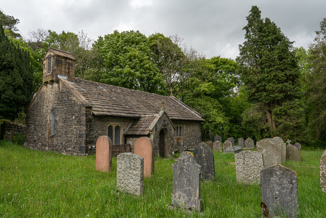
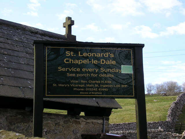
Chapel-le-Dale (valley)

Chapel-le-Dale is west-facing valley in the Yorkshire Dales, England. The U-shaped valley of Chapel-le-Dale is one of the few which drain westwards towards...

Chapel-le-Dale

Chapel-le-Dale is a hamlet in the civil parish of Ingleton, North Yorkshire, England. It is in the Yorkshire Dales National Park in a valley of the same...
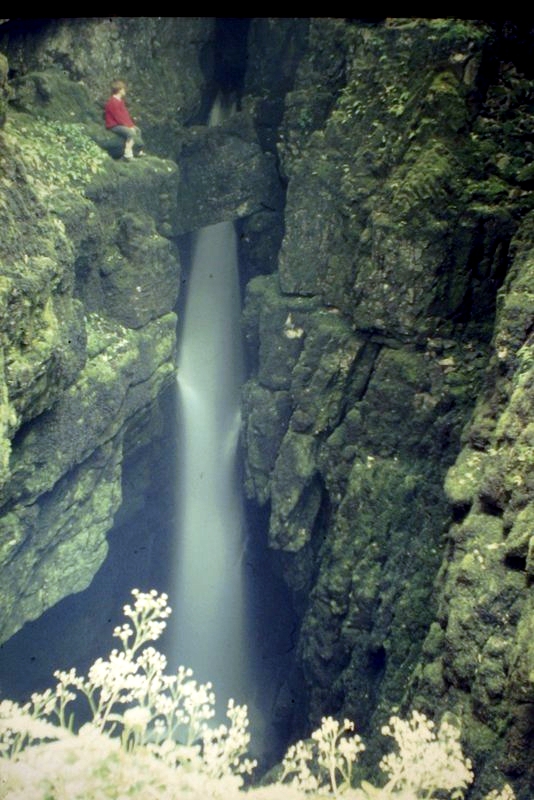
Weathercote Cave

Weathercote Cave is a natural solutional cave in Chapel-le-Dale, North Yorkshire, England. It has been renowned as a natural curiosity since the eighteenth...
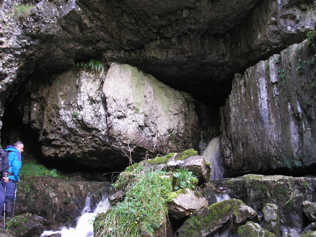
Great Douk Cave

Great Douk Cave is a shallow cave system lying beneath the limestone bench of Ingleborough in Chapel-le-Dale, North Yorkshire, England. It is popular with...

Nearby Amenities

Located within 500m of 54.186257,-2.4145635
Barrier: cattle_grid
Lat/Long: 54.1849674/-2.4151347
Power: pole
Lat/Long: 54.1837274/-2.4193203
Power: pole
Lat/Long: 54.1842375/-2.4181135
Power: pole
Lat/Long: 54.1847399/-2.4169518
Power: pole
Lat/Long: 54.185304/-2.4156168
Power: pole
Lat/Long: 54.1858681/-2.4142913
Power: pole
Lat/Long: 54.1864455/-2.4129639
Power: pole
Lat/Long: 54.1867782/-2.4120037
Power: pole
Lat/Long: 54.1871186/-2.4110434
Power: pole
Lat/Long: 54.1874789/-2.4099985
Power: pole
Lat/Long: 54.1879229/-2.4087671
Power: pole
Lat/Long: 54.187231/-2.4093451
Information: guidepost
Tourism: information
Lat/Long: 54.1869696/-2.4095952
Barrier: stile
Material: stone
Stile: stepover
Lat/Long: 54.1848997/-2.4111564
The data included in this document is from www.openstreetmap.org. The data is made available under ODbL.

Have you been to New Pasture?

Leave your review of New Pasture below (or comments, questions and feedback).