Black Moss

Downs, Moorland in Westmorland Eden

England

Black Moss

'Sandbed'
'Sandbed' Credit: Roger Cornfoot

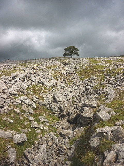
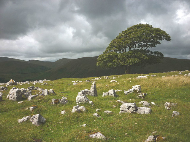
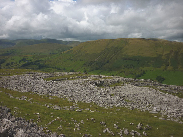
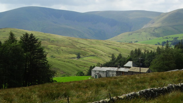
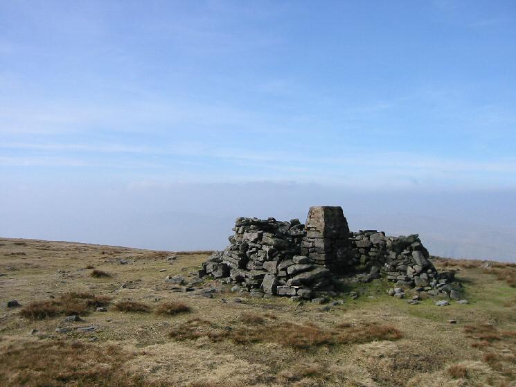
Black Moss is a picturesque region located in the county of Westmorland, nestled in the heart of the English countryside. This charming area is characterized by its stunning landscape, which combines vast downs and expansive moorlands. It is a haven for nature enthusiasts and outdoor adventurers, offering a diverse range of flora and fauna.

The downs of Black Moss are renowned for their rolling hills and lush green meadows, providing a tranquil setting for leisurely walks and picnics. The moorlands, on the other hand, present a more rugged and wild environment, with heather-clad hills and peat bogs. These moorlands are home to numerous species of birds, including the rare black grouse and the elusive golden plover, making it a birdwatcher's paradise.

In addition to its natural beauty, Black Moss is also steeped in history. The area boasts ancient stone circles and burial mounds, revealing its rich Neolithic heritage. Visitors can explore these archaeological sites and gain insight into the lives of the people who once inhabited this land.

For those seeking a peaceful retreat, Black Moss offers a handful of charming villages and traditional pubs where visitors can relax and enjoy the local hospitality. The nearby market town of Westmorland provides amenities and services, ensuring a convenient stay for tourists.

In conclusion, Black Moss in Westmorland is a captivating region that showcases the beauty of the English countryside. With its combination of downs and moorlands, abundant wildlife, and historical sites, it offers a unique and enriching experience for all who visit.

If you have any feedback on the listing, please let us know in the comments section below.

Black Moss Images

Images are sourced within 2km of 54.378254/-2.4220545 or Grid Reference SD7298. Thanks to Geograph Open Source API. All images are credited.

'Sandbed'
'Sandbed'
Converted Wesleyan Chapel
The A368 to Sedbergh
Wesleyan Chapel Conversion
Humps of ground beside minor road and bushes The road, (not in view), is descending to meet the A683 near Rawthey Bridge. The bushes at the left side of the image are beside a minor stream which will soon join the River Rawthey.
The hill range is the Howgills with Great Dummacks at the left side of the image; Cautley Crag shows as a dark band below a declining ridge. The highest of the Howgill peaks, The Calf, is most probably seen to the right of the crag.
Humps of ground beside minor road and bushes
The road, (not in view), is descending to meet the A683 near Rawthey Bridge. The bushes at the left side of the image are beside a minor stream which will soon join the River Rawthey. The hill range is the Howgills with Great Dummacks at the left side of the image; Cautley Crag shows as a dark band below a declining ridge. The highest of the Howgill peaks, The Calf, is most probably seen to the right of the crag.
Rawthey Bridge Ford This ford on the River  Rawthey just below Rawthey Bridge.
Rawthey Bridge Ford
This ford on the River Rawthey just below Rawthey Bridge.
Wandale Beck Ford This ford is found on the Wandale Beck just above its confluence with the River Rawthey.
Wandale Beck Ford
This ford is found on the Wandale Beck just above its confluence with the River Rawthey.
Old workings, Fell End Clouds On the southern slope of the Clouds are a series of open, parallel grooves which were probably worked for lead. One magnificent, solitary sycamore stands in the midst of them.
Old workings, Fell End Clouds
On the southern slope of the Clouds are a series of open, parallel grooves which were probably worked for lead. One magnificent, solitary sycamore stands in the midst of them.
The big tree on Fell End Clouds The solitary sycamore that is the only large tree growing on the limestone uplands. Here it is in November 2012 <a href="https://www.geograph.org.uk/photo/3222092">SD7399 : The big tree, Fell End Clouds</a>.
The big tree on Fell End Clouds
The solitary sycamore that is the only large tree growing on the limestone uplands. Here it is in November 2012 SD7399 : The big tree, Fell End Clouds.
Barn below Harter Fell The steep flank of the fell is scored by the Five Gills.
Barn below Harter Fell
The steep flank of the fell is scored by the Five Gills.
Limestone pavements, Fell End Clouds The Clouds contain areas of pavement that contrast greatly with the smooth, grassy slopes of the adjacent Howgill Fells.
Limestone pavements, Fell End Clouds
The Clouds contain areas of pavement that contrast greatly with the smooth, grassy slopes of the adjacent Howgill Fells.
Old Bridge Marker by the A683, Rawthey Bridge, Sedbergh Parish Bridge Marker by the A683, in parish of Sedbergh (South Lakeland District), Sedbergh Road, 80m West of Rawthey Bridge, on grass verge, North side of road.

Surveyed

Milestone Society National ID: YW_SEDB01br
Old Bridge Marker by the A683, Rawthey Bridge, Sedbergh Parish
Bridge Marker by the A683, in parish of Sedbergh (South Lakeland District), Sedbergh Road, 80m West of Rawthey Bridge, on grass verge, North side of road. Surveyed Milestone Society National ID: YW_SEDB01br
Old Milestone by the A683, north of Rawthey Bridge Carved stone post by the A683, in parish of RAVENSTONEDALE (EDEN District), 250m West of Brigg Cottage, ⅓ mile North of bridge over River Rawthey, on narrow verge, South of finger post, in woods, on West side of road. Sedbergh Kirkby stone, erected by the Sedbergh turnpike trust in the 18th century. 

Inscription reads:-
: KY STEPHEN / 8 / MILES : : SEDBERGH / 6 / MILES :

Grade II listed.  
List Entry Number: 1248963 <span class="nowrap"><a title="https://historicengland.org.uk/listing/the-list/list-entry/1248963" rel="nofollow ugc noopener" href="https://historicengland.org.uk/listing/the-list/list-entry/1248963">Link</a><img style="margin-left:2px;" alt="External link" title="External link - shift click to open in new window" src="https://s1.geograph.org.uk/img/external.png" width="10" height="10"/></span>

Milestone Society National ID: WE_SBKS06.
Old Milestone by the A683, north of Rawthey Bridge
Carved stone post by the A683, in parish of RAVENSTONEDALE (EDEN District), 250m West of Brigg Cottage, ⅓ mile North of bridge over River Rawthey, on narrow verge, South of finger post, in woods, on West side of road. Sedbergh Kirkby stone, erected by the Sedbergh turnpike trust in the 18th century. Inscription reads:- : KY STEPHEN / 8 / MILES : : SEDBERGH / 6 / MILES : Grade II listed. List Entry Number: 1248963 LinkExternal link Milestone Society National ID: WE_SBKS06.
Old Waymarker Stone on Black Moss, Ravenstonedale parish Black Moss Waymarker Stone, standing stone by the UC road, in parish of Ravenstonedale (Eden District), Black Moss, beside the road.

To be surveyed

Milestone Society National ID: CBED_RAV
Old Waymarker Stone on Black Moss, Ravenstonedale parish
Black Moss Waymarker Stone, standing stone by the UC road, in parish of Ravenstonedale (Eden District), Black Moss, beside the road. To be surveyed Milestone Society National ID: CBED_RAV
Old Milestone by the A683, Low Dovengill, Ravenstonedale parish Carved stone post by the A683, in parish of Ravenstonedale (Eden District), Low Dovengill, 150m Northeast of Methodist Chapel, on the verge, on West side of road. Sedbergh Kirkby stone, erected by the Sedbergh turnpike trust in the 18th century. 

Inscription reads:-
: KY STEPHEN / 7 / MILES : : SEDBERGH / 7 / MILES :

Grade II listed.  
List Entry Number: 1248962 <span class="nowrap"><a title="https://historicengland.org.uk/listing/the-list/list-entry/1248962" rel="nofollow ugc noopener" href="https://historicengland.org.uk/listing/the-list/list-entry/1248962">Link</a><img style="margin-left:2px;" alt="External link" title="External link - shift click to open in new window" src="https://s1.geograph.org.uk/img/external.png" width="10" height="10"/></span>

Milestone Society National ID: WE_SBKS07
Old Milestone by the A683, Low Dovengill, Ravenstonedale parish
Carved stone post by the A683, in parish of Ravenstonedale (Eden District), Low Dovengill, 150m Northeast of Methodist Chapel, on the verge, on West side of road. Sedbergh Kirkby stone, erected by the Sedbergh turnpike trust in the 18th century. Inscription reads:- : KY STEPHEN / 7 / MILES : : SEDBERGH / 7 / MILES : Grade II listed. List Entry Number: 1248962 LinkExternal link Milestone Society National ID: WE_SBKS07
New House Farm, & view towards Howgill Fells
White Green on Black Moss, W of Wild Boar Fell
Show me another place!

Black Moss is located at Grid Ref: SD7298 (Lat: 54.378254, Lng: -2.4220545)

Administrative County: Cumbria

District: Eden

Police Authority: Cumbria

What 3 Words

///kite.mint.unfilled. Near Sedbergh, Cumbria

Nearby Locations

Black Moss

Related Wikis

Wild Boar Fell

Wild Boar Fell is a mountain in the Yorkshire Dales National Park, on the eastern edge of Cumbria, England. At 2,323 feet (708 m), it is either the 4th...

Swarth Fell

Swarth Fell is an approximately 1 mile (1.5 km) stretch of high ground (consisting mainly of limestone capped with millstone grit) situated to the south...

Yarlside

Yarlside is a hill in the Howgill Fells, Cumbria (historically Westmorland), England. This fell is not to be confused with the Yarlside area near Barrow...

Randygill Top

Randygill Top is a mountain located in the Howgill Fells, Cumbria (historically Westmorland), England. == References ==

Nearby Amenities

Located within 500m of 54.378254,-2.4220545
Foggy Gill junction to Uldale
Local Ref: AT
Naptan AtcoCode: 090074571439
Naptan Bearing: S
Naptan BusStopType: CUS
Naptan CommonName: Foggy Gill junction to Uldale
Naptan Indicator: at
Naptan Landmark: junction to Uldale
Naptan NaptanCode: cumdgdat
Naptan Street: No name
Naptan Verified: no
Source: naptan_import
Lat/Long: 54.3809126/-2.4280171
Black Moss
Natural: fell
Source: NPE
Lat/Long: 54.3777326/-2.4253293
Natural: sinkhole
Lat/Long: 54.3774534/-2.4279216
Natural: sinkhole
Lat/Long: 54.3774673/-2.4282769
Natural: sinkhole
Lat/Long: 54.3776701/-2.4283417
Natural: sinkhole
Lat/Long: 54.3778113/-2.4279912
Natural: sinkhole
Lat/Long: 54.3776715/-2.428649
Natural: sinkhole
Lat/Long: 54.3778183/-2.4285026
Natural: sinkhole
Lat/Long: 54.3778141/-2.4275831
Natural: sinkhole
Lat/Long: 54.3779763/-2.4275999
Natural: sinkhole
Lat/Long: 54.3780364/-2.4277344
Natural: sinkhole
Lat/Long: 54.3779931/-2.4278592
Natural: sinkhole
Lat/Long: 54.3774575/-2.4280969
Natural: sinkhole
Lat/Long: 54.3773681/-2.4281881
Natural: sinkhole
Lat/Long: 54.3772926/-2.4282529
Natural: sinkhole
Lat/Long: 54.377238/-2.4283105
Natural: sinkhole
Lat/Long: 54.37741/-2.4284378
Natural: sinkhole
Lat/Long: 54.3768409/-2.4290475
Natural: sinkhole
Lat/Long: 54.3783621/-2.4280328
Natural: sinkhole
Lat/Long: 54.3784911/-2.4279142
Natural: sinkhole
Lat/Long: 54.3784589/-2.4276137
Natural: sinkhole
Lat/Long: 54.378627/-2.4277521
Natural: sinkhole
Lat/Long: 54.3787721/-2.4276097
Natural: sinkhole
Lat/Long: 54.3788757/-2.4275148
Natural: sinkhole
Lat/Long: 54.3787905/-2.4279854
Natural: sinkhole
Lat/Long: 54.3785233/-2.4285232
Natural: sinkhole
Lat/Long: 54.3780464/-2.4185149
Natural: sinkhole
Lat/Long: 54.3781224/-2.4183725
Natural: sinkhole
Lat/Long: 54.3781915/-2.4187877
Natural: sinkhole
Lat/Long: 54.3782261/-2.4185228
Natural: sinkhole
Lat/Long: 54.3783343/-2.4186928
Natural: sinkhole
Lat/Long: 54.3783619/-2.4189261
Natural: sinkhole
Lat/Long: 54.3782928/-2.4190962
Natural: sinkhole
Lat/Long: 54.3783735/-2.4180127
Natural: sinkhole
Lat/Long: 54.3788502/-2.4186177
Natural: sinkhole
Lat/Long: 54.3789308/-2.4191911
Natural: sinkhole
Lat/Long: 54.3790045/-2.4194995
Natural: sinkhole
Lat/Long: 54.3790575/-2.4198119
Natural: sinkhole
Lat/Long: 54.3791058/-2.4199147
Natural: sinkhole
Lat/Long: 54.3791519/-2.4201005
Natural: sinkhole
Lat/Long: 54.379198/-2.4199819
Natural: sinkhole
Lat/Long: 54.3792417/-2.4198119
Natural: sinkhole
Lat/Long: 54.3794881/-2.4210338
Natural: sinkhole
Lat/Long: 54.3797069/-2.4208875
Natural: sinkhole
Lat/Long: 54.3822802/-2.423982
Green Slack
Place: locality
Lat/Long: 54.3793368/-2.4264422
Natural: cave_entrance
Lat/Long: 54.378774/-2.4265846
Fell End Bunk House
Tourism: guest_house
Website: https://www.facebook.com/FellEndBunkhouse/
Lat/Long: 54.3796088/-2.4283007
Power: pole
Lat/Long: 54.3796097/-2.4285062
The data included in this document is from www.openstreetmap.org. The data is made available under ODbL.

Have you been to Black Moss?

Leave your review of Black Moss below (or comments, questions and feedback).