Burngrange Moor

Downs, Moorland in Northumberland

England

Burngrange Moor

Cairn near Berrymoor Edge Thankfully, the weather was a bit better on my more recent visit.
Cairn near Berrymoor Edge Credit: Pete Saunders

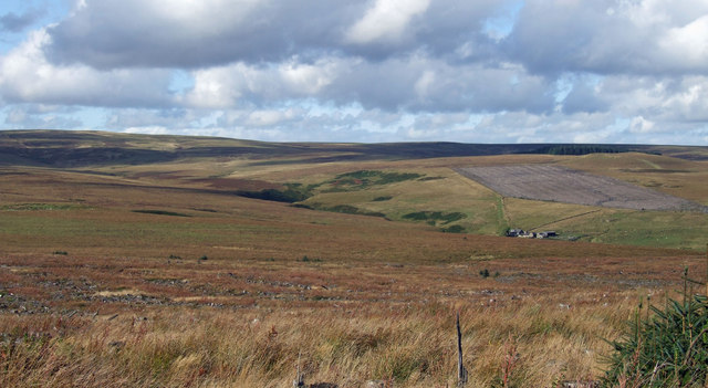
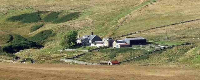
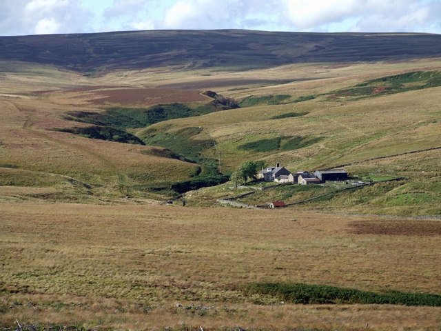
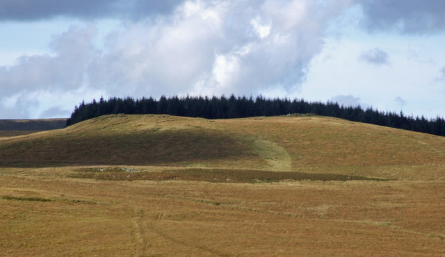
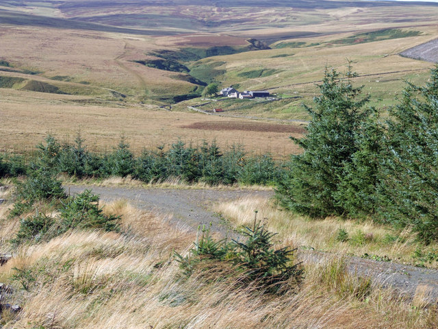
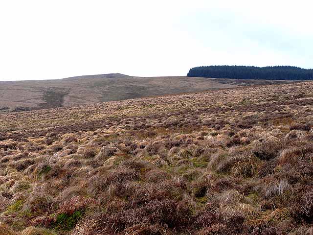
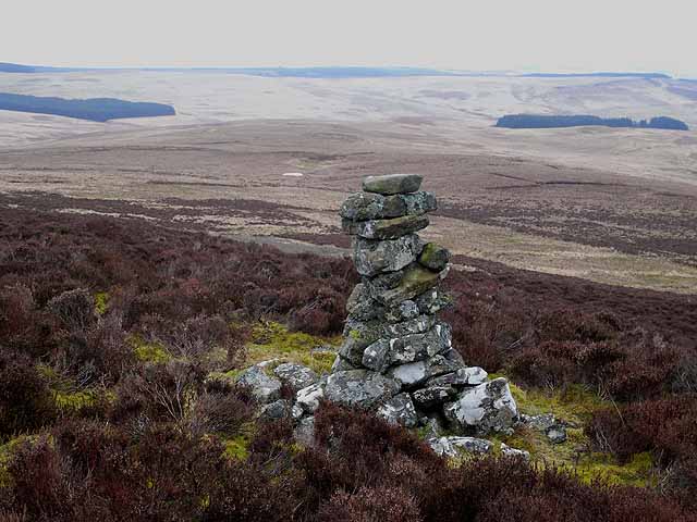
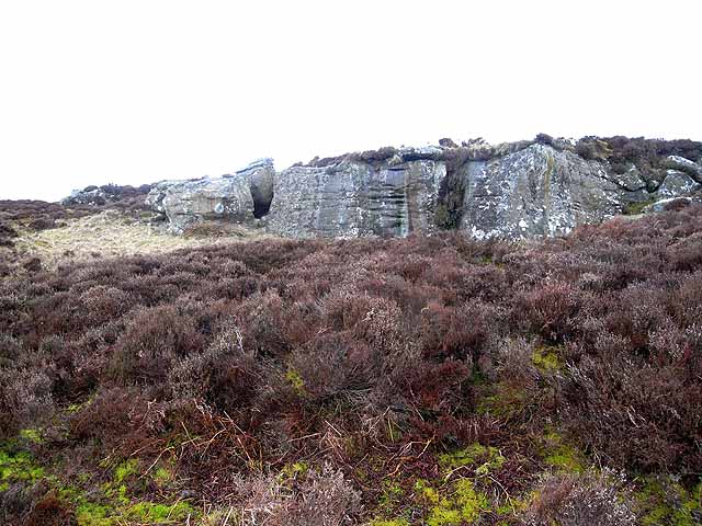
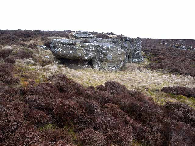
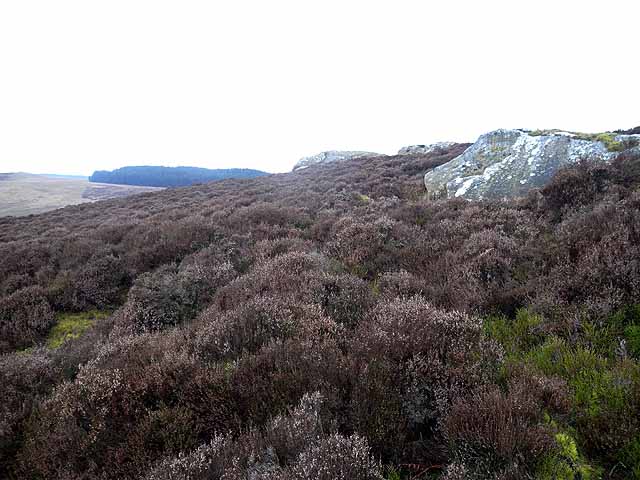
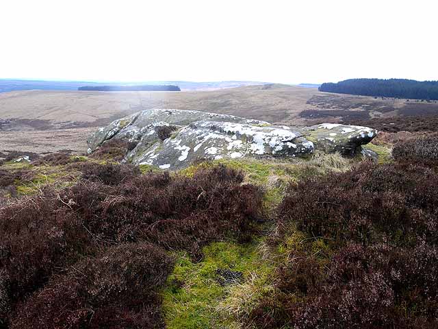
Burngrange Moor is a picturesque expanse of moorland located in the county of Northumberland, England. Situated in the northernmost part of the county, it is nestled within the North Pennines Area of Outstanding Natural Beauty. The moorland covers an area of approximately 3 square kilometers and is characterized by its rolling hills, heather-covered landscapes, and vast open spaces.

The terrain of Burngrange Moor is predominantly flat, with a few gentle slopes and valleys interspersed throughout. The vegetation is primarily composed of heather, creating a stunning purple hue that blankets the moorland during the summer months. Other plant species, such as bilberry and cotton grass, can also be found in abundance.

The moorland is home to a diverse range of wildlife, with several species thriving in this natural habitat. Bird enthusiasts will be delighted to spot a variety of species, including curlews, lapwings, and golden plovers. Additionally, the moorland provides an ideal habitat for the endangered black grouse, making it a popular destination for birdwatchers.

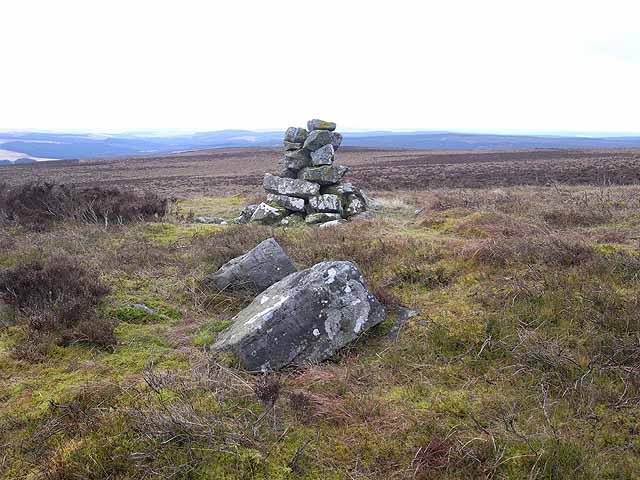
Burngrange Moor offers visitors an opportunity to experience the tranquility and beauty of the Northumberland countryside. Its remote location ensures a peaceful and undisturbed atmosphere, making it an ideal spot for walking, hiking, and nature photography. The moorland is crisscrossed by a network of footpaths and trails, allowing visitors to explore its entirety and enjoy panoramic views of the surrounding landscape.

Overall, Burngrange Moor is a captivating natural area that showcases the stunning beauty of Northumberland's moorland. Its unspoiled landscapes, diverse wildlife, and peaceful ambiance make it a must-visit destination for nature enthusiasts and those seeking solace in the great outdoors.

If you have any feedback on the listing, please let us know in the comments section below.

Burngrange Moor Images

Images are sourced within 2km of 55.251855/-2.4410989 or Grid Reference NY7295. Thanks to Geograph Open Source API. All images are credited.

Cairn near Berrymoor Edge Thankfully, the weather was a bit better on my more recent visit.
Cairn near Berrymoor Edge
Thankfully, the weather was a bit better on my more recent visit.
March Sike View looking across March Sike towards Hunter's Burn.  Burn Grange Farm can be seen on the right of the picture.
March Sike
View looking across March Sike towards Hunter's Burn. Burn Grange Farm can be seen on the right of the picture.
Burn Grange Burn Grange Farm on Burngrange Moor.
Burn Grange
Burn Grange Farm on Burngrange Moor.
Coal Cleugh View looking up Coal Cleugh on Burngrange Moor.
Coal Cleugh
View looking up Coal Cleugh on Burngrange Moor.
Round Law on Burngrange Moor Black Hag Plantation on Round Law
Round Law on Burngrange Moor
Black Hag Plantation on Round Law
March Sike View of turn in the Forest Track above March Sike in Kielder Forest.  Burn Grange is in the distance.
March Sike
View of turn in the Forest Track above March Sike in Kielder Forest. Burn Grange is in the distance.
Round Law and Black Hag Plantation Seen from Long Crag. Part of an extremely remote and inaccessible area in northern Northumberland, an enclave of some 40 square Kilometres comprising just two farms and an extensive area of very rough wet moorland, almost totally surrounded by Kielder Forest. There are a number of small plantations within this area - Black Hag being one of them.
Round Law and Black Hag Plantation
Seen from Long Crag. Part of an extremely remote and inaccessible area in northern Northumberland, an enclave of some 40 square Kilometres comprising just two farms and an extensive area of very rough wet moorland, almost totally surrounded by Kielder Forest. There are a number of small plantations within this area - Black Hag being one of them.
Cairn on Long Crag The middle of three cairns crowning the summit of Long Crag. Beyond can be seen part of an extremely remote and inaccessible area in northern Northumberland, an enclave of some 40 square Kilometres comprising just two farms and an extensive area of very rough wet moorland, almost totally surrounded by Kielder Forest. There are a number of small plantations within this area. The main body of Redesdale Forest (part of the Kielder group) can be seen on the skyline.
Cairn on Long Crag
The middle of three cairns crowning the summit of Long Crag. Beyond can be seen part of an extremely remote and inaccessible area in northern Northumberland, an enclave of some 40 square Kilometres comprising just two farms and an extensive area of very rough wet moorland, almost totally surrounded by Kielder Forest. There are a number of small plantations within this area. The main body of Redesdale Forest (part of the Kielder group) can be seen on the skyline.
Rock outcrop on Long Crag Part of an extremely remote and inaccessible area in northern Northumberland, an enclave of some 40 square Kilometres comprising just two farms and an extensive area of very rough wet moorland, almost totally surrounded by Kielder Forest.
Rock outcrop on Long Crag
Part of an extremely remote and inaccessible area in northern Northumberland, an enclave of some 40 square Kilometres comprising just two farms and an extensive area of very rough wet moorland, almost totally surrounded by Kielder Forest.
Rock outcrop on Long Crag Part of an extremely remote and inaccessible area in northern Northumberland, an enclave of some 40 square Kilometres comprising just two farms and an extensive area of very rough wet moorland, almost totally surrounded by Kielder Forest. Heather and bilberry predominate at the top of this crag.
Rock outcrop on Long Crag
Part of an extremely remote and inaccessible area in northern Northumberland, an enclave of some 40 square Kilometres comprising just two farms and an extensive area of very rough wet moorland, almost totally surrounded by Kielder Forest. Heather and bilberry predominate at the top of this crag.
Long Crag Part of an extremely remote and inaccessible area in northern Northumberland, an enclave of some 40 square Kilometres comprising just two farms and an extensive area of very rough wet moorland, almost totally surrounded by Kielder Forest. Heather and bilberry predominate at the top of this crag. There are a number of small plantations within this area - Black Hag Plantation <a href="https://www.geograph.org.uk/gridref/NY7295">NY7295</a> can be seen on the skyline.
Long Crag
Part of an extremely remote and inaccessible area in northern Northumberland, an enclave of some 40 square Kilometres comprising just two farms and an extensive area of very rough wet moorland, almost totally surrounded by Kielder Forest. Heather and bilberry predominate at the top of this crag. There are a number of small plantations within this area - Black Hag Plantation NY7295 can be seen on the skyline.
Long Crag Part of an extremely remote and inaccessible area in northern Northumberland, an enclave of some 40 square Kilometres comprising just two farms and an extensive area of very rough wet moorland, almost totally surrounded by Kielder Forest. Some low rocky escarpments break up the area, and here heather and bilberry predominate. There are a number of small plantations within this area including Black Hag Plantation <a href="https://www.geograph.org.uk/gridref/NY7295">NY7295</a> to the right. The hill to the left of the plantation is Round Law.
Long Crag
Part of an extremely remote and inaccessible area in northern Northumberland, an enclave of some 40 square Kilometres comprising just two farms and an extensive area of very rough wet moorland, almost totally surrounded by Kielder Forest. Some low rocky escarpments break up the area, and here heather and bilberry predominate. There are a number of small plantations within this area including Black Hag Plantation NY7295 to the right. The hill to the left of the plantation is Round Law.
Cairn on Long Crag The westernmost of three cairns crowning the summit of Long Crag, part of an extremely remote and inaccessible area in northern Northumberland, an enclave of some 40 square kilometres comprising just two farms and an extensive area of very rough wet moorland, almost totally surrounded by Kielder Forest. There are a number of small plantations within this area - the one which lies along Ruken Syke and Hindhope Sike <a href="https://www.geograph.org.uk/gridref/NY7596">NY7596</a> can be seen in the middle distance. The area is bounded to the east by Redesdale Forest, part of the Kielder group of Forests.
Cairn on Long Crag
The westernmost of three cairns crowning the summit of Long Crag, part of an extremely remote and inaccessible area in northern Northumberland, an enclave of some 40 square kilometres comprising just two farms and an extensive area of very rough wet moorland, almost totally surrounded by Kielder Forest. There are a number of small plantations within this area - the one which lies along Ruken Syke and Hindhope Sike NY7596 can be seen in the middle distance. The area is bounded to the east by Redesdale Forest, part of the Kielder group of Forests.
Cairn on Long Crag The westernmost of three cairns crowning the summit of Long Crag, a rocky outcrop within an extremely remote and inaccessible area in northern Northumberland, an enclave of some 40 square Kilometres comprising just two farms and an extensive area of very rough wet moorland, almost totally surrounded by Kielder Forest. There are a number of small plantations within this area - Black Hag Plantation <a href="https://www.geograph.org.uk/gridref/NY7295">NY7295</a> can be seen in the middle ground, with the summit of Round Law to the left.
Cairn on Long Crag
The westernmost of three cairns crowning the summit of Long Crag, a rocky outcrop within an extremely remote and inaccessible area in northern Northumberland, an enclave of some 40 square Kilometres comprising just two farms and an extensive area of very rough wet moorland, almost totally surrounded by Kielder Forest. There are a number of small plantations within this area - Black Hag Plantation NY7295 can be seen in the middle ground, with the summit of Round Law to the left.
Nichol's Bog Seen from Lough Knowe, looking down to Nichol's Bog and the valley of the Smallhope Burn. Part of the Emblehope estate, an extremely remote and inaccessible area in northern Northumberland, an enclave of some 3,000 hectares comprising just two houses and an extensive area of very rough wet moorland supporting some 1500 ewes, almost totally surrounded by Kielder Forest. There are a number of small scattered plantations within the area.
Nichol's Bog
Seen from Lough Knowe, looking down to Nichol's Bog and the valley of the Smallhope Burn. Part of the Emblehope estate, an extremely remote and inaccessible area in northern Northumberland, an enclave of some 3,000 hectares comprising just two houses and an extensive area of very rough wet moorland supporting some 1500 ewes, almost totally surrounded by Kielder Forest. There are a number of small scattered plantations within the area.
Nichol's Bog Seen from Lough Knowe below Long Crag, looking down to Nichols' Bog and the valley of the Smallhope Burn. Part of the Emblehope estate, an extremely remote and inaccessible area in northern Northumberland, an enclave of some 3,000 hectares comprising just two houses and an extensive area of very rough wet moorland supporting some 1500 ewes, almost totally surrounded by Kielder Forest. There are a number of small scattered plantations within the area.
Nichol's Bog
Seen from Lough Knowe below Long Crag, looking down to Nichols' Bog and the valley of the Smallhope Burn. Part of the Emblehope estate, an extremely remote and inaccessible area in northern Northumberland, an enclave of some 3,000 hectares comprising just two houses and an extensive area of very rough wet moorland supporting some 1500 ewes, almost totally surrounded by Kielder Forest. There are a number of small scattered plantations within the area.
Cairn on Emblehope Moor Part of the Emblehope estate. The estate is an extremely remote and inaccessible area in northern Northumberland, an enclave of some 3,000 hectares comprising just two houses and an extensive area of very rough wet moorland supporting some 1500 ewes, almost totally surrounded by Kielder Forest.

This cairn stands on the slopes to the north of Long Crag, and the view is taken looking east over the valley of the Tarn Burn. Bill's Crag <a href="https://www.geograph.org.uk/gridref/NY7497">NY7497</a> and Reedhope Crag <a href="https://www.geograph.org.uk/gridref/NY7597">NY7597</a> lie on the horizon with the edge of Redesdale Forest (part of the Kielder group of forests) beyond.
Cairn on Emblehope Moor
Part of the Emblehope estate. The estate is an extremely remote and inaccessible area in northern Northumberland, an enclave of some 3,000 hectares comprising just two houses and an extensive area of very rough wet moorland supporting some 1500 ewes, almost totally surrounded by Kielder Forest. This cairn stands on the slopes to the north of Long Crag, and the view is taken looking east over the valley of the Tarn Burn. Bill's Crag NY7497 and Reedhope Crag NY7597 lie on the horizon with the edge of Redesdale Forest (part of the Kielder group of forests) beyond.
Cairn on Emblehope Moor Part of the Emblehope estate. The estate is an extremely remote and inaccessible area in northern Northumberland, an enclave of some 3,000 hectares comprising just two houses and an extensive area of very rough wet moorland supporting some 1500 ewes, almost totally surrounded by Kielder Forest.
Cairn on Emblehope Moor
Part of the Emblehope estate. The estate is an extremely remote and inaccessible area in northern Northumberland, an enclave of some 3,000 hectares comprising just two houses and an extensive area of very rough wet moorland supporting some 1500 ewes, almost totally surrounded by Kielder Forest.
Show me another place!

Burngrange Moor is located at Grid Ref: NY7295 (Lat: 55.251855, Lng: -2.4410989)

Unitary Authority: Northumberland

Police Authority: Northumbria

What 3 Words

///cope.lump.torso. Near Rochester, Northumberland

Related Wikis

Nearby Amenities

Located within 500m of 55.251855,-2.4410989
Round Law
Place: locality
Lat/Long: 55.250327/-2.438527
The data included in this document is from www.openstreetmap.org. The data is made available under ODbL.

Have you been to Burngrange Moor?

Leave your review of Burngrange Moor below (or comments, questions and feedback).