Hasgill Fell

Downs, Moorland in Yorkshire Ribble Valley

England

Hasgill Fell

Moorland road north of Bowland Knotts On the horizon are the 'Three Peaks' of Yorkshire.
Moorland road north of Bowland Knotts Credit: John H Darch

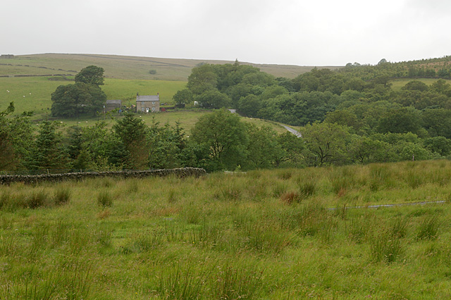
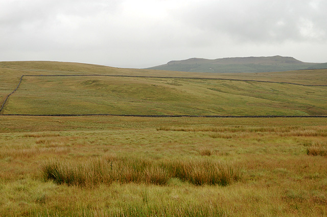
Hasgill Fell is a picturesque and captivating area located in the county of Yorkshire, England. Situated amidst the rolling hills of the Yorkshire Downs, this region offers breathtaking views and an abundance of natural beauty. Known for its rugged and diverse landscape, Hasgill Fell consists of both downs and moorland, providing a rich and varied experience for visitors.

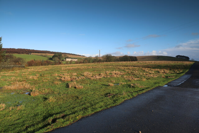
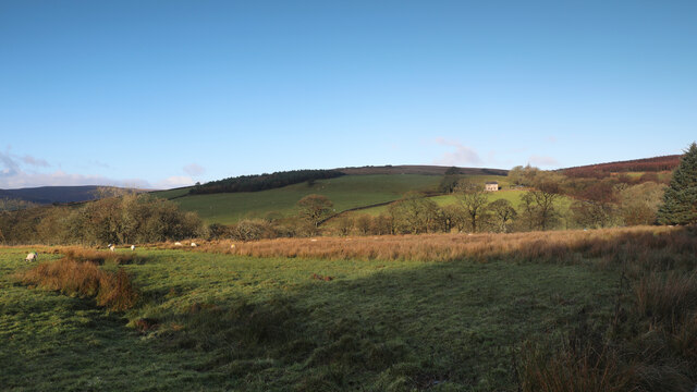
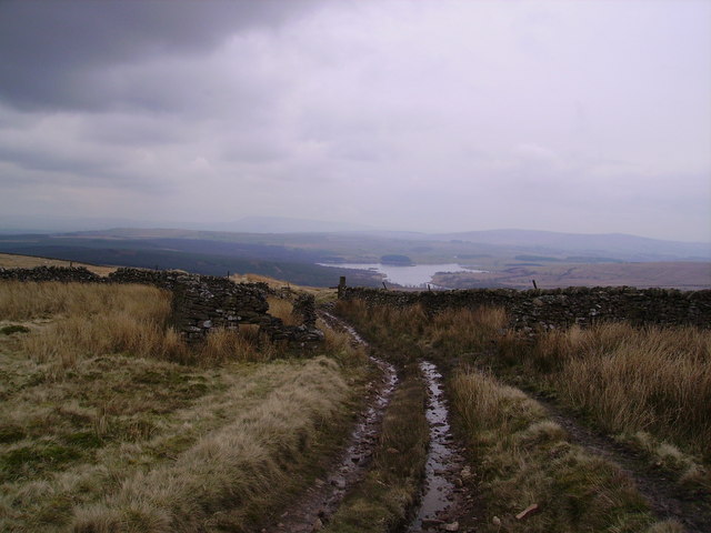
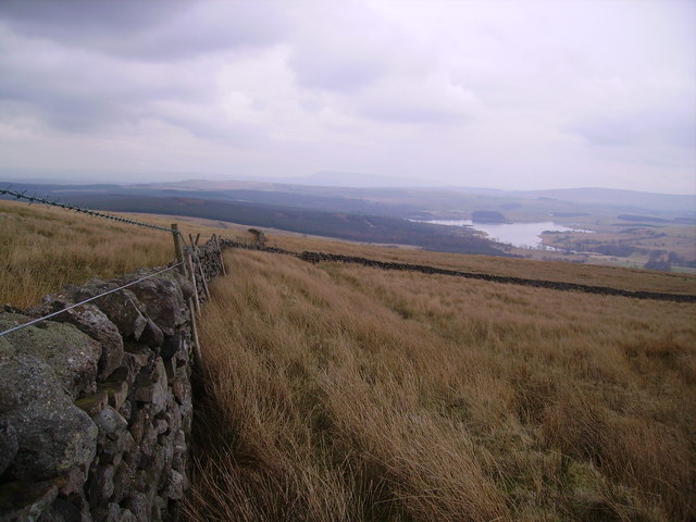
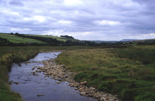
The downs of Hasgill Fell present an expanse of lush green meadows, dotted with vibrant wildflowers during the spring and summer months. These gentle slopes offer splendid vistas of the surrounding countryside, making it a popular spot for hiking and picnicking. The area is also home to a variety of wildlife, including rabbits, foxes, and numerous species of birds.

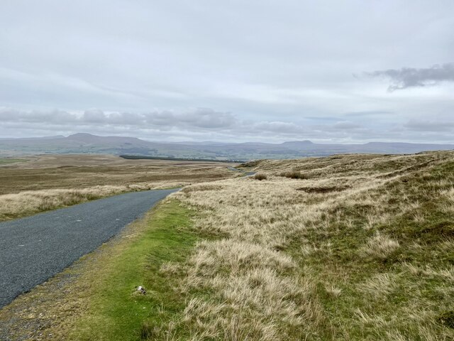
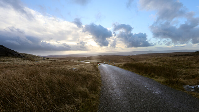
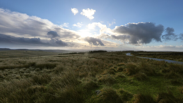
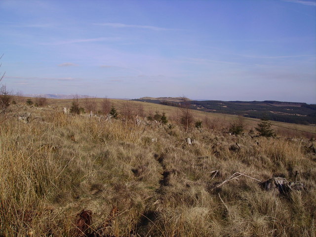
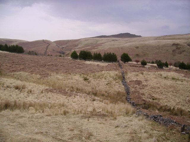
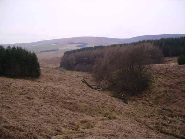
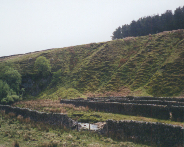
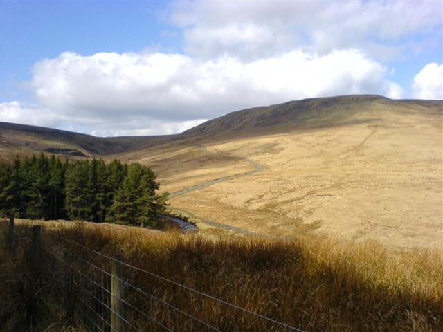
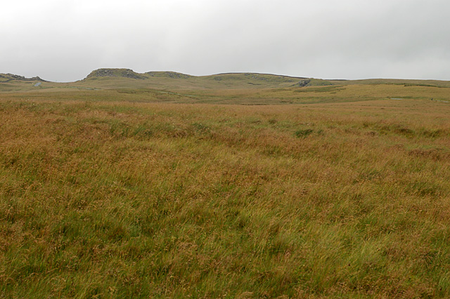
The moorland of Hasgill Fell, on the other hand, offers a stark contrast to the downs. Here, visitors will encounter vast expanses of heather-covered hills, interspersed with rocky outcrops and peat bogs. This unique landscape provides a habitat for a range of flora and fauna, such as grouse, hares, and rare orchids. The moorland also boasts several walking trails, allowing visitors to explore the area and appreciate its untamed beauty.

Hasgill Fell is a haven for nature enthusiasts and outdoor adventurers alike. Whether one seeks a leisurely stroll through the downs or an invigorating hike across the moors, this area promises an unforgettable experience amidst the breathtaking scenery of the Yorkshire countryside.

If you have any feedback on the listing, please let us know in the comments section below.
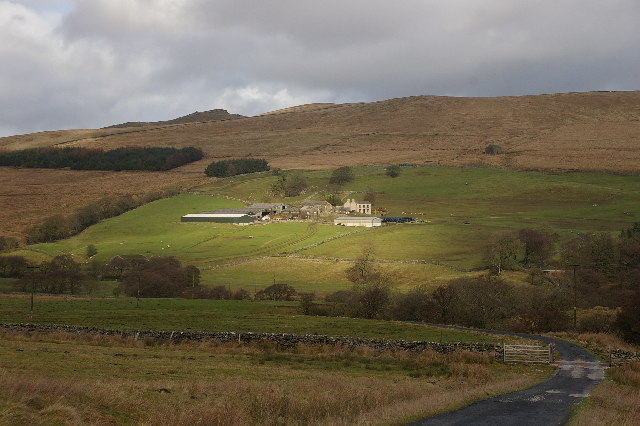
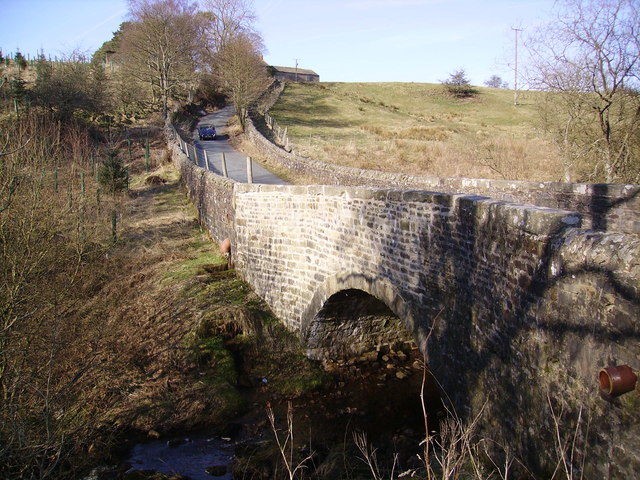
Hasgill Fell Images

Images are sourced within 2km of 54.033676/-2.4298833 or Grid Reference SD7159. Thanks to Geograph Open Source API. All images are credited.

Moorland road north of Bowland Knotts On the horizon are the 'Three Peaks' of Yorkshire.
Moorland road north of Bowland Knotts
On the horizon are the 'Three Peaks' of Yorkshire.
Keasden road heads down Crutchenber Fell Despite rain overngight and an unpromising sky in the morning, the weather is clearing up enough for a good day out in Gisburn Forest. The Keasden road crosses the watershed at Bowland Knotts and heads south for the forest and Stocks reservoir en route for Slaidburn. This used to be a very quiet road when last I passed this way (probably thirty years ago) but now carries a lot of people to the extensive carparks, paths and bike trails provided by the forestry and water companies.
Keasden road heads down Crutchenber Fell
Despite rain overngight and an unpromising sky in the morning, the weather is clearing up enough for a good day out in Gisburn Forest. The Keasden road crosses the watershed at Bowland Knotts and heads south for the forest and Stocks reservoir en route for Slaidburn. This used to be a very quiet road when last I passed this way (probably thirty years ago) but now carries a lot of people to the extensive carparks, paths and bike trails provided by the forestry and water companies.
The northern marches of Gisburn Forest The most recently planted part of Gisburn Forest is also the most northerly and forms an isolated outpost not visited by the main mountain bike trails. The Keasden road descends to it over Crutchenber Fell, passing through it to reach the more mature and popular sections around Stocks reservoir.
The northern marches of Gisburn Forest
The most recently planted part of Gisburn Forest is also the most northerly and forms an isolated outpost not visited by the main mountain bike trails. The Keasden road descends to it over Crutchenber Fell, passing through it to reach the more mature and popular sections around Stocks reservoir.
Looking over Coat Rakes to Dale House Dale House is just by the road north from Gisburn Forest towards Clapham in the Yorkshire Dales. The track here goes to Halsteads Farm, whilst a rougher track to the right goes to Cocklick End, not a place to mention in social media posts, as an AI is likely to take exception...
Looking over Coat Rakes to Dale House
Dale House is just by the road north from Gisburn Forest towards Clapham in the Yorkshire Dales. The track here goes to Halsteads Farm, whilst a rougher track to the right goes to Cocklick End, not a place to mention in social media posts, as an AI is likely to take exception...
Higher Clough On the west side of the Keasden road, land rises to Green Pike above Higher Clough (the farmhouse in the sun). The moor on the far horizon is CROW Access Land, but most of what is visible in this view has no public access.
Higher Clough
On the west side of the Keasden road, land rises to Green Pike above Higher Clough (the farmhouse in the sun). The moor on the far horizon is CROW Access Land, but most of what is visible in this view has no public access.
Catlow Farm Forest of Bowland Taken from the farm road leading to Catlow Farm, looking in a NE direction
Catlow Farm Forest of Bowland
Taken from the farm road leading to Catlow Farm, looking in a NE direction
Crutchenber Fell Looking towards Gisburn Forest
Crutchenber Fell
Looking towards Gisburn Forest
Coat Rakes Bridge On Hasgill Beck
Coat Rakes Bridge
On Hasgill Beck
Catlow Plantation Just above the original plantation. Looking towards Knot Clough and Bowland Knotts
Catlow Plantation
Just above the original plantation. Looking towards Knot Clough and Bowland Knotts
Catlow Plantation From Hasgill Fell. The small beck is called Kearsden Holes
Catlow Plantation
From Hasgill Fell. The small beck is called Kearsden Holes
Track and ruin, The Height Looking towards Stocks Reservoir.
Track and ruin, The Height
Looking towards Stocks Reservoir.
Walls Just in the north edge of the square looking down towards Stock Reservoir
Walls
Just in the north edge of the square looking down towards Stock Reservoir
Sheepfold near Cross of Greet Bridge The sheepfold shown on the Explorer map, adjacent to the River Hodder.
Sheepfold near Cross of Greet Bridge
The sheepfold shown on the Explorer map, adjacent to the River Hodder.
Upper reaches of the River Hodder This looks downstream from the Cross of Greet Bridge on the moorland road from Slaidburn to High Bentham in the Forest of Bowland
Upper reaches of the River Hodder
This looks downstream from the Cross of Greet Bridge on the moorland road from Slaidburn to High Bentham in the Forest of Bowland
Slaidburn Road Taken on the road from Slaidburn to High Bentham
Slaidburn Road
Taken on the road from Slaidburn to High Bentham
Higher Clough Farm
Higher Clough Farm
Birch Clough Rigg With Whelp Stone Crag on the horizon
Birch Clough Rigg
With Whelp Stone Crag on the horizon
Crutchenber Fell Knotteranum on the horizon
Crutchenber Fell
Knotteranum on the horizon
Show me another place!

Hasgill Fell is located at Grid Ref: SD7159 (Lat: 54.033676, Lng: -2.4298833)

Division: West Riding

Administrative County: Lancashire

District: Ribble Valley

Police Authority: Lancashire

What 3 Words

///marching.irrigate.speedily. Near Settle, North Yorkshire

Related Wikis

Easington, Lancashire

Easington () is a civil parish within the Ribble Valley district of Lancashire, England, with a population in 2001 of 52. The Census 2011 population details...

Stocks Reservoir

Stocks Reservoir is a reservoir situated at the head of the Hodder valley in the Forest of Bowland, Lancashire, England (historically in the West Riding...

White Hill (Forest of Bowland)

White Hill is a hill in the Forest of Bowland, north-western England. It lies between Slaidburn and High Bentham, on the boundary between the City of Lancaster...

Geography of the United Kingdom

The United Kingdom is a sovereign state located off the north-western coast of continental Europe. With a total area of approximately 244,376 square kilometres...

Have you been to Hasgill Fell?

Leave your review of Hasgill Fell below (or comments, questions and feedback).