Brackenber Moor

Downs, Moorland in Westmorland Eden

England

Brackenber Moor

Bridge over Hilton Beck The bridge carries Leagarth Lane, Hilton's main road, over Hilton Beck, and is seen from the public footpath on the south bank heading for Langton and Brackenber. Water levels are quite high, and for those keen to try out little-known river descents, is almost at a paddleable level - this would be a convenient put-on, with parking to the left of the background trees. There's at least one livestock fence to watch out for downstream (but has a big eddy and can probably be sneaked via a broken panel, as of early 2022).
Bridge over Hilton Beck Credit: Andy Waddington

Brackenber Moor, located in the historic county of Westmorland in England, is a picturesque expanse of downs and moorland. Situated within the Cumbrian Fells, it provides a stunning natural landscape for visitors to admire and explore.

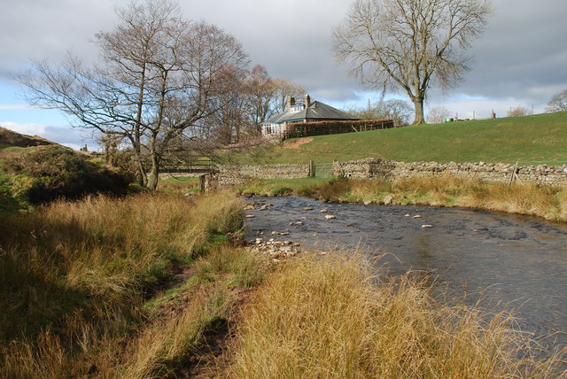
Covering an area of approximately 10 square miles, Brackenber Moor is characterized by rolling hills, heather-covered moorland, and scattered patches of woodland. The terrain is varied, with gentle slopes in some areas and steeper inclines in others, making it an ideal destination for hikers and nature enthusiasts.

The moor is home to a rich variety of plant and animal life, including heather, bilberries, and a diverse array of bird species such as curlews and lapwings. The open expanses of Brackenber Moor offer breathtaking views of the surrounding countryside, providing a sense of tranquility and serenity.

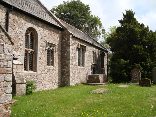
In addition to its natural beauty, Brackenber Moor also boasts a rich cultural heritage. The area is dotted with ancient burial mounds, stone circles, and remnants of prehistoric settlements, adding an element of historical intrigue to the landscape.

Access to Brackenber Moor is facilitated by a network of footpaths and bridleways, allowing visitors to explore the area on foot, horseback, or bicycle. The moor is also a popular spot for picnicking, birdwatching, and wildlife photography.

Overall, Brackenber Moor in Westmorland offers a captivating blend of natural beauty, cultural significance, and recreational opportunities, making it a must-visit destination for those seeking an authentic English countryside experience.

If you have any feedback on the listing, please let us know in the comments section below.

Brackenber Moor Images

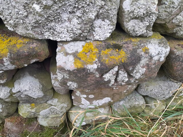
Images are sourced within 2km of 54.572123/-2.4418601 or Grid Reference NY7119. Thanks to Geograph Open Source API. All images are credited.

Bridge over Hilton Beck The bridge carries Leagarth Lane, Hilton's main road, over Hilton Beck, and is seen from the public footpath on the south bank heading for Langton and Brackenber. Water levels are quite high, and for those keen to try out little-known river descents, is almost at a paddleable level - this would be a convenient put-on, with parking to the left of the background trees. There's at least one livestock fence to watch out for downstream (but has a big eddy and can probably be sneaked via a broken panel, as of early 2022).
Bridge over Hilton Beck
The bridge carries Leagarth Lane, Hilton's main road, over Hilton Beck, and is seen from the public footpath on the south bank heading for Langton and Brackenber. Water levels are quite high, and for those keen to try out little-known river descents, is almost at a paddleable level - this would be a convenient put-on, with parking to the left of the background trees. There's at least one livestock fence to watch out for downstream (but has a big eddy and can probably be sneaked via a broken panel, as of early 2022).
Hilton Beck from Thornless Hill The larger scales of map show the public footpath here as being at the bottom of the steep bank, but invasive gorse rather deterred one from trying anything down there. The top of the bank, however, remains largely in keeping with the name of the rising ground behind the photographer - Thornless Hill. It is not improved pasture like the enclosed fields towards the village of Hilton, but is mainly free of prickly walker-deterrent vegetation. The road is the one to Hilton from Appleby and likely the one that a SatNav would bring you to, since the road south of Hilton passes through Warcop training area and is confusingly missing from such navigation technology (presumably because sometimes it is closed to the public).
Hilton Beck from Thornless Hill
The larger scales of map show the public footpath here as being at the bottom of the steep bank, but invasive gorse rather deterred one from trying anything down there. The top of the bank, however, remains largely in keeping with the name of the rising ground behind the photographer - Thornless Hill. It is not improved pasture like the enclosed fields towards the village of Hilton, but is mainly free of prickly walker-deterrent vegetation. The road is the one to Hilton from Appleby and likely the one that a SatNav would bring you to, since the road south of Hilton passes through Warcop training area and is confusingly missing from such navigation technology (presumably because sometimes it is closed to the public).
Hilton Beck at Langton Hilton Beck runs along the northern and western edges of Brackenber Moor (Appleby Golf Course) and for the aficionado of obscure ditches who prefer their paddling not to be too scary, looks quite an attractive proposition. The level seen here is fairly high through snowmelt, but with some rain too it would perhaps be a little quicker from a put-in at Hilton to a take-out at Coupland. This view is from just upstream of the footbridge at Langton and shows what would, in lower water, be an easy ford. The beck seems relatively free of tree hazard for a lowland trip, but there is at least one livestock fence (just around a blind bend) to watch out for - there may be other hazards not seen on my walk (it was a dog walk, not a full river reconnaissance).
Hilton Beck at Langton
Hilton Beck runs along the northern and western edges of Brackenber Moor (Appleby Golf Course) and for the aficionado of obscure ditches who prefer their paddling not to be too scary, looks quite an attractive proposition. The level seen here is fairly high through snowmelt, but with some rain too it would perhaps be a little quicker from a put-in at Hilton to a take-out at Coupland. This view is from just upstream of the footbridge at Langton and shows what would, in lower water, be an easy ford. The beck seems relatively free of tree hazard for a lowland trip, but there is at least one livestock fence (just around a blind bend) to watch out for - there may be other hazards not seen on my walk (it was a dog walk, not a full river reconnaissance).
House nearly finished, Langton The fresh local sandstone construction looks quite colourful but will no doubt weather quite quickly to be a match for the other nearby properties. Open eaves on the nearest part of the building show that there is still work to do on the house, but the next main challenge will surely be the garden. It's a heavy clay soil left by the retreat of the Eden Valley glacier, but at least the site is not beset by the sort of rubble often seen on building sites. I wish them luck.
House nearly finished, Langton
The fresh local sandstone construction looks quite colourful but will no doubt weather quite quickly to be a match for the other nearby properties. Open eaves on the nearest part of the building show that there is still work to do on the house, but the next main challenge will surely be the garden. It's a heavy clay soil left by the retreat of the Eden Valley glacier, but at least the site is not beset by the sort of rubble often seen on building sites. I wish them luck.
Footpath south of Low Barn The footpath leaves the minor road to Flakebridge to follow the northern edge of a patch of woodland. The bits of plastic pipe (seemingly much loved by gamekeepers as markers for all sorts of things) bear numbers for shooting positions, presumably to annihilate pheasant being driven over the horizon from the fields to the north (right, in this view). Anything being driven out of the woods would be in your face before having time to fire a shot and a shorter-range weapon would seem more in order. Tennis rackets to return serve or a net on a long pole as used for Puffins in the Faeroes, perhaps ?
Footpath south of Low Barn
The footpath leaves the minor road to Flakebridge to follow the northern edge of a patch of woodland. The bits of plastic pipe (seemingly much loved by gamekeepers as markers for all sorts of things) bear numbers for shooting positions, presumably to annihilate pheasant being driven over the horizon from the fields to the north (right, in this view). Anything being driven out of the woods would be in your face before having time to fire a shot and a shorter-range weapon would seem more in order. Tennis rackets to return serve or a net on a long pole as used for Puffins in the Faeroes, perhaps ?
Copse south of Murton Beck This stand of trees (which we would have called a copse where I grew up, but they are not coppiced, so whether the term would apply here I'm less sure) occupies the corner of a field south of Murton Beck, the northern edge of which is followed by the public footpath from the Flakebridge road towards Murton, upon which the photographer and his trusty but dawdling hound are standing as the daylight fades (again).
Copse south of Murton Beck
This stand of trees (which we would have called a copse where I grew up, but they are not coppiced, so whether the term would apply here I'm less sure) occupies the corner of a field south of Murton Beck, the northern edge of which is followed by the public footpath from the Flakebridge road towards Murton, upon which the photographer and his trusty but dawdling hound are standing as the daylight fades (again).
Ordnance Survey Cut Mark This OS cut mark can be found on the barn at Kirkber Farm. It marks a point 155.466m above mean sea level.
Ordnance Survey Cut Mark
This OS cut mark can be found on the barn at Kirkber Farm. It marks a point 155.466m above mean sea level.
Ordnance Survey Cut Mark This OS cut mark can be found on the barn at Langton Farm. It marks a point 159.602m above mean sea level.
Ordnance Survey Cut Mark
This OS cut mark can be found on the barn at Langton Farm. It marks a point 159.602m above mean sea level.
Ordnance Survey Pivot This OS pivot can be found on the wall SW side of the road. It marks a point 164.857m above mean sea level.
Ordnance Survey Pivot
This OS pivot can be found on the wall SW side of the road. It marks a point 164.857m above mean sea level.
Ordnance Survey Pivot This OS pivot can be found on the culvert NW side of the road. It marks a point 182.426m above mean sea level.
Ordnance Survey Pivot
This OS pivot can be found on the culvert NW side of the road. It marks a point 182.426m above mean sea level.
Farm Ford at Langton This farm ford is found on the Hilton Beck at Langton.
Farm Ford at Langton
This farm ford is found on the Hilton Beck at Langton.
Near Ellerholme Looking SW.
Near Ellerholme
Looking SW.
Stoneriggs Hill Looking towards Murton Pike.
Stoneriggs Hill
Looking towards Murton Pike.
B6542 turn off, A66 The A66 is a major road in northern England running from near Middlesbrough to Workington. The section between Scotch Corner and Penrith is a Trans-Pennine route between the A1 and M6, following an old Roman Road.
Wikipedia: <span class="nowrap"><a title="http://en.wikipedia.org/wiki/A66_road" rel="nofollow ugc noopener" href="http://en.wikipedia.org/wiki/A66_road">Link</a><img style="margin-left:2px;" alt="External link" title="External link - shift click to open in new window" src="https://s1.geograph.org.uk/img/external.png" width="10" height="10"/></span>
B6542 turn off, A66
The A66 is a major road in northern England running from near Middlesbrough to Workington. The section between Scotch Corner and Penrith is a Trans-Pennine route between the A1 and M6, following an old Roman Road. Wikipedia: LinkExternal link
Sandford Thorn A house by the A66.
Sandford Thorn
A house by the A66.
Cattle grazing by the A66
Track to Far Bank End Long track off the A66 to the farm.
Track to Far Bank End
Long track off the A66 to the farm.
A66 by Far Bank End Looking south east along the A66.
A66 by Far Bank End
Looking south east along the A66.
Show me another place!

Brackenber Moor is located at Grid Ref: NY7119 (Lat: 54.572123, Lng: -2.4418601)

Administrative County: Cumbria

District: Eden

Police Authority: Cumbria

What 3 Words

///helpfully.bystander.tags. Near Appleby-in-Westmorland, Cumbria

Related Wikis

Coupland, Cumbria

Coupland is a small village in Cumbria, England, in the civil parish of Warcop. It is situated a short distance to the south-east of Appleby-in-Westmorland...

Brackenber

Brackenber is a hamlet in the civil parish of Murton in Cumbria, England. It is near the town of Appleby-in-Westmorland and the village of Hilton, Cumbria...

Hilton, Cumbria

Hilton is a village in Cumbria, England, in the civil parish of Murton, about 3 miles (4.8 km) east of Appleby-in-Westmorland and at an elevation of 752...

Ormside

Ormside is a civil parish in the Eden District of Cumbria, England, which includes the village of Great Ormside and the hamlet of Little Ormside. It had...

Nearby Amenities

Located within 500m of 54.572123,-2.4418601
Power: pole
Lat/Long: 54.5765315/-2.4419611
Power: pole
Lat/Long: 54.576253/-2.4423585
Power: pole
Lat/Long: 54.5759344/-2.4427698
Power: pole
Lat/Long: 54.5691416/-2.4468595
Power: pole
Lat/Long: 54.5689146/-2.4452618
Power: pole
Lat/Long: 54.5690041/-2.4443483
Power: pole
Lat/Long: 54.5691038/-2.4433378
The data included in this document is from www.openstreetmap.org. The data is made available under ODbL.

Have you been to Brackenber Moor?

Leave your review of Brackenber Moor below (or comments, questions and feedback).