Brackenber Flodders

Lake, Pool, Pond, Freshwater Marsh in Westmorland Eden

England

Brackenber Flodders

Bridge over Hilton Beck The bridge carries Leagarth Lane, Hilton's main road, over Hilton Beck, and is seen from the public footpath on the south bank heading for Langton and Brackenber. Water levels are quite high, and for those keen to try out little-known river descents, is almost at a paddleable level - this would be a convenient put-on, with parking to the left of the background trees. There's at least one livestock fence to watch out for downstream (but has a big eddy and can probably be sneaked via a broken panel, as of early 2022).
Bridge over Hilton Beck Credit: Andy Waddington

Brackenber Flodders, located in Westmorland, is a picturesque freshwater marsh encompassing a diverse range of aquatic habitats including a lake, pool, pond, and marshland. Spanning over a considerable area, it offers an idyllic haven for wildlife and nature enthusiasts alike.

The star attraction of Brackenber Flodders is its serene lake, which stretches across several acres. The crystal-clear waters are home to an abundance of aquatic species, including fish, amphibians, and waterfowl. Visitors can observe the tranquil scene while strolling along the lake's edge or opt for a leisurely boat ride to explore its hidden corners.

Adjacent to the lake, a smaller pool and pond provide additional ecosystems for various aquatic plants and invertebrates. These habitats offer a glimpse into the delicate balance of nature, with visitors often spotting dragonflies, water lilies, and other fascinating species.

Surrounding the water bodies, the freshwater marshland forms a crucial part of the ecosystem. Saturated with water for most of the year, it provides a perfect breeding ground for wetland plants such as reeds, sedges, and bulrushes. This marshland serves as a sanctuary for numerous bird species, attracting nesting birds and offering a vital stopover for migratory flocks.

Brackenber Flodders, with its diverse aquatic habitats and thriving wildlife, offers a unique opportunity to explore and appreciate the wonders of freshwater ecosystems. Whether it's birdwatching, fishing, or simply enjoying the tranquility of the surroundings, this natural gem promises an unforgettable experience for visitors of all ages.

If you have any feedback on the listing, please let us know in the comments section below.

Brackenber Flodders Images

Images are sourced within 2km of 54.570758/-2.4367101 or Grid Reference NY7119. Thanks to Geograph Open Source API. All images are credited.

Bridge over Hilton Beck The bridge carries Leagarth Lane, Hilton's main road, over Hilton Beck, and is seen from the public footpath on the south bank heading for Langton and Brackenber. Water levels are quite high, and for those keen to try out little-known river descents, is almost at a paddleable level - this would be a convenient put-on, with parking to the left of the background trees. There's at least one livestock fence to watch out for downstream (but has a big eddy and can probably be sneaked via a broken panel, as of early 2022).
Bridge over Hilton Beck
The bridge carries Leagarth Lane, Hilton's main road, over Hilton Beck, and is seen from the public footpath on the south bank heading for Langton and Brackenber. Water levels are quite high, and for those keen to try out little-known river descents, is almost at a paddleable level - this would be a convenient put-on, with parking to the left of the background trees. There's at least one livestock fence to watch out for downstream (but has a big eddy and can probably be sneaked via a broken panel, as of early 2022).
Hilton Beck from Thornless Hill The larger scales of map show the public footpath here as being at the bottom of the steep bank, but invasive gorse rather deterred one from trying anything down there. The top of the bank, however, remains largely in keeping with the name of the rising ground behind the photographer - Thornless Hill. It is not improved pasture like the enclosed fields towards the village of Hilton, but is mainly free of prickly walker-deterrent vegetation. The road is the one to Hilton from Appleby and likely the one that a SatNav would bring you to, since the road south of Hilton passes through Warcop training area and is confusingly missing from such navigation technology (presumably because sometimes it is closed to the public).
Hilton Beck from Thornless Hill
The larger scales of map show the public footpath here as being at the bottom of the steep bank, but invasive gorse rather deterred one from trying anything down there. The top of the bank, however, remains largely in keeping with the name of the rising ground behind the photographer - Thornless Hill. It is not improved pasture like the enclosed fields towards the village of Hilton, but is mainly free of prickly walker-deterrent vegetation. The road is the one to Hilton from Appleby and likely the one that a SatNav would bring you to, since the road south of Hilton passes through Warcop training area and is confusingly missing from such navigation technology (presumably because sometimes it is closed to the public).
Hilton Beck at Langton Hilton Beck runs along the northern and western edges of Brackenber Moor (Appleby Golf Course) and for the aficionado of obscure ditches who prefer their paddling not to be too scary, looks quite an attractive proposition. The level seen here is fairly high through snowmelt, but with some rain too it would perhaps be a little quicker from a put-in at Hilton to a take-out at Coupland. This view is from just upstream of the footbridge at Langton and shows what would, in lower water, be an easy ford. The beck seems relatively free of tree hazard for a lowland trip, but there is at least one livestock fence (just around a blind bend) to watch out for - there may be other hazards not seen on my walk (it was a dog walk, not a full river reconnaissance).
Hilton Beck at Langton
Hilton Beck runs along the northern and western edges of Brackenber Moor (Appleby Golf Course) and for the aficionado of obscure ditches who prefer their paddling not to be too scary, looks quite an attractive proposition. The level seen here is fairly high through snowmelt, but with some rain too it would perhaps be a little quicker from a put-in at Hilton to a take-out at Coupland. This view is from just upstream of the footbridge at Langton and shows what would, in lower water, be an easy ford. The beck seems relatively free of tree hazard for a lowland trip, but there is at least one livestock fence (just around a blind bend) to watch out for - there may be other hazards not seen on my walk (it was a dog walk, not a full river reconnaissance).
House nearly finished, Langton The fresh local sandstone construction looks quite colourful but will no doubt weather quite quickly to be a match for the other nearby properties. Open eaves on the nearest part of the building show that there is still work to do on the house, but the next main challenge will surely be the garden. It's a heavy clay soil left by the retreat of the Eden Valley glacier, but at least the site is not beset by the sort of rubble often seen on building sites. I wish them luck.
House nearly finished, Langton
The fresh local sandstone construction looks quite colourful but will no doubt weather quite quickly to be a match for the other nearby properties. Open eaves on the nearest part of the building show that there is still work to do on the house, but the next main challenge will surely be the garden. It's a heavy clay soil left by the retreat of the Eden Valley glacier, but at least the site is not beset by the sort of rubble often seen on building sites. I wish them luck.
Copse south of Murton Beck This stand of trees (which we would have called a copse where I grew up, but they are not coppiced, so whether the term would apply here I'm less sure) occupies the corner of a field south of Murton Beck, the northern edge of which is followed by the public footpath from the Flakebridge road towards Murton, upon which the photographer and his trusty but dawdling hound are standing as the daylight fades (again).
Copse south of Murton Beck
This stand of trees (which we would have called a copse where I grew up, but they are not coppiced, so whether the term would apply here I'm less sure) occupies the corner of a field south of Murton Beck, the northern edge of which is followed by the public footpath from the Flakebridge road towards Murton, upon which the photographer and his trusty but dawdling hound are standing as the daylight fades (again).
Murton and Hilton church Situated midway between Murton and its smaller satellite Hilton, the church is dedicated to St. John the Baptist. Its graveyard lies just across the minor road between the villages, and slightly nearer to Hilton, and lies among the tall conifers seen on the left of the view.
Murton and Hilton church
Situated midway between Murton and its smaller satellite Hilton, the church is dedicated to St. John the Baptist. Its graveyard lies just across the minor road between the villages, and slightly nearer to Hilton, and lies among the tall conifers seen on the left of the view.
Ordnance Survey Cut Mark This OS cut mark can be found on the barn at Kirkber Farm. It marks a point 155.466m above mean sea level.
Ordnance Survey Cut Mark
This OS cut mark can be found on the barn at Kirkber Farm. It marks a point 155.466m above mean sea level.
Ordnance Survey Cut Mark This OS cut mark can be found on the barn at Langton Farm. It marks a point 159.602m above mean sea level.
Ordnance Survey Cut Mark
This OS cut mark can be found on the barn at Langton Farm. It marks a point 159.602m above mean sea level.
Ordnance Survey Pivot This OS pivot can be found on the wall SW side of the road. It marks a point 164.857m above mean sea level.
Ordnance Survey Pivot
This OS pivot can be found on the wall SW side of the road. It marks a point 164.857m above mean sea level.
Ordnance Survey Pivot This OS pivot can be found on the culvert NW side of the road. It marks a point 182.426m above mean sea level.
Ordnance Survey Pivot
This OS pivot can be found on the culvert NW side of the road. It marks a point 182.426m above mean sea level.
Ordnance Survey Cut Mark This OS cut mark can be found on the east angle of St John's Church. It marks a point 232.361m above mean sea level.
Ordnance Survey Cut Mark
This OS cut mark can be found on the east angle of St John's Church. It marks a point 232.361m above mean sea level.
Church at Murton The Church of St. John the Baptist stands beside the minor road linking the villages of Murton and Hilton.
Church at Murton
The Church of St. John the Baptist stands beside the minor road linking the villages of Murton and Hilton.
The Cottage and barn at Hilton Hilton is a small, attractive village at the foot of the steep western slope of the northern Pennines; it's unfortunate that it's also perhaps the closest settlement to the MOD's Warcop Firing range with 'live' artillery firing occurring on most days of the year. No danger of course but the noise must be aggravating! The small cottage is actually named 'The Cottage'; it's on the north side of the road.
The Cottage and barn at Hilton
Hilton is a small, attractive village at the foot of the steep western slope of the northern Pennines; it's unfortunate that it's also perhaps the closest settlement to the MOD's Warcop Firing range with 'live' artillery firing occurring on most days of the year. No danger of course but the noise must be aggravating! The small cottage is actually named 'The Cottage'; it's on the north side of the road.
St John the Baptist, Murton
Farm Ford at Langton This farm ford is found on the Hilton Beck at Langton.
Farm Ford at Langton
This farm ford is found on the Hilton Beck at Langton.
Near Ellerholme Looking SW.
Near Ellerholme
Looking SW.
Stoneriggs Hill Looking towards Murton Pike.
Stoneriggs Hill
Looking towards Murton Pike.
B6542 turn off, A66 The A66 is a major road in northern England running from near Middlesbrough to Workington. The section between Scotch Corner and Penrith is a Trans-Pennine route between the A1 and M6, following an old Roman Road.
Wikipedia: <span class="nowrap"><a title="http://en.wikipedia.org/wiki/A66_road" rel="nofollow ugc noopener" href="http://en.wikipedia.org/wiki/A66_road">Link</a><img style="margin-left:2px;" alt="External link" title="External link - shift click to open in new window" src="https://s1.geograph.org.uk/img/external.png" width="10" height="10"/></span>
B6542 turn off, A66
The A66 is a major road in northern England running from near Middlesbrough to Workington. The section between Scotch Corner and Penrith is a Trans-Pennine route between the A1 and M6, following an old Roman Road. Wikipedia: LinkExternal link
Show me another place!

Brackenber Flodders is located at Grid Ref: NY7119 (Lat: 54.570758, Lng: -2.4367101)

Administrative County: Cumbria

District: Eden

Police Authority: Cumbria

What 3 Words

///stirs.traps.wiped. Near Appleby-in-Westmorland, Cumbria

Related Wikis

Coupland, Cumbria

Coupland is a small village in Cumbria, England, in the civil parish of Warcop. It is situated a short distance to the south-east of Appleby-in-Westmorland...

Brackenber

Brackenber is a hamlet in the civil parish of Murton in Cumbria, England. It is near the town of Appleby-in-Westmorland and the village of Hilton, Cumbria...

Hilton, Cumbria

Hilton is a village in Cumbria, England, in the civil parish of Murton, about 3 miles (4.8 km) east of Appleby-in-Westmorland and at an elevation of 752...

Ormside

Ormside is a civil parish in the Eden District of Cumbria, England, which includes the village of Great Ormside and the hamlet of Little Ormside. It had...

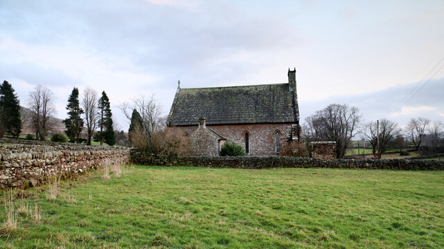
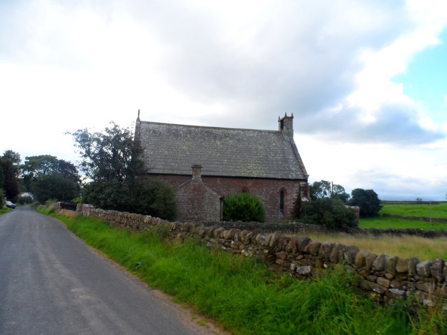
St James' Church, Great Ormside

St James' Church is in the village of Great Ormside, Cumbria, England. It is an active Anglican parish church in the deanery of Appleby, the archdeaconry...

Murton, Cumbria

Murton is a small village and civil parish in the Eden District of Cumbria, England. The parish had a population of 330 in 2001, rising to 360 at the 2011...

Flakebridge

Flakebridge is a woodland and small hamlet in the Eden District, Cumbria, England, 3 kilometres (1.9 mi) south-west from the village of Dufton and 1.95...

Great Ormside

Great Ormside is a small village in the parish of Ormside, in the Eden District, in the English county of Cumbria. It is a few miles away from the small...

Related Videos

North Pennines Walks | High Cup Nick, Murton Fell & Murton Pike | Surprisingly Nice Day

Exciting stuff up High Cup Nick! https://www.youtube.com/@TonysTrails?sub_confirmation=1 #northpennines #walking ...

Murton Pike (Slideshow)

Video camera is out of action at the moment so a slideshow it is then.

Murton Pike... I failed... AGAIN

Hey everyone, welcome to another weird and wonderful adventure. I swear me and Joe are not on day release and no one is ...

#MurtonFell. #HighCupNick. #GoPro7. #Canon250D.

High Cup Nick to klasyczna dolina w kształcie litery U, położona wysoko na zachodnich zboczach obszaru o wybitnych walorach ...

Nearby Amenities

Located within 500m of 54.570758,-2.4367101
Brackenber
Place: hamlet
Source: NPE
Lat/Long: 54.5711107/-2.4294968
Brackenber Gate
Local Ref: AT
Naptan AtcoCode: 090074481438
Naptan Bearing: W
Naptan BusStopType: CUS
Naptan CommonName: Brackenber Gate
Naptan Indicator: at
Naptan Landmark: Brackenber Gate
Naptan NaptanCode: cumdatjt
Naptan Street: No name
Naptan Verified: no
Source: naptan_import
Lat/Long: 54.5712567/-2.4302638
Post Box
Ref: CA16 286
Lat/Long: 54.5712547/-2.4301889
Bench
Lat/Long: 54.5714008/-2.4302458
Barrier: cattle_grid
Lat/Long: 54.5713061/-2.4302636
Power: pole
Lat/Long: 54.5697345/-2.4312992
Power: pole
Lat/Long: 54.5699925/-2.430706
Power: pole
Lat/Long: 54.5702332/-2.4302216
Power: pole
Lat/Long: 54.5704854/-2.4296501
Power: pole
Lat/Long: 54.5707226/-2.4290965
Power: pole
Lat/Long: 54.5691038/-2.4433378
The data included in this document is from www.openstreetmap.org. The data is made available under ODbL.

Have you been to Brackenber Flodders?

Leave your review of Brackenber Flodders below (or comments, questions and feedback).