Catlow Fell

Downs, Moorland in Yorkshire Ribble Valley

England

Catlow Fell

Hailshowers Fell Parked after cattle grid at 427 metres at SD6823860865 then Great Harlow, Hailshowers Fell, Bowlands Knotts, return to Hailshowers Fell, Great Harlow, Thistle Hill, Burn Moor and then to road below Moor Cock Farm and then up road back to my car. Very hot sunny day with drier than average moorland underfoot. 486 metre point next to fence didn't seem to be the highest point walking either way over this hill today. A quad track seemed to stop at the highest point before a lower cairn, buried stake and grit point.
Name: Hailshowers Fell
Hill number: 108526
Height: 486m / 1594ft
Area: 36: Lancashire, Cheshire & the Southern Pennines
Class: 4
Grid ref: SD698608 (est)
Drop: 64m
Col: 422m
Hailshowers Fell Credit: Rude Health

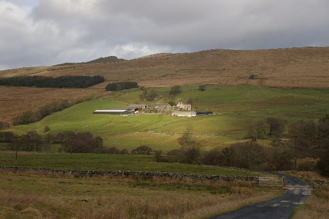
Catlow Fell is a picturesque area located in the county of Yorkshire, England. Situated amidst the stunning Yorkshire Downs and Moorland, it offers breathtaking views and a tranquil atmosphere. The fell is situated near the village of Catlow, which adds to its charm and accessibility.

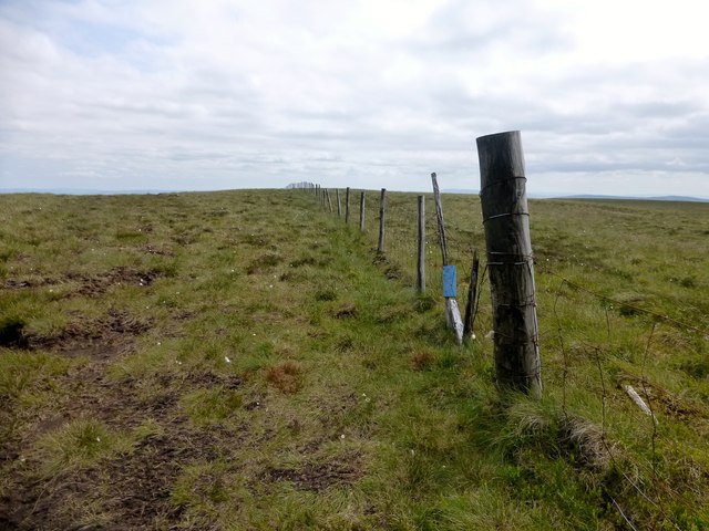
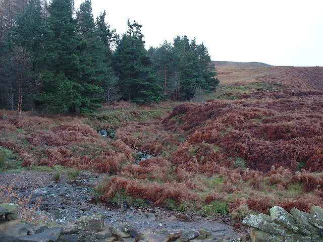
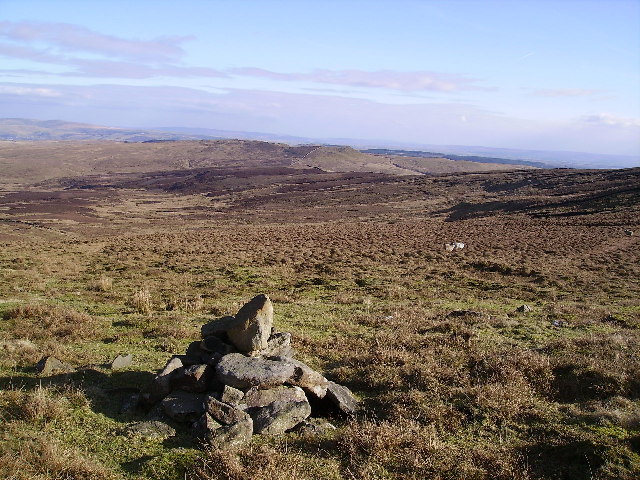
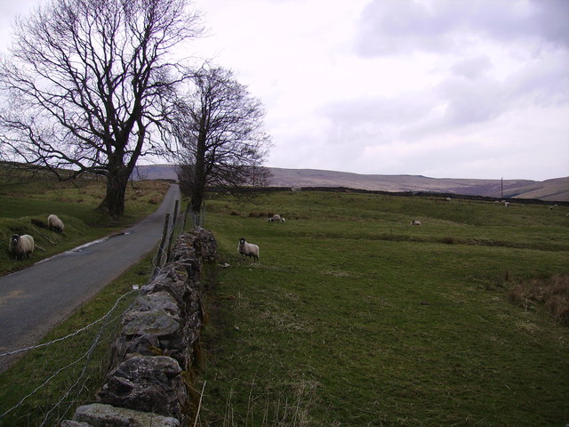
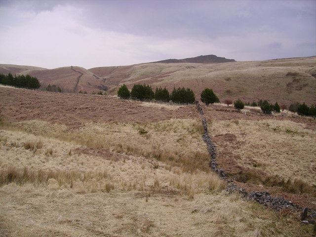
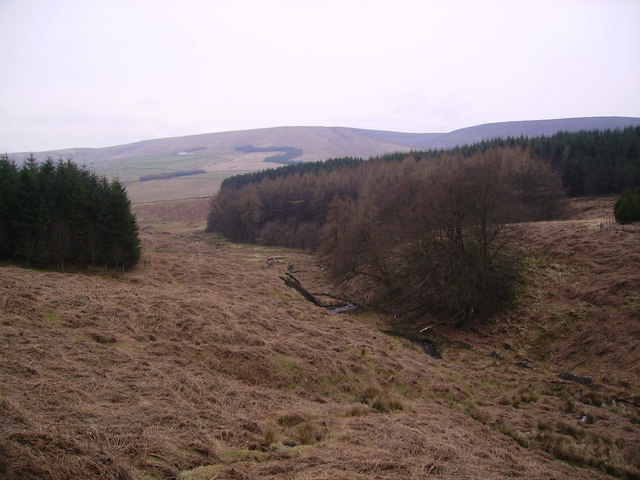
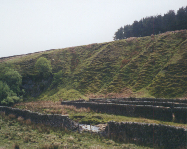
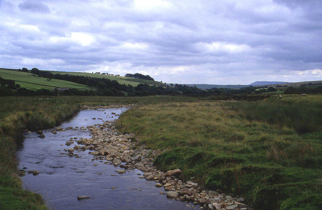
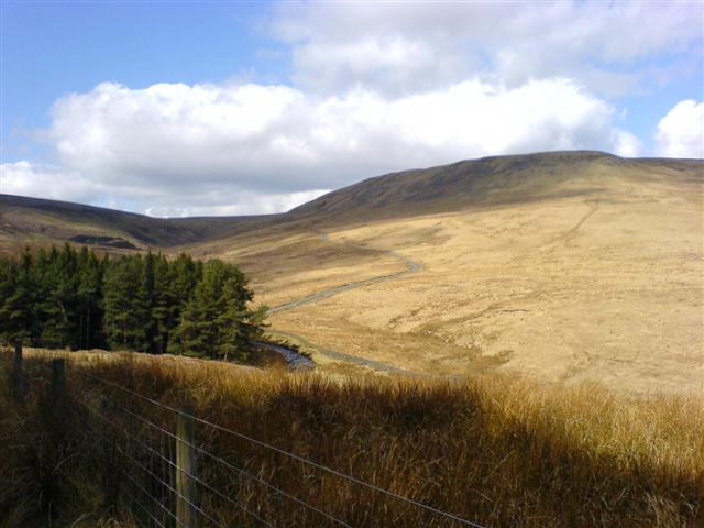
The terrain of Catlow Fell is characterized by rolling hills, heather moorland, and scattered woodlands, making it a haven for nature enthusiasts and outdoor adventurers. The landscape is dotted with a variety of flora and fauna, including wildflowers, birds, and small mammals, creating a vibrant ecosystem.

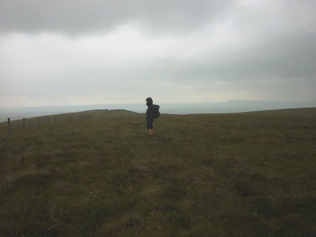
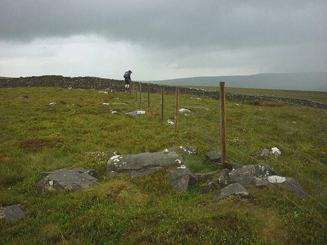
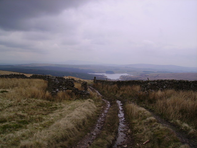
Hikers and walkers are drawn to Catlow Fell for its well-maintained trails and stunning vistas. The paths meander through the heather-covered hills, offering panoramic views of the surrounding countryside. On a clear day, it is possible to see the distant valleys and even the peaks of the Yorkshire Dales.

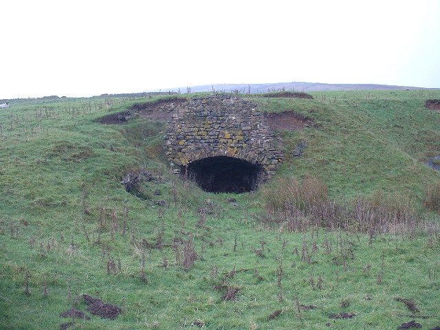
The area is also known for its rich history and archaeological significance. Ancient burial mounds, stone circles, and remnants of old settlements can be found scattered across Catlow Fell, providing a glimpse into its past.

Catlow Fell is a popular destination for those seeking a peaceful retreat or a chance to reconnect with nature. Its untouched beauty and serene ambiance make it an ideal spot for picnics, photography, or simply enjoying a leisurely walk in the countryside.

Overall, Catlow Fell in Yorkshire offers a captivating blend of natural beauty, cultural heritage, and outdoor exploration, making it an appealing destination for visitors of all ages and interests.

If you have any feedback on the listing, please let us know in the comments section below.

Catlow Fell Images

Images are sourced within 2km of 54.033237/-2.4489784 or Grid Reference SD7059. Thanks to Geograph Open Source API. All images are credited.

Hailshowers Fell Parked after cattle grid at 427 metres at SD6823860865 then Great Harlow, Hailshowers Fell, Bowlands Knotts, return to Hailshowers Fell, Great Harlow, Thistle Hill, Burn Moor and then to road below Moor Cock Farm and then up road back to my car. Very hot sunny day with drier than average moorland underfoot. 486 metre point next to fence didn't seem to be the highest point walking either way over this hill today. A quad track seemed to stop at the highest point before a lower cairn, buried stake and grit point.
Name: Hailshowers Fell
Hill number: 108526
Height: 486m / 1594ft
Area: 36: Lancashire, Cheshire & the Southern Pennines
Class: 4
Grid ref: SD698608 (est)
Drop: 64m
Col: 422m
Hailshowers Fell
Parked after cattle grid at 427 metres at SD6823860865 then Great Harlow, Hailshowers Fell, Bowlands Knotts, return to Hailshowers Fell, Great Harlow, Thistle Hill, Burn Moor and then to road below Moor Cock Farm and then up road back to my car. Very hot sunny day with drier than average moorland underfoot. 486 metre point next to fence didn't seem to be the highest point walking either way over this hill today. A quad track seemed to stop at the highest point before a lower cairn, buried stake and grit point. Name: Hailshowers Fell Hill number: 108526 Height: 486m / 1594ft Area: 36: Lancashire, Cheshire & the Southern Pennines Class: 4 Grid ref: SD698608 (est) Drop: 64m Col: 422m
Hailshowers Fell Alternative Summit This spot above the cairn appeared to be as high or higher than the summit of Hailshowers Fell beside the fence on this hot sunny Sunday.  This hill high point is also called Great Harlow.
Hailshowers Fell Alternative Summit
This spot above the cairn appeared to be as high or higher than the summit of Hailshowers Fell beside the fence on this hot sunny Sunday. This hill high point is also called Great Harlow.
Raven's Castle The stile and wall junction at Raven's Castle.
Raven's Castle
The stile and wall junction at Raven's Castle.
The top of Hailshowers Fell (486m) No hail today, just a light rain although Pendle Hill is just visible. Nothing marks the actual top so it could be any one of thousands of tufts of moorland grass.
The top of Hailshowers Fell (486m)
No hail today, just a light rain although Pendle Hill is just visible. Nothing marks the actual top so it could be any one of thousands of tufts of moorland grass.
Raven's Castle or Crowd Stones No raven, no castle and certainly no crowd. Even the stones are pretty unremarkable (I can barely bring myself to tick the 'Rocks, Scree, Cliffs' box!). If the trade descriptions act applied to map names then this place would definitely be in trouble. After the recent disappointment of <a href="https://www.geograph.org.uk/photo/4028170">SD7060 : Ravens Castle (481m)</a> it's all a bit of a letdown.
Raven's Castle or Crowd Stones
No raven, no castle and certainly no crowd. Even the stones are pretty unremarkable (I can barely bring myself to tick the 'Rocks, Scree, Cliffs' box!). If the trade descriptions act applied to map names then this place would definitely be in trouble. After the recent disappointment of SD7060 : Ravens Castle (481m) it's all a bit of a letdown.
Road to Bentham Near the Cross of Greet.
Road to Bentham
Near the Cross of Greet.
River Hodder Just over Cross of Greets Bridge where Near Costy Clough meets the River Hodder
River Hodder
Just over Cross of Greets Bridge where Near Costy Clough meets the River Hodder
Old Kiln Looks like an old kiln there are quite a few dotted about in this area. I assumed they burnt limestone but didn't think Limestone featured hereabouts.
Old Kiln
Looks like an old kiln there are quite a few dotted about in this area. I assumed they burnt limestone but didn't think Limestone featured hereabouts.
Clunter Clough Honest! Feeds the River Hodder from Great Harlow
Clunter Clough
Honest! Feeds the River Hodder from Great Harlow
Cairn Great Harlow On the ridge near the summit.Looking east towards Bowland Knotts
Cairn Great Harlow
On the ridge near the summit.Looking east towards Bowland Knotts
Catlow Farm Forest of Bowland Taken from the farm road leading to Catlow Farm, looking in a NE direction
Catlow Farm Forest of Bowland
Taken from the farm road leading to Catlow Farm, looking in a NE direction
Sheep and Wall On the Cross of Greets road near Kenibus
Sheep and Wall
On the Cross of Greets road near Kenibus
Catlow Plantation Just above the original plantation. Looking towards Knot Clough and Bowland Knotts
Catlow Plantation
Just above the original plantation. Looking towards Knot Clough and Bowland Knotts
Catlow Plantation From Hasgill Fell. The small beck is called Kearsden Holes
Catlow Plantation
From Hasgill Fell. The small beck is called Kearsden Holes
Track and ruin, The Height Looking towards Stocks Reservoir.
Track and ruin, The Height
Looking towards Stocks Reservoir.
Sheepfold near Cross of Greet Bridge The sheepfold shown on the Explorer map, adjacent to the River Hodder.
Sheepfold near Cross of Greet Bridge
The sheepfold shown on the Explorer map, adjacent to the River Hodder.
Upper reaches of the River Hodder This looks downstream from the Cross of Greet Bridge on the moorland road from Slaidburn to High Bentham in the Forest of Bowland
Upper reaches of the River Hodder
This looks downstream from the Cross of Greet Bridge on the moorland road from Slaidburn to High Bentham in the Forest of Bowland
Slaidburn Road Taken on the road from Slaidburn to High Bentham
Slaidburn Road
Taken on the road from Slaidburn to High Bentham
Show me another place!

Catlow Fell is located at Grid Ref: SD7059 (Lat: 54.033237, Lng: -2.4489784)

Division: West Riding

Administrative County: Lancashire

District: Ribble Valley

Police Authority: Lancashire

What 3 Words

///files.remarking.shop. Near High Bentham, North Yorkshire

Nearby Locations

Catlow Fell

Related Wikis

White Hill (Forest of Bowland)

White Hill is a hill in the Forest of Bowland, north-western England. It lies between Slaidburn and High Bentham. The summit houses a tower and a trig...

Stocks Reservoir

Stocks Reservoir is a reservoir situated at the head of the Hodder valley in the Forest of Bowland, Lancashire, England (historically in the West Riding...

Easington, Lancashire

Easington () is a civil parish within the Ribble Valley district of Lancashire, England, with a population in 2001 of 52. The Census 2011 population details...

Geography of the United Kingdom

The United Kingdom is a sovereign state located off the north-western coast of continental Europe. With a total area of approximately 248,532 square kilometres...

Have you been to Catlow Fell?

Leave your review of Catlow Fell below (or comments, questions and feedback).