Brownside Moss

Downs, Moorland in Cumberland Eden

England

Brownside Moss

Old Milestone by the A686, south west of Hartside House Carved stone post by the A686, in parish of ALSTON MOOR (EDEN District), South West of Hartside House, on grass verge, near field gate, on South side of road. Alston stone, erected by the Alston turnpike trust in the 19th century. 

Inscription reads:-
ALSTON
3
PENRITH
16
Carved benchmark and rivet on top front.

Grade II Listed. List Entry Number: 1144985 <span class="nowrap"><a title="https://historicengland.org.uk/listing/the-list/list-entry/1144985" rel="nofollow ugc noopener" href="https://historicengland.org.uk/listing/the-list/list-entry/1144985">Link</a><img style="margin-left:2px;" alt="External link" title="External link - shift click to open in new window" src="https://s1.geograph.org.uk/img/external.png" width="10" height="10"/></span>

Milestone Society National ID: CU_ALPR03.
Old Milestone by the A686, south west of Hartside House Credit: Barbara Todd

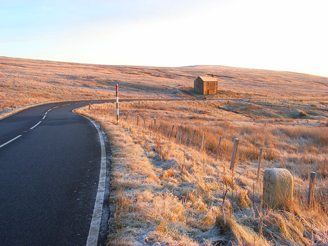
Brownside Moss is a vast expanse of moorland located in the county of Cumberland, England. It stretches across a sprawling area, known for its distinctive mix of downs and moorland terrain. The landscape is characterized by undulating hills, heather-covered slopes, and scattered patches of woodland, presenting a picturesque and serene environment.

The moss is home to a diverse range of plant and animal species, making it a haven for nature enthusiasts and wildlife lovers. The heather dominates the vegetation, painting the landscape with vibrant shades of purple during the blooming season. Other common plants found here include gorse, grasses, and scattered shrubs.

The area is known for its rich birdlife, with several species making Brownside Moss their habitat. The skylark, meadow pipit, and curlew are among the many birds that can be spotted soaring above the moorland. Additionally, the moss provides shelter and sustenance for various mammals, such as rabbits, foxes, and the occasional deer.

Visitors to Brownside Moss can enjoy the tranquil beauty of the surroundings while exploring the network of footpaths that crisscross the area. These paths offer stunning views of the surrounding countryside, providing ample opportunities for hikers, walkers, and photographers.

Brownside Moss is a remarkable natural landscape, offering a glimpse into the untamed beauty of the Cumberland region. Its unique mix of downs, moorland, and woodland, combined with its diverse flora and fauna, make it an enchanting destination for anyone seeking to immerse themselves in the rugged charm of the English countryside.

If you have any feedback on the listing, please let us know in the comments section below.

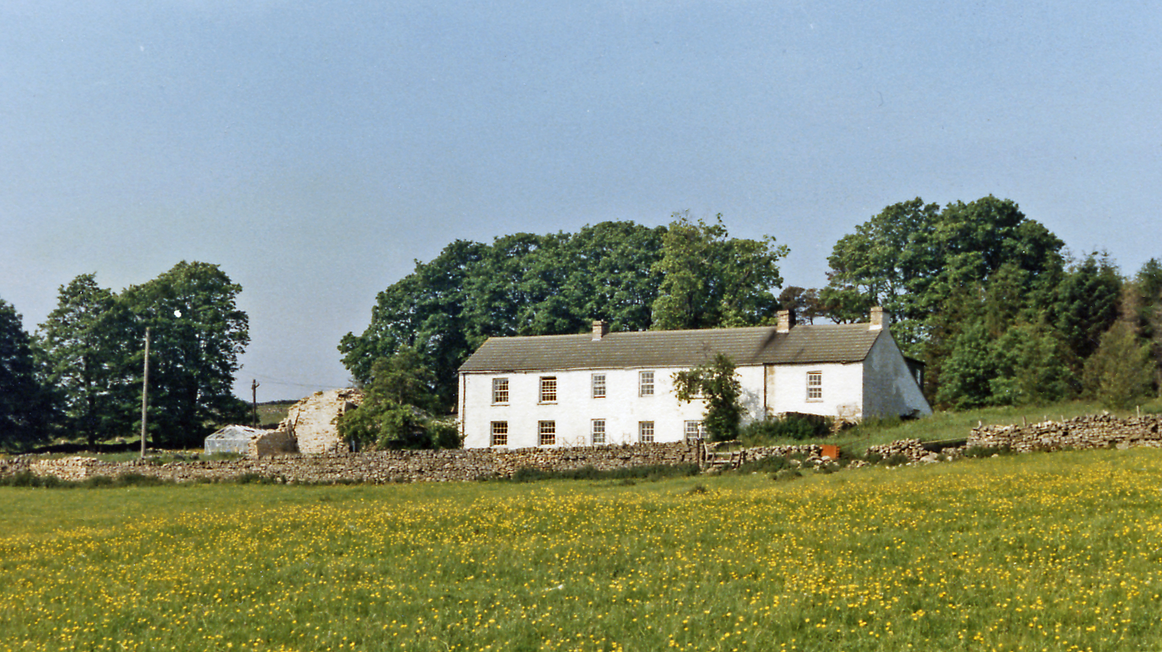
Brownside Moss Images

Images are sourced within 2km of 54.791177/-2.4767656 or Grid Reference NY6944. Thanks to Geograph Open Source API. All images are credited.

Old Milestone by the A686, south west of Hartside House Carved stone post by the A686, in parish of ALSTON MOOR (EDEN District), South West of Hartside House, on grass verge, near field gate, on South side of road. Alston stone, erected by the Alston turnpike trust in the 19th century. 

Inscription reads:-
ALSTON
3
PENRITH
16
Carved benchmark and rivet on top front.

Grade II Listed. List Entry Number: 1144985 <span class="nowrap"><a title="https://historicengland.org.uk/listing/the-list/list-entry/1144985" rel="nofollow ugc noopener" href="https://historicengland.org.uk/listing/the-list/list-entry/1144985">Link</a><img style="margin-left:2px;" alt="External link" title="External link - shift click to open in new window" src="https://s1.geograph.org.uk/img/external.png" width="10" height="10"/></span>

Milestone Society National ID: CU_ALPR03.
Old Milestone by the A686, south west of Hartside House
Carved stone post by the A686, in parish of ALSTON MOOR (EDEN District), South West of Hartside House, on grass verge, near field gate, on South side of road. Alston stone, erected by the Alston turnpike trust in the 19th century. Inscription reads:- ALSTON 3 PENRITH 16 Carved benchmark and rivet on top front. Grade II Listed. List Entry Number: 1144985 LinkExternal link Milestone Society National ID: CU_ALPR03.
Leadgate Regulator Substation near Leadgate
Cycle route 7 towards the A686
Road sign at Little Dow Hill
Cycle route 7 towards Leadgate
Barn near Blackburn Bank Taken from the A686 south of Alston.
Barn near Blackburn Bank
Taken from the A686 south of Alston.
The A686 at Little Dow Hill
Hartside House alongside the A686
A686 below Brownside Moss
Rough grazing near Hartside House Looking south east from the A686.
Rough grazing near Hartside House
Looking south east from the A686.
A686 towards Alston Looking north east on the National Cycle Route 7.
A686 towards Alston
Looking north east on the National Cycle Route 7.
Hartside House Now a barn - on the A686.
Hartside House
Now a barn - on the A686.
Grazing near Hartside House Off the A686.
Grazing near Hartside House
Off the A686.
National Cycle Route 7 Looking north east near Hartside House.
National Cycle Route 7
Looking north east near Hartside House.
Rough grazing near Hartside Cottages
Hartside Cottages A distant view.
Hartside Cottages
A distant view.
A686 towards Alston Looking north east.
A686 towards Alston
Looking north east.
Brownside Moss Rough pasture near Hartside Cottages.
Brownside Moss
Rough pasture near Hartside Cottages.
Show me another place!

Brownside Moss is located at Grid Ref: NY6944 (Lat: 54.791177, Lng: -2.4767656)

Administrative County: Cumbria

District: Eden

Police Authority: Cumbria

What 3 Words

///scales.streaking.sailors. Near Alston, Cumbria

Nearby Locations

Brownside Moss Bayles Moss

Related Wikis

Leadgate, Cumbria

Leadgate is a small hamlet located at the foot of Hartside Fell between the town of Alston and the village of Garrigill in the parish of Alston Moor in...

Bayles, Cumbria

Bayles is a hamlet near Alston in Cumbria, England.

A686 road

The A686 is a road in Northern England. It runs from Penrith in Cumbria to Haydon Bridge in Northumberland. AA Magazine named the A686 as one of their...

Alston, Cumbria

Alston is a town in Westmorland and Furness, Cumbria, England, within the civil parish of Alston Moor on the River South Tyne. It shares the title of the...

Nearby Amenities

Located within 500m of 54.791177,-2.4767656
Brownside Moss
Natural: wetland
Wetland: bog
Lat/Long: 54.7906433/-2.4770998
Power: pole
Lat/Long: 54.7874151/-2.4736416
The data included in this document is from www.openstreetmap.org. The data is made available under ODbL.

Have you been to Brownside Moss?

Leave your review of Brownside Moss below (or comments, questions and feedback).