Long Moor Moss

Downs, Moorland in Yorkshire South Lakeland

England

Long Moor Moss

Walking path beside coniferous plantation The walkers are descending on a track over moorland into Garsdale following an ascent to Aye Gill Pike.
Walking path beside coniferous plantation Credit: Trevor Littlewood

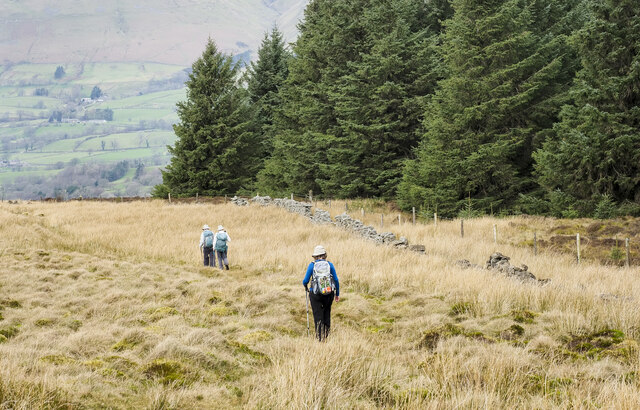
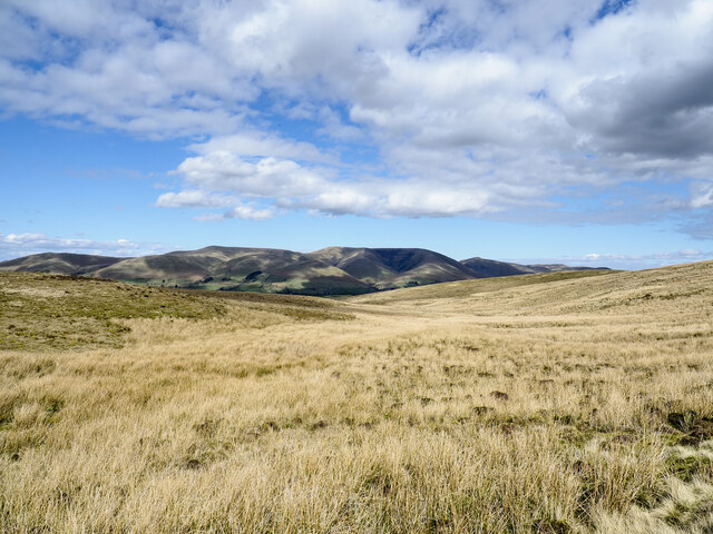
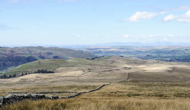
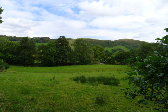
Long Moor Moss is a vast expanse of moorland located in Yorkshire, England. Situated within the beautiful landscape of the Yorkshire Downs, it covers an extensive area of approximately 1,500 acres. This unique ecosystem is characterized by its rolling hills, peat bogs, and heather-covered landscapes.

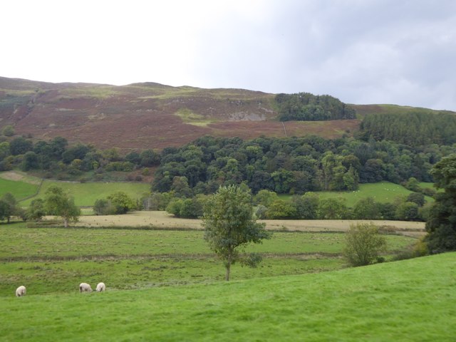
The moss is home to a diverse range of plant and animal species, making it a haven for nature enthusiasts and biologists alike. The heather provides a vibrant purple hue during the summer months, creating a picturesque view that stretches as far as the eye can see. The area is also dotted with scattered trees and shrubs, adding to its natural charm.

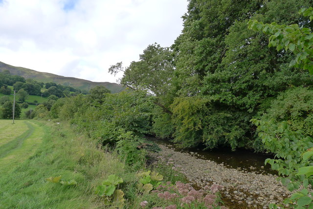
Long Moor Moss is known for its peat bogs, which contribute to the preservation of the area's biodiversity. These bogs act as a natural filter, purifying water and providing a habitat for a variety of unique plant species, including sphagnum moss, bog rosemary, and cotton grass. The moss is also home to several species of birds, such as curlews, lapwings, and merlins, which can be spotted soaring above the moorland.

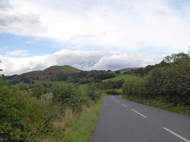
Visitors to Long Moor Moss can enjoy a variety of activities, including hiking, birdwatching, and photography. The moorland offers numerous trails and footpaths, allowing visitors to explore the area's natural beauty at their own pace. Furthermore, the tranquil surroundings make it an ideal location for those seeking solace and relaxation in the heart of nature.

Overall, Long Moor Moss is a captivating destination that showcases the unique and diverse landscapes of the Yorkshire Downs. Its rich biodiversity and stunning vistas make it a must-visit location for nature enthusiasts and those looking to immerse themselves in the beauty of the moorland.

If you have any feedback on the listing, please let us know in the comments section below.

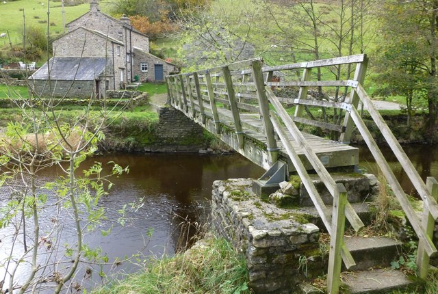
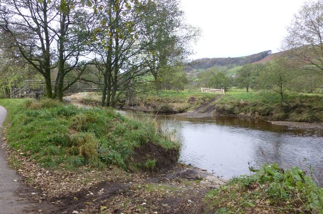
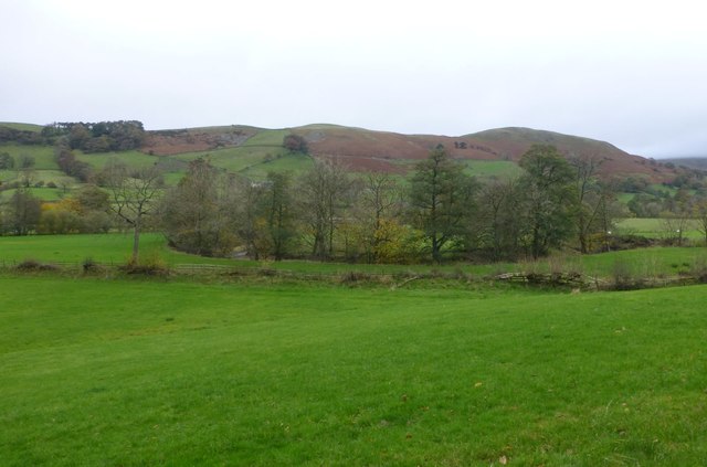
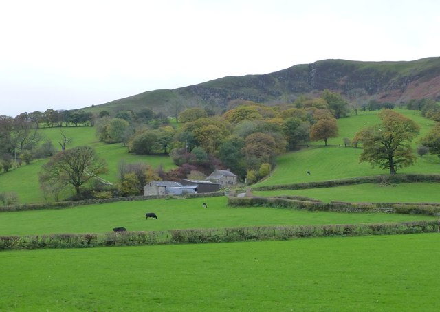
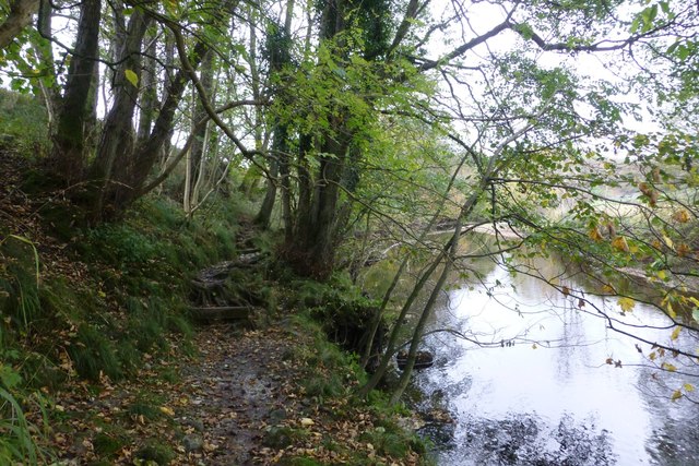
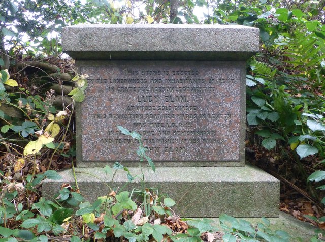
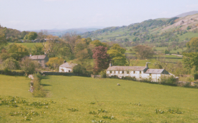
Long Moor Moss Images

Images are sourced within 2km of 54.304249/-2.4785102 or Grid Reference SD6889. Thanks to Geograph Open Source API. All images are credited.

Walking path beside coniferous plantation The walkers are descending on a track over moorland into Garsdale following an ascent to Aye Gill Pike.
Walking path beside coniferous plantation
The walkers are descending on a track over moorland into Garsdale following an ascent to Aye Gill Pike.
Valley of Holebeck Gill The shallow, upper valley of Holebeck Gill heading north to where it will meet the Clough River which drains Garsdale.
The Howgill Fells are in the distance beyond both the Clough River and the River Rawthey.
Valley of Holebeck Gill
The shallow, upper valley of Holebeck Gill heading north to where it will meet the Clough River which drains Garsdale. The Howgill Fells are in the distance beyond both the Clough River and the River Rawthey.
Old milestone The Hawes 13 milestone on the A684 has its back to a drystone wall near Nether House on the south side of the road.   615 of these milestones were set up for the West Riding County Council in 1893/94 not long after the formation of County Councils.   Gill and Frank Stead, stonemasons, of Mirfield won the contract which stated that the work had to be done in 12 months or they would incur a penalty.   Considering the size of the West Riding that was a tremendous feat but they succeeded.   The WRCC didn't always have stones erected on old tollroads.   They wanted to promote new trade routes.   It is Grade II listed 1384039.
Old milestone
The Hawes 13 milestone on the A684 has its back to a drystone wall near Nether House on the south side of the road. 615 of these milestones were set up for the West Riding County Council in 1893/94 not long after the formation of County Councils. Gill and Frank Stead, stonemasons, of Mirfield won the contract which stated that the work had to be done in 12 months or they would incur a penalty. Considering the size of the West Riding that was a tremendous feat but they succeeded. The WRCC didn't always have stones erected on old tollroads. They wanted to promote new trade routes. It is Grade II listed 1384039.
Ford at Ellers The previous day the road here was flooded for 150 metres but today this ford on the River Dee is visible but not passable.
Ford at Ellers
The previous day the road here was flooded for 150 metres but today this ford on the River Dee is visible but not passable.
Moorland of north-west ridge of Aye Gill Pike Aye Gill Pike is the high point of a long ridge oriented almost north-west to south east between two valleys, Garsdale and Dentdale. The broad western end of the ridge is seen here, descending towards Sedbergh.
Moorland of north-west ridge of Aye Gill Pike
Aye Gill Pike is the high point of a long ridge oriented almost north-west to south east between two valleys, Garsdale and Dentdale. The broad western end of the ridge is seen here, descending towards Sedbergh.
The Dales Way alongside the River Dee
The River Dee, Dentdale
The River Dee below the footbridge at Ellers, Dentdale
Looking across Dentdale to Helms Knott
The road to Helmside The road from Dent to Helmside follows the riverbank until this point, where it turns to the north to run along the bank of Helmside Holme stream, on the edge of the flood plain of the River Dee.  In the distance is the distinctive summit of Helms Knott
The road to Helmside
The road from Dent to Helmside follows the riverbank until this point, where it turns to the north to run along the bank of Helmside Holme stream, on the edge of the flood plain of the River Dee. In the distance is the distinctive summit of Helms Knott
Cottage near Mire House
Valley of River Dee near Craggs Farm Here there is marsh in the valley and a stream that runs close to the edge of the sloping field
Valley of River Dee near Craggs Farm
Here there is marsh in the valley and a stream that runs close to the edge of the sloping field
Footbridge over the River Dee At Ellers.
Footbridge over the River Dee
At Ellers.
Ford across the River Dee At Ellers, just above the footbridge.
A convenient start for a walk up the Dales Way to Dent
returning on the opposite bank to the footbridge.
Ford across the River Dee
At Ellers, just above the footbridge. A convenient start for a walk up the Dales Way to Dent returning on the opposite bank to the footbridge.
The River Dee Meanders in its flood plain along Dentdale.
Helms Knott on horizon right of centre.
The River Dee
Meanders in its flood plain along Dentdale. Helms Knott on horizon right of centre.
Cattle grazing in Dentdale Combe Scar up above.
Cattle grazing in Dentdale
Combe Scar up above.
A tricky step on the Dales Way By the River Dee at Bower Bank.
A tricky step on the Dales Way
By the River Dee at Bower Bank.
Roadside Monument to Lucy Elam The benefactress who provided for road improvement at this site by diversion of the road on a level gradient replacing a section of steep and winding track higher up the hill. 
"THIS STONE IS ERECTED
BY THE LANDOWNERS AND INHABITANTS OF DENT
IN GRATEFUL ACKNOWLEDGEMENT TO
LUCY ELAM
AT WHOSE SOLE CHARGE
THIS DEVIATION ROAD 1122 YARDS IN LENGTH
WAS MADE A.D. 1876
IN FILIAL LOVE AND REMEMBRANCE
AND TO FULFIL THE WISHES OF HER FATHER
JOHN ELAM".
Roadside Monument to Lucy Elam
The benefactress who provided for road improvement at this site by diversion of the road on a level gradient replacing a section of steep and winding track higher up the hill. "THIS STONE IS ERECTED BY THE LANDOWNERS AND INHABITANTS OF DENT IN GRATEFUL ACKNOWLEDGEMENT TO LUCY ELAM AT WHOSE SOLE CHARGE THIS DEVIATION ROAD 1122 YARDS IN LENGTH WAS MADE A.D. 1876 IN FILIAL LOVE AND REMEMBRANCE AND TO FULFIL THE WISHES OF HER FATHER JOHN ELAM".
Show me another place!

Long Moor Moss is located at Grid Ref: SD6889 (Lat: 54.304249, Lng: -2.4785102)

Division: West Riding

Administrative County: Cumbria

District: South Lakeland

Police Authority: Cumbria

What 3 Words

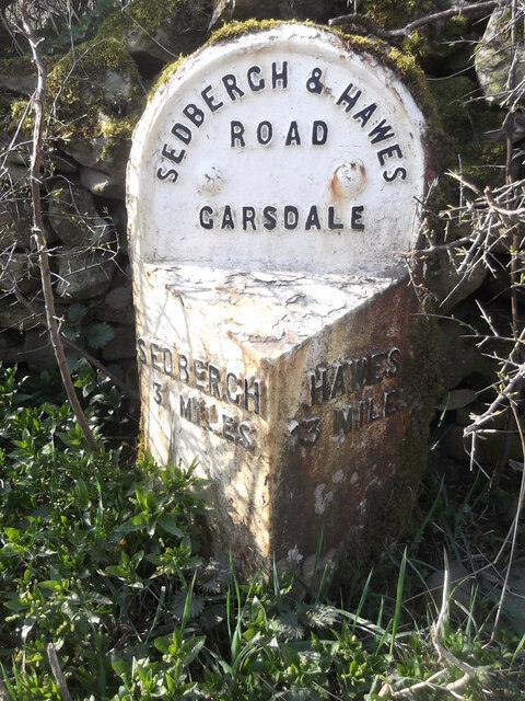
///spans.dissolve.boasted. Near Sedbergh, Cumbria

Related Wikis

Gawthrop

Gawthrop is a hamlet in the South Lakeland district, in the county of Cumbria, England. Historically part of the West Riding of Yorkshire, it lies within...

Clough River

The Clough River is a river in Cumbria, England. A tributary of the River Rawthey, it flows for 21.8 kilometres (13.5 mi) primarily through the Garsdale...

Millthrop

Millthrop is a hamlet in the South Lakeland district of Cumbria, Northern England and the Yorkshire Dales. Millthrop lies on the south bank of the River...

St Andrew's Church, Dent

St Andrew's Church is in the village of Dent, Cumbria, England. It is an active Anglican parish church in the Western Dales Mission Community in the deanery...

Nearby Amenities

Located within 500m of 54.304249,-2.4785102
Long Moor
Natural: moor
Source: npe
Lat/Long: 54.3042491/-2.4711115
Barrier: stile
Material: stone
Source: survey;gps
Stile: stepover
Lat/Long: 54.3004301/-2.4745227
The data included in this document is from www.openstreetmap.org. The data is made available under ODbL.

Have you been to Long Moor Moss?

Leave your review of Long Moor Moss below (or comments, questions and feedback).