Helm's Gill Wood

Wood, Forest in Yorkshire South Lakeland

England

Helm's Gill Wood

Gawthrop A small hamlet around a bridge over Oliver Gill.
Gawthrop Credit: Stephen Craven

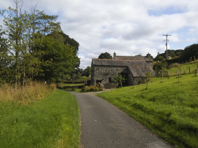
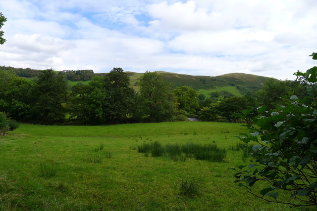
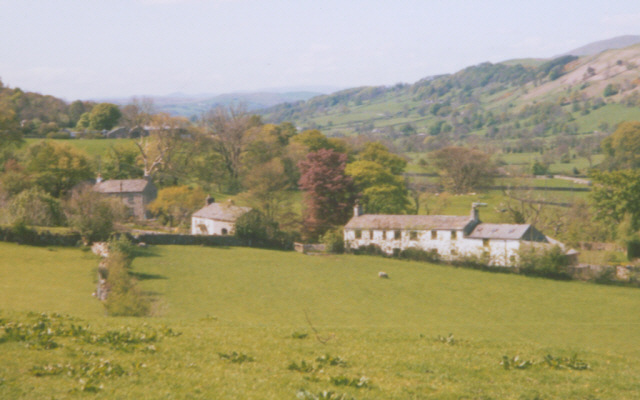
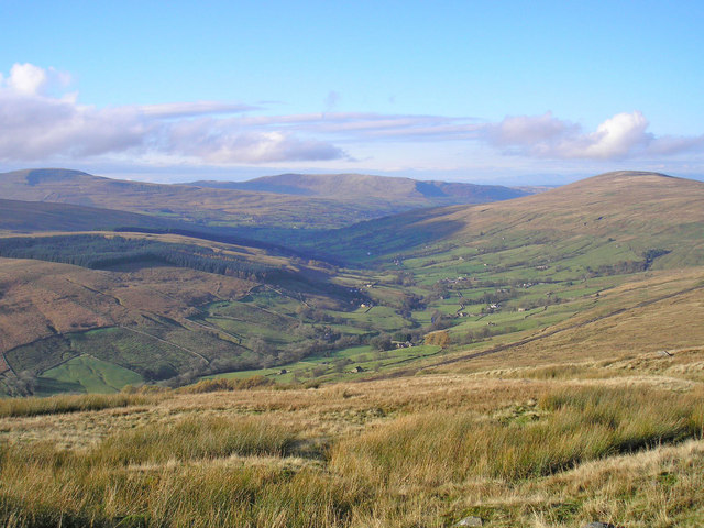
Helm's Gill Wood, located in the county of Yorkshire, is a stunning woodland area that covers a vast expanse of land. Situated near the village of Bolsterstone, this forest is a popular destination for nature enthusiasts and hikers alike.

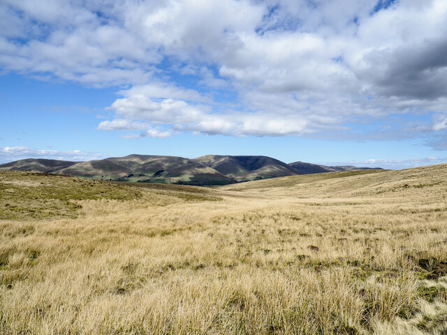
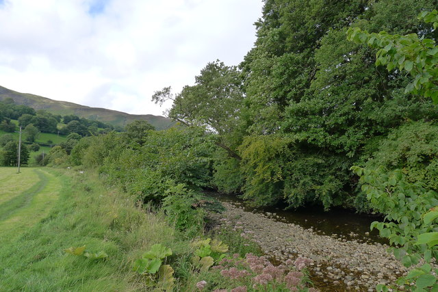
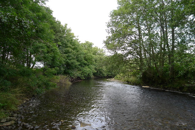
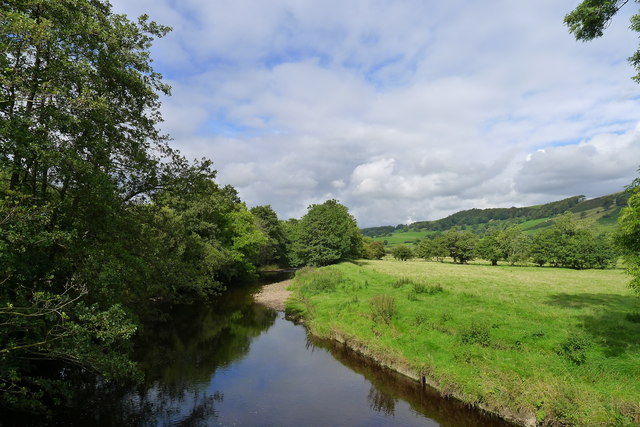
The wood is characterized by its dense canopy of trees, which consists mainly of oak, beech, and birch. These towering trees create a serene and tranquil atmosphere, providing a habitat for a diverse range of wildlife. Visitors can expect to encounter various bird species, including woodpeckers and owls, as well as small mammals such as squirrels and rabbits.

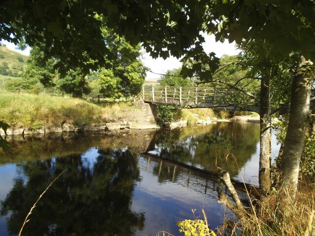
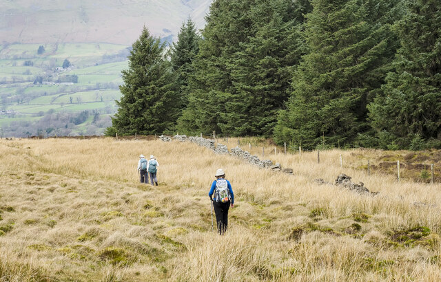
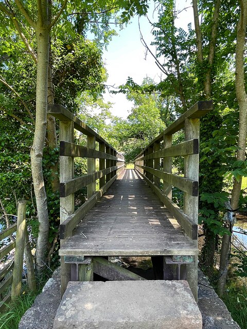
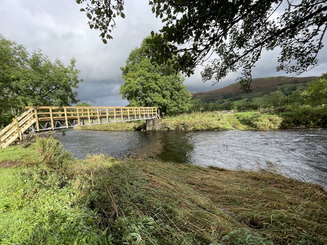
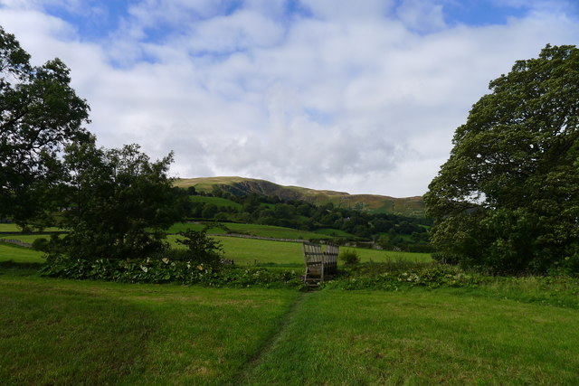
Helm's Gill Wood offers a network of walking trails, allowing visitors to explore its natural beauty at their own pace. These well-maintained paths meander through the forest, offering stunning views of the surrounding countryside. Along the way, hikers can enjoy the sights and sounds of nature, with the occasional babbling brook or trickling stream adding to the enchanting ambiance.

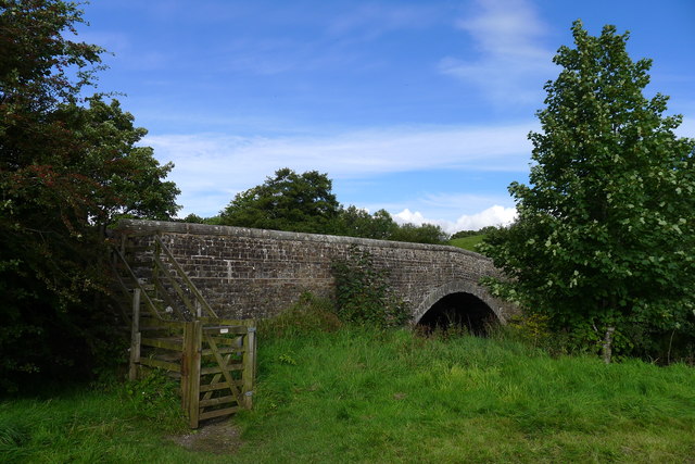
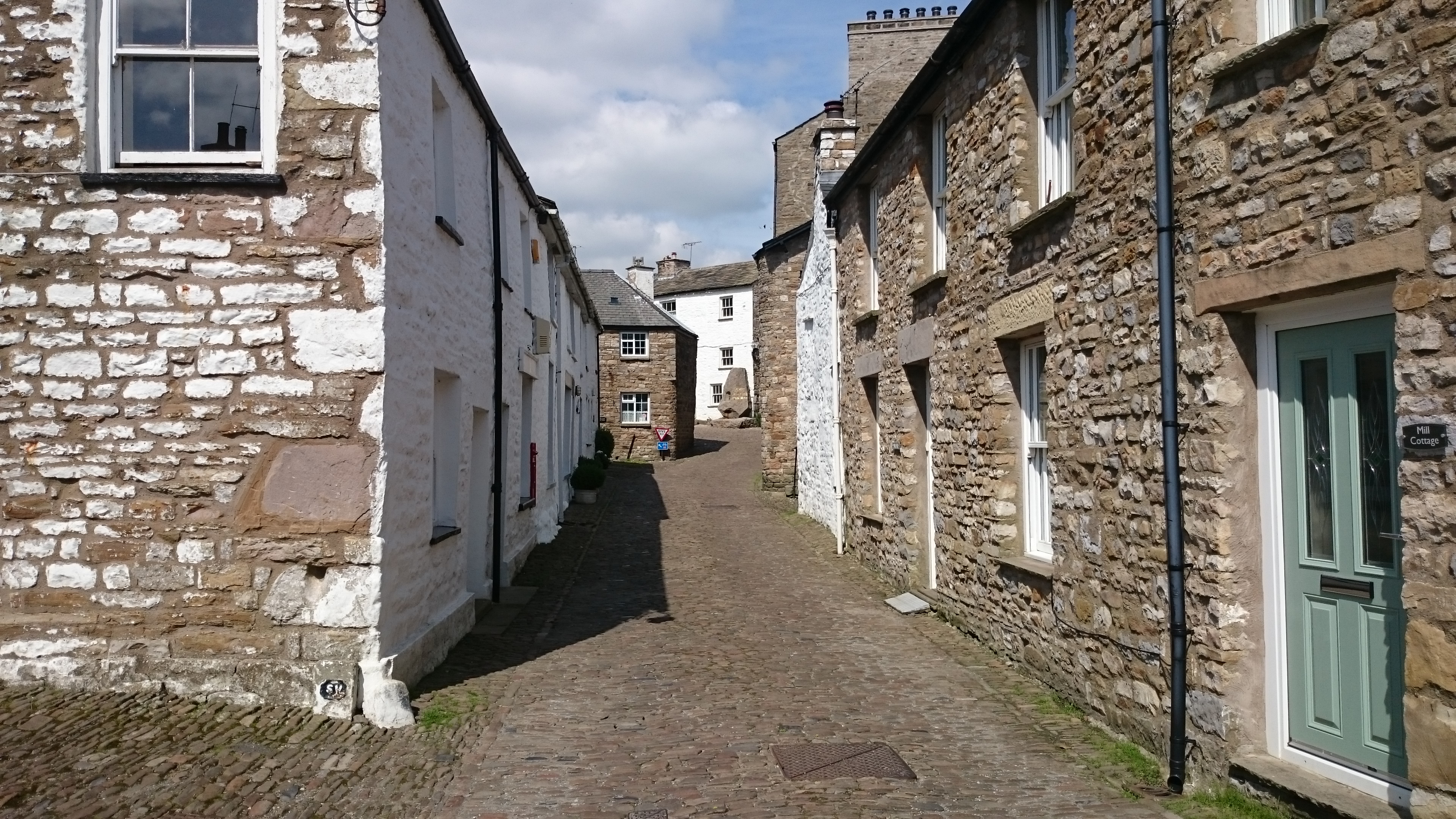
The wood also boasts a rich historical background. It is believed that Helm's Gill Wood was once part of a larger ancient woodland, dating back centuries. Remnants of charcoal hearths and old stone walls can still be discovered within the forest, serving as a reminder of its past.

Overall, Helm's Gill Wood is a captivating destination that offers a perfect blend of natural beauty and historical significance. Whether it's for a leisurely stroll or an immersive hike, this woodland area in Yorkshire provides an unforgettable experience for all who visit.

If you have any feedback on the listing, please let us know in the comments section below.

Helm's Gill Wood Images

Images are sourced within 2km of 54.297083/-2.4837741 or Grid Reference SD6889. Thanks to Geograph Open Source API. All images are credited.

Gawthrop A small hamlet around a bridge over Oliver Gill.
Gawthrop
A small hamlet around a bridge over Oliver Gill.
Ellers barn A grade II listed barn (list entry 1383860).  The farmhouse beyond <a href="https://www.geograph.org.uk/photo/3629842">SD6788 : The farm at Ellers</a>, not clearly visible in this photo, is also listed (1383859).
Ellers barn
A grade II listed barn (list entry 1383860). The farmhouse beyond SD6788 : The farm at Ellers, not clearly visible in this photo, is also listed (1383859).
Footbridge over the river Dee at Ellers This is the small river Dee in Cumbria, not the better known larger rivers of that name in Cheshire or Aberdeen. The bridge is close to Ellers Farm <a href="https://www.geograph.org.uk/photo/2674190">SD6788 : Ellers, lower Dentdale</a>, so I presume it was intended primarily for their use, but it is on a public footpath.   Quite a long single span (c.15m) for a straight (not arched) wooden footbridge.
Footbridge over the river Dee at Ellers
This is the small river Dee in Cumbria, not the better known larger rivers of that name in Cheshire or Aberdeen. The bridge is close to Ellers Farm SD6788 : Ellers, lower Dentdale, so I presume it was intended primarily for their use, but it is on a public footpath. Quite a long single span (c.15m) for a straight (not arched) wooden footbridge.
Walking path beside coniferous plantation The walkers are descending on a track over moorland into Garsdale following an ascent to Aye Gill Pike.
Walking path beside coniferous plantation
The walkers are descending on a track over moorland into Garsdale following an ascent to Aye Gill Pike.
Valley of Holebeck Gill The shallow, upper valley of Holebeck Gill heading north to where it will meet the Clough River which drains Garsdale.
The Howgill Fells are in the distance beyond both the Clough River and the River Rawthey.
Valley of Holebeck Gill
The shallow, upper valley of Holebeck Gill heading north to where it will meet the Clough River which drains Garsdale. The Howgill Fells are in the distance beyond both the Clough River and the River Rawthey.
Footbringe over the River Dee
Old Bridge Marker on Oliver Bridge at Gawthrop Bridge Marker at the southeast end of the parapet of Oliver Bridge, Oliver Beck, in Gawthrop. Dent parish. W R in raised lettering on adjacent faces to mark the extent of roadway adjoining the bridge that the County was obliged to maintain. See also <span class="nowrap"><a title="http://www.geog.port.ac.uk/webmap/thelakes/photos/bnh63.jpg" rel="nofollow ugc noopener" href="http://www.geog.port.ac.uk/webmap/thelakes/photos/bnh63.jpg">Link</a><img style="margin-left:2px;" alt="External link" title="External link - shift click to open in new window" src="https://s1.geograph.org.uk/img/external.png" width="10" height="10"/></span>.

Milestone Society National ID: YW_DENT07br
Old Bridge Marker on Oliver Bridge at Gawthrop
Bridge Marker at the southeast end of the parapet of Oliver Bridge, Oliver Beck, in Gawthrop. Dent parish. W R in raised lettering on adjacent faces to mark the extent of roadway adjoining the bridge that the County was obliged to maintain. See also LinkExternal link. Milestone Society National ID: YW_DENT07br
Old Bridge Marker on Oliver Bridge at Gawthrop Bridge Marker against the wall of a garage at the east end of the parapet of Oliver Bridge, Oliver Beck, Gawthrop. Dent parish. W R in raised lettering on adjacent faces to mark the extent of roadway adjoining the bridge that the County was obliged to maintain. See also <span class="nowrap"><a title="http://www.geog.port.ac.uk/webmap/thelakes/photos/bnh64.jpg" rel="nofollow ugc noopener" href="http://www.geog.port.ac.uk/webmap/thelakes/photos/bnh64.jpg">Link</a><img style="margin-left:2px;" alt="External link" title="External link - shift click to open in new window" src="https://s1.geograph.org.uk/img/external.png" width="10" height="10"/></span> and <a title="https://www.geograph.org.uk/photo/2993136" href="https://www.geograph.org.uk/photo/2993136">Link</a>

Milestone Society National ID: YW_DENT04br
Old Bridge Marker on Oliver Bridge at Gawthrop
Bridge Marker against the wall of a garage at the east end of the parapet of Oliver Bridge, Oliver Beck, Gawthrop. Dent parish. W R in raised lettering on adjacent faces to mark the extent of roadway adjoining the bridge that the County was obliged to maintain. See also LinkExternal link and Link Milestone Society National ID: YW_DENT04br
Brackensgill Ford Already signed on this bridleway as a’ deep ford’ the river has today backed up along the bridleway itself.
Brackensgill Ford
Already signed on this bridleway as a’ deep ford’ the river has today backed up along the bridleway itself.
Ford at Ellers The previous day the road here was flooded for 150 metres but today this ford on the River Dee is visible but not passable.
Ford at Ellers
The previous day the road here was flooded for 150 metres but today this ford on the River Dee is visible but not passable.
Barth Bridge Carrying the Dent to Sedbergh road over the River Dee
Barth Bridge
Carrying the Dent to Sedbergh road over the River Dee
The Dales Way in Dentdale The slopes of Combe Scar in the distance
The Dales Way in Dentdale
The slopes of Combe Scar in the distance
The Dales Way alongside the River Dee
The River Dee, Dentdale
The River Dee below the footbridge at Ellers, Dentdale
Looking across Dentdale to Helms Knott
The Dales Way alongside the boundary wall of Gate Manor The Way finally climbing out of Dentdale - a pretty dale I've very much enjoyed walking through.
The Dales Way alongside the boundary wall of Gate Manor
The Way finally climbing out of Dentdale - a pretty dale I've very much enjoyed walking through.
Brackensgill Lane at Gowlands Cross Contrasting walls on the two sides of the road
Brackensgill Lane at Gowlands Cross
Contrasting walls on the two sides of the road
Show me another place!

Helm's Gill Wood is located at Grid Ref: SD6889 (Lat: 54.297083, Lng: -2.4837741)

Division: West Riding

Administrative County: Cumbria

District: South Lakeland

Police Authority: Cumbria

What 3 Words

///cattle.poetry.sorry. Near Sedbergh, Cumbria

Related Wikis

Gawthrop

Gawthrop is a hamlet in the South Lakeland district, in the county of Cumbria, England. Historically part of the West Riding of Yorkshire, it lies within...

St Andrew's Church, Dent

St Andrew's Church is in the village of Dent, Cumbria, England. It is an active Anglican parish church in the Western Dales Mission Community in the deanery...

Dentdale

Dentdale is a dale or valley in the north-west of the Yorkshire Dales National Park in Cumbria, England. It is the valley of the River Dee, but takes...

Dent, Cumbria

Dent is a village and civil parish in Cumbria, England, within the historic boundaries of the West Riding of Yorkshire. It lies in Dentdale, a narrow valley...

Clough River

The Clough River is a river in Cumbria, England. A tributary of the River Rawthey, it flows for 21.8 kilometres (13.5 mi) primarily through the Garsdale...

Millthrop

Millthrop is a hamlet in the South Lakeland district of Cumbria, Northern England and the Yorkshire Dales. Millthrop lies on the south bank of the River...

Aye Gill Pike

Aye Gill Pike is a Marilyn in the Yorkshire Dales, the highest point of the ridge of Rise Hill between Dentdale and Garsdale in Cumbria, England.

Settlebeck School

Settlebeck School is a small coeducational secondary school with academy status. It is located in Sedbergh in the English county of Cumbria, drawing pupils...

Nearby Amenities

Located within 500m of 54.297083,-2.4837741
Natural: spring
Lat/Long: 54.297913/-2.4867426
Natural: spring
Lat/Long: 54.2970364/-2.4866783
Barrier: stile
Material: stone
Source: survey;gps
Stile: stepover
Lat/Long: 54.2951884/-2.4851924
Barrier: stile
Material: wood
Source: survey;gps
Stile: stepover
Lat/Long: 54.2959679/-2.4836566
Barrier: stile
Material: wood
Source: survey;gps
Stile: stepover
Lat/Long: 54.2943764/-2.4776554
Power: pole
Lat/Long: 54.2942043/-2.4788933
Power: pole
Lat/Long: 54.2941106/-2.480168
Power: pole
Lat/Long: 54.2934217/-2.48105
Power: pole
Lat/Long: 54.2929218/-2.4817995
Power: pole
Lat/Long: 54.2938138/-2.4814324
Power: pole
Lat/Long: 54.2949475/-2.4823502
Power: pole
Lat/Long: 54.2959562/-2.4831915
Power: pole
Lat/Long: 54.2962329/-2.4847975
Power: pole
Lat/Long: 54.296535/-2.4865897
Power: pole
Lat/Long: 54.2968385/-2.4883767
Power: pole
Lat/Long: 54.297142/-2.4901536
The data included in this document is from www.openstreetmap.org. The data is made available under ODbL.

Have you been to Helm's Gill Wood?

Leave your review of Helm's Gill Wood below (or comments, questions and feedback).