Hanby

Settlement in Lincolnshire South Kesteven

England

Hanby

St Peter's Church, Lenton: the tower The tower of the church dates from the 14th century, and is typical of the period.

This is a grade I listed building: <span class="nowrap"><a title="https://historicengland.org.uk/listing/the-list/list-entry/1253206?section=official-list-entry" rel="nofollow ugc noopener" href="https://historicengland.org.uk/listing/the-list/list-entry/1253206?section=official-list-entry">Link</a><img style="margin-left:2px;" alt="External link" title="External link - shift click to open in new window" src="https://s1.geograph.org.uk/img/external.png" width="10" height="10"/></span> .
St Peter's Church, Lenton: the tower Credit: Bob Harvey

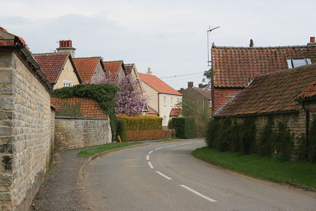
Hanby is a small village located in the West Lindsey district of Lincolnshire, England. Situated approximately 7 miles northeast of the historic city of Lincoln, it is nestled amidst the beautiful Lincolnshire countryside. The village is primarily residential, with a population of around 200 people.

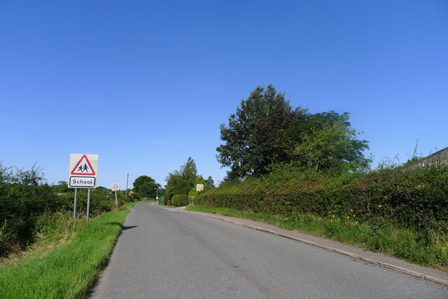
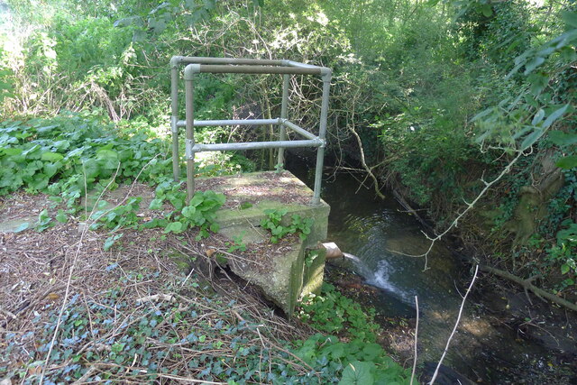
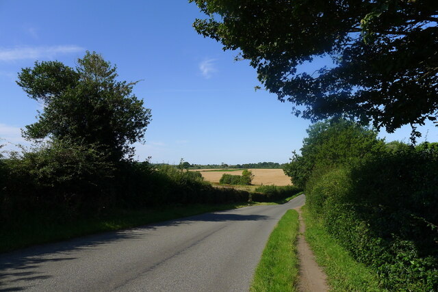
Hanby is known for its quaint charm and peaceful atmosphere. The village boasts a picturesque setting, surrounded by rolling hills, lush fields, and meandering streams. It offers a tranquil escape from the hustle and bustle of city life.

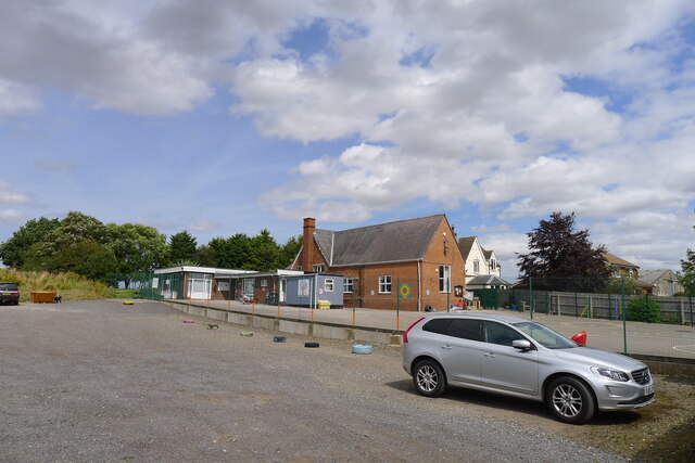
The village itself is adorned with traditional stone cottages, many of which date back several centuries, giving Hanby a distinct historical character. The local church, St. Peter's, is a notable landmark and serves as a gathering place for the community.

While Hanby is a small village, it benefits from its proximity to Lincoln. Residents can easily access the city's amenities, including shopping centers, restaurants, and cultural attractions. The nearby Lincolnshire Wolds, an Area of Outstanding Natural Beauty, also provides ample opportunities for outdoor activities such as hiking, cycling, and wildlife spotting.

Despite its small size, Hanby has a strong sense of community, with various social events and activities taking place throughout the year. Residents can enjoy a close-knit and friendly environment, fostering a sense of belonging.

Overall, Hanby is a charming village that offers a peaceful countryside lifestyle while still being within reach of city conveniences. Its idyllic setting, historic architecture, and strong community spirit make it an attractive place to live or visit.

If you have any feedback on the listing, please let us know in the comments section below.
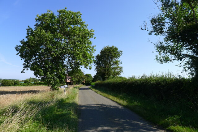
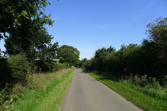
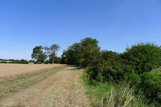
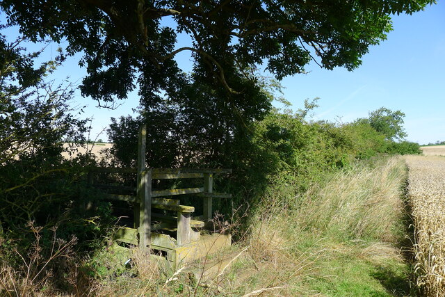
Hanby Images

Images are sourced within 2km of 52.872545/-0.478564 or Grid Reference TF0231. Thanks to Geograph Open Source API. All images are credited.

St Peter's Church, Lenton: the tower The tower of the church dates from the 14th century, and is typical of the period.

This is a grade I listed building: <span class="nowrap"><a title="https://historicengland.org.uk/listing/the-list/list-entry/1253206?section=official-list-entry" rel="nofollow ugc noopener" href="https://historicengland.org.uk/listing/the-list/list-entry/1253206?section=official-list-entry">Link</a><img style="margin-left:2px;" alt="External link" title="External link - shift click to open in new window" src="https://s1.geograph.org.uk/img/external.png" width="10" height="10"/></span> .
St Peter's Church, Lenton: the tower
The tower of the church dates from the 14th century, and is typical of the period. This is a grade I listed building: LinkExternal link .
St Peter's Church, Lenton: the font Angels round the font.  These are part of the Millennium art project created by  the late Roger Heaton.  It has been erected again for the 24th anniversary.

The octagonal font is 15th century.  The church is grade I listed - see <span class="nowrap"><a title="https://historicengland.org.uk/listing/the-list/list-entry/1253206?section=official-list-entry" rel="nofollow ugc noopener" href="https://historicengland.org.uk/listing/the-list/list-entry/1253206?section=official-list-entry">Link</a><img style="margin-left:2px;" alt="External link" title="External link - shift click to open in new window" src="https://s1.geograph.org.uk/img/external.png" width="10" height="10"/></span> .
St Peter's Church, Lenton: the font
Angels round the font. These are part of the Millennium art project created by the late Roger Heaton. It has been erected again for the 24th anniversary. The octagonal font is 15th century. The church is grade I listed - see LinkExternal link .
St Peter's Church, Lenton: chancel arch Decorated with angels, the chancel arch dates from the 14th century.
This is a Grade I listed church - <span class="nowrap"><a title="https://historicengland.org.uk/listing/the-list/list-entry/1253206?section=official-list-entry" rel="nofollow ugc noopener" href="https://historicengland.org.uk/listing/the-list/list-entry/1253206?section=official-list-entry">Link</a><img style="margin-left:2px;" alt="External link" title="External link - shift click to open in new window" src="https://s1.geograph.org.uk/img/external.png" width="10" height="10"/></span>.
St Peter's Church, Lenton: chancel arch
Decorated with angels, the chancel arch dates from the 14th century. This is a Grade I listed church - LinkExternal link.
St Peter's Church, Lenton: a flight of angels The Artists Roger and Liz Heaton created the display of angel images for the Millennium .
St Peter's Church, Lenton: a flight of angels
The Artists Roger and Liz Heaton created the display of angel images for the Millennium .
St Peter's Church, Lenton: the ring of angels Part of the display of Millennium Angels.
St Peter's Church, Lenton: the ring of angels
Part of the display of Millennium Angels.
St Peter's Church, Lenton: An angel Grade I listed

The church dates from the 13th century onwards and was restored in 1879 by James Fowler. The church was rebuilt after a severe storm in the 1870s

The church consists of chancel, nave with three bays of 13th century pointed arches, south aisle, porch and western tower and spire. There are three bells of mediaeval date. The tower is 14th century.
The chancel arch dates from the 13th century, the chancel was probably rebuilt in the late 15th century.
The nave has two fine 15th century windows and is there is a blocked up doorway in the north wall and also a blocked doorway of the former Rood stairs.
There is a Memorial to Jane Chaworth who died in 1606 and had 12 sons and four daughters.
The font is octagonal and dates from the 14th century. It was probably originally painted.
The only stained-glass in the church is the east window from 1884.
St Peter's Church, Lenton: An angel
Grade I listed The church dates from the 13th century onwards and was restored in 1879 by James Fowler. The church was rebuilt after a severe storm in the 1870s The church consists of chancel, nave with three bays of 13th century pointed arches, south aisle, porch and western tower and spire. There are three bells of mediaeval date. The tower is 14th century. The chancel arch dates from the 13th century, the chancel was probably rebuilt in the late 15th century. The nave has two fine 15th century windows and is there is a blocked up doorway in the north wall and also a blocked doorway of the former Rood stairs. There is a Memorial to Jane Chaworth who died in 1606 and had 12 sons and four daughters. The font is octagonal and dates from the 14th century. It was probably originally painted. The only stained-glass in the church is the east window from 1884.
Entering Ingoldsby past Ingoldsby Academy
Ingoldsby Academy Primary school with nursery facility
Ingoldsby Academy
Primary school with nursery facility
Sewage works outfall into the East Glen River Work was being undertaken at the sewage works, which might explain the high flow from the outfall
Sewage works outfall into the East Glen River
Work was being undertaken at the sewage works, which might explain the high flow from the outfall
Ingoldsby Road leaving Lenton
Church of St Peter, Lenton Listed Grade I, from the 13th century <span class="nowrap"><a title="https://historicengland.org.uk/listing/the-list/list-entry/1253206" rel="nofollow ugc noopener" href="https://historicengland.org.uk/listing/the-list/list-entry/1253206">Link</a><img style="margin-left:2px;" alt="External link" title="External link - shift click to open in new window" src="https://s1.geograph.org.uk/img/external.png" width="10" height="10"/></span>
Church of St Peter, Lenton
Listed Grade I, from the 13th century LinkExternal link
Leaving Lenton and entering Hanby
King Street leading through Hanby After last appearing as a visible road outside Hanthorpe, almost 6 miles to the south-east <a href="https://www.geograph.org.uk/photo/5681655">TF0823 : Clipsey Gap Lane, part of King street</a>, the Roman road 'King Street' reappears on its route north-west towards Ancaster.
King Street leading through Hanby
After last appearing as a visible road outside Hanthorpe, almost 6 miles to the south-east TF0823 : Clipsey Gap Lane, part of King street, the Roman road 'King Street' reappears on its route north-west towards Ancaster.
Wheat field by the East Glen River The river - barely a trickle in this headwater - is hidden amongst the shrubs on the right.
Wheat field by the East Glen River
The river - barely a trickle in this headwater - is hidden amongst the shrubs on the right.
Footbridge over the East Glen River Carrying the footpath from Hanby to Ingoldsby. The bridge is quite substantial, whereas the path is poorly marked.
Footbridge over the East Glen River
Carrying the footpath from Hanby to Ingoldsby. The bridge is quite substantial, whereas the path is poorly marked.
King Street; the Roman road through Hanby Dropping down the slight hill from Hanby Lodge, to pass 'Valley Cottage' at the bottom.
King Street; the Roman road through Hanby
Dropping down the slight hill from Hanby Lodge, to pass 'Valley Cottage' at the bottom.
The Cross Britain Way leading off King Street The Cross Britain Way is a 279 mile, east-west trail across England and Wales, created to help raise money for Macmillan Cancer Support. Starting at Boston (where the original Macmillan Way starts), it crosses the Fens, the Vale of Belvoir, the Leicestershire/Nottinghamshire Wolds, the National Forest, Cannock Chase, East Shropshire along the Iron Bridge Gorge, the Shropshire Hills, the hills of mid Wales, the Berwyn Mountains, and Snowdonia National Park, to its end at Barmouth. <span class="nowrap"><a title="https://ldwa.org.uk/ldp/members/show_path.php?path_name=Macmillan+Way+-+Cross+Britain+Way" rel="nofollow ugc noopener" href="https://ldwa.org.uk/ldp/members/show_path.php?path_name=Macmillan+Way+-+Cross+Britain+Way">Link</a><img style="margin-left:2px;" alt="External link" title="External link - shift click to open in new window" src="https://s1.geograph.org.uk/img/external.png" width="10" height="10"/></span>
The Cross Britain Way leading off King Street
The Cross Britain Way is a 279 mile, east-west trail across England and Wales, created to help raise money for Macmillan Cancer Support. Starting at Boston (where the original Macmillan Way starts), it crosses the Fens, the Vale of Belvoir, the Leicestershire/Nottinghamshire Wolds, the National Forest, Cannock Chase, East Shropshire along the Iron Bridge Gorge, the Shropshire Hills, the hills of mid Wales, the Berwyn Mountains, and Snowdonia National Park, to its end at Barmouth. LinkExternal link
King Street north of Hanby The Roman road crossing the productive farmland of the Kesteven Uplands.
King Street north of Hanby
The Roman road crossing the productive farmland of the Kesteven Uplands.
Show me another place!

Hanby is located at Grid Ref: TF0231 (Lat: 52.872545, Lng: -0.478564)

Division: Parts of Kesteven

Administrative County: Lincolnshire

District: South Kesteven

Police Authority: Lincolnshire

What 3 Words

///pickup.offers.craftsmen. Near Corby Glen, Lincolnshire

Nearby Locations

Hanby

Related Wikis

Hanby, Lincolnshire

Hanby is a hamlet in the South Kesteven district of Lincolnshire, England. It is situated between Lenton and Ropsley Heath, on the line of the Roman...

Lenton, Keisby and Osgodby

Lenton, Keisby and Osgodby is a civil parish in South Kesteven, Lincolnshire, England. The population of the civil parish at the 2011 census was 187....

Lenton, Lincolnshire

Lenton is a hamlet in the district of South Kesteven, Lincolnshire, England. It is situated approximately 7 miles (11 km) south-east from Grantham, and...

Ingoldsby

Ingoldsby is a small village in the South Kesteven district of Lincolnshire, England. It is situated 7 miles (11 km) south-east from the market town of...

Sapperton, Lincolnshire

Sapperton is a village in the South Kesteven district of Lincolnshire, England. The nearest town is Grantham, 6 miles (9.7 km) to the west. Adjacent villages...

Pickworth, Lincolnshire

Pickworth is a village and civil parish in the South Kesteven district of Lincolnshire, England. The population of the civil parish including Braceby and...

Little Humby

Little Humby or Humby is a hamlet in the South Kesteven district of Lincolnshire, England. It lies in the civil parish of Ropsley and Humby, 5 miles (8...
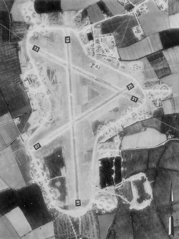
RAF Folkingham

Royal Air Force Folkingham or RAF Folkingham is a former Royal Air Force station located south west of Folkingham, Lincolnshire and about 29 miles (47...

Nearby Amenities

Located within 500m of 52.872545,-0.478564
Hanby
Is In: Lincolnshire, England, UK
Place: hamlet
Source: NPE
Lat/Long: 52.8746175/-0.4773509
Hanby Grange
Place: farm
Source: Bing
Lat/Long: 52.8733706/-0.4719854
Inglenook Cottage
Place: isolated_dwelling
Source: Bing
Lat/Long: 52.8702272/-0.475247
Hanby Grange
Historic Place: isolated_dwelling
Lat/Long: 52.8757501/-0.4742141
Place: farm
Lat/Long: 52.8727373/-0.4785601
The data included in this document is from www.openstreetmap.org. The data is made available under ODbL.

Have you been to Hanby?

Leave your review of Hanby below (or comments, questions and feedback).