Hanbury

Settlement in Worcestershire Wychavon

England

Hanbury

NT Hanbury Hall View across the autumnal formal garden towards the South-west facade.
NT Hanbury Hall Credit: Jonathan Billinger

Hanbury is a village located in the county of Worcestershire, England. Situated approximately six miles northeast of Droitwich Spa and eight miles south of Bromsgrove, it is nestled in the picturesque valley of the River Salwarpe. The village has a population of around 1,200 residents and is part of the Wychavon district.

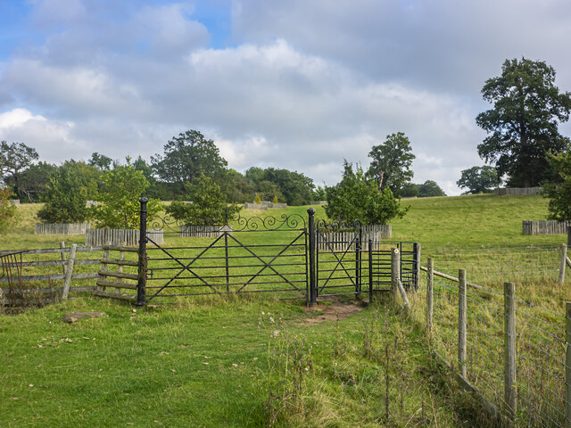
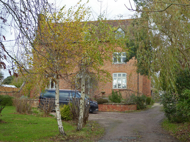
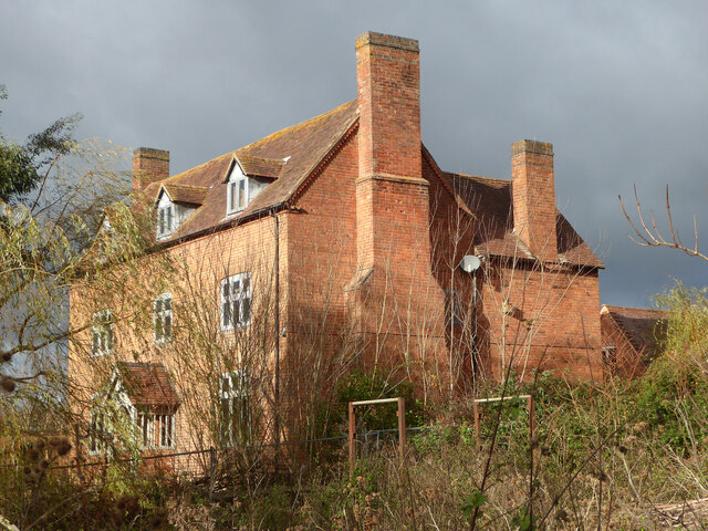
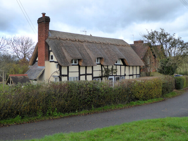
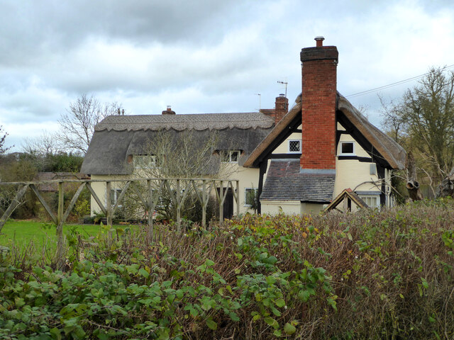
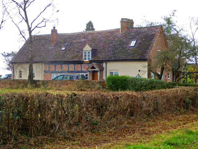
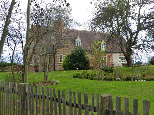
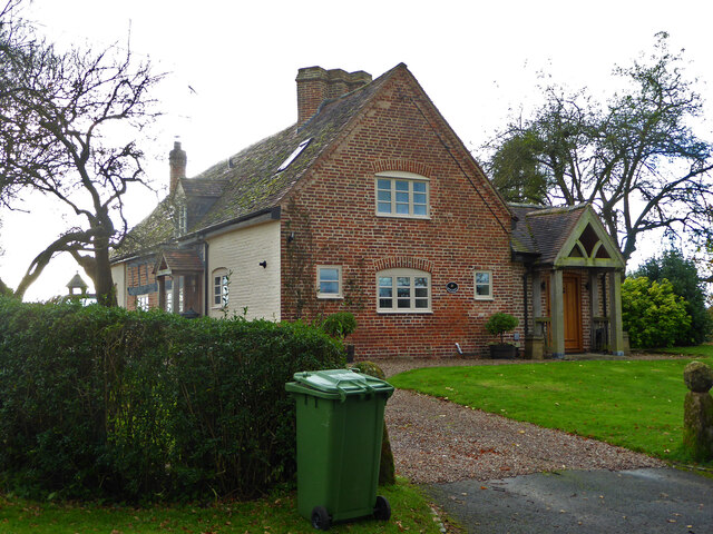
Hanbury is known for its stunning natural beauty, with rolling hills and expansive green fields surrounding the area. The landscape is dotted with charming cottages and historic buildings, adding to the village's traditional English countryside charm.

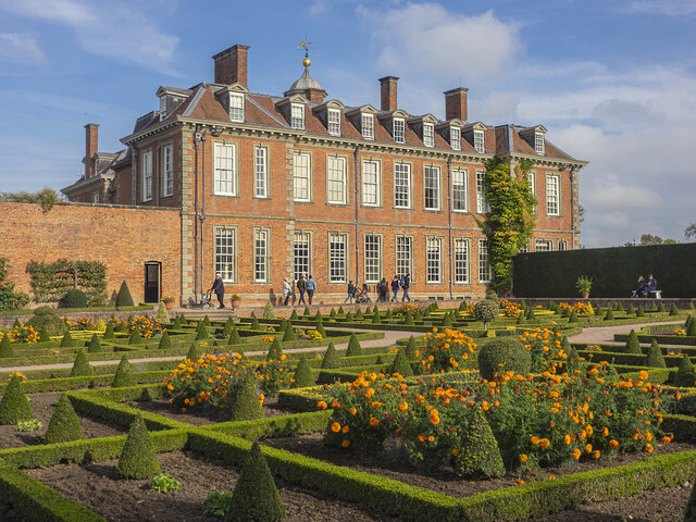
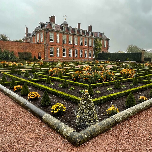
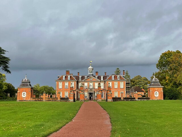
The centerpiece of the village is Hanbury Hall, a magnificent stately home that dates back to the early 18th century. The hall is surrounded by extensive gardens and parkland, which are open to the public and provide a popular spot for leisurely walks and picnics.

The village also boasts a thriving community, with a primary school, a village hall, and a parish church dedicated to St. Mary the Virgin. The church dates back to the 13th century and features beautiful stained glass windows and intricate stonework.

Hanbury is well-connected to nearby towns and cities, with good road links to Worcester, Birmingham, and the wider West Midlands region. This accessibility, combined with its tranquil and idyllic setting, makes Hanbury an attractive place to live for those seeking a peaceful and rural lifestyle while still having access to urban amenities.

If you have any feedback on the listing, please let us know in the comments section below.

Hanbury Images

Images are sourced within 2km of 52.274895/-2.057098 or Grid Reference SO9664. Thanks to Geograph Open Source API. All images are credited.

NT Hanbury Hall View across the autumnal formal garden towards the South-west facade.
NT Hanbury Hall
View across the autumnal formal garden towards the South-west facade.
Still Life at Hanbury An autumnal display near the entrance to Hanbury Hall.
Still Life at Hanbury
An autumnal display near the entrance to Hanbury Hall.
Dahlia display Within the walled garden at Hanbury Hall.
Dahlia display
Within the walled garden at Hanbury Hall.
Gate on the estate A fine piece of ironwork on a public path through the NT Hanbury Hall estate.
Gate on the estate
A fine piece of ironwork on a public path through the NT Hanbury Hall estate.
The parterre garden at Hanbury Hall A recreation of the garden designed by George London in 1705.
The parterre garden at Hanbury Hall
A recreation of the garden designed by George London in 1705.
Hanbury Hall National Trust property in Worcestershire built in 1701.
Hanbury Hall
National Trust property in Worcestershire built in 1701.
Mere Green Farmhouse Grade II Listed. Listed as in Hanbury ward. The view from the public road. There are two further listed buildings in the complex but there are no good trespass free views.
Mere Green Farmhouse
Grade II Listed. Listed as in Hanbury ward. The view from the public road. There are two further listed buildings in the complex but there are no good trespass free views.
Mere Green Farmhouse Grade II Listed. This was the best view I could manage from a public place. The complex includes two further listed buildings but I could not get a meaningful view of those from public places.
Mere Green Farmhouse
Grade II Listed. This was the best view I could manage from a public place. The complex includes two further listed buildings but I could not get a meaningful view of those from public places.
Well Cottage, Hanbury A 17th century house with a thatched roof, Listed Grade II.
Well Cottage, Hanbury
A 17th century house with a thatched roof, Listed Grade II.
Well Cottage, Hanbury A 17th century thatched dwelling, Listed Grade II.
Well Cottage, Hanbury
A 17th century thatched dwelling, Listed Grade II.
Dovecote by Pumphouse Farm Early 17th century dovecote, Listed Grade II. Difficult to get a clear view over the hedge from the public road. There is no convenient public footpath here.
Dovecote by Pumphouse Farm
Early 17th century dovecote, Listed Grade II. Difficult to get a clear view over the hedge from the public road. There is no convenient public footpath here.
Barn at Pumphouse Farm, Hanbury Grade II Listed.
Barn at Pumphouse Farm, Hanbury
Grade II Listed.
Pumphouse Farmhouse, Hanbury Grade II Listed.
Pumphouse Farmhouse, Hanbury
Grade II Listed.
White House Cottage, Hanbury Early 18th century with late 19th and early 20th century alterations. Grade II Listed.
White House Cottage, Hanbury
Early 18th century with late 19th and early 20th century alterations. Grade II Listed.
Appleby, Hanbury An early 17th century house with late 19th and mid-20th century alterations and additions. Listed Grade II.
Appleby, Hanbury
An early 17th century house with late 19th and mid-20th century alterations and additions. Listed Grade II.
Appleby, Hanbury An early 17th century house with late 19th and mid-20th century alterations and additions. Listed Grade II.
Appleby, Hanbury
An early 17th century house with late 19th and mid-20th century alterations and additions. Listed Grade II.
Appleby, Hanbury An early 17th century house with late 19th and mid-20th century alterations and additions. Listed Grade II.
Appleby, Hanbury
An early 17th century house with late 19th and mid-20th century alterations and additions. Listed Grade II.
Public footpath off Pumphouse Lane, Hanbury Hanbury Church is seen on the hill in the background
Public footpath off Pumphouse Lane, Hanbury
Hanbury Church is seen on the hill in the background
Show me another place!

Hanbury is located at Grid Ref: SO9664 (Lat: 52.274895, Lng: -2.057098)

Administrative County: Worcestershire

District: Wychavon

Police Authority: West Mercia

What 3 Words

///farmland.narrowest.rail. Near Stoke Prior, Worcestershire

Related Wikis

Hanbury, Worcestershire

Hanbury is a rural village in Worcestershire, England near Droitwich Spa and the M5 motorway. The population of Hanbury has remained around 1,000 since...

St Mary the Virgin, Hanbury

The church of St Mary the Virgin is an Anglican parish church in the village of Hanbury, Worcestershire. Its earliest parts date from about 1210 and it...

Hanbury Hall

Hanbury Hall is a large 18th-century stately home standing in parkland at Hanbury, Worcestershire. The main range has two storeys and is built of red brick...

Mere Green, Worcestershire

Mere Green is a hamlet in the English county of Worcestershire. It is located south of the village of Hanbury roughly midway between Worcester and Redditch...

Feckenham Forest

Feckenham Forest was a royal forest, centred on the village of Feckenham, covering large parts of Worcestershire and west Warwickshire. It was not entirely...

Stoke Works railway station

Stoke Works railway station was a station in the hamlet of Stoke Prior in the English county of Worcestershire, near Bromsgrove. It was located on the...

Droitwich Road railway station

Droitwich Road railway station served the town of Droitwich Spa, Worcestershire, England, from 1840 to 1855 on the Birmingham and Gloucester Railway....

Stoke Prior, Worcestershire

Stoke Prior is a village in the civil parish of Stoke in the Bromsgrove district of Worcestershire. The parish includes the settlement of Stoke Wharf and...

Nearby Amenities

Located within 500m of 52.274895,-2.057098
Jinney Ring Craft Centre
Naptan AtcoCode: 2000G019400
Naptan Bearing: N
Naptan BusStopType: CUS
Naptan CommonName: Jinney Ring Craft Centre
Naptan Indicator: adj
Naptan Landmark: Craft Centre
Naptan NaptanCode: wocdgatg
Naptan Street: Hanbury road
Naptan Verified: no
Source: naptan_import
Lat/Long: 52.2745893/-2.0570481
New Inn Cottage
Naptan AtcoCode: 2000G021200
Naptan Bearing: NW
Naptan BusStopType: CUS
Naptan CommonName: New Inn Cottage
Naptan Indicator: adj
Naptan NaptanCode: wocgjata
Naptan Street: Hanbury Road
Naptan Verified: no
Source: naptan_import
Lat/Long: 52.2731003/-2.0559268
New Inn Cottage
Naptan AtcoCode: 2000G323315
Naptan Bearing: SE
Naptan BusStopType: CUS
Naptan CommonName: New Inn Cottage
Naptan Indicator: opp
Naptan NaptanCode: wocgmaja
Naptan Street: Hanbury Road
Naptan Verified: no
Source: naptan_import
Lat/Long: 52.2731453/-2.0556777
Jinney Ring-Craft Centre
Naptan AtcoCode: 2000G323316
Naptan Bearing: S
Naptan BusStopType: CUS
Naptan CommonName: Jinney Ring-Craft Centre
Naptan Indicator: opp
Naptan Landmark: Craft Centre
Naptan NaptanCode: wocgmajd
Naptan Street: Hanbury Road
Naptan Verified: no
Source: naptan_import
Lat/Long: 52.2745736/-2.0569073
Valley Farm
Naptan AtcoCode: 2000G323335
Naptan Bearing: SE
Naptan BusStopType: CUS
Naptan CommonName: Valley Farm
Naptan Indicator: adj
Naptan NaptanCode: wocgagda
Naptan PlusbusZoneRef: BRMSGRV
Naptan Street: Hanbury Road
Naptan Verified: no
Source: naptan_import
Lat/Long: 52.2765335/-2.0583495
Valley Farm
Naptan AtcoCode: 2000G662004
Naptan Bearing: NW
Naptan BusStopType: CUS
Naptan CommonName: Valley Farm
Naptan Indicator: opp
Naptan NaptanCode: wocdpjwd
Naptan PlusbusZoneRef: BRMSGRV
Naptan Street: Hanbury Road
Naptan Verified: no
Source: naptan_import
Lat/Long: 52.2764435/-2.0585692
Power: pole
Source: bing
Lat/Long: 52.2736198/-2.0571474
Power: pole
Source: bing
Lat/Long: 52.2737323/-2.0568145
Power: pole
Source: bing
Lat/Long: 52.2738818/-2.0564484
Power: pole
Source: bing
Lat/Long: 52.2739049/-2.050667
Power: pole
Source: bing
Lat/Long: 52.273979/-2.0520757
Power: pole
Source: bing
Lat/Long: 52.2741325/-2.0547667
Power: pole
Source: bing
Lat/Long: 52.274197/-2.0556315
Forest Lane Hanbury
Power: pole
Source: bing
Transformer: distribution
Voltage Primary: 11000
Lat/Long: 52.2748998/-2.0558416
Power: pole
Source: bing
Lat/Long: 52.2750738/-2.0558976
Power: pole
Source: bing
Lat/Long: 52.2759367/-2.0561609
Location Transition: yes
Power: pole
Source: bing
Lat/Long: 52.2765017/-2.058227
Power: pole
Source: bing
Lat/Long: 52.276756/-2.0564098
Power: pole
Source: bing
Lat/Long: 52.2768502/-2.0583042
Power: pole
Source: bing
Lat/Long: 52.2771673/-2.0585476
Power: pole
Source: bing
Lat/Long: 52.2775276/-2.0588194
Power: pole
Source: bing
Lat/Long: 52.2776563/-2.0566617
Power: pole
Source: bing
Lat/Long: 52.2779109/-2.0567298
Power: pole
Source: bing
Lat/Long: 52.2779243/-2.059119
Power: pole
Source: bing
Lat/Long: 52.2779123/-2.059355
Power: pole
Source: bing
Lat/Long: 52.2785913/-2.056922
The Square Hanbury
Power: pole
Source: bing
Transformer: distribution
Voltage Primary: 11000
Lat/Long: 52.2726316/-2.0569844
Power: pole
Source: bing
Lat/Long: 52.272979/-2.0570719
Power: pole
Source: bing
Lat/Long: 52.2733157/-2.0571298
Hanbury Village
Power: pole
Source: bing
Transformer: distribution
Voltage Primary: 11000
Lat/Long: 52.2740376/-2.0571817
Power: pole
Source: bing
Lat/Long: 52.2742722/-2.057201
Entrance: main
Source: bing;survey
Lat/Long: 52.274575/-2.0578215
Entrance: main
Source: bing;survey
Lat/Long: 52.274646/-2.0576821
Power: pole
Source: bing
Lat/Long: 52.2747614/-2.0583198
Power: pole
Source: bing
Lat/Long: 52.2749923/-2.0591864
Power: pole
Source: bing
Lat/Long: 52.2752076/-2.0600489
Power: pole
Source: bing
Lat/Long: 52.2754987/-2.061033
Power: pole
Source: bing
Lat/Long: 52.2755366/-2.0641295
Power: pole
Source: bing
Lat/Long: 52.2756005/-2.0629396
Power: pole
Source: bing
Lat/Long: 52.2756762/-2.0617134
Restaurant
Farmhouse Restaurant
Operator: The Jinney Ring
Smoking: no
Wheelchair: yes
Lat/Long: 52.2746546/-2.0578021
Power: pole
Lat/Long: 52.2704356/-2.0566441
Woodrow Farm
Power: pole
Transformer: distribution
Voltage Primary: 11000
Lat/Long: 52.2710306/-2.0567541
Power: pole
Lat/Long: 52.2716563/-2.0568714
The Valley
Power: pole
Transformer: distribution
Voltage Primary: 11000
Lat/Long: 52.2771822/-2.058464
Power: pole
Lat/Long: 52.2774682/-2.0580965
Power: pole
Lat/Long: 52.2777308/-2.0577452
Power: pole
Lat/Long: 52.2778276/-2.0572382
Power: pole
Lat/Long: 52.2719852/-2.0569095
Power: pole
Lat/Long: 52.2722761/-2.0569433
Old Bell Farm
Power: pole
Transformer: distribution
Voltage Primary: 11000
Lat/Long: 52.2753503/-2.0605145
Power: pole
Lat/Long: 52.2740649/-2.0535737
The data included in this document is from www.openstreetmap.org. The data is made available under ODbL.

Have you been to Hanbury?

Leave your review of Hanbury below (or comments, questions and feedback).