Fishpools Coppice

Wood, Forest in Worcestershire Wychavon

England

Fishpools Coppice

Well Cottage, Hanbury A 17th century house with a thatched roof, Listed Grade II.
Well Cottage, Hanbury Credit: Chris Allen

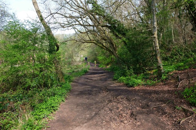
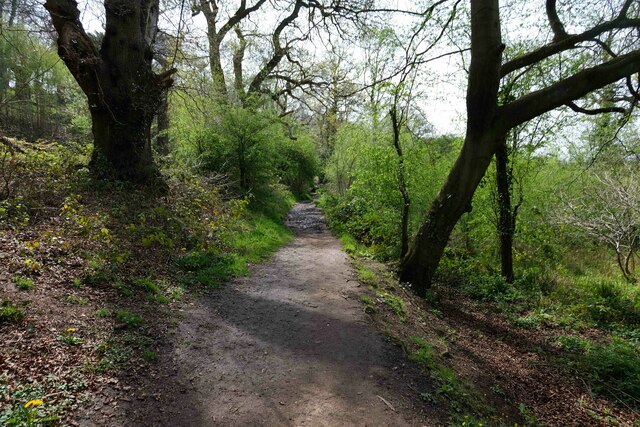
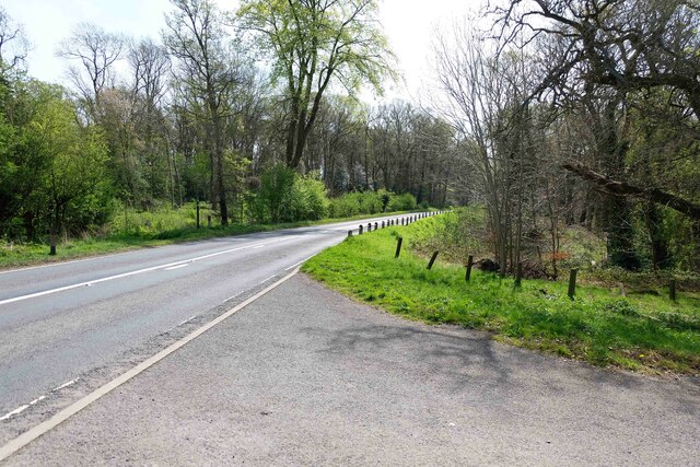
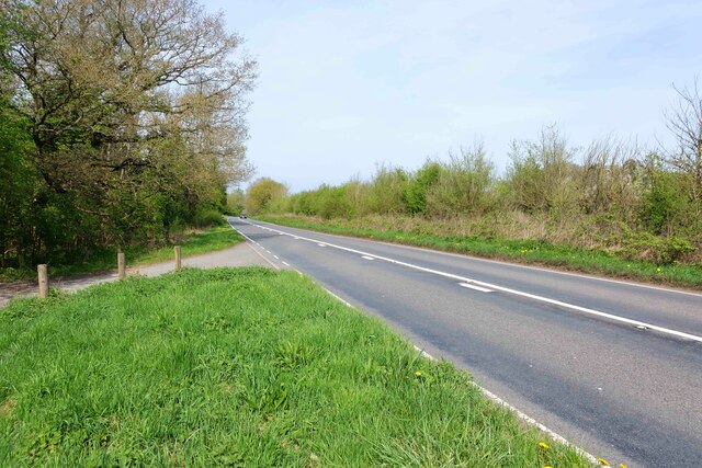
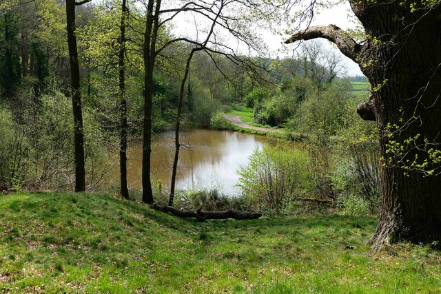
Fishpools Coppice is a picturesque woodland located in Worcestershire, England. Covering an area of approximately 50 hectares, it is a popular destination for nature lovers, hikers, and bird watchers. The coppice is characterized by its dense growth of various tree species, including oak, ash, birch, and hazel.

The woodland is known for its rich biodiversity, providing a habitat for a wide range of flora and fauna. Bluebells, primroses, and wood anemones carpet the forest floor during spring, creating a stunning display of colors. The diverse vegetation attracts numerous bird species, such as woodpeckers, nuthatches, and tawny owls. Additionally, small mammals like badgers, foxes, and squirrels can be spotted within the coppice.

Visitors to Fishpools Coppice can enjoy several walking trails that wind through the forest, offering a peaceful and tranquil escape from the hustle and bustle of everyday life. These trails cater to different levels of fitness and provide opportunities for both short leisurely strolls and longer, more challenging hikes.

The coppice is managed by the Worcestershire Wildlife Trust, which ensures the preservation of its natural beauty and protection of its wildlife. They organize educational programs and events to raise awareness about the importance of conservation and the role of forests in maintaining a healthy ecosystem.

Overall, Fishpools Coppice is a captivating woodland that offers visitors a chance to immerse themselves in nature's beauty. Whether it's exploring the trails, observing wildlife, or simply enjoying the peaceful ambiance, this Worcestershire gem is a must-visit for nature enthusiasts.

If you have any feedback on the listing, please let us know in the comments section below.

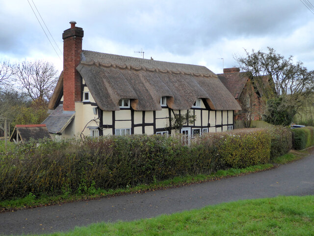
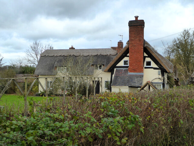
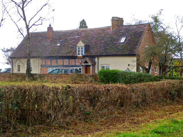
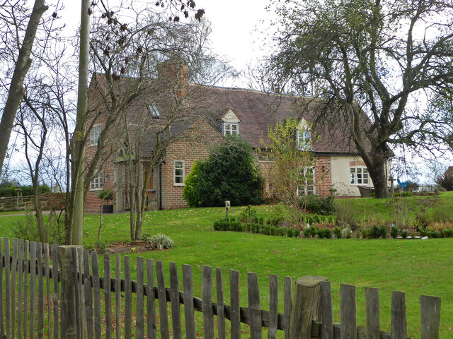
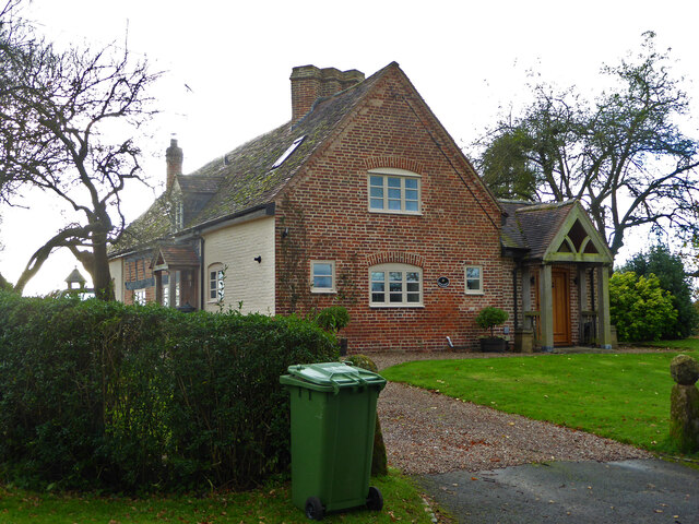
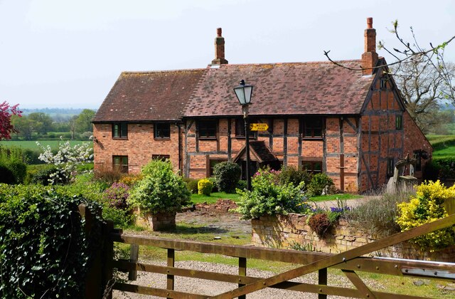
Fishpools Coppice Images

Images are sourced within 2km of 52.274887/-2.0511487 or Grid Reference SO9664. Thanks to Geograph Open Source API. All images are credited.

Well Cottage, Hanbury A 17th century house with a thatched roof, Listed Grade II.
Well Cottage, Hanbury
A 17th century house with a thatched roof, Listed Grade II.
Well Cottage, Hanbury A 17th century thatched dwelling, Listed Grade II.
Well Cottage, Hanbury
A 17th century thatched dwelling, Listed Grade II.
Dovecote by Pumphouse Farm Early 17th century dovecote, Listed Grade II. Difficult to get a clear view over the hedge from the public road. There is no convenient public footpath here.
Dovecote by Pumphouse Farm
Early 17th century dovecote, Listed Grade II. Difficult to get a clear view over the hedge from the public road. There is no convenient public footpath here.
Barn at Pumphouse Farm, Hanbury Grade II Listed.
Barn at Pumphouse Farm, Hanbury
Grade II Listed.
Pumphouse Farmhouse, Hanbury Grade II Listed.
Pumphouse Farmhouse, Hanbury
Grade II Listed.
White House Cottage, Hanbury Early 18th century with late 19th and early 20th century alterations. Grade II Listed.
White House Cottage, Hanbury
Early 18th century with late 19th and early 20th century alterations. Grade II Listed.
Appleby, Hanbury An early 17th century house with late 19th and mid-20th century alterations and additions. Listed Grade II.
Appleby, Hanbury
An early 17th century house with late 19th and mid-20th century alterations and additions. Listed Grade II.
Appleby, Hanbury An early 17th century house with late 19th and mid-20th century alterations and additions. Listed Grade II.
Appleby, Hanbury
An early 17th century house with late 19th and mid-20th century alterations and additions. Listed Grade II.
Appleby, Hanbury An early 17th century house with late 19th and mid-20th century alterations and additions. Listed Grade II.
Appleby, Hanbury
An early 17th century house with late 19th and mid-20th century alterations and additions. Listed Grade II.
Public footpath off Pumphouse Lane, Hanbury Hanbury Church is seen on the hill in the background
Public footpath off Pumphouse Lane, Hanbury
Hanbury Church is seen on the hill in the background
The White House, Hanbury A large old house in this Worcestershire village. I thought at first it must be one of the local listed buildings but soon realised it does not have any statutory protection.
The White House, Hanbury
A large old house in this Worcestershire village. I thought at first it must be one of the local listed buildings but soon realised it does not have any statutory protection.
Signpost at the junction of Loggerheads Lane and Pumphouse Lane, Hanbury Hanbury Church is in the right background.
Signpost at the junction of Loggerheads Lane and Pumphouse Lane, Hanbury
Hanbury Church is in the right background.
Footpath, Piper's Hill, near Hanbury, Worcs Piper's Hill and Dodderhill Commons is a nature reserve managed by Worcestershire Wildlife Trust. It contains over two hundred of the oldest trees in the county of Worcestershire. This footpath runs along the western edge of the reserve.
Footpath, Piper's Hill, near Hanbury, Worcs
Piper's Hill and Dodderhill Commons is a nature reserve managed by Worcestershire Wildlife Trust. It contains over two hundred of the oldest trees in the county of Worcestershire. This footpath runs along the western edge of the reserve.
Knotts Farmhouse, near Hanbury, Worcs Although the style of the building makes it look quite old, it was in fact constructed in 1950.
Knotts Farmhouse, near Hanbury, Worcs
Although the style of the building makes it look quite old, it was in fact constructed in 1950.
B4091 road to Hanbury, Worcs The B4091 road runs from north of Bromsgrove and then through that town and via Stoke Heath and Stoke Wharf on to Hanbury, all in Worcestershire. This view is looking in the direction of Hanbury. The road on the right is the access road to that nature reserve of Piper's Hill and Dodderhill Commons, managed by Worcestershire Wildlife Trust.
B4091 road to Hanbury, Worcs
The B4091 road runs from north of Bromsgrove and then through that town and via Stoke Heath and Stoke Wharf on to Hanbury, all in Worcestershire. This view is looking in the direction of Hanbury. The road on the right is the access road to that nature reserve of Piper's Hill and Dodderhill Commons, managed by Worcestershire Wildlife Trust.
B4091 road to Stoke Wharf, Worcs The B4091 road runs from Hanbury to Stoke Wharf and Stoke Heath and then to north of Bromsgrove after passing through that town. It is completely within the County of Worcestershire. This view is looking in the direction of Stoke Wharf. On the left is the Piper's Hill and Dodderhill Commons Nature Reserve, managed by Worcestershire Wildlife Trust.
B4091 road to Stoke Wharf, Worcs
The B4091 road runs from Hanbury to Stoke Wharf and Stoke Heath and then to north of Bromsgrove after passing through that town. It is completely within the County of Worcestershire. This view is looking in the direction of Stoke Wharf. On the left is the Piper's Hill and Dodderhill Commons Nature Reserve, managed by Worcestershire Wildlife Trust.
Pool (1), Piper's Hill & Dodderhill Commons Nature Reserve, near Hanbury, Worcs This pool is within the Nature Reserve managed by Worcestershire Wildlife Trust.

<a href="https://www.geograph.org.uk/photo/7151762">SO9565 : Pool (2), Piper's Hill & Dodderhill Commons Nature Reserve, near Hanbury, Worcs</a>.
<a href="https://www.geograph.org.uk/photo/7151768">SO9565 : Pool (3), Piper's Hill & Dodderhill Commons Nature Reserve, near Hanbury, Worcs</a>.
Pool (1), Piper's Hill & Dodderhill Commons Nature Reserve, near Hanbury, Worcs
Show me another place!

Fishpools Coppice is located at Grid Ref: SO9664 (Lat: 52.274887, Lng: -2.0511487)

Administrative County: Worcestershire

District: Wychavon

Police Authority: West Mercia

What 3 Words

///onion.tablet.rezoning. Near Stoke Prior, Worcestershire

Related Wikis

Hanbury, Worcestershire

Hanbury is a rural village in Worcestershire, England near Droitwich Spa and the M5 motorway. The population of Hanbury has remained around 1,000 since...

St Mary the Virgin, Hanbury

The church of St Mary the Virgin is an Anglican parish church in the village of Hanbury, Worcestershire. Its earliest parts date from about 1210 and it...

Hanbury Hall

Hanbury Hall is a large 18th-century stately home standing in parkland at Hanbury, Worcestershire. The main range has two storeys and is built of red brick...

Mere Green, Worcestershire

Mere Green is a hamlet in the English county of Worcestershire. It is located south of the village of Hanbury roughly midway between Worcester and Redditch...

Feckenham Forest

Feckenham Forest was a royal forest, centred on the village of Feckenham, covering large parts of Worcestershire and west Warwickshire. It was not entirely...

Stoke Works railway station

Stoke Works railway station was a station in the hamlet of Stoke Prior in the English county of Worcestershire, near Bromsgrove. It was located on the...

Upper Bentley

Upper Bentley is a village in Worcestershire, England. It is located between the towns of Redditch and Bromsgrove. It is near the villages of Elcocks Brook...

Cruise Hill

Cruise Hill is a hamlet outside Redditch, Worcestershire. It lies in between the villages of Feckenham, Callow Hill, Elcocks Brook & Ham Green.

Nearby Amenities

Located within 500m of 52.274887,-2.0511487
Jinney Ring Craft Centre
Naptan AtcoCode: 2000G019400
Naptan Bearing: N
Naptan BusStopType: CUS
Naptan CommonName: Jinney Ring Craft Centre
Naptan Indicator: adj
Naptan Landmark: Craft Centre
Naptan NaptanCode: wocdgatg
Naptan Street: Hanbury road
Naptan Verified: no
Source: naptan_import
Lat/Long: 52.2745893/-2.0570481
New Inn Cottage
Naptan AtcoCode: 2000G021200
Naptan Bearing: NW
Naptan BusStopType: CUS
Naptan CommonName: New Inn Cottage
Naptan Indicator: adj
Naptan NaptanCode: wocgjata
Naptan Street: Hanbury Road
Naptan Verified: no
Source: naptan_import
Lat/Long: 52.2731003/-2.0559268
New Inn Cottage
Naptan AtcoCode: 2000G323315
Naptan Bearing: SE
Naptan BusStopType: CUS
Naptan CommonName: New Inn Cottage
Naptan Indicator: opp
Naptan NaptanCode: wocgmaja
Naptan Street: Hanbury Road
Naptan Verified: no
Source: naptan_import
Lat/Long: 52.2731453/-2.0556777
Jinney Ring-Craft Centre
Naptan AtcoCode: 2000G323316
Naptan Bearing: S
Naptan BusStopType: CUS
Naptan CommonName: Jinney Ring-Craft Centre
Naptan Indicator: opp
Naptan Landmark: Craft Centre
Naptan NaptanCode: wocgmajd
Naptan Street: Hanbury Road
Naptan Verified: no
Source: naptan_import
Lat/Long: 52.2745736/-2.0569073
Power: pole
Source: bing
Lat/Long: 52.2736198/-2.0571474
Power: pole
Source: bing
Lat/Long: 52.2737253/-2.047718
Power: pole
Source: bing
Lat/Long: 52.2737323/-2.0568145
Power: pole
Source: bing
Lat/Long: 52.2738123/-2.0492099
Power: pole
Source: bing
Lat/Long: 52.2738818/-2.0564484
Power: pole
Source: bing
Lat/Long: 52.2739049/-2.050667
Power: pole
Source: bing
Lat/Long: 52.273979/-2.0520757
Fishpool Cottage
Power: pole
Source: bing
Transformer: distribution
Voltage Primary: 11000
Lat/Long: 52.2740725/-2.0464879
Power: pole
Source: bing
Lat/Long: 52.2741325/-2.0547667
Power: pole
Source: bing
Lat/Long: 52.274197/-2.0556315
Power: pole
Source: bing
Lat/Long: 52.2742716/-2.0457646
Power: pole
Source: bing
Lat/Long: 52.2747715/-2.0447236
Forest Lane Hanbury
Power: pole
Source: bing
Transformer: distribution
Voltage Primary: 11000
Lat/Long: 52.2748998/-2.0558416
Power: pole
Source: bing
Lat/Long: 52.2750738/-2.0558976
Power: pole
Source: bing
Lat/Long: 52.2752853/-2.043958
Power: pole
Source: bing
Lat/Long: 52.2759367/-2.0561609
Power: pole
Source: bing
Lat/Long: 52.276756/-2.0564098
Power: pole
Source: bing
Lat/Long: 52.2776563/-2.0566617
The Square Hanbury
Power: pole
Source: bing
Transformer: distribution
Voltage Primary: 11000
Lat/Long: 52.2726316/-2.0569844
Power: pole
Source: bing
Lat/Long: 52.272979/-2.0570719
Power: pole
Source: bing
Lat/Long: 52.2733157/-2.0571298
Hanbury Village
Power: pole
Source: bing
Transformer: distribution
Voltage Primary: 11000
Lat/Long: 52.2740376/-2.0571817
Power: pole
Source: bing
Lat/Long: 52.2742722/-2.057201
Entrance: main
Source: bing;survey
Lat/Long: 52.274575/-2.0578215
Entrance: main
Source: bing;survey
Lat/Long: 52.274646/-2.0576821
Power: pole
Source: bing
Lat/Long: 52.2747614/-2.0583198
Restaurant
Farmhouse Restaurant
Operator: The Jinney Ring
Smoking: no
Wheelchair: yes
Lat/Long: 52.2746546/-2.0578021
Power: pole
Lat/Long: 52.2740751/-2.0440471
Power: pole
Lat/Long: 52.2722761/-2.0569433
Power: pole
Lat/Long: 52.2740649/-2.0535737
The data included in this document is from www.openstreetmap.org. The data is made available under ODbL.

Have you been to Fishpools Coppice?

Leave your review of Fishpools Coppice below (or comments, questions and feedback).