Charlton Park

Downs, Moorland in Somerset Mendip

England

Charlton Park

Field of Stubble near White Post The white post used to stand at a junction on the nearby fosse Way. There is now a pub called the White Post. One or two bales of straw had not been collected from the field.
Field of Stubble near White Post Credit: Nigel Mykura

Charlton Park is a picturesque estate situated in the county of Somerset, England. It is nestled within the stunning countryside, encompassing both downs and moorland landscapes. The park covers a vast area of approximately 500 acres, offering visitors an idyllic and tranquil retreat from the hustle and bustle of everyday life.

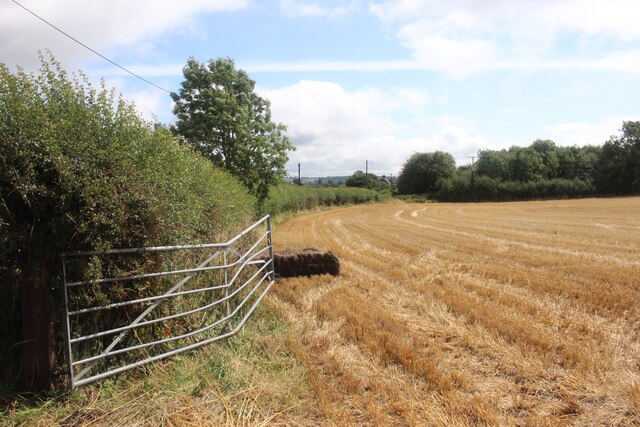
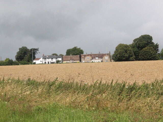
The park boasts an abundance of natural beauty, with rolling hills, lush green meadows, and ancient woodlands. It is home to a diverse range of flora and fauna, making it a haven for nature enthusiasts and wildlife lovers. The vast moorlands are particularly enchanting, with their rugged and untamed charm.

Charlton Park also holds historical significance, with the main house dating back to the 17th century. The stunning Georgian mansion is a true architectural gem, showcasing grandeur and elegance. The estate has been meticulously maintained and restored, preserving its original charm and character.

Visitors to Charlton Park can enjoy a variety of activities and attractions. The extensive grounds provide ample opportunities for leisurely walks, picnics, and outdoor games. The estate also hosts various events throughout the year, including music festivals, vintage car shows, and craft fairs.

Additionally, Charlton Park offers a range of amenities to cater to its visitors' needs. These include a café for refreshments, ample parking facilities, and wheelchair accessibility. The park is easily accessible by car and public transport, making it a popular destination for both locals and tourists alike.

In summary, Charlton Park in Somerset is a stunning estate that offers a harmonious blend of natural beauty, historical significance, and recreational activities. Whether one seeks a peaceful stroll or a lively event, this idyllic location has something to offer for everyone.

If you have any feedback on the listing, please let us know in the comments section below.

Charlton Park Images

Images are sourced within 2km of 51.271721/-2.4519231 or Grid Reference ST6852. Thanks to Geograph Open Source API. All images are credited.

Field of Stubble near White Post The white post used to stand at a junction on the nearby fosse Way. There is now a pub called the White Post. One or two bales of straw had not been collected from the field.
Field of Stubble near White Post
The white post used to stand at a junction on the nearby fosse Way. There is now a pub called the White Post. One or two bales of straw had not been collected from the field.
The White Post Inn The White Post Inn is on the A37 Fosse Way. This is the rear of the pub viewed from the B3139 , the minor road to Kilmersdon viewed across a field of standing wheat.
The White Post Inn
The White Post Inn is on the A37 Fosse Way. This is the rear of the pub viewed from the B3139 , the minor road to Kilmersdon viewed across a field of standing wheat.
The Old Redhouse Farm  Industrial Estate This is a small rural industrial estate that has a variety of small businesses including ones dedicated to stone memorials, kick boxing classes, care providers, roofing requirements, timber preservation and car repairs.
The Old Redhouse Farm Industrial Estate
This is a small rural industrial estate that has a variety of small businesses including ones dedicated to stone memorials, kick boxing classes, care providers, roofing requirements, timber preservation and car repairs.
House near Charlton This house sits right on the junction where the minor road the B3139 from Charlton meets the minor road from Kilmersdon to Holcombe.
House near Charlton
This house sits right on the junction where the minor road the B3139 from Charlton meets the minor road from Kilmersdon to Holcombe.
Old Milepost by the B3139, Kilmersdon Hill Cast iron post by the B3139, in parish of KILMERSDON (MENDIP District), Kilmersdon Hill, near Kilmersdon Village, on grass verge in front of hedge, on South side of road. Radstock iron casting, erected by the Radstock turnpike trust in the 19th century. 

Inscription reads:-
: WELLS / 11 : : LONDON / 111 : : KILMERSDON : : TROWBRIDGE / 12 / DEVIZES / 22 :

Grade II listed.
List Entry Number: 1177856 <span class="nowrap"><a title="https://historicengland.org.uk/listing/the-list/list-entry/1177856" rel="nofollow ugc noopener" href="https://historicengland.org.uk/listing/the-list/list-entry/1177856">Link</a><img style="margin-left:2px;" alt="External link" title="External link - shift click to open in new window" src="https://s1.geograph.org.uk/img/external.png" width="10" height="10"/></span>

Milestone Society National ID: SO_LBWL111
Old Milepost by the B3139, Kilmersdon Hill
Cast iron post by the B3139, in parish of KILMERSDON (MENDIP District), Kilmersdon Hill, near Kilmersdon Village, on grass verge in front of hedge, on South side of road. Radstock iron casting, erected by the Radstock turnpike trust in the 19th century. Inscription reads:- : WELLS / 11 : : LONDON / 111 : : KILMERSDON : : TROWBRIDGE / 12 / DEVIZES / 22 : Grade II listed. List Entry Number: 1177856 LinkExternal link Milestone Society National ID: SO_LBWL111
Direction Sign – Signpost by the B3139 in Kilmersdon Located on the northeast side of the junction of the B3139 and Church Street in the village centre, Kilmersdon parish. 1 arm and pyramid finial. See <a title="https://www.geograph.org.uk/photo/6035483" href="https://www.geograph.org.uk/photo/6035483">Link</a> to see it before it was refurbished and the finial replaced.

Milestone Society National ID: SO_ST6952
Direction Sign – Signpost by the B3139 in Kilmersdon
Located on the northeast side of the junction of the B3139 and Church Street in the village centre, Kilmersdon parish. 1 arm and pyramid finial. See Link to see it before it was refurbished and the finial replaced. Milestone Society National ID: SO_ST6952
Church of St. Peter and St. Paul The origin of the church is in the Norman period, but the main fabric dates from the 15th and 16th centuries with major restoration taking place in the 19th century.  The four stage tower has an embattled top with pinnacles.
Church of St. Peter and St. Paul
The origin of the church is in the Norman period, but the main fabric dates from the 15th and 16th centuries with major restoration taking place in the 19th century. The four stage tower has an embattled top with pinnacles.
Lychgate, Church of St Peter and St Paul The design of the lychgate symbolizes the Trinity and it was designed in 1900 by Sir Edwin Lutyens (29 March 1869 – 1 January 1944) for the Hylton family.

Many churches have a lych gate built over the main entrance to the enclosed area round the church. The name, also spelt lich or lytch, is from the Anglo Saxon 'lich' meaning corpse. The gate marks the division between consecrated and unconsecrated ground, where the bearers sheltered with the coffin, waiting for the clergyman to lead the procession before the burial. The original lych gates had seats, a lych cross and a lych stone - a slab on which the coffin rested.
Lychgate, Church of St Peter and St Paul
The design of the lychgate symbolizes the Trinity and it was designed in 1900 by Sir Edwin Lutyens (29 March 1869 – 1 January 1944) for the Hylton family. Many churches have a lych gate built over the main entrance to the enclosed area round the church. The name, also spelt lich or lytch, is from the Anglo Saxon 'lich' meaning corpse. The gate marks the division between consecrated and unconsecrated ground, where the bearers sheltered with the coffin, waiting for the clergyman to lead the procession before the burial. The original lych gates had seats, a lych cross and a lych stone - a slab on which the coffin rested.
Door, Church of St Peter and St Paul This is the west door to the church which is to be found under the tower.  For a wider view of the church <a href="https://www.geograph.org.uk/photo/2690088">ST6952 : Church of St. Peter and St. Paul</a>
Door, Church of St Peter and St Paul
This is the west door to the church which is to be found under the tower. For a wider view of the church ST6952 : Church of St. Peter and St. Paul
Detail, Church of St Peter and St Paul The boot scraper is set beside the west door.  For a wider view <a href="https://www.geograph.org.uk/photo/2690158">ST6952 : Door, Church of St Peter and St Paul</a>

These metal objects are prized by antique dealers, revered by history buffs, but are an object of puzzlement to many a 21st century pedestrian.
Detail, Church of St Peter and St Paul
The boot scraper is set beside the west door. For a wider view ST6952 : Door, Church of St Peter and St Paul These metal objects are prized by antique dealers, revered by history buffs, but are an object of puzzlement to many a 21st century pedestrian.
Bench Mark, Church of St Peter and St Paul The Ordnance Survey bench mark is to be found on the south west face of the church.  For a wider view <a href="https://www.geograph.org.uk/photo/2690088">ST6952 : Church of St. Peter and St. Paul</a> and for further information on the cut mark and others in the area <span class="nowrap"><a title="http://www.bench-marks.org.uk/bm31103" rel="nofollow ugc noopener" href="http://www.bench-marks.org.uk/bm31103">Link</a><img style="margin-left:2px;" alt="External link" title="External link - shift click to open in new window" src="https://s1.geograph.org.uk/img/external.png" width="10" height="10"/></span>
Bench Mark, Church of St Peter and St Paul
The Ordnance Survey bench mark is to be found on the south west face of the church. For a wider view ST6952 : Church of St. Peter and St. Paul and for further information on the cut mark and others in the area LinkExternal link
Gargoyle, Church of St Peter and St Paul The gargoyle is to be found on the church tower.
Gargoyle, Church of St Peter and St Paul
The gargoyle is to be found on the church tower.
Rural gridlock? Kilmersdon remains a quiet little village, despite the heavy traffic clogging the roads.
Rural gridlock?
Kilmersdon remains a quiet little village, despite the heavy traffic clogging the roads.
The old Blind House - lock up A plaque reads thus:

'The Blind House - Lock Up
Originally built by the churchyard wall as a guardhouse in 1785, rebuilt in its present position in 1835 on the site of the parish stocks. Restored by the parish council in 1992.'

It also appears to be used as a bus shelter too.
The old Blind House - lock up
A plaque reads thus: 'The Blind House - Lock Up Originally built by the churchyard wall as a guardhouse in 1785, rebuilt in its present position in 1835 on the site of the parish stocks. Restored by the parish council in 1992.' It also appears to be used as a bus shelter too.
It wouldn't be a village If it didn't have a church and a pub! The Jolliffe Arms, in close proximity to St Peter and St Paul.
It wouldn't be a village
If it didn't have a church and a pub! The Jolliffe Arms, in close proximity to St Peter and St Paul.
Not open for stamps The old post office is now a residential address; the post box is boarded up and the K6 phone kiosk has become grey. Oddly enough, when this design of phone box was first introduced in 1936 the familiar red colour was greeted in certain quarters with shock and dismay, leading to some boxes in sensitive areas being repainted grey!
Not open for stamps
The old post office is now a residential address; the post box is boarded up and the K6 phone kiosk has become grey. Oddly enough, when this design of phone box was first introduced in 1936 the familiar red colour was greeted in certain quarters with shock and dismay, leading to some boxes in sensitive areas being repainted grey!
Toll house The old toll house on Kilmersdon Hill, showing its formal doorway but no windows.
Toll house
The old toll house on Kilmersdon Hill, showing its formal doorway but no windows.
Leading to the scene of the accident? Ames Lane, near the foot of the hill whence a certain Jack and Jill are reputed to have been acquainted. The moulding on the wall directs the curious traveller to the small path. See <a href="https://www.geograph.org.uk/photo/3331010">ST6952 : Up Jack and Jill Hill</a> for the latter.
Leading to the scene of the accident?
Ames Lane, near the foot of the hill whence a certain Jack and Jill are reputed to have been acquainted. The moulding on the wall directs the curious traveller to the small path. See ST6952 : Up Jack and Jill Hill for the latter.
Show me another place!

Charlton Park is located at Grid Ref: ST6852 (Lat: 51.271721, Lng: -2.4519231)

Administrative County: Somerset

District: Mendip

Police Authority: Avon and Somerset

What 3 Words

///sailor.unpainted.common. Near Radstock, Somerset

Nearby Locations

Charlton Charlton Park

Related Wikis

Kilmersdon

Kilmersdon is a village and civil parish on the north eastern slopes of the Mendip Hills in Somerset between the towns of Radstock and Frome. It is located...

Haydon, Somerset

Haydon is a village lying between Radstock and Kilmersdon in Somerset, England. It is 1 mile (1.6 km) south-west of Radstock and 1.5 miles (2.4 km) north...

F. Pratten and Co Ltd

F. Pratten and Co Ltd, commonly known as Prattens, was a business located in Midsomer Norton that manufactured prefabricated buildings. Production included...

Kilmersdon Road Quarry

Kilmersdon Road Quarry (grid reference ST689542) is a 0.43 hectare geological Site of Special Scientific Interest between the village of Haydon and the...

Huish Colliery Quarry

Huish Colliery Quarry (grid reference ST695542) is a 0.8 hectare geological Site of Special Scientific Interest near the town of Radstock, Bath and North...

Norton Radstock College

Norton Radstock College was a further education college in Westfield, Somerset serving Midsomer Norton, Radstock, Westfield, Keynsham and surrounding districts...

Westfield, Somerset

Westfield is a settlement lying on the Fosse Way between Radstock and Midsomer Norton in Somerset, England. In 2011 it was raised to the status of a civil...

Radstock Town F.C.

Radstock Town Football Club is a football club based in Radstock, Somerset, England. It is a member of the Western League Division One and plays at the...

Nearby Amenities

Located within 500m of 51.271721,-2.4519231
Charlton
Place: hamlet
Lat/Long: 51.2684597/-2.4544043
Barrier: stile
Lat/Long: 51.2690026/-2.4575401
Barrier: stile
Lat/Long: 51.2744561/-2.4512788
Power: pole
Lat/Long: 51.2758185/-2.4504077
Power: pole
Lat/Long: 51.2752619/-2.4526423
Power: pole
Lat/Long: 51.2748381/-2.4544523
Power: pole
Lat/Long: 51.274243/-2.4569706
The data included in this document is from www.openstreetmap.org. The data is made available under ODbL.

Have you been to Charlton Park?

Leave your review of Charlton Park below (or comments, questions and feedback).