Hazel Moor

Downs, Moorland in Lancashire Ribble Valley

England

Hazel Moor

A59 at Clayton Le Dale
A59 at Clayton Le Dale Credit: Phil and Juliette Platt

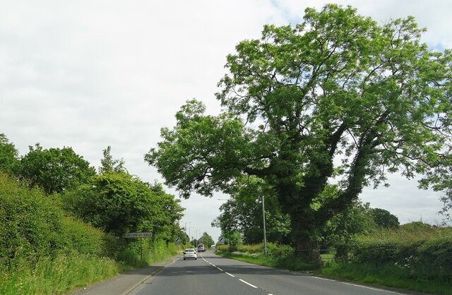
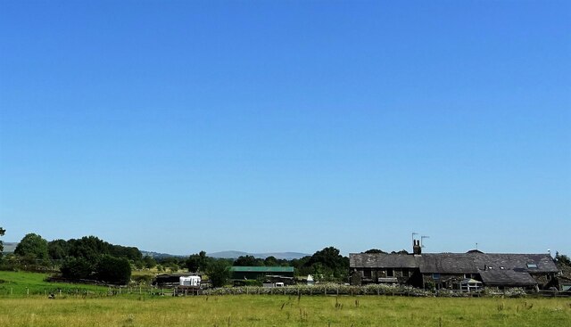
Hazel Moor, located in Lancashire, England, is a picturesque area known for its scenic beauty and diverse landscapes. Covering a vast expanse of both downs and moorland, this region offers a unique blend of natural wonders and tranquil surroundings.

Situated in the southern part of Lancashire, Hazel Moor is characterized by its rolling hills, heather-covered moors, and expansive grasslands. The area is rich in biodiversity, featuring a variety of rare plant species and an abundance of wildlife. Visitors can expect to see colorful wildflowers, such as heather and gorse, dotting the landscape during the summer months.

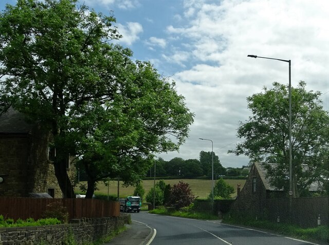
The moorland of Hazel Moor is a haven for outdoor enthusiasts, offering an array of activities such as hiking, birdwatching, and nature photography. There are numerous trails and paths that wind through the moor, providing stunning views of the surrounding countryside. The area is also home to several nature reserves, allowing visitors to explore and appreciate the unique flora and fauna that thrive in this environment.

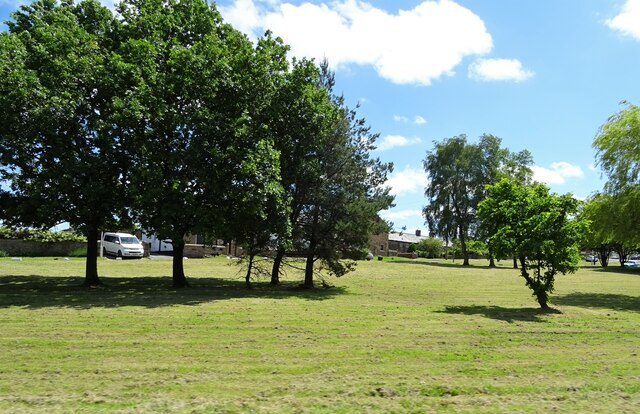
Additionally, Hazel Moor is known for its historical significance. The remnants of ancient settlements, stone circles, and burial mounds can be found throughout the area, providing a glimpse into the rich cultural heritage of the region.

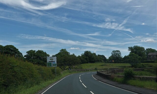
Overall, Hazel Moor, Lancashire, is a captivating destination that appeals to nature lovers, history enthusiasts, and those seeking a peaceful retreat away from the hustle and bustle of city life. Its stunning landscapes, diverse wildlife, and historical treasures make it a must-visit location in Lancashire.

If you have any feedback on the listing, please let us know in the comments section below.

Hazel Moor Images

Images are sourced within 2km of 53.792065/-2.4860775 or Grid Reference SD6832. Thanks to Geograph Open Source API. All images are credited.

A59 at Clayton Le Dale
A59 at Brook Cottage
Oakes Bridge Carrying Ribchester Road (B6245) over Park Brook.
Oakes Bridge
Carrying Ribchester Road (B6245) over Park Brook.
The green at Copster Green A village on the A59.
The green at Copster Green
A village on the A59.
Wheatley Farm Off the A59 near Copster Green.
Wheatley Farm
Off the A59 near Copster Green.
St Peters Stained Glass Window
St Peters Alter
St Peters Alter
St Peters Stained Glass Window
St Peters Modern Stained Glass Window
St Peters Font
St Peters Font
St Peters, Salesbury
OS Cut Mark - Salesbury, Saint Peters Church <span class="nowrap"><a title="https://www.bench-marks.org.uk/bm95593" rel="nofollow ugc noopener" href="https://www.bench-marks.org.uk/bm95593">Link</a><img style="margin-left:2px;" alt="External link" title="External link - shift click to open in new window" src="https://s1.geograph.org.uk/img/external.png" width="10" height="10"/></span>
OS Cut Mark - Salesbury, Saint Peters Church
Location of OS Cut Mark - Salesbury, Saint Peters Church
Electric fence - cross here
Ramsgreave and Wilpshire station I took this photo to show my mother because she always said that the family's first cat was a stray that my father found on Wilpshire station when working there in the 1950s. But it turns out that the original Wilpshire station <a href="https://www.geograph.org.uk/photo/4090131">SD6831 : Wilpshire railway station (site), Lancashire</a> was about 400 metres north of here and closed in 1962; this replacement opened in 1994.
Ramsgreave and Wilpshire station
I took this photo to show my mother because she always said that the family's first cat was a stray that my father found on Wilpshire station when working there in the 1950s. But it turns out that the original Wilpshire station SD6831 : Wilpshire railway station (site), Lancashire was about 400 metres north of here and closed in 1962; this replacement opened in 1994.
Ribchester Road Near Oakes Bridge.
Ribchester Road
Near Oakes Bridge.
The Lodge at Eden Holme On Ribchester Road.
The Lodge at Eden Holme
On Ribchester Road.
Parsonage Road, Blackburn
Show me another place!

Hazel Moor is located at Grid Ref: SD6832 (Lat: 53.792065, Lng: -2.4860775)

Administrative County: Lancashire

District: Ribble Valley

Police Authority: Lancashire

What 3 Words

///singles.hotspots.scan. Near Langho, Lancashire

Nearby Locations

Wilpshire Hazel Moor

Related Wikis

Salesbury

Salesbury is a village and civil parish in Ribble Valley, located centrally in the county of Lancashire, England. The B6245 road runs straight through...

Clayton-le-Dale

Clayton-le-Dale is a village and civil parish situated on the A59 road near Blackburn, in Lancashire, England. The population of the civil parish as of...

Ramsgreave and Wilpshire railway station

Ramsgreave and Wilpshire is a railway station on the Ribble Valley Line that serves the villages/suburbs of Ramsgreave and Wilpshire, just north of Blackburn...

Wilpshire

Wilpshire is a village and civil parish in the county of Lancashire, England. It is 2.5 miles (4.0 km) north of Blackburn, and forms part of the town...

Nearby Amenities

Located within 500m of 53.792065,-2.4860775
Salesbury
Place: village
Source: npe
Lat/Long: 53.7903995/-2.4857295
Turning Circle
Lat/Long: 53.7898537/-2.4846846
Turning Circle
Lat/Long: 53.7907183/-2.4907885
Turning Circle
Lat/Long: 53.7900191/-2.4881589
Turning Circle
Lat/Long: 53.7891522/-2.4833481
Bus Stop
Naptan AtcoCode: 250015716
Naptan NaptanCode: lanapwad
Public Transport: platform
Lat/Long: 53.7903725/-2.4835758
Bus Stop
Bus: yes
Public Transport: platform
Lat/Long: 53.7893363/-2.4802634
Booth: K6
Removed Amenity: telephone
Lat/Long: 53.7913416/-2.4860794
Bus Stop
Naptan AtcoCode: 2500IMG1474
Naptan NaptanCode: landtgat
Public Transport: platform
Lat/Long: 53.7904105/-2.4842866
SALASBURY CC
Ele: 143.60
Wpt Description: 29-APR-10 11:09:34
Wpt Symbol: Restaurant
Lat/Long: 53.791456/-2.483091
Turning Circle
Lat/Long: 53.7904269/-2.487883
Barrier: stile
Source: survey
Lat/Long: 53.7914224/-2.4860958
Parking
Lat/Long: 53.790509/-2.4870834
Turning Circle
Lat/Long: 53.7895217/-2.4847507
Generator Method: photovoltaic
Generator Output Electricity: yes
Generator Source: solar
Generator Type: solar_photovoltaic_panel
Location: roof
Power: generator
Lat/Long: 53.7883544/-2.483682
Generator Method: photovoltaic
Generator Output Electricity: yes
Generator Source: solar
Generator Type: solar_photovoltaic_panel
Location: roof
Power: generator
Lat/Long: 53.7883449/-2.4836445
Generator Method: photovoltaic
Generator Output Electricity: yes
Generator Source: solar
Generator Type: solar_photovoltaic_panel
Location: roof
Power: generator
Lat/Long: 53.7910181/-2.4919032
Generator Method: photovoltaic
Generator Output Electricity: yes
Generator Source: solar
Generator Type: solar_photovoltaic_panel
Location: roof
Power: generator
Lat/Long: 53.7904636/-2.4802574
Post Box
Post Box Type: wall
Royal Cypher: GR
Royal Cypher Wikidata: Q33102273
Lat/Long: 53.7913295/-2.4862907
The data included in this document is from www.openstreetmap.org. The data is made available under ODbL.

Have you been to Hazel Moor?

Leave your review of Hazel Moor below (or comments, questions and feedback).