Higher Stonyhurst Park

Downs, Moorland in Lancashire Ribble Valley

England

Higher Stonyhurst Park

Old Wayside Cross south of Old Clitheroe Road Kemple End Cross, or the Cross of St Paulinus, is a wayside cross with old head, shaft and base. Set beside a footpath in a field south of the Old Clitheroe Road in Aighton, Bailey and Chaigley parish. Reference <span class="nowrap"><a title="https://thejournalofantiquities.com/category/the-kemple-end-cross/" rel="nofollow ugc noopener" href="https://thejournalofantiquities.com/category/the-kemple-end-cross/">Link</a><img style="margin-left:2px;" alt="External link" title="External link - shift click to open in new window" src="https://s1.geograph.org.uk/img/external.png" width="10" height="10"/></span>. Grade II Listed <span class="nowrap"><a title="https://historicengland.org.uk/listing/the-list/list-entry/1146900" rel="nofollow ugc noopener" href="https://historicengland.org.uk/listing/the-list/list-entry/1146900">Link</a><img style="margin-left:2px;" alt="External link" title="External link - shift click to open in new window" src="https://s1.geograph.org.uk/img/external.png" width="10" height="10"/></span>. See also <span class="nowrap"><a title="https://www.flickr.com/photos/67668518@N08/9725412982" rel="nofollow ugc noopener" href="https://www.flickr.com/photos/67668518@N08/9725412982">Link</a><img style="margin-left:2px;" alt="External link" title="External link - shift click to open in new window" src="https://s1.geograph.org.uk/img/external.png" width="10" height="10"/></span>.

Milestone Society National ID: LARV_AIG01
Old Wayside Cross south of Old Clitheroe Road Credit: S Lister

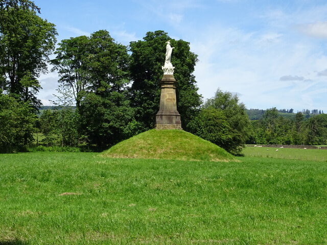
Higher Stonyhurst Park is a picturesque area located in Lancashire, England, known for its stunning natural beauty and diverse landscape. The park covers a vast expanse of land, encompassing both downs and moorland.

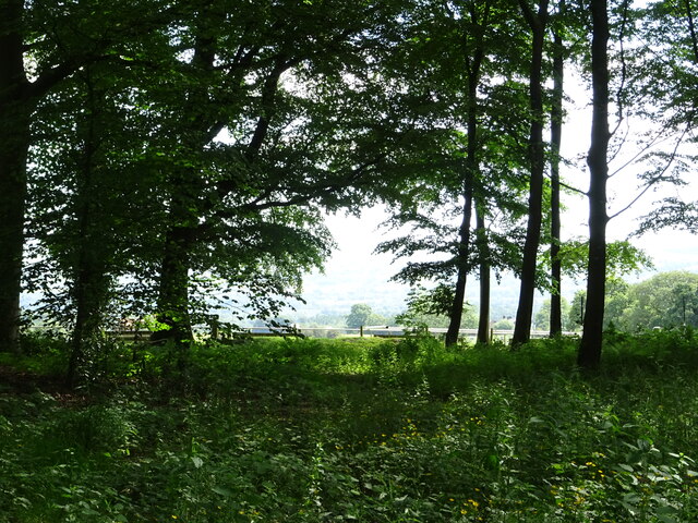
The downs in Higher Stonyhurst Park offer rolling hills and expansive grasslands, creating a serene and idyllic atmosphere. The lush greenery of the downs provides a perfect backdrop for leisurely walks and picnics, allowing visitors to immerse themselves in nature's tranquility. The area is also home to a variety of flora and fauna, including vibrant wildflowers and various bird species, making it a haven for nature enthusiasts and birdwatchers alike.

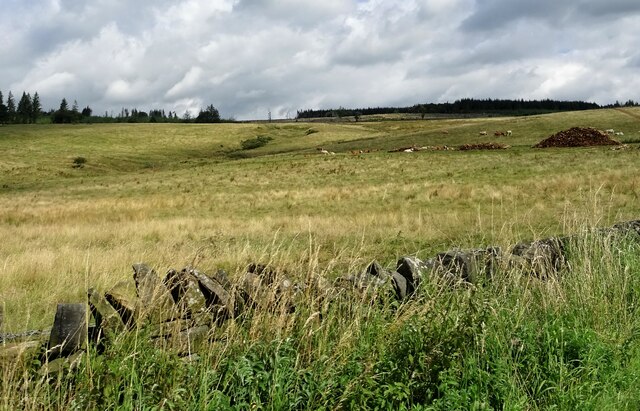
In contrast, the moorland in Higher Stonyhurst Park presents a more rugged and wild landscape. The moors are characterized by vast stretches of heather-covered hills, interspersed with rocky outcrops and peat bogs. This unique terrain is not only visually striking but also provides a habitat for a diverse range of wildlife, such as grouse, curlews, and hares.

The park offers numerous recreational activities for visitors to enjoy. Hiking and cycling trails crisscross the area, allowing outdoor enthusiasts to explore the stunning surroundings at their own pace. Additionally, the park provides ample opportunities for photography and painting, with breathtaking vistas and ever-changing natural light.

Overall, Higher Stonyhurst Park in Lancashire is a true gem, offering a harmonious blend of downs and moorland. Its natural splendor, abundant wildlife, and recreational opportunities make it a must-visit destination for anyone seeking a peaceful retreat in the heart of nature.

If you have any feedback on the listing, please let us know in the comments section below.

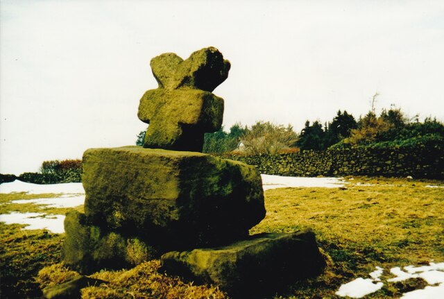
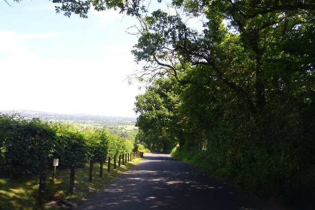
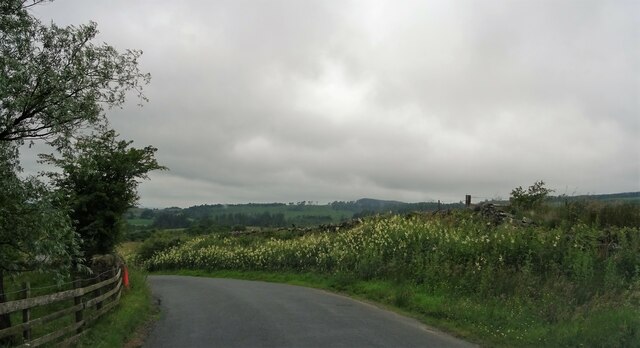
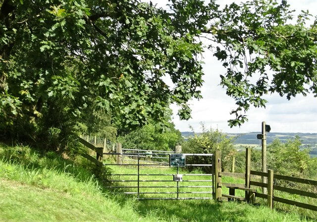
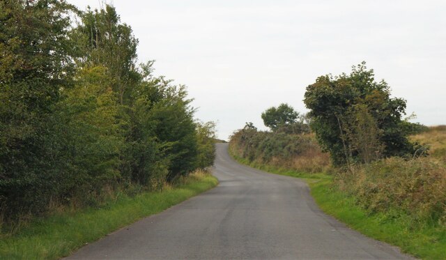
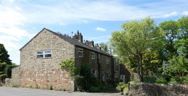
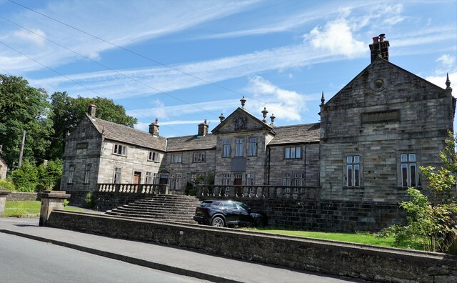
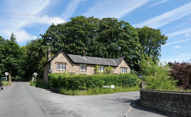
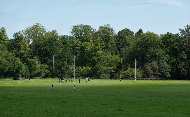
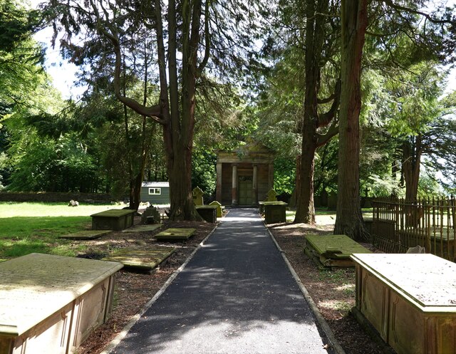
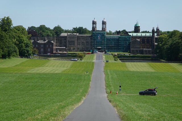
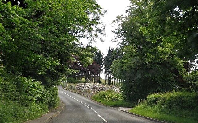
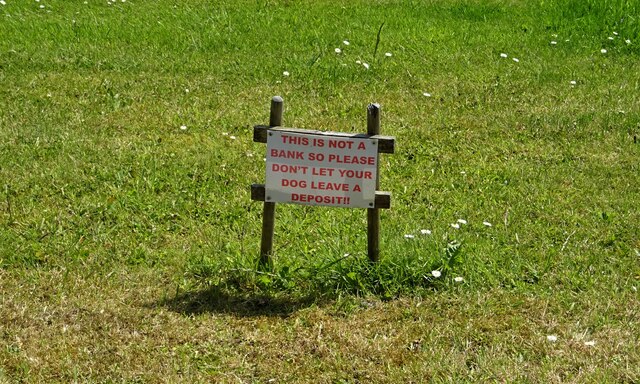
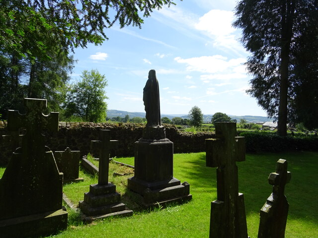
Higher Stonyhurst Park Images

Images are sourced within 2km of 53.851548/-2.4926497 or Grid Reference SD6739. Thanks to Geograph Open Source API. All images are credited.

Old Wayside Cross south of Old Clitheroe Road Kemple End Cross, or the Cross of St Paulinus, is a wayside cross with old head, shaft and base. Set beside a footpath in a field south of the Old Clitheroe Road in Aighton, Bailey and Chaigley parish. Reference <span class="nowrap"><a title="https://thejournalofantiquities.com/category/the-kemple-end-cross/" rel="nofollow ugc noopener" href="https://thejournalofantiquities.com/category/the-kemple-end-cross/">Link</a><img style="margin-left:2px;" alt="External link" title="External link - shift click to open in new window" src="https://s1.geograph.org.uk/img/external.png" width="10" height="10"/></span>. Grade II Listed <span class="nowrap"><a title="https://historicengland.org.uk/listing/the-list/list-entry/1146900" rel="nofollow ugc noopener" href="https://historicengland.org.uk/listing/the-list/list-entry/1146900">Link</a><img style="margin-left:2px;" alt="External link" title="External link - shift click to open in new window" src="https://s1.geograph.org.uk/img/external.png" width="10" height="10"/></span>. See also <span class="nowrap"><a title="https://www.flickr.com/photos/67668518@N08/9725412982" rel="nofollow ugc noopener" href="https://www.flickr.com/photos/67668518@N08/9725412982">Link</a><img style="margin-left:2px;" alt="External link" title="External link - shift click to open in new window" src="https://s1.geograph.org.uk/img/external.png" width="10" height="10"/></span>.

Milestone Society National ID: LARV_AIG01
Old Wayside Cross south of Old Clitheroe Road
Kemple End Cross, or the Cross of St Paulinus, is a wayside cross with old head, shaft and base. Set beside a footpath in a field south of the Old Clitheroe Road in Aighton, Bailey and Chaigley parish. Reference LinkExternal link. Grade II Listed LinkExternal link. See also LinkExternal link. Milestone Society National ID: LARV_AIG01
Birdy Brow Approaching Kemple End.
Birdy Brow
Approaching Kemple End.
Birdy Brow A bank of wild flowers near Chilsey Green Farm.
Birdy Brow
A bank of wild flowers near Chilsey Green Farm.
Cattle at pasture Near Chilsey Green.
Cattle at pasture
Near Chilsey Green.
Public footpath The path crosses private land and walkers are requested to keep strictly to the path.
Public footpath
The path crosses private land and walkers are requested to keep strictly to the path.
Old Clitheroe Road Near Chaigley.
Old Clitheroe Road
Near Chaigley.
Cottages at Hurst Green On Avenue Road.
Cottages at Hurst Green
On Avenue Road.
Shireburn Cottages The building was originally at Kemple on Longridge Fell and was constructed in 1706 as almshouses. The structure was removed to this site in 1946 when extensions were added. The building is grade II* listed.
Shireburn Cottages
The building was originally at Kemple on Longridge Fell and was constructed in 1706 as almshouses. The structure was removed to this site in 1946 when extensions were added. The building is grade II* listed.
Houses in Hurst Green At the junction of Smithy Row and Avenue Road. Smithy Row is a private road and public footpath.
Houses in Hurst Green
At the junction of Smithy Row and Avenue Road. Smithy Row is a private road and public footpath.
Rugby practice Students of Stonyhurst College hone their skills.
Rugby practice
Students of Stonyhurst College hone their skills.
The mausoleum at Hurst Green The building, which is grade II listed is in St. Joseph's cemetery
The mausoleum at Hurst Green
The building, which is grade II listed is in St. Joseph's cemetery
Stonyhurst College The college is a private R.C. school, founded in 1593. Alumni include Alfred Austin (appointed poet laureate in 1896), Sir Arthur Conan Doyle, Bill Cash M.P., and the recently deceased peace activist Bruce Kent.
Stonyhurst College
The college is a private R.C. school, founded in 1593. Alumni include Alfred Austin (appointed poet laureate in 1896), Sir Arthur Conan Doyle, Bill Cash M.P., and the recently deceased peace activist Bruce Kent.
Remains of the Punch Bowl The pub on Longridge Road outside Hurst Green was a grade II listed building. It was demolished without notification to or permission from the relevant authority, who have now ordered the owners to rebuild the structure.
Remains of the Punch Bowl
The pub on Longridge Road outside Hurst Green was a grade II listed building. It was demolished without notification to or permission from the relevant authority, who have now ordered the owners to rebuild the structure.
Humorous sign With a serious message.
Humorous sign
With a serious message.
From The Avenue in Hurst Green
St. Joseph's R.C. cemetery By the side of The Avenue at Stonyhurst.
St. Joseph's R.C. cemetery
By the side of The Avenue at Stonyhurst.
Statue of the Virgin Mary The recently refurbished statue stands by The Avenue at Stonyhurst.
Statue of the Virgin Mary
The recently refurbished statue stands by The Avenue at Stonyhurst.
Hurst Green war memorial With pretty flowers in full bloom.
Hurst Green war memorial
With pretty flowers in full bloom.
Show me another place!

Higher Stonyhurst Park is located at Grid Ref: SD6739 (Lat: 53.851548, Lng: -2.4926497)

Administrative County: Lancashire

District: Ribble Valley

Police Authority: Lancashire

What 3 Words

///kicked.enacted.plod. Near Billington, Lancashire

Related Wikis

Aighton, Bailey and Chaigley

Aighton, Bailey and Chaigley is a civil parish in the Borough of Ribble Valley in Lancashire, England, just west of Clitheroe. The population of the civil...
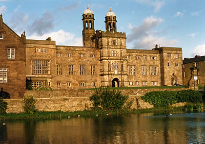
Stonyhurst

Stonyhurst is the name of a 1,000-acre (4 km2) rural estate owned by the Society of Jesus near Clitheroe in Lancashire, England. It is centred on Stonyhurst...

Libraries and collections of Stonyhurst College

The Jesuit origins of Stonyhurst College in Lancashire, England, have enabled it to amass a large collection of books, a number of which concern recusant...

Stonyhurst Saint Mary's Hall

Stonyhurst St Mary's Hall (commonly known as S.M.H.) is the preparatory school to Stonyhurst College. It is an independent co-educational Catholic school...

Nearby Amenities

Located within 500m of 53.851548,-2.4926497
Park Wood
Natural: wood
Source: OS_OpenData_StreetView
Lat/Long: 53.8485014/-2.4875582
The data included in this document is from www.openstreetmap.org. The data is made available under ODbL.

Have you been to Higher Stonyhurst Park?

Leave your review of Higher Stonyhurst Park below (or comments, questions and feedback).