Sickers Fell

Downs, Moorland in Yorkshire South Lakeland

England

Sickers Fell

Weirs on Hebblethwaite Hall Gill at Burntmill Bridge
Weirs on Hebblethwaite Hall Gill at Burntmill Bridge Credit: David Robinson

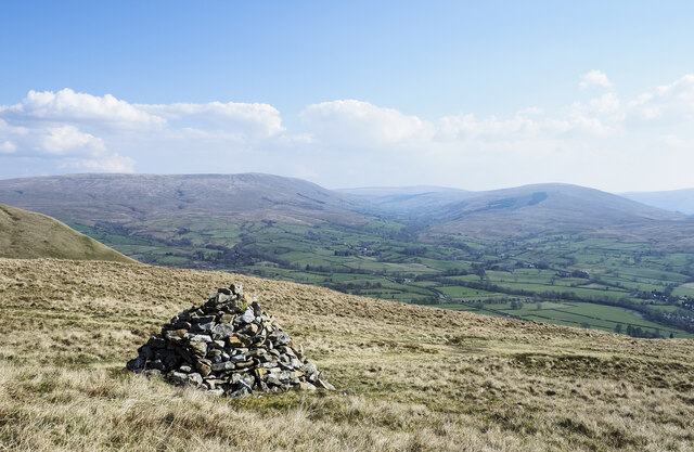
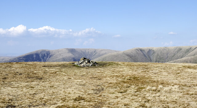
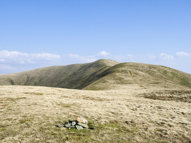
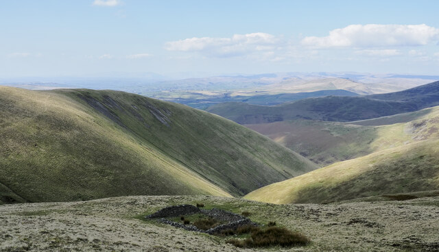
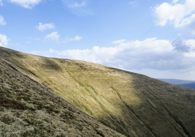
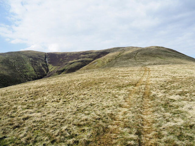
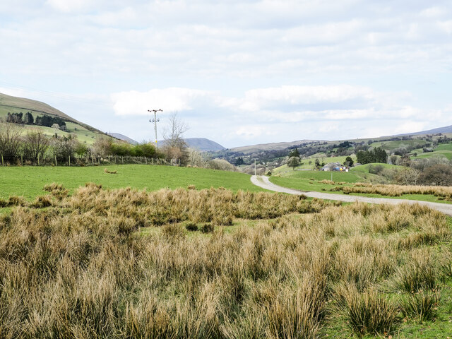
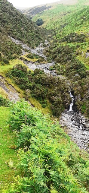
Situated in the county of Yorkshire, England, Sickers Fell is a prominent geographical feature known for its stunning landscapes and diverse natural habitats. Nestled within the Yorkshire Downs and Moorland, this area encompasses a vast expanse of undulating hills, heather-clad moors, and picturesque valleys.

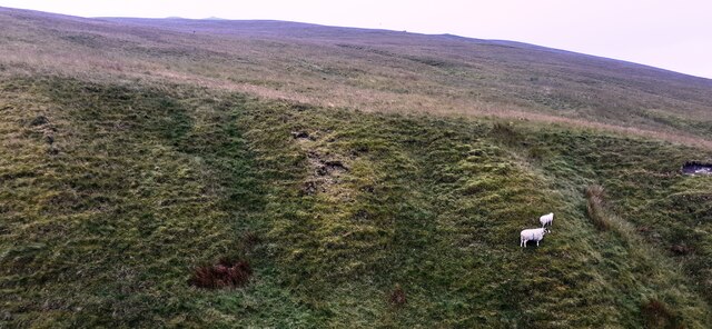
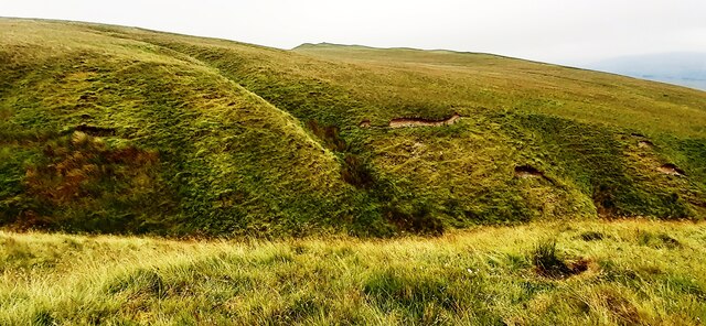
Sickers Fell offers breathtaking views, with its elevated position providing panoramic vistas of the surrounding countryside. The region is characterized by its rugged terrain, featuring rocky outcrops and steep slopes, which contribute to its wild and unspoiled appeal.

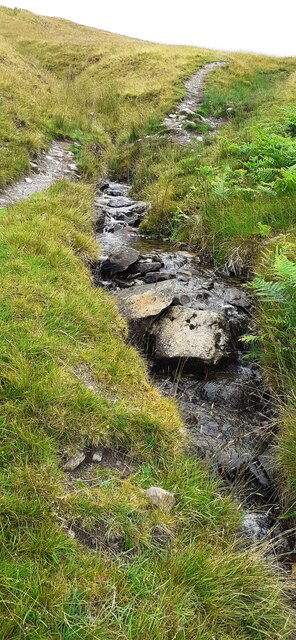
The moorland of Sickers Fell is a habitat of great ecological significance. It is home to a variety of flora and fauna, including heather, bilberry, and cotton grass, as well as numerous species of birds such as grouse and curlews. It is also a site of conservation interest due to the presence of rare and threatened species, such as the golden plover.

The area is known for its rich history, with evidence of human activity dating back thousands of years. Ancient burial mounds and stone circles can be found throughout the landscape, attesting to the long-standing connection between people and the land.

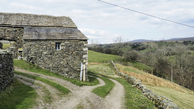
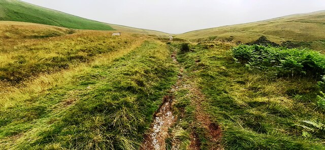
Sickers Fell offers numerous opportunities for outdoor activities such as hiking, wildlife spotting, and photography. There are well-maintained footpaths and trails that allow visitors to explore the area and appreciate its natural beauty. The tranquility and solitude of Sickers Fell make it a popular destination for those seeking to escape the bustle of urban life and immerse themselves in nature.

Overall, Sickers Fell is a captivating location, where the Yorkshire Downs and Moorland converge, offering a unique blend of scenic beauty, biodiversity, and cultural heritage.

If you have any feedback on the listing, please let us know in the comments section below.
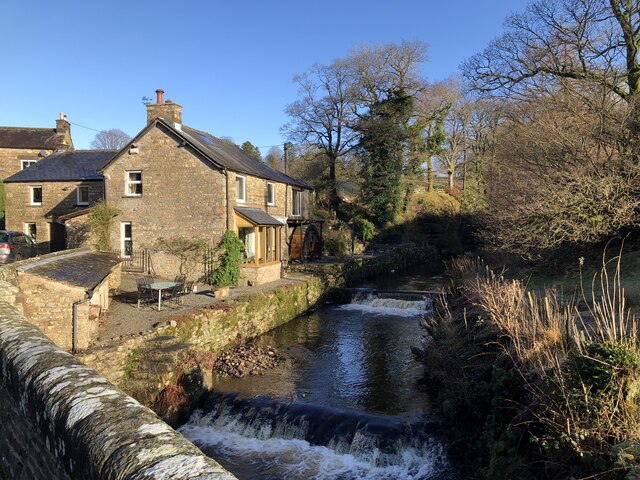
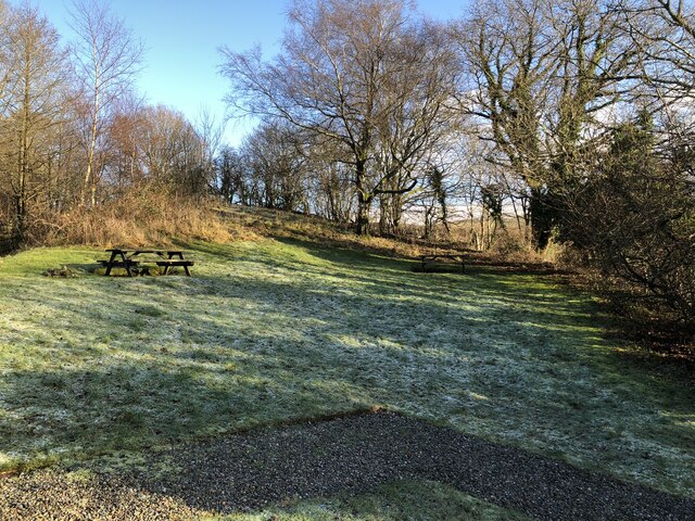
Sickers Fell Images

Images are sourced within 2km of 54.342468/-2.5080722 or Grid Reference SD6794. Thanks to Geograph Open Source API. All images are credited.

Weirs on Hebblethwaite Hall Gill at Burntmill Bridge
Picnic Area Beside A 683
Conical cairn close to bridleway The cairn lies at around 370 m. on the south-eastern slope of the hill, Winder, above Sedbergh.
Baugh Fell is the distant, flat-topped hill at the left side of the image, the other obvious hill is actually a lengthy ridge rising to Aye Gill Pike; Garsdale is the valley between them.
Conical cairn close to bridleway
The cairn lies at around 370 m. on the south-eastern slope of the hill, Winder, above Sedbergh. Baugh Fell is the distant, flat-topped hill at the left side of the image, the other obvious hill is actually a lengthy ridge rising to Aye Gill Pike; Garsdale is the valley between them.
Crook Crook is an outlying southern top of Arant Haw; there's a cairn at the summit.
Whernside, Great Coum and Calf Top are the three hills in the distance.
Crook
Crook is an outlying southern top of Arant Haw; there's a cairn at the summit. Whernside, Great Coum and Calf Top are the three hills in the distance.
Summit area of Arant Haw A flat, grassy summit with a cairn.
Fell Head is the distant hill above the cairn.
Summit area of Arant Haw
A flat, grassy summit with a cairn. Fell Head is the distant hill above the cairn.
West ridge of Arant Haw The grassy west ridge of Arant Haw with a small cairn at a minor rise to 515 metres. As with most significant ridges of the Howgill Fells there's a track along the ridge crest created either by the passage of quad bikes, walkers, or most likely, both.
West ridge of Arant Haw
The grassy west ridge of Arant Haw with a small cairn at a minor rise to 515 metres. As with most significant ridges of the Howgill Fells there's a track along the ridge crest created either by the passage of quad bikes, walkers, or most likely, both.
Northern side of Arant Haw Part of the northern side of Arant Haw rises to the left above the deep valley. Rowantree Grains Fold is in the foreground: as Karl & Ali comment - <a title="https://www.geograph.org.uk/photo/4233407" href="https://www.geograph.org.uk/photo/4233407">Link</a> -  it's in an unusually exposed location.
Northern side of Arant Haw
Part of the northern side of Arant Haw rises to the left above the deep valley. Rowantree Grains Fold is in the foreground: as Karl & Ali comment - Link - it's in an unusually exposed location.
Grassy headwall of valley of Hobdale Gill The summit of Calders lies just above the steep ground; from it, the ridge at the right side of the image descends over Middle Tongue.
Grassy headwall of valley of Hobdale Gill
The summit of Calders lies just above the steep ground; from it, the ridge at the right side of the image descends over Middle Tongue.
Minor road with passing place The road is seen heading north towards the farm at Thursgill where it ends as a publicly motorable route. It's climbing from a stream crossing near to Ellerthwaite.
Minor road with passing place
The road is seen heading north towards the farm at Thursgill where it ends as a publicly motorable route. It's climbing from a stream crossing near to Ellerthwaite.
Ridge rising to Great Dummacks Great Dummacks is an elongated rib of ground at the top of the rising ridge and across the head of the valley to the left. As with most Howgill ridges there's a quad bike track following this one which acts perfectly as a path for those on foot.
Ridge rising to Great Dummacks
Great Dummacks is an elongated rib of ground at the top of the rising ridge and across the head of the valley to the left. As with most Howgill ridges there's a quad bike track following this one which acts perfectly as a path for those on foot.
Barn at Fawcett Bank Fawcett Bank is a farm in the valley of the River Rawthey. The farm road, also a public footpath, is the course of a named long distance path based on a walk made by Alfred Wainwright in 1938, 'A Pennine Journey'.
Barn at Fawcett Bank
Fawcett Bank is a farm in the valley of the River Rawthey. The farm road, also a public footpath, is the course of a named long distance path based on a walk made by Alfred Wainwright in 1938, 'A Pennine Journey'.
Route of 'A Pennine Journey' The road is the access route for the farm at Fawcett Bank; it's not a public road for motoring but is a public footpath and is now the route of the long distance walk. The route is not the one followed in 1938 by Alfred Wainwright and recorded by him in a version not originally intended for publication, but a similar one made in 1998 by David and Heather Pitt.
Route of 'A Pennine Journey'
The road is the access route for the farm at Fawcett Bank; it's not a public road for motoring but is a public footpath and is now the route of the long distance walk. The route is not the one followed in 1938 by Alfred Wainwright and recorded by him in a version not originally intended for publication, but a similar one made in 1998 by David and Heather Pitt.
Looking north along stream and footpath on eastern flank of Winder
View over valley of Settlebeck Gill towards Crook
Radio mast on north side of Sedbergh
Looking north along Settlebeck Gill
Stream beside Dales High Way
Looking cross valley of Settlebeck Gill towards Crook
Show me another place!

Sickers Fell is located at Grid Ref: SD6794 (Lat: 54.342468, Lng: -2.5080722)

Division: West Riding

Administrative County: Cumbria

District: South Lakeland

Police Authority: Cumbria

What 3 Words

///working.yield.greeting. Near Sedbergh, Cumbria

Related Wikis

Calders (Yorkshire Dales)

Calders is a summit of 2,211 feet (674 m) in the Howgill Fells, Cumbria, England. It lies about 2⁄3 mile (1 km) south east of the summit of The Calf and...

Clough River

The Clough River is a river in Cumbria, England. A tributary of the River Rawthey, it flows for 21.8 kilometres (13.5 mi) primarily through the Garsdale...

Settlebeck School

Settlebeck School is a small coeducational secondary school with academy status. It is located in Sedbergh in the English county of Cumbria, drawing pupils...

The Bull Hotel, Sedbergh

The Bull Hotel, formerly The Black Bull Hotel, is a 17th-century coaching inn in Sedbergh, Cumbria. It is located in a narrow passage parallel with the...

Sedbergh People's Hall

Sedbergh People's Hall is a village hall in Sedbergh, unique because it was built by the people, for the people. == Land and lease == The land on which...

St Andrew's Church, Sedbergh

St Andrew's Church is in Main Street, Sedbergh, Cumbria, England. It is an active Anglican parish church in the deanery of Kendal, and the diocese of Carlisle...

Sedbergh

Sedbergh ( SED-bər or locally SEB-ər) is a town and civil parish in the ceremonial county of Cumbria. It falls within the historic boundaries of the West...

Sedbergh School Chapel

Sedbergh School Chapel is located to the southeast of Sedbergh School, Sedbergh, Cumbria, England. It is considered to be of architectural importance...

Nearby Amenities

Located within 500m of 54.342468,-2.5080722
Man Made: cairn
Lat/Long: 54.342832/-2.5087129
Sickers Fell
Ele: 498
Natural: peak
Lat/Long: 54.3430654/-2.5086955
Ford: yes
Lat/Long: 54.3385809/-2.5043191
Ford: yes
Lat/Long: 54.3425431/-2.5142897
The data included in this document is from www.openstreetmap.org. The data is made available under ODbL.

Have you been to Sickers Fell?

Leave your review of Sickers Fell below (or comments, questions and feedback).