Cauldron Braes
Downs, Moorland in Banffshire
Scotland
Cauldron Braes
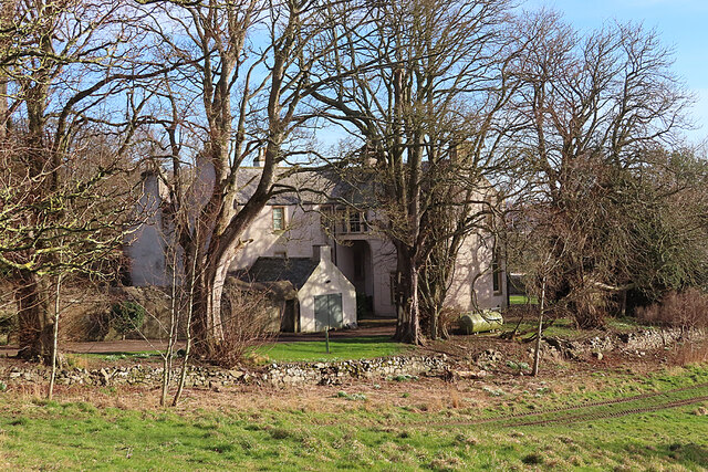
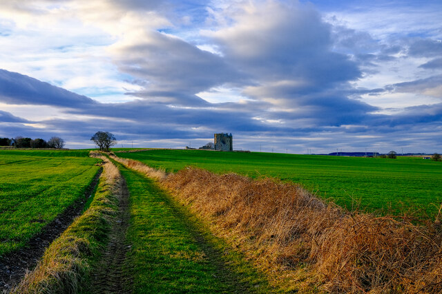
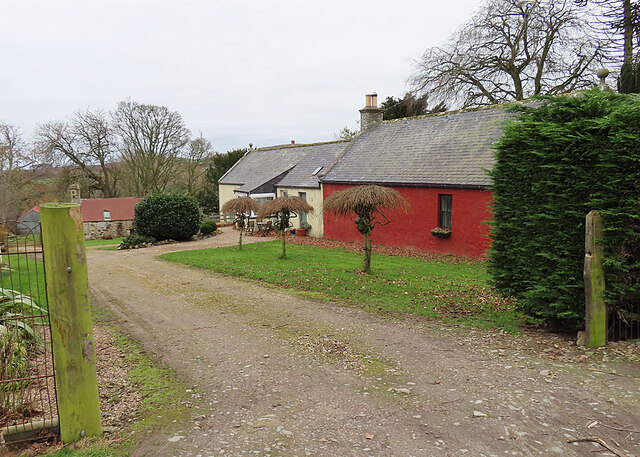
Cauldron Braes, located in Banffshire, Scotland, is a picturesque area known for its stunning natural beauty and diverse landscapes. Nestled between the Cairngorms National Park and the North Sea coast, Cauldron Braes offers a unique mix of downs and moorland that attracts nature enthusiasts and outdoor adventurers alike.
The downs of Cauldron Braes are characterized by rolling hills and expansive grasslands, providing a serene and idyllic setting. These downs are home to a variety of plant species, including heather and wildflowers, creating a vibrant and colorful tapestry. The area is also inhabited by a range of bird species, such as curlews, lapwings, and red grouse, making it a haven for birdwatchers.
In contrast, the moorland of Cauldron Braes offers a more rugged and untamed landscape. Here, visitors can explore vast expanses of heather-covered hills, interspersed with scattered boulders and rocky outcrops. The moorland provides a habitat for a variety of wildlife, including red deer, mountain hares, and golden eagles, making it a popular destination for wildlife enthusiasts and photographers.
Outdoor activities abound in Cauldron Braes, offering something for everyone. Hikers can embark on scenic trails that meander through the downs and moorland, providing breathtaking views of the surrounding countryside. Cyclists can enjoy challenging routes that take them through the undulating hills and valleys. Additionally, the area is a prime location for picnicking, with numerous picturesque spots to relax and enjoy the tranquility of nature.
Overall, Cauldron Braes in Banffshire is a haven for nature lovers and outdoor enthusiasts, offering a diverse and captivating landscape that showcases the natural wonders of Scotland.
If you have any feedback on the listing, please let us know in the comments section below.
Cauldron Braes Images
Images are sourced within 2km of 57.63298/-2.5541596 or Grid Reference NJ6760. Thanks to Geograph Open Source API. All images are credited.


Cauldron Braes is located at Grid Ref: NJ6760 (Lat: 57.63298, Lng: -2.5541596)
Unitary Authority: Aberdeenshire
Police Authority: North East
What 3 Words
///cherished.nurse.squad. Near Banff, Aberdeenshire
Nearby Locations
Related Wikis
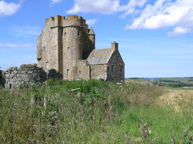
Inchdrewer Castle
Inchdrewer Castle is a 16th-century tower house in the parish of Banff, Aberdeenshire, in the north-east of Scotland. Situated on a slight rise 3.5 miles...

Eden Castle
Eden Castle is a castle near Banff in Aberdeenshire, Scotland. The castle was built in the latter half of the 16th century by the Meldrum family with renovation...

Banff Academy
Banff Academy is a S1–S6 secondary school in Banff, Aberdeenshire, Scotland. It serves the towns of Banff, Macduff, Whitehills, Portsoy, Aberchirder, Gardenstown...

Duff House
Duff House is a Georgian estate house in Banff, Aberdeenshire, Scotland. Now in the care of Historic Environment Scotland, it is part of the National Galleries...

Ladysbridge railway station
Ladysbridge railway station was a station in Aberdeenshire, Scotland. Opened as Lady's Bridge railway station in 1859 it was renamed Ladysbridge railway...
Duff House Royal Golf Club
Duff House Royal Golf Club is a Championship Course and one of the best golf courses in Aberdeenshire. Located in Banff, Scotland it was founded in 1910...
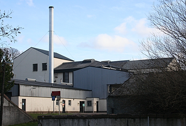
Macduff distillery
Macduff distillery is a single malt Scotch whisky distillery in Macduff in the Highland whisky producing area of Scotland. == History == The Macduff Distillery...

Banff distillery
Banff distillery was a producer of single malt Scotch whisky that operated between 1863 and 1983. == History == The first distillery to use the name "Banff...
Nearby Amenities
Located within 500m of 57.63298,-2.5541596Have you been to Cauldron Braes?
Leave your review of Cauldron Braes below (or comments, questions and feedback).