Fox Covert

Downs, Moorland in Somerset Mendip

England

Fox Covert

2012 : Minor road to Spargrove Five years after <a href="https://www.geograph.org.uk/photo/492359">ST6638 : Bridge on the lane to Spargrove</a>
Taken after a night of heavy rain, the brook under the bridge was swollen and running fast.
2012 : Minor road to Spargrove Credit: Maurice Pullin

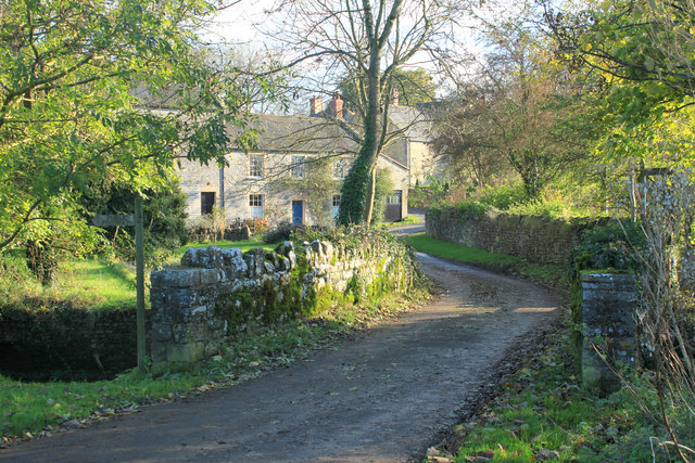
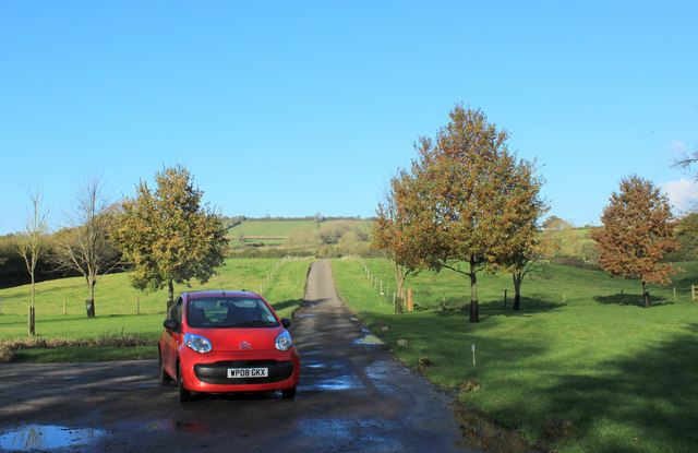
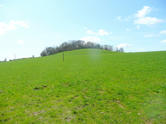
Fox Covert is a picturesque area situated in Somerset, England. Located within the vibrant Somerset countryside, it is known for its stunning combination of downs and moorland landscapes. Spanning approximately 200 acres, Fox Covert offers a diverse range of natural features, making it a popular destination for nature enthusiasts and hikers.

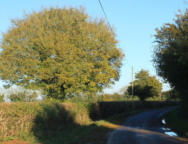
The downs of Fox Covert are characterized by rolling hills, lush green grasslands, and breathtaking panoramic views. These open spaces provide ample opportunities for outdoor activities such as walking, picnicking, and birdwatching. The downs are home to a variety of flora and fauna, including wildflowers, rabbits, and numerous bird species.

The moorland area of Fox Covert offers a striking contrast to the downs, with its rugged terrain and heather-covered hills. This section of the landscape is particularly renowned for its tranquility and untouched beauty. Moorland plants, such as heather and gorse, dominate the area, creating a vibrant and colorful setting during the summer months.

Fox Covert is also home to a diverse range of wildlife. Visitors may encounter animals such as deer, badgers, foxes, and various bird species while exploring the area. The presence of these animals adds an element of natural wonder to the already captivating surroundings.

Overall, Fox Covert in Somerset is a place of natural splendor, showcasing the beauty of downs and moorland landscapes. With its idyllic scenery, abundant wildlife, and opportunities for outdoor activities, it is a destination that promises a memorable experience for nature enthusiasts and those seeking solace in the countryside.

If you have any feedback on the listing, please let us know in the comments section below.

Fox Covert Images

Images are sourced within 2km of 51.129417/-2.480471 or Grid Reference ST6636. Thanks to Geograph Open Source API. All images are credited.

2012 : Minor road to Spargrove Five years after <a href="https://www.geograph.org.uk/photo/492359">ST6638 : Bridge on the lane to Spargrove</a>
Taken after a night of heavy rain, the brook under the bridge was swollen and running fast.
2012 : Minor road to Spargrove
Five years after ST6638 : Bridge on the lane to Spargrove Taken after a night of heavy rain, the brook under the bridge was swollen and running fast.
2012 : Lane junction between Stoney Stratton and Spargrove Found the right viewpoint, set the camera up, looking through the viewfinder, about to press the button when this kind gentleman arrived in his tractor right on cue. Thank you sir.

Was somewhat intrigued by the stone pillars, look like entrance to a minor estate. A quick look at the www revealed Thomas Moore (1618 - 95) had property in Spargrove. A possible explanation.
2012 : Lane junction between Stoney Stratton and Spargrove
Found the right viewpoint, set the camera up, looking through the viewfinder, about to press the button when this kind gentleman arrived in his tractor right on cue. Thank you sir. Was somewhat intrigued by the stone pillars, look like entrance to a minor estate. A quick look at the www revealed Thomas Moore (1618 - 95) had property in Spargrove. A possible explanation.
2012 : The little brook a-babbling Looking toward Spargrove. The stream passes under a minor road bridge a few yards to the right then joins the River Alham.
2012 : The little brook a-babbling
Looking toward Spargrove. The stream passes under a minor road bridge a few yards to the right then joins the River Alham.
2012 : Double five bar gate on the road to Spargrove Creech Hill in the background.
What does it say on the notice?
2012 : Double five bar gate on the road to Spargrove
Creech Hill in the background. What does it say on the notice?
2012 : A dangerous parasite carried by dogs Dog owners please note. This is not the only parasite spread in dog faeces, best to clean them up at all times. More information in <span class="nowrap"><a title="http://en.wikipedia.org/wiki/Neospora" rel="nofollow ugc noopener" href="http://en.wikipedia.org/wiki/Neospora">Link</a><img style="margin-left:2px;" alt="External link" title="External link - shift click to open in new window" src="https://s1.geograph.org.uk/img/external.png" width="10" height="10"/></span>
2012 : A dangerous parasite carried by dogs
Dog owners please note. This is not the only parasite spread in dog faeces, best to clean them up at all times. More information in LinkExternal link
2012 : Spargrove Farm and Mill The mill is partly hidden to the left, for a better view taken in 1987 see <a href="https://www.geograph.org.uk/photo/83614">ST6738 : Batcombe: Spargrove Mill</a>. The River Alham flows between a road bridge is in the immediate foreground.
Thomas Moore (1618 - 1695) lived at Spargrove at one time. <span class="nowrap"><a title="http://www.historyofparliamentonline.org/volume/1660-1690/member/moore-thomas-1618-95" rel="nofollow ugc noopener" href="http://www.historyofparliamentonline.org/volume/1660-1690/member/moore-thomas-1618-95">Link</a><img style="margin-left:2px;" alt="External link" title="External link - shift click to open in new window" src="https://s1.geograph.org.uk/img/external.png" width="10" height="10"/></span>
2012 : Spargrove Farm and Mill
The mill is partly hidden to the left, for a better view taken in 1987 see ST6738 : Batcombe: Spargrove Mill. The River Alham flows between a road bridge is in the immediate foreground. Thomas Moore (1618 - 1695) lived at Spargrove at one time. LinkExternal link
2012 : Spargrove Lane, bottom of the hill Westcombe is at the top, and a few farms.
Westcombe Hill is behind.
2012 : Spargrove Lane, bottom of the hill
Westcombe is at the top, and a few farms. Westcombe Hill is behind.
2012 : Lane to Stoney Stratton and Evercreech Two delightful miles.
2012 : Lane to Stoney Stratton and Evercreech
Two delightful miles.
2012 : West from the tops of Portway Hill and Crow's Hill An interesting collection of river formed valleys. Spargrove on the River Alham is near the right hand edge. Evercreech is lost in the interlocking spurs on the opposite side.
2012 : West from the tops of Portway Hill and Crow's Hill
An interesting collection of river formed valleys. Spargrove on the River Alham is near the right hand edge. Evercreech is lost in the interlocking spurs on the opposite side.
2012 : Ploughed field and view south of Batcombe The trees on the left hide Higher Green's Combe Farm.
The low November sun puts shadows across the freshly ploughed field.
Whaddon Hill is in the background.
2012 : Ploughed field and view south of Batcombe
The trees on the left hide Higher Green's Combe Farm. The low November sun puts shadows across the freshly ploughed field. Whaddon Hill is in the background.
2012 : Lane heading east near Higher Green's Combe Farm Toward Hedgestocks, Copplesbury Lane and the A359.
2012 : Lane heading east near Higher Green's Combe Farm
Toward Hedgestocks, Copplesbury Lane and the A359.
2012 : South west  near Higher Green's Combe Farm The road follows the top of a ridge leading to Creech Hill.
2012 : South west near Higher Green's Combe Farm
The road follows the top of a ridge leading to Creech Hill.
2012 : Pasture near Higher Green's Combe Farm Long shadows in the late afternoon sun.
Alfred's Tower <a href="https://www.geograph.org.uk/gridref/ST7435">ST7435</a> is at the top of the background hill.
2012 : Pasture near Higher Green's Combe Farm
Long shadows in the late afternoon sun. Alfred's Tower ST7435 is at the top of the background hill.
2012 : West from the lane to Spargrove Seen near the junction with Copplesbury Lane.
A pasture taking it's winter rest.
Little of interest here, but wait, what have I said, look at the larger version, along the horizon from the left, that thing sticking up, it's Glastonbury Tor <a href="https://www.geograph.org.uk/gridref/ST5138">ST5138</a> 10 miles away and very faint.
2012 : West from the lane to Spargrove
Seen near the junction with Copplesbury Lane. A pasture taking it's winter rest. Little of interest here, but wait, what have I said, look at the larger version, along the horizon from the left, that thing sticking up, it's Glastonbury Tor ST5138 10 miles away and very faint.
2012 : North west from the lane to Spargrove Across a wide valley east of Evercreech to a hill beyond. not important enough to have a name on OS Explorer Map 142.
To make up for that look at the larger image, on the horizon to the left a faint thread stands, it is the Mendip TV transmitter on Pen Hill <a href="https://www.geograph.org.uk/gridref/ST5648">ST5648</a>
2012 : North west from the lane to Spargrove
Across a wide valley east of Evercreech to a hill beyond. not important enough to have a name on OS Explorer Map 142. To make up for that look at the larger image, on the horizon to the left a faint thread stands, it is the Mendip TV transmitter on Pen Hill ST5648
Ordnance Survey Triangulation Pillar S5695 Atop the hill (Enclosure) to the west of Lamyatt Lodge.
Ordnance Survey Triangulation Pillar S5695
Atop the hill (Enclosure) to the west of Lamyatt Lodge.
On the Bruton Road looking towards Creech Hill
Looking toward the high point from the Batcombe turning
Show me another place!

Fox Covert is located at Grid Ref: ST6636 (Lat: 51.129417, Lng: -2.480471)

Administrative County: Somerset

District: Mendip

Police Authority: Avon and Somerset

What 3 Words

///frames.lingering.survived. Near Bruton, Somerset

Related Wikis

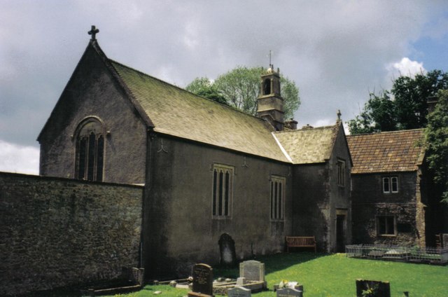
Church of St Mary and St John, Lamyat

The Anglican Church Of St Mary and St John in Lamyatt, within the English county of Somerset, was built in the 13th century. It is a Grade II* listed building...

Milton Clevedon

Milton Clevedon is a village and civil parish 1 mile (1.6 km) south of Evercreech in the Mendip district of Somerset, England. == History == The name of...

Church of St James, Milton Clevedon

The Anglican Church of St James in Milton Clevedon, within the English county of Somerset, was rebuilt in 1790. It is a Grade II* listed building.The first...

Creech Hill

Creech Hill is a hill in south east Somerset, England, which is notable for a univallate Iron Age hill fort. The hill is situated approximately 1.2 miles...

Lamyatt

Lamyatt is a village and civil parish in the Mendip district of Somerset, England. It lies 5 miles (8 km) south east of Shepton Mallet, 2 miles (3 km)...

Evercreech

Evercreech is a village and civil parish in Somerset, England. The village is 3 miles (4.8 km) southeast of Shepton Mallet, and 5 miles (8.0 km) northeast...

Church of the Holy Trinity, Wyke Champflower

The Church of the Holy Trinity in Wyke Champflower, Bruton, Somerset, England, dates from 1623 and has been designated as a Grade I listed building.A wooden...

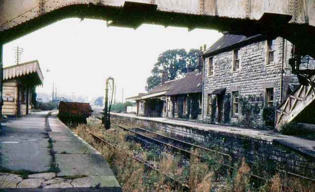
Evercreech Junction railway station

Evercreech Junction was a railway station at Evercreech on the Somerset and Dorset Joint Railway. Originally opened in 1862 as "Evercreech" on the original...

Nearby Amenities

Located within 500m of 51.129417,-2.480471
Post Box
Mapillary: 404593991404730
Operator: Royal Mail
Operator Wikidata: Q638098
Post Box Mounting: building
Post Box Type: wall
Lat/Long: 51.1321179/-2.4773236
The data included in this document is from www.openstreetmap.org. The data is made available under ODbL.

Have you been to Fox Covert?

Leave your review of Fox Covert below (or comments, questions and feedback).