Hampton Park

Settlement in Herefordshire

England

Hampton Park

Aylestone Hill, Hereford
Aylestone Hill, Hereford Credit: Alex McGregor

Hampton Park is a historic country estate located in Herefordshire, England. Set amidst picturesque countryside, the park spans over 1,000 acres and is renowned for its stunning landscapes and rich heritage. The estate is privately owned and has been in the same family for several generations.

The centerpiece of Hampton Park is the grand Georgian mansion, which was built in the early 18th century. The house boasts impressive architecture, with its elegant façade and meticulously maintained gardens. The interior of the mansion is equally impressive, showcasing exquisite period features and opulent furnishings.

The parkland surrounding the house is a haven for wildlife enthusiasts and nature lovers. It features a mix of meadows, woodlands, and formal gardens, all carefully designed to provide a harmonious blend of natural beauty and cultivated landscapes. Visitors can explore the numerous walking trails that crisscross the estate, offering breathtaking views of the Herefordshire countryside.

Hampton Park also offers a range of recreational activities for visitors to enjoy. The estate has a fishing lake, where anglers can try their luck at catching trout and salmon. Additionally, there are several well-maintained tennis courts and a croquet lawn, perfect for sports enthusiasts. The estate also hosts various events throughout the year, including garden tours, outdoor concerts, and seasonal festivities.

In summary, Hampton Park is a stunning country estate in Herefordshire, offering a glimpse into the region's rich history and natural beauty. With its magnificent mansion, expansive parkland, and recreational activities, it is a must-visit destination for those seeking a blend of elegance, tranquility, and outdoor pursuits.

If you have any feedback on the listing, please let us know in the comments section below.

Hampton Park Images

Images are sourced within 2km of 52.047388/-2.6867467 or Grid Reference SO5339. Thanks to Geograph Open Source API. All images are credited.
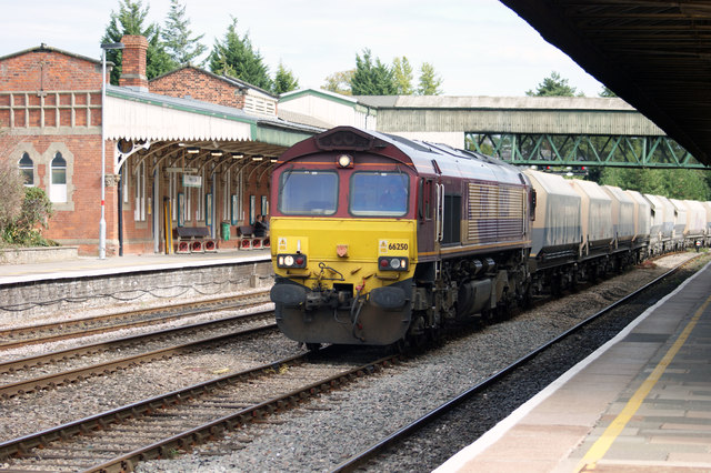
Aylestone Hill, Hereford
Northbound Freight Train at Hereford Diesel electric locomotive No 66250, hauling a northbound freight train through one of the centre roads at Hereford Station, slows to a halt to allow a change of driver.
Northbound Freight Train at Hereford
Diesel electric locomotive No 66250, hauling a northbound freight train through one of the centre roads at Hereford Station, slows to a halt to allow a change of driver.
Stanier 8F at Hereford, 1991 Preserved steam locomotive Stanier 8F 2-8-0 No 8233, in LMS livery, [owned by the Stanier 8F Locomotive Society and normally based on the Severn Valley Railway] brings the stock for the 'Welsh Marches Express' into Hereford station in the autumn of 1991.
Stanier 8F at Hereford, 1991
Preserved steam locomotive Stanier 8F 2-8-0 No 8233, in LMS livery, [owned by the Stanier 8F Locomotive Society and normally based on the Severn Valley Railway] brings the stock for the 'Welsh Marches Express' into Hereford station in the autumn of 1991.
SE end of Hereford railway station Looking towards the signal box <a title="https://www.geograph.org.uk/photo/2231439" href="https://www.geograph.org.uk/photo/2231439">Link</a> and the A465 bridge.
SE end of Hereford railway station
Looking towards the signal box Link and the A465 bridge.
Roadside cider press, Bath Street, Hereford The cider press is at the edge of Hereford Police Station, <a title="https://www.geograph.org.uk/photo/5175023" href="https://www.geograph.org.uk/photo/5175023">Link</a> Bath Street.
Roadside cider press, Bath Street, Hereford
The cider press is at the edge of Hereford Police Station, Link Bath Street.
Hereford Dental Clinic Located in Florida House, on the corner of Bath Street and Kyrle Street.
Hereford Dental Clinic
Located in Florida House, on the corner of Bath Street and Kyrle Street.
Berrows Business Centre, Hereford The Bath Street building was formerly a flour mill. <a title="https://www.geograph.org.uk/photo/1010665" href="https://www.geograph.org.uk/photo/1010665">Link</a>
Berrows Business Centre, Hereford
The Bath Street building was formerly a flour mill. Link
Hereford Commercial Road
Gaol Street, Hereford Viewed from Union Street. Spirit <a title="https://www.geograph.org.uk/photo/3098325" href="https://www.geograph.org.uk/photo/3098325">Link</a> is on the right.
A sign on the right points along Gaol Street to the police station.
Gaol Street, Hereford
Viewed from Union Street. Spirit Link is on the right. A sign on the right points along Gaol Street to the police station.
Former city gaol for sale, Hereford Viewed along Gaol Street. The building was for sale at the mid-January 2012 date of the view. 
It was previously Elim Christian Centre. See <a title="https://www.geograph.org.uk/photo/1010659" href="https://www.geograph.org.uk/photo/1010659">Link</a> for an earlier view and a potted history.
Former city gaol for sale, Hereford
Viewed along Gaol Street. The building was for sale at the mid-January 2012 date of the view. It was previously Elim Christian Centre. See Link for an earlier view and a potted history.
Bus Station Cafe & Takeaway, Hereford Located at the southern edge of the bus station, near Union Walk.
Bus Station Cafe & Takeaway, Hereford
Located at the southern edge of the bus station, near Union Walk.
Public toilets near Hereford bus station Viewed across Union Walk near the SW corner of the bus station. The row of six modern toilets are free, and open on a Sunday. The sign pointing to WC is curiously placed only a few metres from the facilities. Perhaps the previous toilets were elsewhere.
Public toilets near Hereford bus station
Viewed across Union Walk near the SW corner of the bus station. The row of six modern toilets are free, and open on a Sunday. The sign pointing to WC is curiously placed only a few metres from the facilities. Perhaps the previous toilets were elsewhere.
Hereford bus station The bus station viewed on a rainy Sunday afternoon in late September.
The bus is a Stagecoach double decker waiting to depart on route 32 to Ross-on-Wye.
Hereford bus station
The bus station viewed on a rainy Sunday afternoon in late September. The bus is a Stagecoach double decker waiting to depart on route 32 to Ross-on-Wye.
Entrance to Hereford County Hospital Viewed from the corner of Union Walk and Kyrle Street.
Entrance to Hereford County Hospital
Viewed from the corner of Union Walk and Kyrle Street.
Brick plinth with various inscriptions near Hereford County Hospital The side of the plinth in view is dedicated to Lieutenant Colonel R.C. Hewat, formerly of the Royal Scots Fusiliers, who was "Chairman of House Committee" from 1909-1912 and 1917-1922. Inscriptions on other sides of the plinth mark the NW boundary of the burial ground of St Guthlac's Priory 1143 to 1539, an 1866 boundary line, and the hospital foundation stone laid on October 22nd 1929.
Brick plinth with various inscriptions near Hereford County Hospital
The side of the plinth in view is dedicated to Lieutenant Colonel R.C. Hewat, formerly of the Royal Scots Fusiliers, who was "Chairman of House Committee" from 1909-1912 and 1917-1922. Inscriptions on other sides of the plinth mark the NW boundary of the burial ground of St Guthlac's Priory 1143 to 1539, an 1866 boundary line, and the hospital foundation stone laid on October 22nd 1929.
Entrance to Hereford County Hospital, Hereford
Entrance to A & E Hereford County Hospital, Hereford
Play Area off Grandison Rise
Show me another place!

Hampton Park is located at Grid Ref: SO5339 (Lat: 52.047388, Lng: -2.6867467)

Unitary Authority: County of Herefordshire

Police Authority: West Mercia

What 3 Words

///dairy.pipe.cover. Near Lower Bullingham, Herefordshire

Nearby Locations

Hampton Park

Related Wikis

Herefordshire Council

Herefordshire Council is the local authority for the county of Herefordshire in England. It is a unitary authority, combining the powers of a district...

Rotherwas Chapel

Rotherwas Chapel is a family chapel, once belonging to the Bodenham family. It is now state-owned and administered by English Heritage. The chapel contains...

Herefordshire Archive and Records Centre

Herefordshire Archive and Records Centre holds the archives for the county of Herefordshire. The archives are held at Fir Tree Lane, Rotherwas, Hereford...

ROF Rotherwas

ROF Rotherwas was a Royal Ordnance Factory filling factory, No 4, located in Rotherwas, Dinedor Parish, Herefordshire, England. == Background == In the...

Nearby Amenities

Located within 500m of 52.047388,-2.6867467
Post Box
Collection Times: Mo-Fr 17:00; Sa 11:30
Post Box Type: pillar
Ref: HR1 10
Royal Cypher: VR
Royal Cypher Wikidata: Q33102356
Lat/Long: 52.049228/-2.6909628
Place Of Worship
Hampton Park United Reformed Church
Addr City: Hereford
Addr Postcode: HR1 1UJ
Addr Street: Hampton Dene Road
Denomination: presbyterian
Fhrs Id: 488784
Religion: christian
Source Addr: FHRS Open Data
Lat/Long: 52.0517431/-2.6872268
Bus Stop
Bus: yes
Public Transport: platform
Lat/Long: 52.0516545/-2.688352
Post Box
Old Eign Hill
Collection Times: Mo-Fr 17:15; Sa 12:00
Operator: Royal Mail
Ref: HR1 150
Lat/Long: 52.0517433/-2.6881866
Bus Stop
Hampton Grange
Bus: yes
Naptan AtcoCode: 2090A0106098
Naptan Bearing: E
Naptan CommonName: Hampton Grange
Naptan Indicator: opp
Naptan Landmark: Hampton Grange
Naptan NaptanCode: heratgaw
Naptan PlusbusZoneRef: HEREFRD
Naptan Street: Hampton Park Road
Naptan Verified: no
Public Transport: platform
Source: naptan_import
Lat/Long: 52.0493131/-2.6896268
Bus Stop
Old Eign Hill Post Office
Bus: yes
Naptan AtcoCode: 2090A19446
Naptan Bearing: W
Naptan CommonName: Old Eign Hill Post Office
Naptan Indicator: opp
Naptan Landmark: opp Post Office
Naptan NaptanCode: heramapm
Naptan PlusbusZoneRef: HEREFRD
Naptan Street: Old Eign Hill Road
Naptan Verified: no
Public Transport: platform
Source: naptan_import
Lat/Long: 52.0515874/-2.6881743
Bus Stop
Nimrod Drive
Bus: yes
Naptan AtcoCode: 2090A19454
Naptan Bearing: E
Naptan CommonName: Nimrod Drive
Naptan Indicator: adj
Naptan Landmark: opp The Park
Naptan NaptanCode: heramatd
Naptan PlusbusZoneRef: HEREFRD
Naptan Street: Hampton Park Road
Naptan Verified: no
Public Transport: platform
Source: naptan_import
Lat/Long: 52.0492005/-2.6827274
Generator Method: photovoltaic
Generator Output Electricity: yes
Generator Source: solar
Generator Type: solar_photovoltaic_panel
Location: roof
Power: generator
Lat/Long: 52.0489375/-2.6929727
Generator Method: photovoltaic
Generator Output Electricity: yes
Generator Source: solar
Generator Type: solar_photovoltaic_panel
Location: roof
Power: generator
Lat/Long: 52.0489607/-2.6922753
Generator Method: photovoltaic
Generator Output Electricity: yes
Generator Source: solar
Generator Type: solar_photovoltaic_panel
Location: roof
Power: generator
Lat/Long: 52.047415/-2.6805702
Generator Method: photovoltaic
Generator Output Electricity: yes
Generator Source: solar
Generator Type: solar_photovoltaic_panel
Location: roof
Power: generator
Lat/Long: 52.0485351/-2.6806533
Generator Method: photovoltaic
Generator Output Electricity: yes
Generator Source: solar
Generator Type: solar_photovoltaic_panel
Location: roof
Power: generator
Lat/Long: 52.0498596/-2.6863879
Generator Method: photovoltaic
Generator Output Electricity: yes
Generator Source: solar
Generator Type: solar_photovoltaic_panel
Location: roof
Power: generator
Lat/Long: 52.0507487/-2.685889
Generator Method: photovoltaic
Generator Output Electricity: yes
Generator Source: solar
Generator Type: solar_photovoltaic_panel
Location: roof
Power: generator
Lat/Long: 52.0508361/-2.6863959
Generator Method: photovoltaic
Generator Output Electricity: yes
Generator Source: solar
Generator Type: solar_photovoltaic_panel
Location: roof
Power: generator
Lat/Long: 52.0494192/-2.6825953
Generator Method: photovoltaic
Generator Output Electricity: yes
Generator Source: solar
Generator Type: solar_photovoltaic_panel
Location: roof
Power: generator
Lat/Long: 52.0494769/-2.6837862
Generator Method: photovoltaic
Generator Output Electricity: yes
Generator Source: solar
Generator Type: solar_photovoltaic_panel
Location: roof
Power: generator
Lat/Long: 52.0497953/-2.6851273
Generator Method: photovoltaic
Generator Output Electricity: yes
Generator Source: solar
Generator Type: solar_photovoltaic_panel
Location: roof
Power: generator
Lat/Long: 52.0495165/-2.6848993
Generator Method: photovoltaic
Generator Output Electricity: yes
Generator Source: solar
Generator Type: solar_photovoltaic_panel
Location: roof
Power: generator
Lat/Long: 52.0500559/-2.6865757
Generator Method: photovoltaic
Generator Output Electricity: yes
Generator Source: solar
Generator Type: solar_photovoltaic_panel
Location: roof
Power: generator
Lat/Long: 52.0510274/-2.6876593
Generator Method: photovoltaic
Generator Output Electricity: yes
Generator Source: solar
Generator Type: solar_photovoltaic_panel
Location: roof
Power: generator
Lat/Long: 52.0485598/-2.6813936
Generator Method: photovoltaic
Generator Output Electricity: yes
Generator Source: solar
Generator Type: solar_photovoltaic_panel
Location: roof
Power: generator
Lat/Long: 52.049058/-2.6849234
Generator Method: photovoltaic
Generator Output Electricity: yes
Generator Source: solar
Generator Type: solar_photovoltaic_panel
Location: roof
Power: generator
Lat/Long: 52.0487017/-2.6863557
Generator Method: photovoltaic
Generator Output Electricity: yes
Generator Source: solar
Generator Type: solar_photovoltaic_panel
Location: roof
Power: generator
Lat/Long: 52.0487577/-2.6878926
Generator Method: photovoltaic
Generator Output Electricity: yes
Generator Source: solar
Generator Type: solar_photovoltaic_panel
Location: roof
Power: generator
Lat/Long: 52.0501582/-2.684741
Generator Method: photovoltaic
Generator Output Electricity: yes
Generator Source: solar
Generator Type: solar_photovoltaic_panel
Location: roof
Power: generator
Lat/Long: 52.0501615/-2.6843253
Generator Method: photovoltaic
Generator Output Electricity: yes
Generator Source: solar
Generator Type: solar_photovoltaic_panel
Location: roof
Power: generator
Lat/Long: 52.0505969/-2.6835823
Generator Method: photovoltaic
Generator Output Electricity: yes
Generator Source: solar
Generator Type: solar_photovoltaic_panel
Location: roof
Power: generator
Lat/Long: 52.0491025/-2.6810557
Generator Method: photovoltaic
Generator Output Electricity: yes
Generator Source: solar
Generator Type: solar_photovoltaic_panel
Location: roof
Power: generator
Lat/Long: 52.0515932/-2.6851434
Generator Method: photovoltaic
Generator Output Electricity: yes
Generator Source: solar
Generator Type: solar_photovoltaic_panel
Location: roof
Power: generator
Lat/Long: 52.0504567/-2.6917899
Generator Method: photovoltaic
Generator Output Electricity: yes
Generator Source: solar
Generator Type: solar_photovoltaic_panel
Location: roof
Power: generator
Lat/Long: 52.0493945/-2.6914439
The data included in this document is from www.openstreetmap.org. The data is made available under ODbL.

Have you been to Hampton Park?

Leave your review of Hampton Park below (or comments, questions and feedback).