Fordington Down

Downs, Moorland in Dorset

England

Fordington Down

Descending on the path from Maiden Castle
Descending on the path from Maiden Castle Credit: Basher Eyre

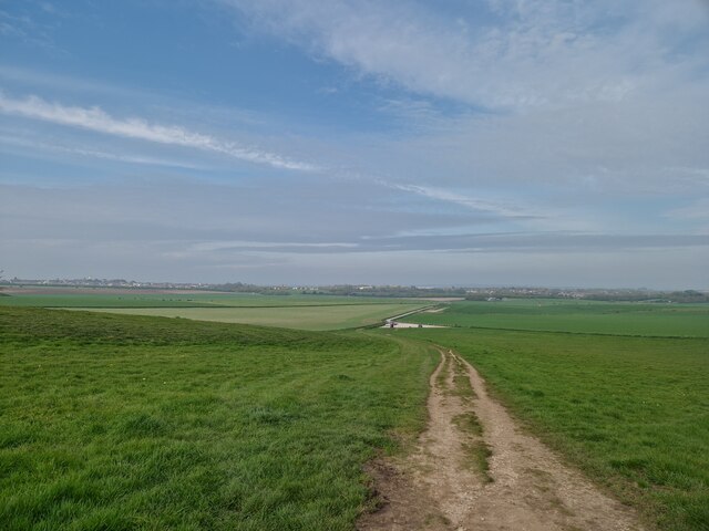
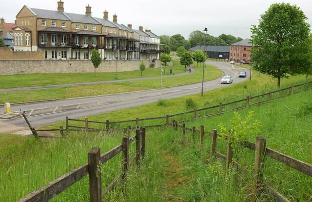
Fordington Down is a picturesque area located in the county of Dorset, England. Situated near the town of Dorchester, it is part of the larger Dorset Downs and Moorland region. Fordington Down is known for its rolling hills, vast expanses of open land, and stunning natural beauty.

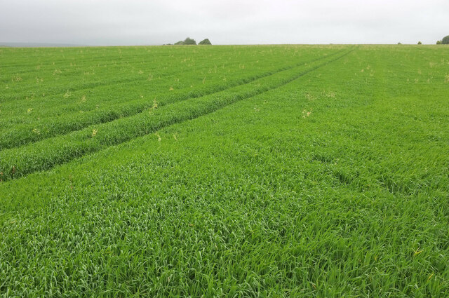
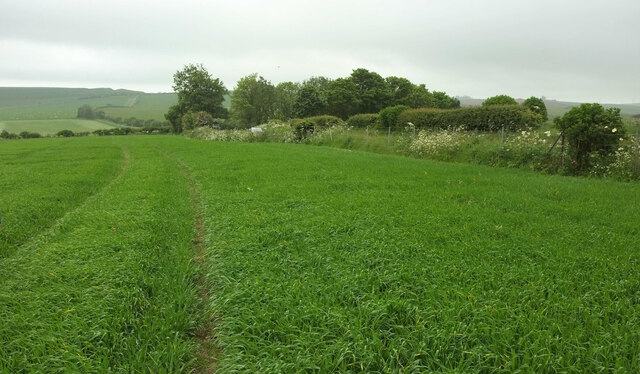
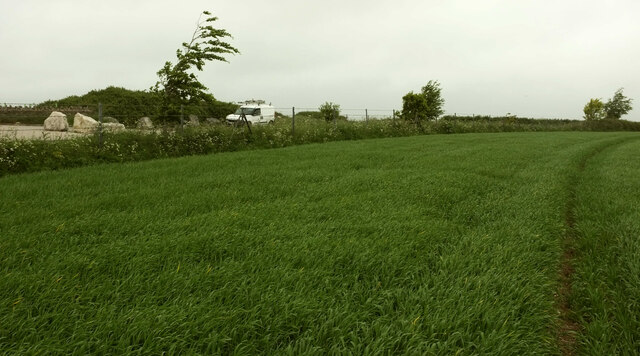
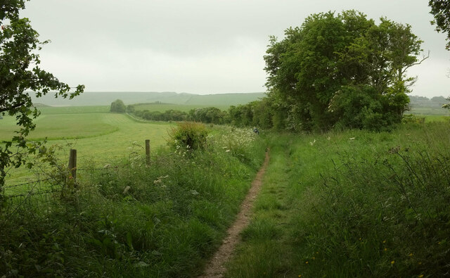
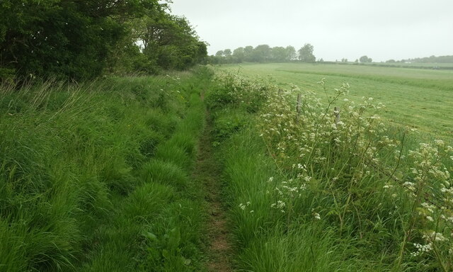
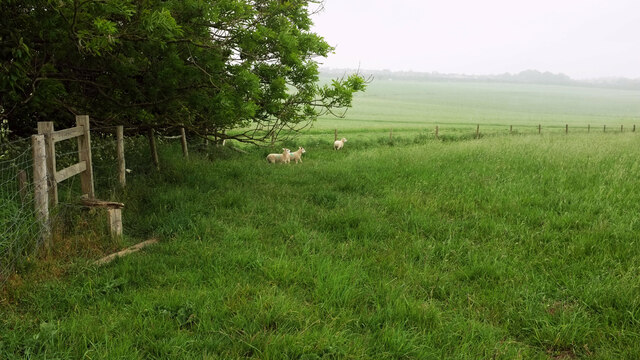
Covering an area of approximately 200 acres, Fordington Down offers visitors a diverse range of landscapes to explore. The area is characterized by its gently sloping hills and valleys, which are covered in lush green grass and dotted with vibrant wildflowers during the summer months. The higher elevations of the downs provide breathtaking panoramic views of the surrounding countryside, with glimpses of distant villages and towns.

This area is also home to a variety of wildlife, including numerous species of birds, small mammals, and insects. Birdwatchers will be delighted to encounter species such as skylarks, buzzards, and kestrels soaring above the downs. Additionally, Fordington Down is known for its rich biodiversity, with rare plants and wildflowers adding bursts of color to the landscape.

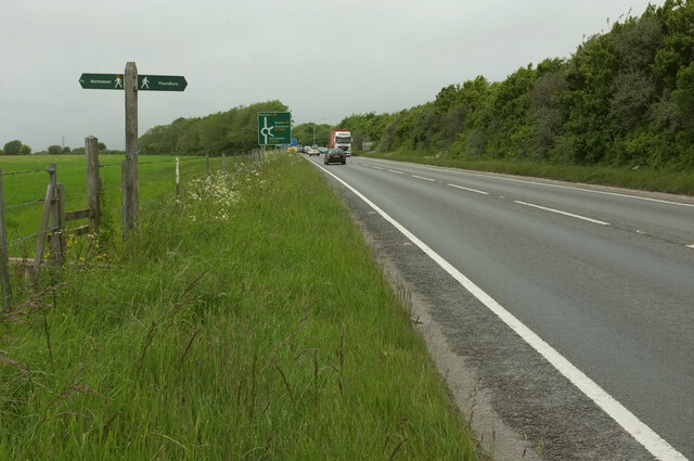
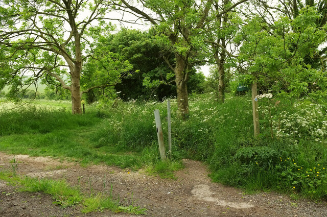
The area is crisscrossed with footpaths and bridleways, making it a popular destination for outdoor enthusiasts. Hikers and walkers can enjoy leisurely strolls or challenging treks, while horse riders and cyclists can explore the downs at their own pace. Fordington Down offers a tranquil and serene environment, providing a perfect escape from the hustle and bustle of everyday life.

Overall, Fordington Down is a captivating area that showcases the natural beauty and diversity of Dorset. Whether you are a nature lover, an avid hiker, or simply seeking a peaceful retreat, this downs and moorland region is sure to captivate and inspire.

If you have any feedback on the listing, please let us know in the comments section below.

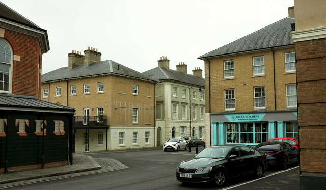
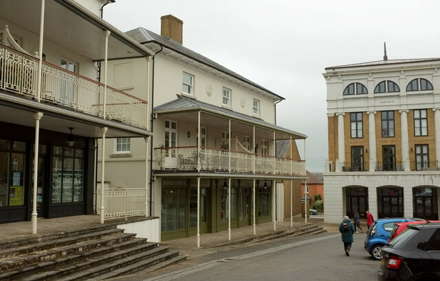
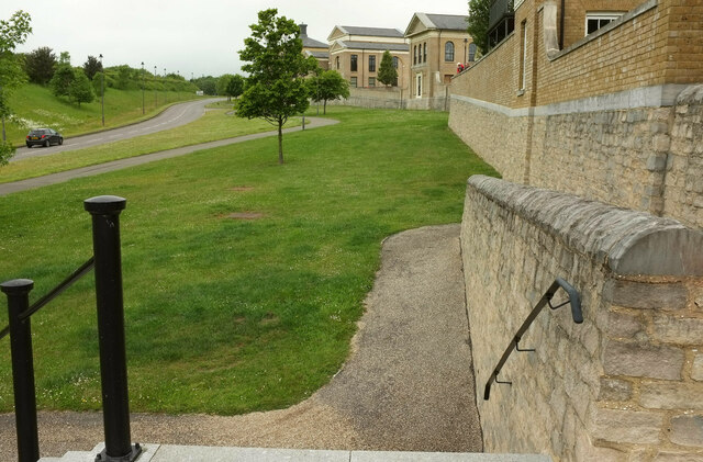
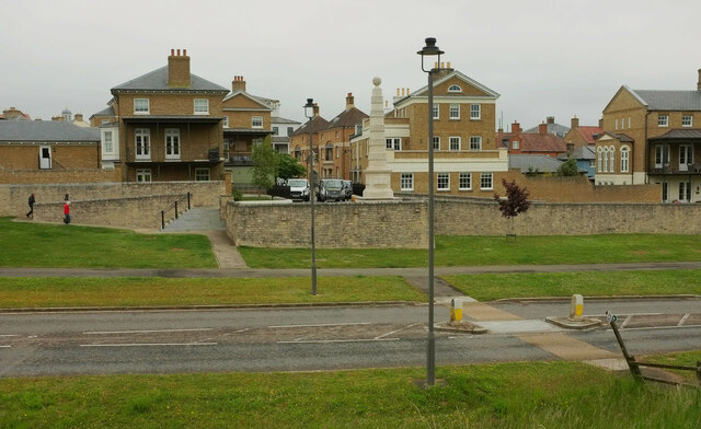
Fordington Down Images

Images are sourced within 2km of 50.715484/-2.4788587 or Grid Reference SY6690. Thanks to Geograph Open Source API. All images are credited.

Descending on the path from Maiden Castle
Woodlands Crescent, Poundbury Houses on the west side of the crescent.
Woodlands Crescent, Poundbury
Houses on the west side of the crescent.
Woodlands Crescent, Poundbury Looking the other way from <a href="https://www.geograph.org.uk/photo/7629335">SY6790 : Woodlands Crescent, Poundbury</a>, showing the junction with Challacombe Street.
Woodlands Crescent, Poundbury
Looking the other way from SY6790 : Woodlands Crescent, Poundbury, showing the junction with Challacombe Street.
Challacombe Street, Poundbury From the green open space seen on the left of <a href="https://www.geograph.org.uk/photo/7632875">SY6790 : Woodlands Crescent, Poundbury</a>, across the junction with Woodlands Crescent.
Challacombe Street, Poundbury
From the green open space seen on the left of SY6790 : Woodlands Crescent, Poundbury, across the junction with Woodlands Crescent.
By the Butter Cross, Poundbury Part of the Butter Cross <a href="https://www.geograph.org.uk/photo/6591829">SY6790 : Butter Cross, Poundbury</a> is glimpsed on the left. The road leading away in the centre is Bridport Road.
By the Butter Cross, Poundbury
Part of the Butter Cross SY6790 : Butter Cross, Poundbury is glimpsed on the left. The road leading away in the centre is Bridport Road.
Shops, Poundbury Landscaping, beauty therapy, gifts are available in the shops here, set in buildings with canopied balconies.
Shops, Poundbury
Landscaping, beauty therapy, gifts are available in the shops here, set in buildings with canopied balconies.
Southern edge of Poundbury A ramp and steps lead down to the B3150 Middle Farm Way.
Southern edge of Poundbury
A ramp and steps lead down to the B3150 Middle Farm Way.
Obelisk, Poundbury The obelisk, "crafted by students of The Prince’s Foundation" <span class="nowrap"><a title="https://poundbury.co.uk/new-ten-metre-high-stone-obelisk-erected-in-poundbury/" rel="nofollow ugc noopener" href="https://poundbury.co.uk/new-ten-metre-high-stone-obelisk-erected-in-poundbury/">Link</a><img style="margin-left:2px;" alt="External link" title="External link - shift click to open in new window" src="https://s1.geograph.org.uk/img/external.png" width="10" height="10"/></span> was "installed at the bastion wall at the bottom of Wadebridge Lane, overlooking Middle Farm Way"  in November 2019 <span class="nowrap"><a title="https://www.townandcountrymag.com/society/tradition/a30360528/prince-charles-poundbury-obelisk-installation-photos/" rel="nofollow ugc noopener" href="https://www.townandcountrymag.com/society/tradition/a30360528/prince-charles-poundbury-obelisk-installation-photos/">Link</a><img style="margin-left:2px;" alt="External link" title="External link - shift click to open in new window" src="https://s1.geograph.org.uk/img/external.png" width="10" height="10"/></span> , with Prince Charles present. <a href="https://www.geograph.org.uk/photo/7633911">SY6790 : Southern edge of Poundbury</a> was taken from the top of the grey steps on the left.
Obelisk, Poundbury
The obelisk, "crafted by students of The Prince’s Foundation" LinkExternal link was "installed at the bastion wall at the bottom of Wadebridge Lane, overlooking Middle Farm Way" in November 2019 LinkExternal link , with Prince Charles present. SY6790 : Southern edge of Poundbury was taken from the top of the grey steps on the left.
Middle Farm Way, Poundbury Looking right from <a href="https://www.geograph.org.uk/photo/7634600">SY6790 : Obelisk, Poundbury</a> along the B3150 as it skirts the southern edge of Poundbury. The buildings on the right of the road are at Parkway Farm Business Park. In the foreground is footpath S2 51, which descends precipitously and awkwardly to the A35.
Middle Farm Way, Poundbury
Looking right from SY6790 : Obelisk, Poundbury along the B3150 as it skirts the southern edge of Poundbury. The buildings on the right of the road are at Parkway Farm Business Park. In the foreground is footpath S2 51, which descends precipitously and awkwardly to the A35.
Footpath sign on A35 at Poundbury This is probably Dorset's busiest main road, but where a footpath crosses it there is not even any sort of pedestrian refuge. After a steep and very awkward descent on footpath S2 51, it was daunting to face crossing an A road with fast traffic in both directions. The path to the left, S57 6, is supposed to cross Fordington Field in a straightish line to meet the road to Martinstown at an appropriate bend. However, the farmer has failed to provide a route through their crop, requiring a detour along tramlines, This is not developing into a good walk.

The A35 is approaching the Monkey's Jump roundabout.
Footpath sign on A35 at Poundbury
This is probably Dorset's busiest main road, but where a footpath crosses it there is not even any sort of pedestrian refuge. After a steep and very awkward descent on footpath S2 51, it was daunting to face crossing an A road with fast traffic in both directions. The path to the left, S57 6, is supposed to cross Fordington Field in a straightish line to meet the road to Martinstown at an appropriate bend. However, the farmer has failed to provide a route through their crop, requiring a detour along tramlines, This is not developing into a good walk. The A35 is approaching the Monkey's Jump roundabout.
Crop, Fordington Field Footpath S57 6 should be heading towards those trees left of centre, and indeed I see that satellite images, taken presumably after harvesting, show a straight line leading to them. However, no footpath route has been left, forcing those who would be unhappy to damage the crop to follow tramlines which take one on a rather longer route. See <a href="https://www.geograph.org.uk/photo/7634816">SY6690 : Footpath sign on A35 at Poundbury</a>; perhaps this walk will improve as we progress. Spoiler alert: it rained for most of the way.
Crop, Fordington Field
Footpath S57 6 should be heading towards those trees left of centre, and indeed I see that satellite images, taken presumably after harvesting, show a straight line leading to them. However, no footpath route has been left, forcing those who would be unhappy to damage the crop to follow tramlines which take one on a rather longer route. See SY6690 : Footpath sign on A35 at Poundbury; perhaps this walk will improve as we progress. Spoiler alert: it rained for most of the way.
Crop, Fordington Field Heading to meet the road on the right (from Poundbury to Martinstown) by the trees, where footpath S57 6 meets it. See <a href="https://www.geograph.org.uk/photo/7634854">SY6690 : Crop, Fordington Field</a>; we shouldn't be here, but no route through the crop along the correct line of the path has been provided, so we've had to walk further than anticipated.
Crop, Fordington Field
Heading to meet the road on the right (from Poundbury to Martinstown) by the trees, where footpath S57 6 meets it. See SY6690 : Crop, Fordington Field; we shouldn't be here, but no route through the crop along the correct line of the path has been provided, so we've had to walk further than anticipated.
Crop, Fordington Field This looks the other way from <a href="https://www.geograph.org.uk/photo/7634874">SY6690 : Crop, Fordington Field</a>. Trees bend as wind and rain arrive. The huge rocks on the left are at the start of the entrance road to the anaerobic digestion plant at Rainbarrow Farm.
Crop, Fordington Field
This looks the other way from SY6690 : Crop, Fordington Field. Trees bend as wind and rain arrive. The huge rocks on the left are at the start of the entrance road to the anaerobic digestion plant at Rainbarrow Farm.
Farmland southwest of Poundbury From where footpath S57 6 meets the road from Poundbury to Martinstown. Some seagulls are following the tractor beyond the hedge.
Farmland southwest of Poundbury
From where footpath S57 6 meets the road from Poundbury to Martinstown. Some seagulls are following the tractor beyond the hedge.
Bridleway to Maiden Castle So that's not the field access track leading off to the left, but the path on the other side of it, which is bridleway S57 5.
Bridleway to Maiden Castle
So that's not the field access track leading off to the left, but the path on the other side of it, which is bridleway S57 5.
Bridleway to Maiden Castle Bridleway S57 5 follows a field boundary southwards. The field boundary is also the parish boundary between Winterborne Monkton (this side) and Winterborne St Martin. It's poor visibility but the outline of Maiden Castle is on the horizon.
Bridleway to Maiden Castle
Bridleway S57 5 follows a field boundary southwards. The field boundary is also the parish boundary between Winterborne Monkton (this side) and Winterborne St Martin. It's poor visibility but the outline of Maiden Castle is on the horizon.
Bridleway towards Poundbury Bridleway S57 5 heads along the edge of field towards its junction with the road from Martinstown to Poundbury. The field boundary on the left is the parish boundary between Winterborne Monkton (this side) and Winterborne St Martin.
Bridleway towards Poundbury
Bridleway S57 5 heads along the edge of field towards its junction with the road from Martinstown to Poundbury. The field boundary on the left is the parish boundary between Winterborne Monkton (this side) and Winterborne St Martin.
Sheep north east of Clandon Farm The stile is covered in barbed wire. I can't remember, but I assume there was a proper gate, this being a bridleway (S57 5).
Sheep north east of Clandon Farm
The stile is covered in barbed wire. I can't remember, but I assume there was a proper gate, this being a bridleway (S57 5).
Show me another place!

Fordington Down is located at Grid Ref: SY6690 (Lat: 50.715484, Lng: -2.4788587)

Unitary Authority: Dorset

Police Authority: Dorset

What 3 Words

///takeovers.savings.happily. Near Charminster, Dorset

Related Wikis

Poundbury

Poundbury is an experimental urban extension on the western outskirts of Dorchester in the county of Dorset, England. The development is led by the Duchy...

Clandon Barrow

Clandon Barrow is a very large bowl barrow dating from the Bronze Age, which overlooks the village of Martinstown, near Dorchester in Dorset, and which...

Poundbury Hill

Poundbury Hill (grid reference SY682911) is the site of a scheduled Prehistoric and Roman archaeological remains and includes evidence of a Neolithic settlement...

The Thomas Hardye School

The Thomas Hardye School is a secondary academy school in Dorchester, Dorset, England. It is also part of the DASP group. == History == === Grammar school... ===

Nearby Amenities

Located within 500m of 50.715484,-2.4788587
Material: wood
Power: pole
Source: bing
Lat/Long: 50.7119716/-2.4802156
Material: wood
Power: pole
Source: bing
Lat/Long: 50.7119761/-2.4786257
Material: wood
Power: pole
Source: bing
Lat/Long: 50.7120128/-2.4745586
Material: wood
Power: pole
Source: bing
Lat/Long: 50.7124026/-2.4744555
Material: wood
Power: pole
Source: bing
Lat/Long: 50.7125068/-2.4751011
Material: wood
Power: pole
Source: bing
Lat/Long: 50.7126107/-2.4757457
Material: wood
Power: pole
Source: bing
Lat/Long: 50.7127079/-2.4764517
Material: wood
Power: pole
Source: bing
Lat/Long: 50.7130654/-2.4753761
Material: wood
Power: pole
Source: bing
Lat/Long: 50.7133404/-2.4743701
Material: wood
Power: pole
Source: bing
Lat/Long: 50.7136845/-2.47332
Material: wood
Power: pole
Source: bing
Lat/Long: 50.7119543/-2.4770121
Material: wood
Power: pole
Source: bing
Lat/Long: 50.7119669/-2.4817738
The data included in this document is from www.openstreetmap.org. The data is made available under ODbL.

Have you been to Fordington Down?

Leave your review of Fordington Down below (or comments, questions and feedback).