Longridge Fell
Downs, Moorland in Lancashire Ribble Valley
England
Longridge Fell
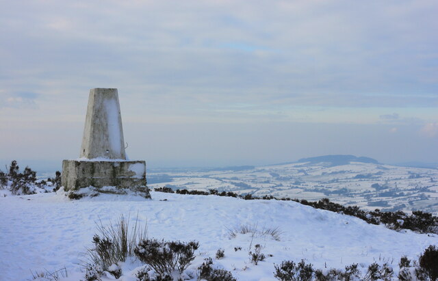
Longridge Fell is a prominent hill situated in Lancashire, England. With an elevation of 1,148 feet (350 meters), it dominates the landscape of the Ribble Valley and offers breathtaking panoramic views. This area is a designated Area of Outstanding Natural Beauty and is a popular destination for hikers, nature enthusiasts, and local residents.
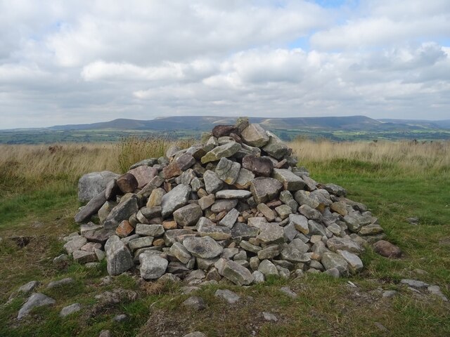
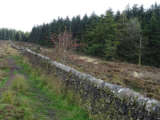
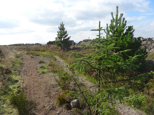
The fell is characterized by rolling hills, heather moorland, and pockets of dense woodland. It is home to a diverse range of flora and fauna, including rare bird species such as the ring ouzel and merlin. The moorland is scattered with rocks and boulders, remnants of an ancient glacier that once covered the area.
There are several well-marked walking trails on the fell, catering to different levels of fitness and experience. The most popular route starts from the town of Longridge, ascending through open fields before reaching the summit. From the top, visitors are rewarded with stunning views of the Ribble Valley, Pendle Hill, and the Forest of Bowland.
Longridge Fell has a rich history, with evidence of prehistoric settlements and burial mounds. In the 19th century, the area was extensively quarried for stone, which was used for construction projects in the nearby towns. The remnants of these quarries can still be seen today, adding an interesting historical dimension to the landscape.
Overall, Longridge Fell is a beautiful and diverse natural area, offering a peaceful retreat from the hustle and bustle of urban life. Whether it's a leisurely stroll through the woodland or a challenging hike to the summit, visitors are guaranteed a memorable experience in this stunning part of Lancashire.
If you have any feedback on the listing, please let us know in the comments section below.
Longridge Fell Images
Images are sourced within 2km of 53.859954/-2.5281139 or Grid Reference SD6540. Thanks to Geograph Open Source API. All images are credited.


Longridge Fell is located at Grid Ref: SD6540 (Lat: 53.859954, Lng: -2.5281139)
Administrative County: Lancashire
District: Ribble Valley
Police Authority: Lancashire
What 3 Words
///blackbird.redeemed.dispenser. Near Longridge, Lancashire
Nearby Locations
Related Wikis

Longridge Fell
Longridge Fell is the most southerly fell in England, near the town of Longridge, Lancashire. It lies at the southern end of the Forest of Bowland Area...
Thornley-with-Wheatley
Thornley-with-Wheatley is a civil parish in the Borough of Ribble Valley, Lancashire, England. It is entirely rural, with no villages or other substantial...

River Loud
The River Loud is a river of Lancashire, England. Starting out on Parlick, the Loud meanders mainly through the parish of Chipping, tracing its course...
Longridge Golf Club
Longridge Golf Club, in Longridge, England, was founded around 1915, making it one of the oldest golf clubs in the county of Lancashire. Situated on Longridge...

Aighton, Bailey and Chaigley
Aighton, Bailey and Chaigley is a civil parish in the Borough of Ribble Valley in Lancashire, England, just west of Clitheroe. The population of the civil...

Punch Bowl Inn
The Punch Bowl Inn was an 18th-century grade II-listed public house in Hurst Green, Ribble Valley, Lancashire, England. It consisted of a number of independent...

Lower Lees Farmhouse
Lower Lees Farmhouse is a historic building in the English parish of Bowland Forest Low, Lancashire. It is Grade II listed, built in 1678, and is a sandstone...
Dutton, Lancashire
Dutton is a civil parish in the Borough of Ribble Valley in the English county of Lancashire, its principal settlement being the hamlet of Lower Dutton...
Nearby Amenities
Located within 500m of 53.859954,-2.5281139Have you been to Longridge Fell?
Leave your review of Longridge Fell below (or comments, questions and feedback).