West Kielder Moor

Downs, Moorland in Northumberland

England

West Kielder Moor

Carlin Tooth, Peel Fell and Deadwater Fell These are the respective distant summits, left to right, as viewed from the trackbed of the former Waverley Route.

This photograph was taken during the Coronavirus (COVID-19) pandemic of 2020/21/22.
Carlin Tooth, Peel Fell and Deadwater Fell Credit: James T M Towill

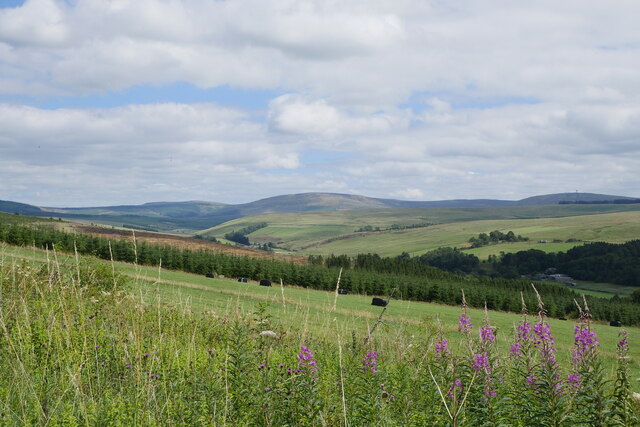
West Kielder Moor is a vast expanse of upland moorland situated in the county of Northumberland, England. It covers an area of approximately 20 square kilometers and is part of the Kielder Forest and Water Park.

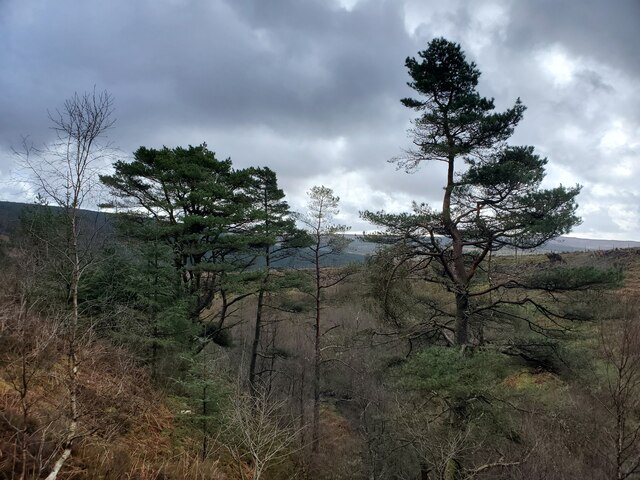
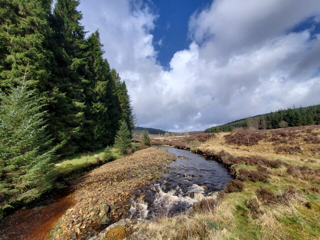
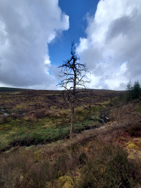
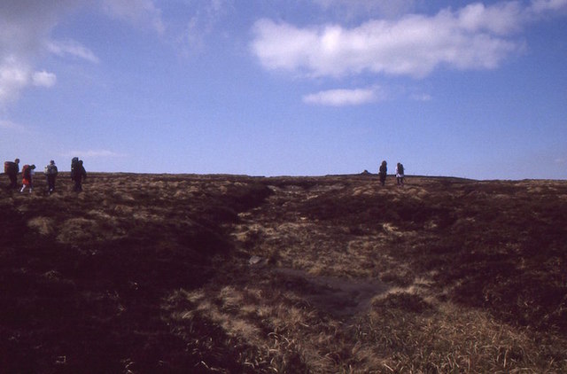
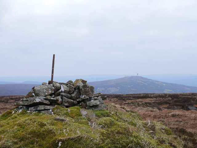
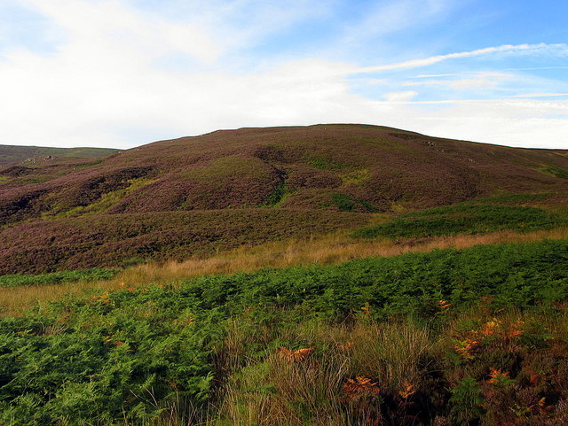
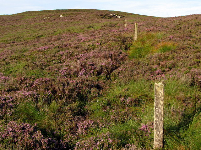
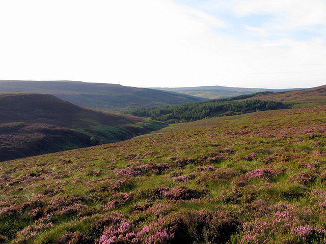
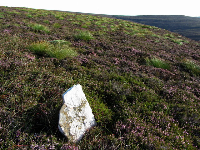
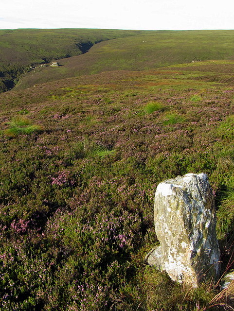
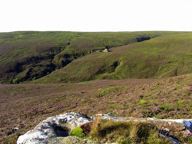
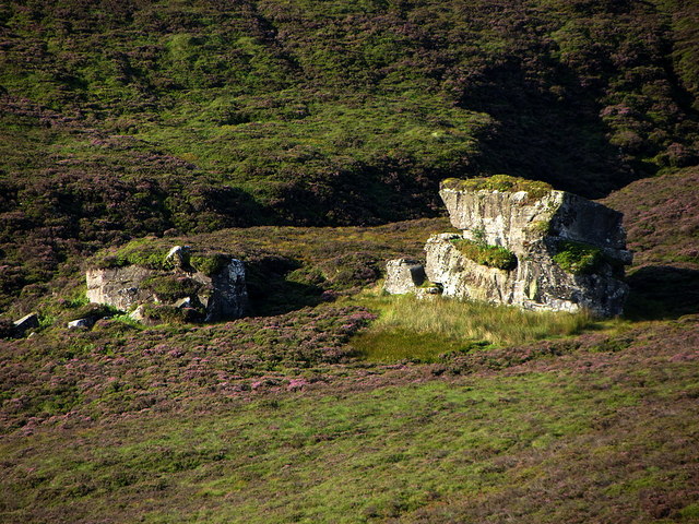
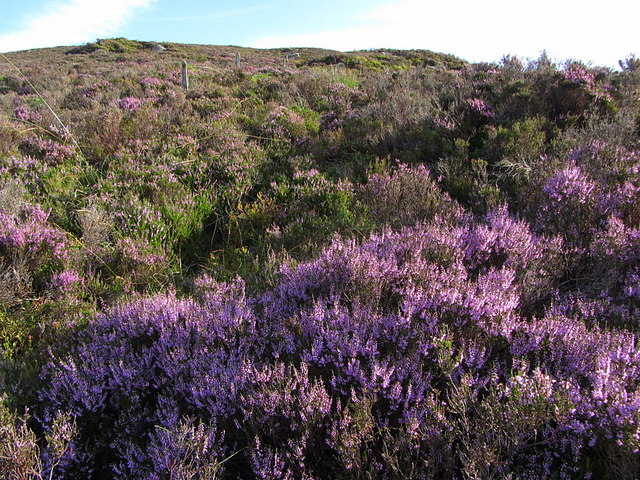
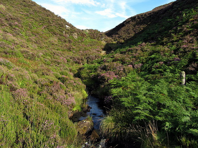
The moorland landscape of West Kielder Moor is characterized by rolling hills, heather-covered slopes, and scattered patches of woodland. It lies at an elevation of around 300 meters above sea level, offering breathtaking views of the surrounding countryside.

The area is rich in biodiversity, providing a habitat for a diverse range of flora and fauna. The moorland is predominantly covered in heather, with species such as bilberry, crowberry, and cotton grass also thriving in the acidic soil. The moorland is home to various bird species, including the red grouse, curlew, and golden plover, which nest and forage in the area.

West Kielder Moor is also known for its archaeological significance. There are remnants of ancient settlements and burial cairns that date back to the Neolithic and Bronze Age periods, indicating human activity in the area for thousands of years.

The moorland is a popular destination for outdoor enthusiasts, offering opportunities for hiking, birdwatching, and nature exploration. Several walking trails crisscross the area, providing access to its stunning natural beauty.

Overall, West Kielder Moor is a picturesque and ecologically diverse landscape that offers visitors a chance to connect with nature and explore the rich history of Northumberland.

If you have any feedback on the listing, please let us know in the comments section below.

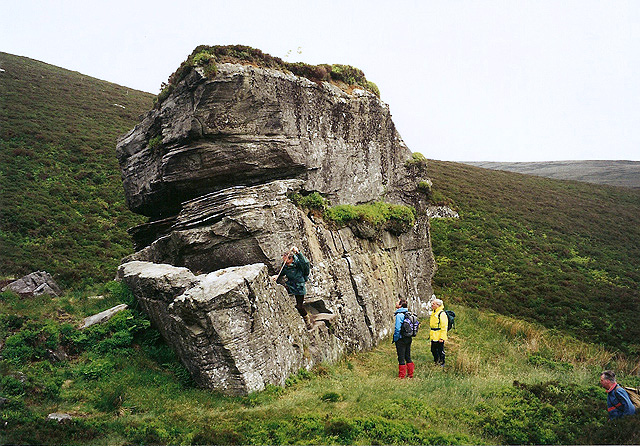
West Kielder Moor Images

Images are sourced within 2km of 55.290301/-2.5625517 or Grid Reference NY6499. Thanks to Geograph Open Source API. All images are credited.

Carlin Tooth, Peel Fell and Deadwater Fell These are the respective distant summits, left to right, as viewed from the trackbed of the former Waverley Route.

This photograph was taken during the Coronavirus (COVID-19) pandemic of 2020/21/22.
Carlin Tooth, Peel Fell and Deadwater Fell
These are the respective distant summits, left to right, as viewed from the trackbed of the former Waverley Route. This photograph was taken during the Coronavirus (COVID-19) pandemic of 2020/21/22.
William's Cleuch Pine Trees William’s Cleugh, a ravine on the eastern slope of West Kielder Moor with fragments of rowan, birch and willow woodland, contains a group of five Scots pines that pre-date the adjacent planted forest. Another pine stands alone near the foot of the cleugh. The absence of any other Scots pine in the area suggests either:
1. That they or their ancestors were planted.
2. That they are a native remnant.
If the latter were true, they would represent the only surviving native pinewood remnant in England.

To determine the age of the six trees, annual rings were counted from cores taken from the base of their trunks. Four of the trees were 59-80 years old and probably arose as seedlings. Two of the mature trees were 155 and 130 years old, the different ages suggesting that they hadn't been planted at the same time.
Ecotype (Forest Research) No.28 May 2005: <span class="nowrap"><a title="http://www.forestry.gov.uk/pdf/Ecotype28.pdf/$FILE/Ecotype28.pdf" rel="nofollow ugc noopener" href="http://www.forestry.gov.uk/pdf/Ecotype28.pdf/$FILE/Ecotype28.pdf">Link</a><img style="margin-left:2px;" alt="External link" title="External link - shift click to open in new window" src="https://s1.geograph.org.uk/img/external.png" width="10" height="10"/></span>

Scots Pine trees are undoubtedly native to the north Northumberland region as there is plenty of evidence of preserved pollen and wood.

Kielder Castle has a table made from old wood dug from the peat in Black Cleugh. The presence of ancient woodland in the area was still within the memory of the last generation in the late 1880s. The name 'Woody Crags' still retained for some scars on the east side of White Kielder between 1,250 and 1,500 ft in altitude. The destruction of the woods is attributed to the sheep by many of the shepherds, and it is considered that the small patches of natural wood which still remain will also be gradually destroyed unless fenced in.
The geology of the Plashetts and Kielder (explanation of quarter-sheet 108 S.W., new series, sheet 7), C T Clough (1889)

That the pines in William's Cleugh are native remnants is also supported by:
Possible 'pine' place names dating from post-Roman times
Limited pine wood flora found in William's Cleugh: chickweed wintergreen and Issler's clubmoss
The rare lichen, Alectoria sarmentosa, is found on the Kielder Stone but unknown outside the Scottish Highlands and a possible pine forest relict.

Although not yet proven, the William's Cleugh pines are being used as a seed source to bolster the population in situ and for new woodland planting.
Northumberland by Angus Lunn (2004).
William's Cleuch Pine Trees
William’s Cleugh, a ravine on the eastern slope of West Kielder Moor with fragments of rowan, birch and willow woodland, contains a group of five Scots pines that pre-date the adjacent planted forest. Another pine stands alone near the foot of the cleugh. The absence of any other Scots pine in the area suggests either: 1. That they or their ancestors were planted. 2. That they are a native remnant. If the latter were true, they would represent the only surviving native pinewood remnant in England. To determine the age of the six trees, annual rings were counted from cores taken from the base of their trunks. Four of the trees were 59-80 years old and probably arose as seedlings. Two of the mature trees were 155 and 130 years old, the different ages suggesting that they hadn't been planted at the same time. Ecotype (Forest Research) No.28 May 2005: LinkExternal link Scots Pine trees are undoubtedly native to the north Northumberland region as there is plenty of evidence of preserved pollen and wood. Kielder Castle has a table made from old wood dug from the peat in Black Cleugh. The presence of ancient woodland in the area was still within the memory of the last generation in the late 1880s. The name 'Woody Crags' still retained for some scars on the east side of White Kielder between 1,250 and 1,500 ft in altitude. The destruction of the woods is attributed to the sheep by many of the shepherds, and it is considered that the small patches of natural wood which still remain will also be gradually destroyed unless fenced in. The geology of the Plashetts and Kielder (explanation of quarter-sheet 108 S.W., new series, sheet 7), C T Clough (1889) That the pines in William's Cleugh are native remnants is also supported by: Possible 'pine' place names dating from post-Roman times Limited pine wood flora found in William's Cleugh: chickweed wintergreen and Issler's clubmoss The rare lichen, Alectoria sarmentosa, is found on the Kielder Stone but unknown outside the Scottish Highlands and a possible pine forest relict. Although not yet proven, the William's Cleugh pines are being used as a seed source to bolster the population in situ and for new woodland planting. Northumberland by Angus Lunn (2004).
Scaup Burn from bridge
William's Cleuch Pine Sadly died a few years back
William's Cleuch Pine
Sadly died a few years back
The Scotland/England border from the air Approximately Scotland to the left of centre, England to the right.
The Scotland/England border from the air
Approximately Scotland to the left of centre, England to the right.
The Scotland/England border from the air Approximately Scotland to the left of centre, England to the right.
The Scotland/England border from the air
Approximately Scotland to the left of centre, England to the right.
Peel Fell Approaching the cairn, one of two 602m spot heights on this very boggy hill.  Like Cheviot, the high point is just over the border in England.  Celebrating the first traverse of the east-west watershed of Scotland by Dave Hewitt in 1987 with some irony as only a few of us actually walked as far as the border on this day.
Peel Fell
Approaching the cairn, one of two 602m spot heights on this very boggy hill. Like Cheviot, the high point is just over the border in England. Celebrating the first traverse of the east-west watershed of Scotland by Dave Hewitt in 1987 with some irony as only a few of us actually walked as far as the border on this day.
A cairn on Peel Fell The cairn on the English side of Peel Fell, not far from the border.  Deadwater Fell can be noted in the distance.

This photograph was taken during the Coronavirus (COVID-19) pandemic of 2020/21.
A cairn on Peel Fell
The cairn on the English side of Peel Fell, not far from the border. Deadwater Fell can be noted in the distance. This photograph was taken during the Coronavirus (COVID-19) pandemic of 2020/21.
The Kielder Stone This huge piece of fell sandstone, also known as the Girdle Stone, weighs about 1400 tons. It is said that messages were left here by reivers in the days of the Debatable Lands on the Scottish-English border. Some members of the Scottish Borders Hill Walking Club were unable to resist a scramble on the stone.
The Kielder Stone
This huge piece of fell sandstone, also known as the Girdle Stone, weighs about 1400 tons. It is said that messages were left here by reivers in the days of the Debatable Lands on the Scottish-English border. Some members of the Scottish Borders Hill Walking Club were unable to resist a scramble on the stone.
North-east ridge of Haggie Knowe above Green Needle The England-Scotland Border, heading west, leaves the deep valley of Black Needle at its junction with Green Needle and heads directly up the ridge towards Haggie Knowe marked by the bleached posts of a ruined fence <a href="https://www.geograph.org.uk/photo/533706">NT6401 : Heather moorland</a>
North-east ridge of Haggie Knowe above Green Needle
The England-Scotland Border, heading west, leaves the deep valley of Black Needle at its junction with Green Needle and heads directly up the ridge towards Haggie Knowe marked by the bleached posts of a ruined fence NT6401 : Heather moorland
The Border climbing Haggie Knowe A ruined fence marks the England-Scotland Border on the climb of Haggie Knowe from the junction of the Black and Green Needles.
The Border climbing Haggie Knowe
A ruined fence marks the England-Scotland Border on the climb of Haggie Knowe from the junction of the Black and Green Needles.
Moorland south-west of ridge on Haggie Knowe "By Raven Burn and Carlin Tooth
She came at last to Hartshorn Pike,
Then, turning east to Haggie Knowe,
She rested in a rushy syke—

She rested in a rushy syke
And laid her baby in the fern;
And low and sad the song she sang
Beside the tumbling burn."

Part of 'Haggie Knowe' by Wilfred Wilson Gibson (1878-1962).
Moorland south-west of ridge on Haggie Knowe
"By Raven Burn and Carlin Tooth She came at last to Hartshorn Pike, Then, turning east to Haggie Knowe, She rested in a rushy syke— She rested in a rushy syke And laid her baby in the fern; And low and sad the song she sang Beside the tumbling burn." Part of 'Haggie Knowe' by Wilfred Wilson Gibson (1878-1962).
Boundary stone on Haggie Knowe
Boundary stone on Wylies Craigs View towards the Kielder Stone.
Boundary stone on Wylies Craigs
View towards the Kielder Stone.
The Kielder Stone from Haggie Knowe There is a closer view here <a href="https://www.geograph.org.uk/photo/4112952">NT6300 : The Kielder Stone from Haggie Knowe</a>
The Kielder Stone from Haggie Knowe
There is a closer view here NT6300 : The Kielder Stone from Haggie Knowe
The Kielder Stone from Haggie Knowe
Deep heather on the England-Scotland Border above Wylies Sike
Wylies Sike north of Kielder Stone
Show me another place!

West Kielder Moor is located at Grid Ref: NY6499 (Lat: 55.290301, Lng: -2.5625517)

Unitary Authority: Northumberland

Police Authority: Northumbria

What 3 Words

///enchanted.obligated.state. Near Rochester, Northumberland

Related Wikis

Deadwater railway station

Deadwater railway station is a closed railway station situated on the border between England and Scotland at the head of the North Tyne River. The station...

Deadwater, Northumberland

Deadwater is a small settlement in Northumberland, England, about 3 miles (5 km) north west of Kielder, Northumberland, on the English side of the border...

Kielder Forest Star Camp

The Kielder Forest Star Camp is an annual star party held each autumn and spring in Kielder Forest. The five night event is based on the Kielder Campsite...

Butteryhaugh

Butteryhaugh is a village in Northumberland, in England. It is situated a short distance to the south-east of Kielder. Although a separate "village" from...

Nearby Amenities

Located within 500m of 55.290301,-2.5625517
Long Crag
Place: locality
Lat/Long: 55.2933826/-2.5617331
The Bizzle
Place: locality
Lat/Long: 55.2889818/-2.5635167
The data included in this document is from www.openstreetmap.org. The data is made available under ODbL.

Have you been to West Kielder Moor?

Leave your review of West Kielder Moor below (or comments, questions and feedback).