Higher Common

Downs, Moorland in Dorset

England

Higher Common

The Holm Bushes
The Holm Bushes Credit: Richard Webb

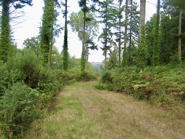
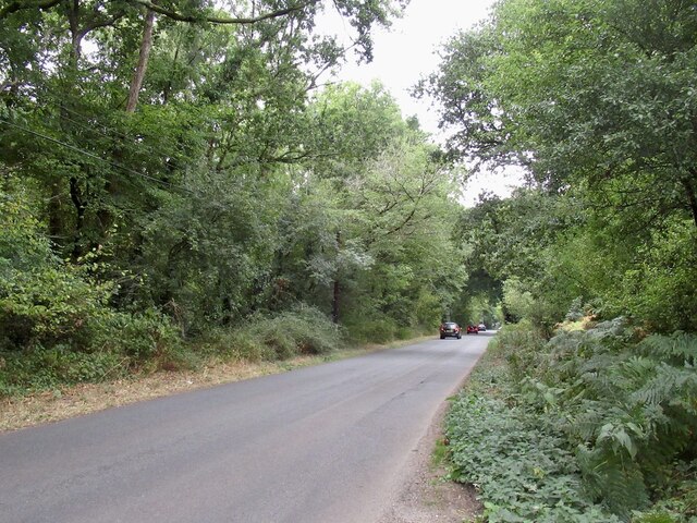
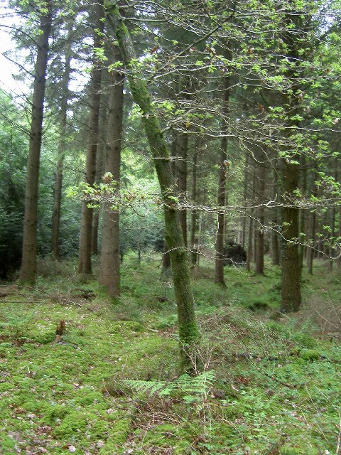
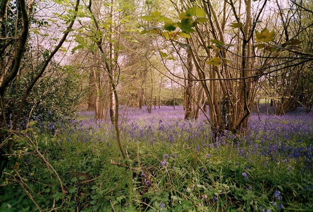
Higher Common is a picturesque region located in the county of Dorset, England. Situated amidst the stunning landscape of the Dorset Downs and Moorland, it offers breathtaking scenery and a tranquil atmosphere. Covering a vast area, Higher Common is renowned for its natural beauty and rich biodiversity.

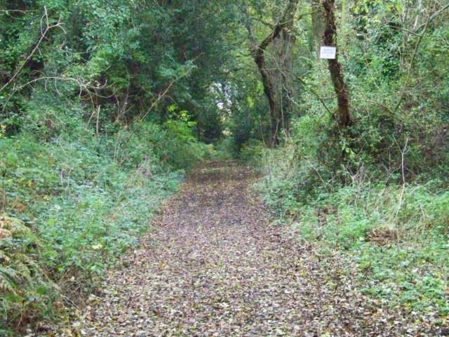
The Dorset Downs, part of the larger South Downs National Park, dominate the northern part of Higher Common. These rolling chalk hills provide a stunning backdrop with their lush greenery and gentle slopes. The area is particularly famous for its abundance of rare chalk grasslands, which support a wide range of plant and animal species. Walkers and hikers are drawn to the Downs, as they offer numerous trails and paths that allow visitors to explore the area's stunning views and unique flora and fauna.

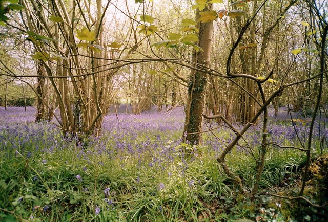
To the south of Higher Common lies the Moorland, characterized by its heathland, open spaces, and peat bogs. This diverse and wild landscape provides a stark contrast to the Downs. Visitors can witness the vibrant purple hues of heather in bloom, listen to the calls of native birds, and observe unique species such as the Dartford warbler, which thrives in this habitat.

Higher Common is a haven for nature enthusiasts, with opportunities for birdwatching, wildlife spotting, and photography. The region also offers various recreational activities, including camping, hiking, and picnicking. Its peaceful and idyllic surroundings make it a popular destination for those seeking a break from the hustle and bustle of city life.

In conclusion, Higher Common in Dorset is a region of outstanding natural beauty, offering visitors a chance to immerse themselves in the stunning landscapes of the Dorset Downs and Moorland. It is a place where one can reconnect with nature and marvel at the diverse ecosystems that thrive in this picturesque corner of England.

If you have any feedback on the listing, please let us know in the comments section below.

Higher Common Images

Images are sourced within 2km of 50.876927/-2.519144 or Grid Reference ST6308. Thanks to Geograph Open Source API. All images are credited.

The Holm Bushes
The Holm Bushes
Road to Leigh, The Holm Bushes
Managed woodland near Seven Ash Common
Bluebells in The Holm Bushes, Bailey Ridge near Leigh
Bluebells in The Holm Bushes, Bailey Ridge, near Leigh
View from Bailey Ridge Bailey Ridge Farm in the foreground with views across to Yetminster
View from Bailey Ridge
Bailey Ridge Farm in the foreground with views across to Yetminster
Farmland below Bailey Ridge Farm Taken from footpath north of the Stake Ford road, north east towards St Antony's School, Leweston
Farmland below Bailey Ridge Farm
Taken from footpath north of the Stake Ford road, north east towards St Antony's School, Leweston
The Holm Bushes, Bailey Ridge The road at the top of Bailey Ridge passes through The Holm Bushes woodland on its way to the A352 Sherborne-Dorchester main road.  The signpost points towards Holnest.  The sunlight has picked out the rather isolated looking postbox but there are a number of houses set back along the righthand side.
The Holm Bushes, Bailey Ridge
The road at the top of Bailey Ridge passes through The Holm Bushes woodland on its way to the A352 Sherborne-Dorchester main road. The signpost points towards Holnest. The sunlight has picked out the rather isolated looking postbox but there are a number of houses set back along the righthand side.
Leigh: postbox № DT9 98, Holm Bushes A little neighbourless postbox, emptied at 9:30 each morning except Sunday.
Leigh: postbox № DT9 98, Holm Bushes
A little neighbourless postbox, emptied at 9:30 each morning except Sunday.
The Holm Bushes The Holm Bushes are the woods that run along the Longburton to Leigh road in this square. The lane on the right goes to Drove Farm.
The Holm Bushes
The Holm Bushes are the woods that run along the Longburton to Leigh road in this square. The lane on the right goes to Drove Farm.
Hedge Cutting at The Holm Bushes. This farmer was trimming hedges on the Longburton to Leigh road close to the junction with the road to Holnest on the A352
Hedge Cutting at The Holm Bushes.
This farmer was trimming hedges on the Longburton to Leigh road close to the junction with the road to Holnest on the A352
Countryside near Leigh This ploughed field had several large trees which the farmer had ploughed round. The field is just north of Bailey Ridge Lane
Countryside near Leigh
This ploughed field had several large trees which the farmer had ploughed round. The field is just north of Bailey Ridge Lane
Ploughed field near Leigh The field had recently been ploughed and due to the dry weather the soil was extremely hard. This is the view east just north of Bailey Ridge Lane.
Ploughed field near Leigh
The field had recently been ploughed and due to the dry weather the soil was extremely hard. This is the view east just north of Bailey Ridge Lane.
Seven Ash Common and Long Plantation This is the view just east of north across Seven Ash Common to Long Plantation which can be seen in the distance. The photographers location was just north of Red House Farm.
Seven Ash Common and Long Plantation
This is the view just east of north across Seven Ash Common to Long Plantation which can be seen in the distance. The photographers location was just north of Red House Farm.
Bridleway, The Holm Bushes The bridleway takes riders and walkers to Holmbushes Farm.
Bridleway, The Holm Bushes
The bridleway takes riders and walkers to Holmbushes Farm.
Leigh: St Andrew's Church
Leigh: rich spring pasture along Bailey Ridge
Leigh: pasture land (with curious cows)
Show me another place!

Higher Common is located at Grid Ref: ST6308 (Lat: 50.876927, Lng: -2.519144)

Unitary Authority: Dorset

Police Authority: Dorset

What 3 Words

///ribcage.moral.assume. Near Yetminster, Dorset

Related Wikis

Leigh, Dorset

Leigh ( ) is a village and civil parish in the county of Dorset in southern England, situated approximately 5 miles (8.0 km) south-southwest of Sherborne...

Hermitage, Dorset

Hermitage is a small village and civil parish in the county of Dorset in southern England. It is situated in the Blackmore Vale under the scarp of the...

Holnest

Holnest is a village and civil parish in the county of Dorset in southern England. It lies in the Blackmore Vale 4 miles (6.4 km) south of Sherborne. It...

Chetnole

Chetnole is a village and civil parish in the county of Dorset in southern England. It lies approximately 6 miles (9.7 km) south-southwest of Sherborne...

Nearby Amenities

Located within 500m of 50.876927,-2.519144
Material: wood
Power: pole
Source: bing
Lat/Long: 50.8752851/-2.5128367
Material: wood
Power: pole
Source: bing
Lat/Long: 50.8757399/-2.5146636
Material: wood
Power: pole
Source: bing
Lat/Long: 50.8762063/-2.5164122
Material: wood
Power: pole
Source: bing
Lat/Long: 50.876793/-2.5187069
Material: wood
Power: pole
Source: bing
Lat/Long: 50.8771941/-2.5202598
Material: wood
Power: pole
Source: bing
Lat/Long: 50.8776549/-2.5220488
Material: wood
Power: pole
Source: bing
Lat/Long: 50.8781084/-2.5237526
Material: wood
Power: pole
Source: bing
Lat/Long: 50.8784566/-2.5251395
The data included in this document is from www.openstreetmap.org. The data is made available under ODbL.

Have you been to Higher Common?

Leave your review of Higher Common below (or comments, questions and feedback).