Little Down

Downs, Moorland in Gloucestershire

England

Little Down

Olveston (Glos) St Mary's church
Olveston (Glos) St Mary's church Credit: ChurchCrawler

Little Down is a picturesque area located in Gloucestershire, England, known for its stunning downs and moorland landscapes. Situated in the heart of the Cotswolds, this idyllic countryside offers visitors a tranquil and scenic experience.

Covering an area of approximately 50 square miles, Little Down is characterized by rolling hills and open grasslands, commonly referred to as downs. These downs provide sweeping panoramic views of the surrounding countryside and are perfect for hiking, walking, and picnicking.

The moorland in Little Down is a unique feature of the area. It consists of vast expanses of open, wild spaces covered in heather and gorse. This moorland is home to a wide variety of wildlife, including birds, deer, and other small mammals. Nature enthusiasts will find great joy in exploring the moorland and observing the native flora and fauna in their natural habitat.

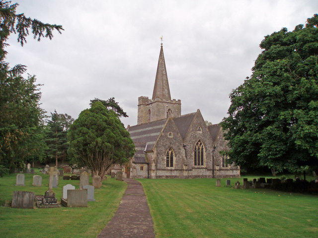
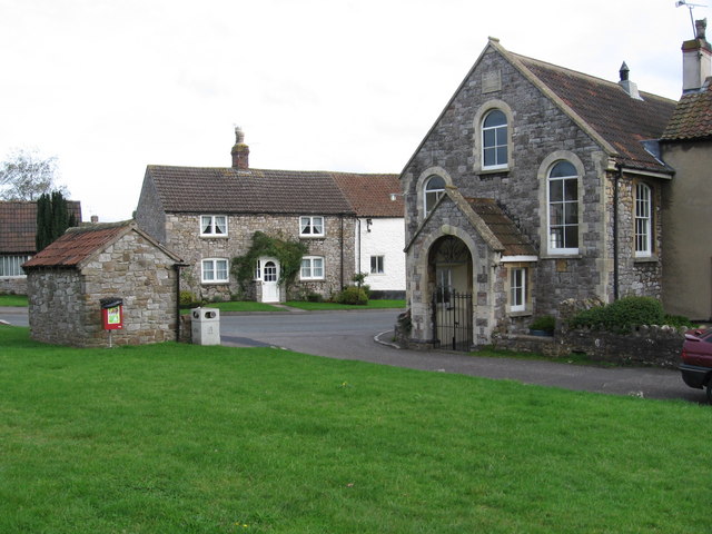
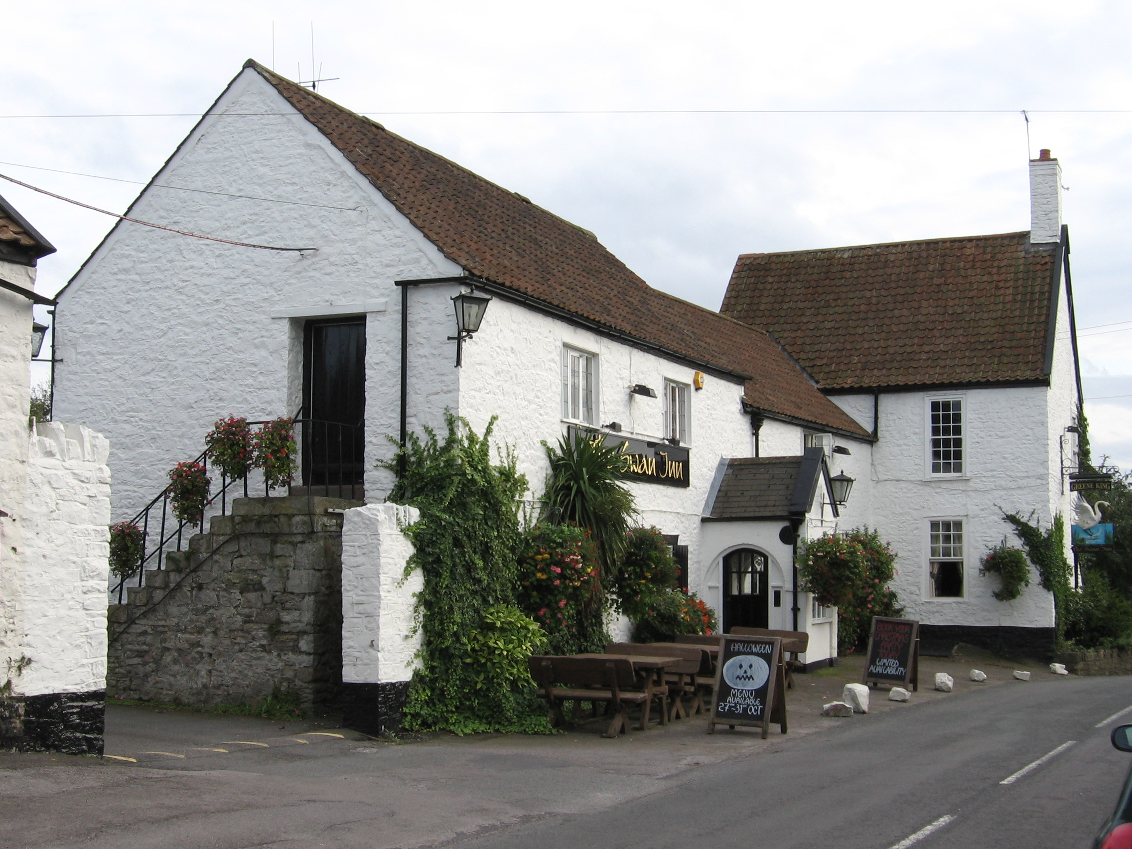
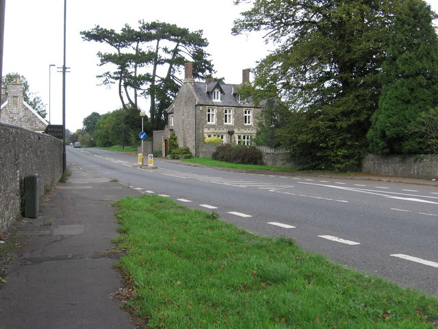
Little Down offers a peaceful retreat from the bustling city life, with its charming villages and quaint cottages dotting the landscape. Visitors can immerse themselves in the local culture and history by visiting the historic churches, traditional pubs, and small market towns scattered throughout the area.

The region also boasts several well-marked trails, such as the Cotswold Way and the Gloucestershire Way, which provide opportunities for long walks and hikes, allowing visitors to fully appreciate the natural beauty that Little Down has to offer.

Overall, Little Down, Gloucestershire, is a haven for nature lovers and those seeking a peaceful escape in the heart of the English countryside. Its downs, moorland, and charming villages make it a truly enchanting destination.

If you have any feedback on the listing, please let us know in the comments section below.

Little Down Images

Images are sourced within 2km of 51.582/-2.5649549 or Grid Reference ST6087. Thanks to Geograph Open Source API. All images are credited.

Olveston (Glos) St Mary's church
Recently harvested field Photograph taken from Woodhouse Park Scout Camp Site.
Recently harvested field
Photograph taken from Woodhouse Park Scout Camp Site.
Elberton church St John's church, Elberton.
Elberton church
St John's church, Elberton.
Going under the M4 More a tunnel through an embankment than a bridge.
Going under the M4
More a tunnel through an embankment than a bridge.
Livestock
Livestock
Tockington Methodist Meeting Rooms
The Swan Inn, Tockington
The road to Almondsbury in Tockington On the left is a bridge carrying the driveway of a private house over the Tockington Mill Rhine.
The road to Almondsbury in Tockington
On the left is a bridge carrying the driveway of a private house over the Tockington Mill Rhine.
Tockington Manor School This is marked on the 1940s map as 'Manor' It has a ha-ha in front.
Tockington Manor School
This is marked on the 1940s map as 'Manor' It has a ha-ha in front.
Pavilion on Tockington Manor School playing fields
A38 heading towards Rudgeway
Garden needs attention Presumably uninhabited house. The right of way runs along the far side of it.
Garden needs attention
Presumably uninhabited house. The right of way runs along the far side of it.
Looking east along the right of way The derelict byre looks like part of a lorry that was recycled.
Looking east along the right of way
The derelict byre looks like part of a lorry that was recycled.
Beechcroft. The Green, Olveston
Post Office, New Road, Olveston
Old School House, Elberton Road, Olveston
Elberton Court With entrance guarded by ceremonial wheelie bins.
Elberton Court
With entrance guarded by ceremonial wheelie bins.
Ploughed field, at Gate Farm
Show me another place!

Little Down is located at Grid Ref: ST6087 (Lat: 51.582, Lng: -2.5649549)

Unitary Authority: South Gloucestershire

Police Authority: Avon and Somerset

What 3 Words

///qualify.essay.boomers. Near Olveston, Gloucestershire

Nearby Locations

Little Down Olveston

Related Wikis

Tockington

Tockington is a village in South Gloucestershire, England. Historically the village developed around farming based mainly on the rearing of cattle on the...

Old Down

Old Down is a hamlet in South Gloucestershire, near the larger villages of Olveston and Tockington and a mile west of Alveston. A tourist attraction called...

Olveston

Olveston is a small village and larger parish in South Gloucestershire, England. The parish comprises the villages of Olveston and Tockington, and the...

Rudgeway

Rudgeway is a village in South Gloucestershire in south west England, located between Alveston and Almondsbury on the A38 trunk road. It lies west of Earthcott...

Nearby Amenities

Located within 500m of 51.582,-2.5649549
Post Box
Collection Times: Mo-Fr 16:30; Sa 11:00
Operator: Royal Mail
Post Box Type: wall
Postal Code: BS32
Ref: BS32 248
Royal Cypher: EVIIR
Royal Cypher Wikidata: Q33102324
Lat/Long: 51.5832226/-2.5621016
Access: designated
Barrier: stile
Foot: designated
Material: stone
Stile: stepover
Lat/Long: 51.5776776/-2.5664658
Bus Stop
Haw Lane
Naptan AtcoCode: 0170SGB20651
Naptan Bearing: E
Naptan CommonName: Haw Lane
Naptan Crossing: Orchard Rise
Naptan NaptanCode: sglamdp
Naptan Street: Haw Lane
Naptan Verified: no
Source: naptan_import
Lat/Long: 51.5808927/-2.5717884
Bus Stop
Old Down Crossroads
Naptan AtcoCode: 0170SGB20659
Naptan Bearing: W
Naptan CommonName: Old Down Crossroads
Naptan Crossing: Foxholes Lane
Naptan NaptanCode: sglapmd
Naptan Street: Alveston Road
Naptan Verified: no
Shelter: no
Source: naptan_import
Lat/Long: 51.5831548/-2.5614106
Bus Stop
Old Down Crossroads
Naptan AtcoCode: 0170SGB20660
Naptan Bearing: E
Naptan CommonName: Old Down Crossroads
Naptan Crossing: Foxholes Lane
Naptan NaptanCode: sglapmg
Naptan Street: Alveston Road
Naptan Verified: no
Shelter: no
Source: naptan_import
Lat/Long: 51.5832534/-2.5612937
Ele: 79.193726
Lat/Long: 51.5822747/-2.560333
Bench
Backrest: yes
Lat/Long: 51.5830427/-2.5623229
Barrier: kissing_gate
Bicycle: yes
Foot: yes
Lat/Long: 51.5826022/-2.5600871
Defibrillator
Emergency: defibrillator
Lat/Long: 51.582483/-2.560609
Waste Basket
Lat/Long: 51.5825831/-2.5601675
Information: map
Tourism: information
Lat/Long: 51.5826006/-2.560152
Barrier: block
Bicycle: yes
Foot: yes
Lat/Long: 51.5834431/-2.5589552
Barrier: stile
Bicycle: no
Foot: yes
Horse: no
Motor Vehicle: no
Lat/Long: 51.5789624/-2.569498
Turning Loop
Lat/Long: 51.5832549/-2.5582901
Barrier: kissing_gate
Lat/Long: 51.5789796/-2.5641315
Power: pole
Lat/Long: 51.5803105/-2.5644783
Power: pole
Lat/Long: 51.5806123/-2.5643429
Power: pole
Lat/Long: 51.580917/-2.5638432
Power: pole
Lat/Long: 51.5812262/-2.5633535
Power: pole
Lat/Long: 51.581512/-2.5630878
Power: pole
Lat/Long: 51.5818063/-2.5629566
Power: pole
Lat/Long: 51.5821486/-2.5628204
Little Down
Place: locality
Lat/Long: 51.5819009/-2.5647653
Tockington Hill
Place: locality
Lat/Long: 51.5810031/-2.5612907
Street Lamp
Lat/Long: 51.5811019/-2.5720483
Waste Basket
Waste: dog_excrement
Lat/Long: 51.5810436/-2.5718988
Street Lamp
Lat/Long: 51.5808537/-2.5718743
Power: pole
Lat/Long: 51.580787/-2.5714937
Power: pole
Lat/Long: 51.5808668/-2.5712007
Power: pole
Lat/Long: 51.5810366/-2.5705702
Power: pole
Lat/Long: 51.5812759/-2.5698929
Power: pole
Lat/Long: 51.5815084/-2.5692558
Power: pole
Lat/Long: 51.585545/-2.5616903
Power: pole
Lat/Long: 51.5850183/-2.5617025
Communication Mobile Phone: yes
Man Made: mast
Tower Type: communication
Lat/Long: 51.5813083/-2.5657273
Power: pole
Lat/Long: 51.5825833/-2.5675235
Power: pole
Lat/Long: 51.5830244/-2.5669444
Power: pole
Lat/Long: 51.5833799/-2.5664937
Power: pole
Lat/Long: 51.5838355/-2.5659077
Power: pole
Lat/Long: 51.5843665/-2.5652282
Power: pole
Lat/Long: 51.5849585/-2.5644648
Power: pole
Lat/Long: 51.5821633/-2.5680472
Direction: 200
Generator Method: photovoltaic
Generator Output Electricity: yes
Generator Solar Modules: 3
Generator Source: solar
Generator Type: solar_photovoltaic_panel
Location: roof
Power: generator
Lat/Long: 51.58136/-2.5626778
Direction: 200
Generator Method: photovoltaic
Generator Output Electricity: yes
Generator Solar Modules: 3
Generator Source: solar
Generator Type: solar_photovoltaic_panel
Location: roof
Power: generator
Lat/Long: 51.5813455/-2.5626883
The data included in this document is from www.openstreetmap.org. The data is made available under ODbL.

Have you been to Little Down?

Leave your review of Little Down below (or comments, questions and feedback).