Langden Head Rush Beds

Downs, Moorland in Yorkshire Ribble Valley

England

Langden Head Rush Beds

Moorland between Greave Clough Head and the Upper Calder Tramping over virgin moor from the boundary fence near Greave Clough Head and the upper reaches of the Calder - an experience I care not to repeat
Moorland between Greave Clough Head and the Upper Calder Credit: Chris Heaton

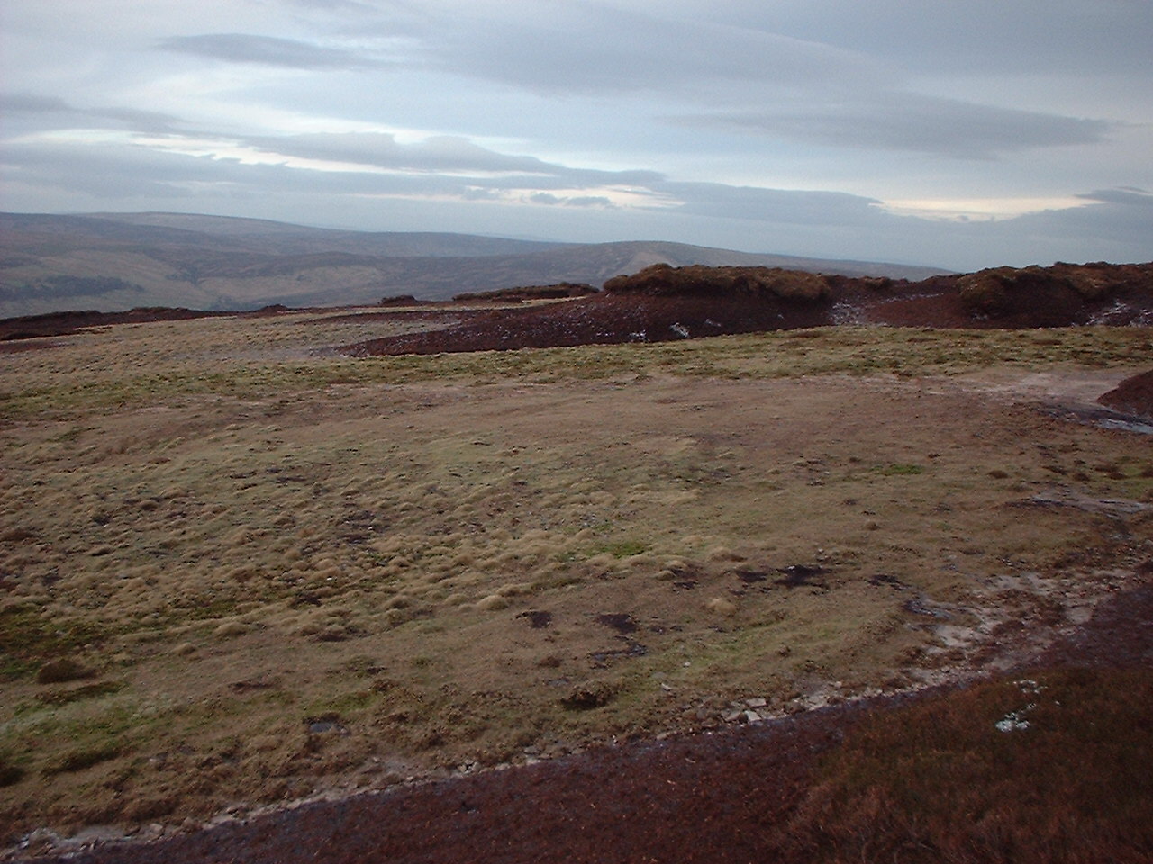
Langden Head Rush Beds is a unique natural area located in Yorkshire, England. Situated amidst the picturesque landscape of the Yorkshire Downs and Moorland, this site offers a captivating and diverse environment for visitors to explore.

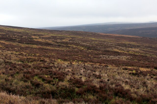
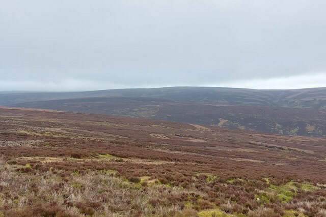
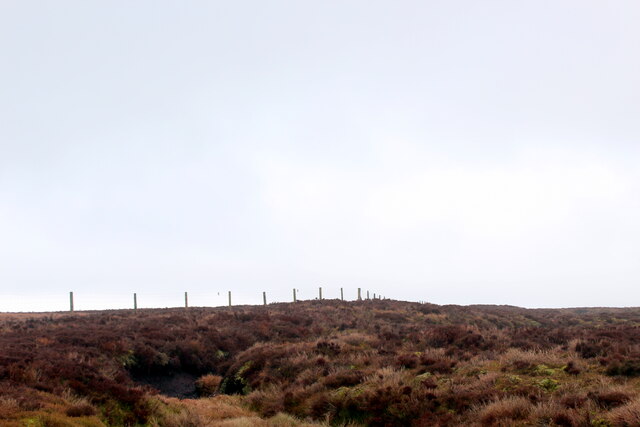
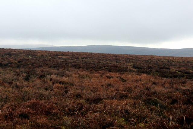
Covering a vast expanse of land, Langden Head Rush Beds is home to a rich variety of plant and animal species, making it an ideal destination for nature enthusiasts. The rush beds themselves are a prominent feature, consisting of dense clusters of grass-like rushes that thrive in the wetland conditions of the area. These beds provide a habitat for numerous bird species, including reed buntings, snipes, and lapwings, which can often be spotted darting and soaring above the marshy terrain.

Apart from the rush beds, the Yorkshire Downs and Moorland surrounding Langden Head offer breathtaking panoramic views and a tranquil atmosphere. Visitors can enjoy leisurely walks or hikes along the extensive network of trails, taking in the stunning vistas and immersing themselves in the natural beauty of the countryside. The area is also popular among birdwatchers and photographers, who flock to capture the beauty of the diverse birdlife and capture the essence of the landscape through their lenses.

Langden Head Rush Beds, Yorkshire, truly offers a unique and captivating natural experience. Whether it's the rush beds, the wildlife, or the striking views, this area provides a memorable and enchanting escape from the hustle and bustle of everyday life.

If you have any feedback on the listing, please let us know in the comments section below.

Langden Head Rush Beds Images

Images are sourced within 2km of 53.954214/-2.6315261 or Grid Reference SD5851. Thanks to Geograph Open Source API. All images are credited.

Moorland between Greave Clough Head and the Upper Calder Tramping over virgin moor from the boundary fence near Greave Clough Head and the upper reaches of the Calder - an experience I care not to repeat
Moorland between Greave Clough Head and the Upper Calder
Tramping over virgin moor from the boundary fence near Greave Clough Head and the upper reaches of the Calder - an experience I care not to repeat
Looking over the headwater catchment area of the River Calder The south-west corner of the 'Forest of Bowland'
Looking over the headwater catchment area of the River Calder
The south-west corner of the 'Forest of Bowland'
Boundary Fence West of Greave Clough Head Deep furrows of exposed peat, straggly heather, tussocks and ancillary vegetation makes progress difficult and tiresome
Boundary Fence West of Greave Clough Head
Deep furrows of exposed peat, straggly heather, tussocks and ancillary vegetation makes progress difficult and tiresome
Gradual ascent of Greave Clough Head from the West
On the Fellside below Greave Head Clough
Peat bank on White Moss Starting our boggy descent among the catchment headwaters of the River Calder
Peat bank on White Moss
Starting our boggy descent among the catchment headwaters of the River Calder
Head of Catshaw Greave
On top of White Moss Not quite the 464m spot height but near enough.
On top of White Moss
Not quite the 464m spot height but near enough.
Hawthornthwaite Fell moorland Lower level moorland.
Hawthornthwaite Fell moorland
Lower level moorland.
Shooting Track approaching Well Brook Clough The track approaching a small ford to cross Well Brook at the foot of Hawthornthwaite Fell
Shooting Track approaching Well Brook Clough
The track approaching a small ford to cross Well Brook at the foot of Hawthornthwaite Fell
Shooting Track along the Foot of Hawthornthwaite Fell
Shooting Track on the Flanks of Hawthornthwaite Fell Parts of this shooting track has an extremely steep gradient - so steep that even a Land Rover may struggle to ascend.
Splendid views over to Morecambe Bay can be admired from here.
Shooting Track on the Flanks of Hawthornthwaite Fell
Parts of this shooting track has an extremely steep gradient - so steep that even a Land Rover may struggle to ascend. Splendid views over to Morecambe Bay can be admired from here.
Shelter on the Flanks of Hawthornthwaite Fell The shooting track terminates at this rudimentary shelter.
Those walking towards the summit of Hawthornthwaite Fell need to negotiate virgin moorland of mixed vegetation including heather, tussocks, bog plants and peat country.
Shelter on the Flanks of Hawthornthwaite Fell
The shooting track terminates at this rudimentary shelter. Those walking towards the summit of Hawthornthwaite Fell need to negotiate virgin moorland of mixed vegetation including heather, tussocks, bog plants and peat country.
Peat Formations on Langden Head Peat groughs and haggs on the broad ridge east of Hawthornthwaite Fell Top
Peat Formations on Langden Head
Peat groughs and haggs on the broad ridge east of Hawthornthwaite Fell Top
More Peat Formations on Langden Head A peat landscape on the broad ridge east of Hawthornthwaite Fell Top
More Peat Formations on Langden Head
A peat landscape on the broad ridge east of Hawthornthwaite Fell Top
Boundary Fence on Langden Head Heading west towards Hawthornthwaite Fell Top
Boundary Fence on Langden Head
Heading west towards Hawthornthwaite Fell Top
Trig Point on Hawthornthwaite Fell Top This is the first triangulation pillar I have visited that has adopted a horizontal position rather than the standard vertical.
The foundation is at least 3 times longer than the concrete column itself, yet that was not enough to save it from the weathering and erosion of the peat base.
<a href="https://www.geograph.org.uk/photo/6565184">SD5751 : Collapsed Trig Column on Hawthornthwaite Fell Top</a>
<a href="https://www.geograph.org.uk/photo/1828347">SD5751 : Trig Pillar, Hawthornthwaite Fell Top</a>
Trig Point on Hawthornthwaite Fell Top
This is the first triangulation pillar I have visited that has adopted a horizontal position rather than the standard vertical. The foundation is at least 3 times longer than the concrete column itself, yet that was not enough to save it from the weathering and erosion of the peat base. SD5751 : Collapsed Trig Column on Hawthornthwaite Fell Top SD5751 : Trig Pillar, Hawthornthwaite Fell Top
Collapsed Trig Column on Hawthornthwaite Fell Top Severe erosion of the peat around the pillar's foundation has caused this trig point to adopt a horizontal attitude - rather than the vertical.
<a href="https://www.geograph.org.uk/photo/1828347">SD5751 : Trig Pillar, Hawthornthwaite Fell Top</a>
<a href="https://www.geograph.org.uk/photo/6564232">SD5751 : Trig Point on Hawthornthwaite Fell Top</a>
Collapsed Trig Column on Hawthornthwaite Fell Top
Severe erosion of the peat around the pillar's foundation has caused this trig point to adopt a horizontal attitude - rather than the vertical. SD5751 : Trig Pillar, Hawthornthwaite Fell Top SD5751 : Trig Point on Hawthornthwaite Fell Top
Show me another place!

Langden Head Rush Beds is located at Grid Ref: SD5851 (Lat: 53.954214, Lng: -2.6315261)

Division: West Riding

Administrative County: Lancashire

District: Ribble Valley

Police Authority: Lancashire

What 3 Words

///exit.flippers.shakes. Near Bay Horse, Lancashire

Related Wikis

Hawthornthwaite Fell

Hawthornthwaite Fell is one of the larger hills in the Forest of Bowland in the north west of England. Hawthornthwaite Fell marks the extreme western limit...

National nature reserves in Lancashire

National nature reserves in Lancashire in England are established by Natural England. There are two national nature reserves in Lancashire, both of which...

Forest of Bowland

The Forest of Bowland, also known as the Bowland Fells and formerly the Chase of Bowland, is an area of gritstone fells, deep valleys and peat moorland...

Abbeystead House

Abbeystead House is a large country house to the east of the village of Abbeystead, Lancashire, England, some 12 km (7 miles) south-east of Lancaster....

William Molyneux, 4th Earl of Sefton

William Philip Molyneux, 4th Earl of Sefton, (14 October 1835 – 27 June 1897) was a British peer. == Biography == Born Viscount Molyneux, he was the eldest...

Abbeystead

Abbeystead is a small hamlet located in the Forest of Bowland Area of Outstanding Natural Beauty, in Lancashire, England. Abbeystead lies close to the...

Over Wyresdale

Over Wyresdale is a civil parish and a parish of the Church of England in the City of Lancaster in the English county of Lancashire. It has a population...

Grey Stone of Trough

The Grey Stone of Trough is an historic boundary marker in Bowland Forest High, in the Trough of Bowland, Lancashire, England. A Grade II listed structure...

Nearby Amenities

Located within 500m of 53.954214,-2.6315261
Barrier: kissing_gate
Lat/Long: 53.9569472/-2.6276462
Barrier: kissing_gate
Lat/Long: 53.9576274/-2.6298021
Barrier: kissing_gate
Lat/Long: 53.9576144/-2.6298366
The data included in this document is from www.openstreetmap.org. The data is made available under ODbL.

Have you been to Langden Head Rush Beds?

Leave your review of Langden Head Rush Beds below (or comments, questions and feedback).