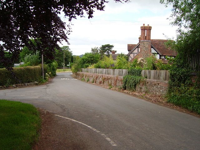
The Park
Downs, Moorland in Shropshire
England
The Park

The Park, located in the county of Shropshire, England, is a vast area of natural beauty renowned for its stunning downs and moorland. Spanning over hundreds of acres, this picturesque landscape is a haven for outdoor enthusiasts, nature lovers, and those seeking tranquility.
The Park boasts a diverse range of flora and fauna, with its downs characterized by rolling hills covered in lush grasses and wildflowers. These open spaces provide a perfect backdrop for leisurely walks, picnics, and recreational activities. The moorland, on the other hand, offers a more rugged and untamed experience, with its heather-clad hills and rocky outcrops. The dramatic scenery of the moors attracts hikers, birdwatchers, and photographers alike.
Throughout the year, The Park hosts a myriad of events and festivals, celebrating the rich cultural heritage of the region. Visitors can immerse themselves in traditional music, arts and crafts, and local delicacies at these gatherings. Additionally, the park offers various amenities such as well-maintained trails, picnic areas, and visitor centers, ensuring a comfortable and enjoyable experience for all.
Wildlife enthusiasts will be delighted to encounter a range of species that call The Park their home. From birds like peregrine falcons and red grouse to mammals like hares and deer, there are plenty of opportunities to observe and appreciate the local fauna. The Park also supports conservation efforts, with initiatives in place to protect endangered species and preserve the natural landscape.
In conclusion, The Park in Shropshire is an idyllic destination that showcases the beauty of downs and moorland. With its breathtaking scenery, abundant wildlife, and a range of recreational activities, it offers an unforgettable experience for visitors of all ages and interests.
If you have any feedback on the listing, please let us know in the comments section below.
The Park Images
Images are sourced within 2km of 52.387215/-2.6090803 or Grid Reference SO5876. Thanks to Geograph Open Source API. All images are credited.


The Park is located at Grid Ref: SO5876 (Lat: 52.387215, Lng: -2.6090803)
Unitary Authority: Shropshire
Police Authority: West Mercia
What 3 Words
///broker.lengthen.fields. Near Ludlow, Shropshire
Related Wikis

Bedlam, Shropshire
Bedlam (also known as Titterstone Village) is a small hamlet in south Shropshire, England.It is located east of Bitterley and north of Cleehill, situated...
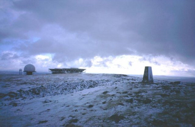
Titterstone Clee Hill
Titterstone Clee Hill, sometimes referred to as Titterstone Clee or Clee Hill, is a prominent hill in the rural English county of Shropshire, rising at...
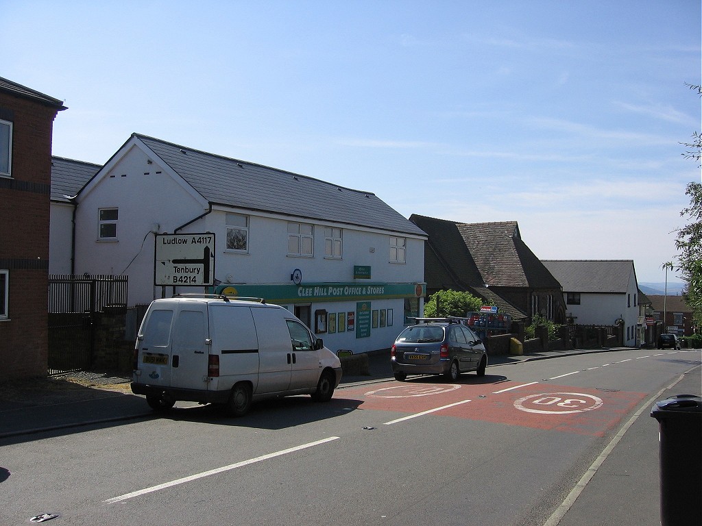
Cleehill
Cleehill is a village in south Shropshire, England. It is sometimes written as Clee Hill Village (including the road sign entering the village) to avoid...
Angelbank
Angelbank (or Angel Bank) is a small settlement in south Shropshire, England. It is located on the A4117 road, between Ludlow and Cleehill; the road goes...
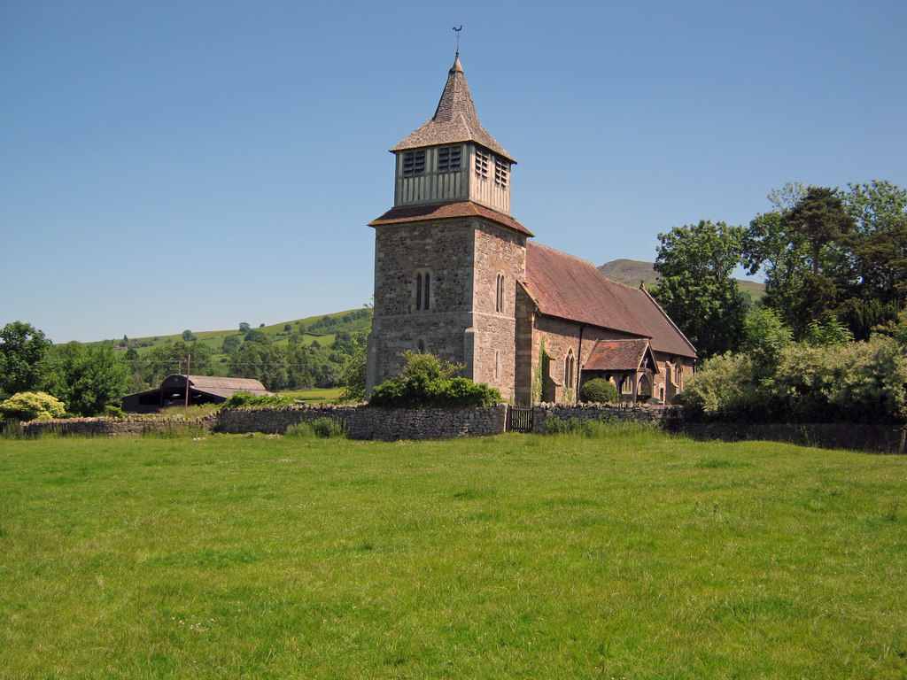
Church of St Mary, Bitterley
The Church of St Mary is located in Bitterley, Shropshire, England. Built in the 12th century and later, it is a Grade II* listed building. == History... ==

Knowbury
Knowbury is a small village near Ludlow in Shropshire, England. It is located in the civil parish of Caynham. It is near to Clee Hill Village and had a...
Bitterley
Bitterley is a village and civil parish in Shropshire, England. According to the 2001 census the parish had a population of 802, increasing to 902 at...
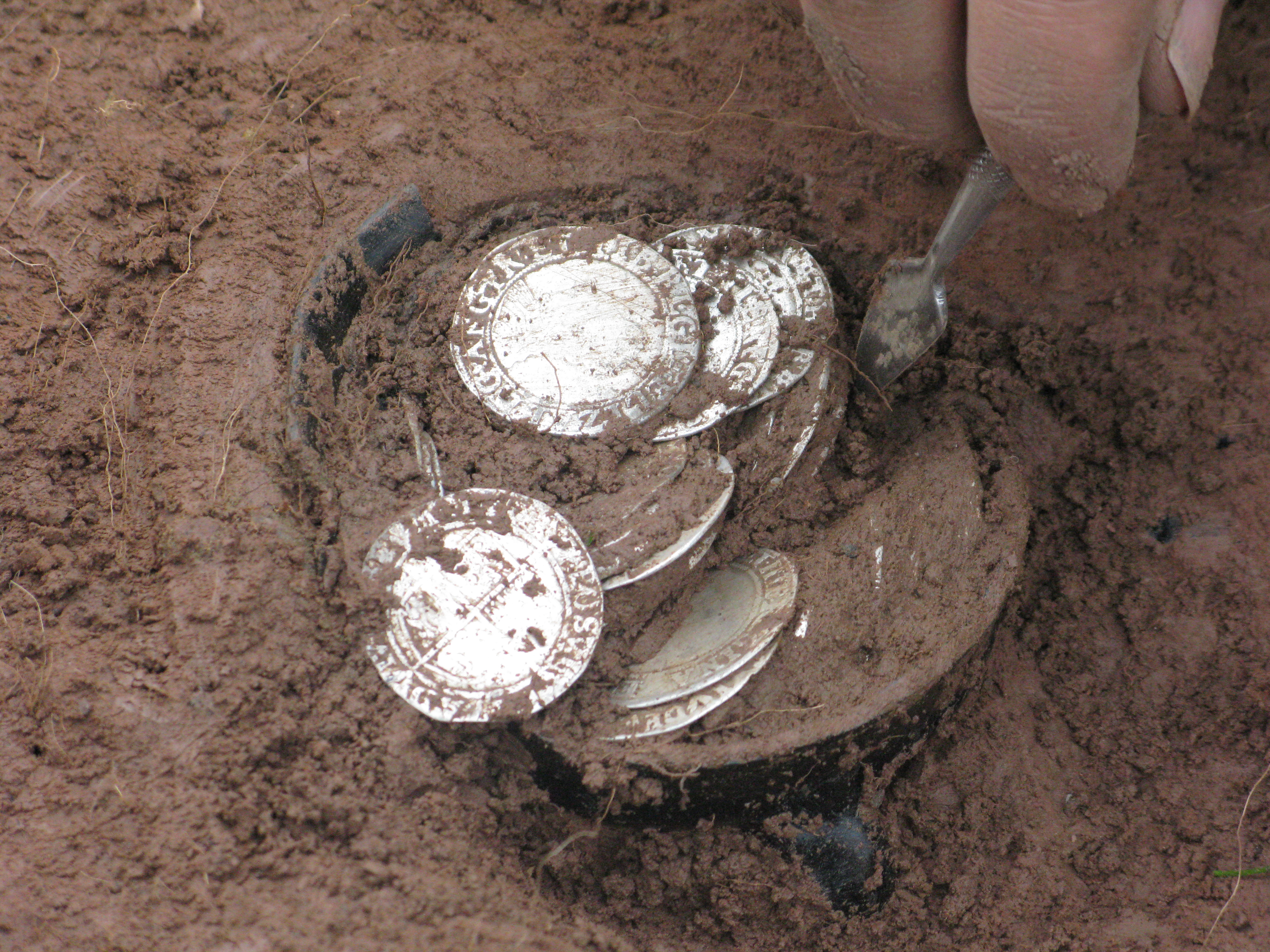
Bitterley Hoard
The Bitterley Hoard is the largest post medieval / English Civil War Coin Hoard found to date from Shropshire, England. It was discovered on 17 February...
Nearby Amenities
Located within 500m of 52.387215,-2.6090803Have you been to The Park?
Leave your review of The Park below (or comments, questions and feedback).