Hammond's Green

Settlement in Hampshire New Forest

England

Hammond's Green

Morrisons Supermarket This large branch of Morrisons is on the western edge of Totton close to the bypass.
Morrisons Supermarket Credit: Nigel Mykura

Hammond's Green is a charming village located in the county of Hampshire, England. Situated approximately 5 miles northeast of the bustling town of Basingstoke, this peaceful rural area offers a serene escape from city life. Surrounded by picturesque countryside, Hammond's Green is a haven for nature lovers and outdoor enthusiasts.

The village itself is characterized by a collection of traditional thatched cottages and historic buildings, giving it a quintessential English charm. The local community is tight-knit, with a population of around 500 residents who take pride in maintaining the village's beauty and preserving its heritage.

Hammond's Green benefits from its proximity to the North Wessex Downs Area of Outstanding Natural Beauty, providing residents and visitors with ample opportunities to explore the stunning landscapes and walking trails. The nearby Watership Down, made famous by Richard Adams' novel, offers panoramic views and is a popular destination for hikers and nature enthusiasts.

In terms of amenities, Hammond's Green boasts a village hall, a quaint local pub, and a small community shop that caters to the daily needs of the residents. For more extensive shopping and entertainment options, the town of Basingstoke is easily accessible.

Overall, Hammond's Green provides a peaceful and idyllic setting for those seeking a slower pace of life, while still offering convenient access to nearby towns and attractions. Whether it's enjoying the tranquility of the countryside or immersing oneself in the rich history of the area, Hammond's Green is a truly enchanting place to call home.

If you have any feedback on the listing, please let us know in the comments section below.

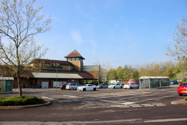
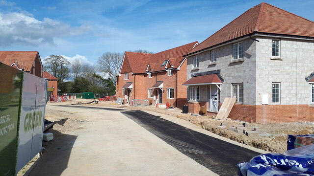
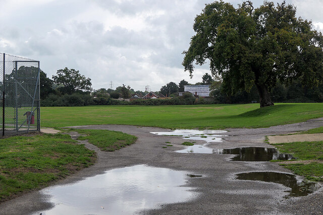
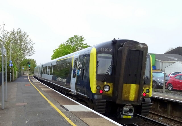
Hammond's Green Images

Images are sourced within 2km of 50.924179/-1.508394 or Grid Reference SU3413. Thanks to Geograph Open Source API. All images are credited.

Morrisons Supermarket This large branch of Morrisons is on the western edge of Totton close to the bypass.
Morrisons Supermarket
This large branch of Morrisons is on the western edge of Totton close to the bypass.
New housing development, Loperwood Lane
Totton recreation ground The site of the Annual Totton Fair, which has been operating since the end of the 2nd World War, apart from during the covid hiatus.
Totton recreation ground
The site of the Annual Totton Fair, which has been operating since the end of the 2nd World War, apart from during the covid hiatus.
Totton bypass Viewed from the Rushington roundabout bus stop.
Totton bypass
Viewed from the Rushington roundabout bus stop.
Totton Railway Station South Western Railway Class 444, No. 444012.
Totton Railway Station
South Western Railway Class 444, No. 444012.
Totton Railway Station
Footbridge, Totton Railway Station
The Station House
The Station House
Totton By-pass (A35) The A35 is a major (and regularly congested) route along England's south coast. It runs for 97 miles, connecting Honiton in Devon with Southampton in Hampshire, via Poole and Bournemouth, with much of its route passing through Dorset and the New Forest. It is a trunk road for some of its length.
<span class="nowrap"><a title="http://www.sabre-roads.org.uk/wiki/index.php?title=A35" rel="nofollow ugc noopener" href="http://www.sabre-roads.org.uk/wiki/index.php?title=A35">Link</a><img style="margin-left:2px;" alt="External link" title="External link - shift click to open in new window" src="https://s1.geograph.org.uk/img/external.png" width="10" height="10"/></span>  SABRE
Totton By-pass (A35)
The A35 is a major (and regularly congested) route along England's south coast. It runs for 97 miles, connecting Honiton in Devon with Southampton in Hampshire, via Poole and Bournemouth, with much of its route passing through Dorset and the New Forest. It is a trunk road for some of its length. LinkExternal link SABRE
Office block, Totton
Totton By-pass (A35) The A35 is a major (and regularly congested) route along England's south coast. It runs for 97 miles, connecting Honiton in Devon with Southampton in Hampshire, via Poole and Bournemouth, with much of its route passing through Dorset and the New Forest. It is a trunk road for some of its length.
<span class="nowrap"><a title="http://www.sabre-roads.org.uk/wiki/index.php?title=A35" rel="nofollow ugc noopener" href="http://www.sabre-roads.org.uk/wiki/index.php?title=A35">Link</a><img style="margin-left:2px;" alt="External link" title="External link - shift click to open in new window" src="https://s1.geograph.org.uk/img/external.png" width="10" height="10"/></span>  SABRE
Totton By-pass (A35)
The A35 is a major (and regularly congested) route along England's south coast. It runs for 97 miles, connecting Honiton in Devon with Southampton in Hampshire, via Poole and Bournemouth, with much of its route passing through Dorset and the New Forest. It is a trunk road for some of its length. LinkExternal link SABRE
Houses on Bartram Road
Footbridge over Totton By-pass (A35) The A35 is a major (and regularly congested) route along England's south coast. It runs for 97 miles, connecting Honiton in Devon with Southampton in Hampshire, via Poole and Bournemouth, with much of its route passing through Dorset and the New Forest. It is a trunk road for some of its length.
<span class="nowrap"><a title="http://www.sabre-roads.org.uk/wiki/index.php?title=A35" rel="nofollow ugc noopener" href="http://www.sabre-roads.org.uk/wiki/index.php?title=A35">Link</a><img style="margin-left:2px;" alt="External link" title="External link - shift click to open in new window" src="https://s1.geograph.org.uk/img/external.png" width="10" height="10"/></span>  SABRE
Footbridge over Totton By-pass (A35)
The A35 is a major (and regularly congested) route along England's south coast. It runs for 97 miles, connecting Honiton in Devon with Southampton in Hampshire, via Poole and Bournemouth, with much of its route passing through Dorset and the New Forest. It is a trunk road for some of its length. LinkExternal link SABRE
A35 Totton Bypass Heading west.
A35 Totton Bypass
Heading west.
A326 northwards towards M27
A326 northwards towards M27 Approaching the roundabout crossing of the A336.
A326 northwards towards M27
Approaching the roundabout crossing of the A336.
A326 northwards towards M27
Show me another place!

Hammond's Green is located at Grid Ref: SU3413 (Lat: 50.924179, Lng: -1.508394)

Administrative County: Hampshire

District: New Forest

Police Authority: Hampshire

What 3 Words

///steady.bicker.avocado. Near Totton, Hampshire

Nearby Locations

Hammond's Green

Related Wikis

Totton College

Totton College is a further education college located in Totton, Hampshire, providing courses for mainly 16- to 19-year-olds as well as adult education...

A.F.C. Totton

Amalgamated Football Club Totton is a football club based in Totton, Hampshire, England. The club is affiliated to the Hampshire Football Association and...

Totton & Eling F.C.

Totton & Eling Football Club are a football club based in Totton & Eling, Hampshire, England. The club is affiliated to the Hampshire Football Association...

River Blackwater (River Test)

This River Blackwater drains small parts of the English counties of Hampshire and Wiltshire. It is a tributary of the River Test. == Course == It rises...

Nearby Amenities

Located within 500m of 50.924179,-1.508394
Turning Circle
Lat/Long: 50.922158/-1.5036852
Morrisons Daily
Addr Country: GB
Addr Housenumber: 182
Addr Postcode: SO40 3GX
Addr Street: Water Lane
Brand: Morrisons Daily
Brand Wikidata: Q99752411
Fhrs Id: 547538
Operator: McColl's
Operator Wikidata: Q16997477
Shop: convenience
Website: https://my.morrisons.com/storefinder/61177/morrisons-daily-totton-182-water-lane
Lat/Long: 50.9213595/-1.5043526
Turning Circle
Lat/Long: 50.9210638/-1.5122942
Bus Stop
Totton College
Bus: yes
Naptan AtcoCode: 1900HA080043
Naptan Bearing: SW
Naptan CommonName: Totton College
Naptan Crossing: Boniface Close
Naptan NaptanCode: hamampgm
Naptan Street: Water Lane
Naptan Verified: no
Public Transport: platform
Source: naptan_import
Lat/Long: 50.9203913/-1.507736
Bus Stop
Totton College
Bus: yes
Naptan AtcoCode: 1900HA080044
Naptan Bearing: NE
Naptan CommonName: Totton College
Naptan Crossing: Calmore Road
Naptan NaptanCode: hamampdt
Naptan Street: Water Lane
Naptan Verified: no
Public Transport: platform
Source: naptan_import
Lat/Long: 50.9203295/-1.508007
Bus Stop
Calmore Service Station
Bus: yes
Naptan AtcoCode: 1900HA080045
Naptan Bearing: NW
Naptan CommonName: Calmore Service Station
Naptan Crossing: Michigan Way
Naptan NaptanCode: hamamjaj
Naptan Street: Calmore Road
Naptan Verified: no
Public Transport: platform
Source: naptan_import
Lat/Long: 50.9227023/-1.5141425
Bus Stop
Calmore Service Station
Bus: yes
Naptan AtcoCode: 1900HA080046
Naptan Bearing: SE
Naptan CommonName: Calmore Service Station
Naptan Crossing: Michigan Way
Naptan NaptanCode: hamamgwp
Naptan Street: Calmore Road
Naptan Verified: no
Public Transport: platform
Source: naptan_import
Lat/Long: 50.9228831/-1.5143825
Bus Stop
Bearslane Close
Bus: yes
Naptan AtcoCode: 1900HA080057
Naptan Bearing: SE
Naptan CommonName: Bearslane Close
Naptan Crossing: Blackwater Drive
Naptan NaptanCode: hamampam
Naptan Notes: R2 = fix bearing
Naptan Street: Bearslane Close
Naptan Verified: no
Public Transport: platform
Source: naptan_import
Lat/Long: 50.9280528/-1.5090877
Bus Stop
Mortimer Close
Bus: yes
Naptan AtcoCode: 1900HA080058
Naptan Bearing: S
Naptan CommonName: Mortimer Close
Naptan Crossing: Opp Mortimer Close
Naptan NaptanCode: hamampmd
Naptan Street: Blackwater Drive
Naptan Verified: no
Public Transport: platform
Source: naptan_import
Lat/Long: 50.9255556/-1.5061875
Bus Stop
Sarum Compton House
Bus: yes
Naptan AtcoCode: 1900HA080059
Naptan Bearing: NW
Naptan CommonName: Sarum Compton House
Naptan NaptanCode: hamamjtw
Naptan Street: Blackwater Drive
Naptan Verified: no
Public Transport: platform
Source: naptan_import
Lat/Long: 50.9252576/-1.5101746
Bus Stop
Bowater Way
Bus: yes
Naptan AtcoCode: 1900HA080060
Naptan Bearing: S
Naptan CommonName: Bowater Way
Naptan Crossing: Blackwater Drive
Naptan NaptanCode: hamamjpj
Naptan Street: Calmore Drive
Naptan Verified: no
Public Transport: platform
Source: naptan_import
Lat/Long: 50.9243639/-1.5119149
Bus Stop
Bowater Way
Bus: yes
Naptan AtcoCode: 1900HAA09332
Naptan Bearing: N
Naptan CommonName: Bowater Way
Naptan Crossing: Bowater Way
Naptan NaptanCode: hamjdmpt
Naptan Street: Calmore Drive
Naptan Verified: no
Public Transport: platform
Source: naptan_import
Lat/Long: 50.9253264/-1.5115683
Bus Stop
Sarum Compton House
Bus: yes
Naptan AtcoCode: 1900HAA09333
Naptan Bearing: E
Naptan CommonName: Sarum Compton House
Naptan Crossing: Calmore Drive
Naptan Landmark: Sarum House
Naptan NaptanCode: hamjdmpw
Naptan Street: Blackwater Drive
Naptan Verified: no
Public Transport: platform
Source: naptan_import
Lat/Long: 50.9252933/-1.5101173
Bus Stop
Mortimer Close
Bus: yes
Naptan AtcoCode: 1900HAA09334
Naptan Bearing: N
Naptan CommonName: Mortimer Close
Naptan Crossing: Mortimer Close
Naptan NaptanCode: hamjdmta
Naptan Street: Blackwater Drive
Naptan Verified: no
Public Transport: platform
Source: naptan_import
Lat/Long: 50.9254842/-1.5063163
Bus Stop
Bearslane Close
Bus: yes
Naptan AtcoCode: 1900HAA09335
Naptan Bearing: NW
Naptan CommonName: Bearslane Close
Naptan Crossing: Bearslane Close
Naptan NaptanCode: hamjdmtd
Naptan Street: Blackwater Drive
Naptan Verified: no
Public Transport: platform
Source: naptan_import
Lat/Long: 50.9277298/-1.5078578
Power: tower
Source: Bing
Lat/Long: 50.9228039/-1.5148016
Power: tower
Source: Bing
Lat/Long: 50.9242647/-1.5136188
Power: tower
Source: Bing
Lat/Long: 50.9254787/-1.5117171
Power: tower
Source: Bing
Lat/Long: 50.9280653/-1.5108159
Power: tower
Source: Bing
Lat/Long: 50.9279588/-1.5104726
Power: tower
Source: Bing
Lat/Long: 50.9256765/-1.5119773
Totton Leisure Centre
Leisure: swimming_pool
Lat/Long: 50.9208087/-1.5080424
Turning Circle
Lat/Long: 50.9216694/-1.5130752
Post Box
Collection Plate: CP1
Collection Times: Mo-Fr 09:00; Sa 07:00
Operator: Royal Mail
Operator Wikidata: Q638098
Post Box Type: pillar
Ref: SO40 316
Royal Cypher: GR
Royal Cypher Wikidata: Q33102273
Lat/Long: 50.9213358/-1.5038696
Post Box
Collection Plate: CP7D
Collection Times: Mo-Fr 09:00; Sa 07:00
Operator: Royal Mail
Operator Wikidata: Q638098
Post Box Type: lamp
Ref: SO40 751D
Royal Cypher: EIIR
Royal Cypher Wikidata: Q33102113
Lat/Long: 50.9260633/-1.5071676
Post Box
Collection Plate: CP7D
Collection Times: Mo-Fr 09:00; Sa 07:00
Operator: Royal Mail
Operator Wikidata: Q638098
Post Box Type: lamp
Ref: SO40 166D
Royal Cypher: EIIR
Royal Cypher Wikidata: Q33102113
Lat/Long: 50.9255454/-1.5108109
Post Box
Collection Plate: CP7D
Collection Times: Mo-Fr 09:00; Sa 07:00
Operator: Royal Mail
Operator Wikidata: Q638098
Post Box Type: lamp
Ref: SO40 471D
Royal Cypher: EIIR
Royal Cypher Wikidata: Q33102113
Lat/Long: 50.9230532/-1.5147146
Post Box
Collection Plate: CP1
Collection Times: Mo-Fr 16:45; Sa 11:30
Operator: Royal Mail
Operator Wikidata: Q638098
Post Box Type: wall
Ref: SO40 622
Royal Cypher: EIIR
Royal Cypher Wikidata: Q33102113
Lat/Long: 50.9200511/-1.5089546
Calmore Service Station
Name En: Calmore Service Station
Shop: car
Lat/Long: 50.9224691/-1.5127527
Noexit: yes
Lat/Long: 50.9250436/-1.512052
Noexit: yes
Lat/Long: 50.9250846/-1.512272
Noexit: yes
Lat/Long: 50.9254454/-1.5148877
Noexit: yes
Lat/Long: 50.927745/-1.5124318
Direction: 195
Generator Method: photovoltaic
Generator Output Electricity: yes
Generator Solar Modules: 16
Generator Source: solar
Generator Type: solar_photovoltaic_panel
Location: roof
Note: zigzag oriented 285<->105
Power: generator
Lat/Long: 50.9236848/-1.5092609
Direction: 195
Generator Method: photovoltaic
Generator Output Electricity: yes
Generator Solar Modules: 16
Generator Source: solar
Generator Type: solar_photovoltaic_panel
Location: roof
Power: generator
Lat/Long: 50.9269478/-1.5111009
Direction: 195
Generator Method: photovoltaic
Generator Output Electricity: yes
Generator Solar Modules: 14
Generator Source: solar
Generator Type: solar_photovoltaic_panel
Location: roof
Power: generator
Lat/Long: 50.9269271/-1.5109983
Direction: SSW
Generator Method: photovoltaic
Generator Output Electricity: yes
Generator Solar Modules: 8
Generator Source: solar
Generator Type: solar_photovoltaic_panel
Location: roof
Power: generator
Lat/Long: 50.9247594/-1.5120916
Direction: 35
Generator Method: photovoltaic
Generator Output Electricity: yes
Generator Solar Modules: 6
Generator Source: solar
Generator Type: solar_photovoltaic_panel
Location: roof
Power: generator
Lat/Long: 50.924166/-1.5133711
Direction: 215
Generator Method: photovoltaic
Generator Output Electricity: yes
Generator Solar Modules: 10
Generator Source: solar
Generator Type: solar_photovoltaic_panel
Location: roof
Power: generator
Lat/Long: 50.9241307/-1.51341
Direction: SSW
Generator Method: photovoltaic
Generator Output Electricity: yes
Generator Solar Modules: 14
Generator Source: solar
Generator Type: solar_photovoltaic_panel
Location: roof
Power: generator
Lat/Long: 50.9239012/-1.5087064
Direction: 195
Generator Method: photovoltaic
Generator Output Electricity: yes
Generator Solar Modules: 15
Generator Source: solar
Generator Type: solar_photovoltaic_panel
Location: roof
Power: generator
Lat/Long: 50.923681/-1.5124675
Direction: 195
Generator Method: photovoltaic
Generator Output Electricity: yes
Generator Solar Modules: 17
Generator Source: solar
Generator Type: solar_photovoltaic_panel
Location: roof
Power: generator
Lat/Long: 50.9256371/-1.50812
Direction: 195
Generator Method: photovoltaic
Generator Output Electricity: yes
Generator Solar Modules: 8
Generator Source: solar
Generator Type: solar_photovoltaic_panel
Location: roof
Power: generator
Lat/Long: 50.9254127/-1.5147068
Direction: 195
Generator Method: photovoltaic
Generator Output Electricity: yes
Generator Solar Modules: 6
Generator Source: solar
Generator Type: solar_photovoltaic_panel
Location: roof
Power: generator
Lat/Long: 50.9281608/-1.511522
Direction: 195
Generator Method: photovoltaic
Generator Output Electricity: yes
Generator Solar Modules: 6
Generator Source: solar
Generator Type: solar_photovoltaic_panel
Location: roof
Power: generator
Lat/Long: 50.9278068/-1.5113835
Direction: 195
Generator Method: photovoltaic
Generator Output Electricity: yes
Generator Solar Modules: 10
Generator Source: solar
Generator Type: solar_photovoltaic_panel
Location: roof
Power: generator
Lat/Long: 50.9275602/-1.5117802
Direction: 285
Generator Method: photovoltaic
Generator Output Electricity: yes
Generator Solar Modules: 4
Generator Source: solar
Generator Type: solar_photovoltaic_panel
Location: roof
Power: generator
Lat/Long: 50.9248112/-1.5102584
Direction: SSW
Generator Method: photovoltaic
Generator Output Electricity: yes
Generator Solar Modules: 3
Generator Source: solar
Generator Type: solar_photovoltaic_panel
Location: roof
Power: generator
Lat/Long: 50.9240724/-1.5066444
Direction: SSW
Generator Method: photovoltaic
Generator Output Electricity: yes
Generator Solar Modules: 3
Generator Source: solar
Generator Type: solar_photovoltaic_panel
Location: roof
Power: generator
Lat/Long: 50.9240517/-1.5066605
Direction: SSW
Generator Method: photovoltaic
Generator Output Electricity: yes
Generator Solar Modules: 15
Generator Source: solar
Generator Type: solar_photovoltaic_panel
Location: roof
Power: generator
Lat/Long: 50.9239471/-1.5063048
Direction: 195
Generator Method: photovoltaic
Generator Output Electricity: yes
Generator Solar Modules: 12
Generator Source: solar
Generator Type: solar_photovoltaic_panel
Location: roof
Power: generator
Lat/Long: 50.9272056/-1.5118305
Direction: 195
Generator Method: photovoltaic
Generator Output Electricity: yes
Generator Solar Modules: 13
Generator Source: solar
Generator Type: solar_photovoltaic_panel
Location: roof
Power: generator
Lat/Long: 50.9271496/-1.51169
Direction: 195
Generator Method: photovoltaic
Generator Output Electricity: yes
Generator Solar Modules: 12
Generator Source: solar
Generator Type: solar_photovoltaic_panel
Location: roof
Power: generator
Lat/Long: 50.9271336/-1.5116122
Direction: 105
Fixme: module count estimated
Generator Method: photovoltaic
Generator Output Electricity: yes
Generator Solar Modules: 12
Generator Source: solar
Generator Type: solar_photovoltaic_panel
Location: roof
Power: generator
Lat/Long: 50.9248201/-1.510194
Direction: 195
Generator Method: photovoltaic
Generator Output Electricity: yes
Generator Solar Modules: 12
Generator Source: solar
Generator Type: solar_photovoltaic_panel
Location: roof
Power: generator
Lat/Long: 50.9264577/-1.5129771
Direction: 100
Generator Method: photovoltaic
Generator Output Electricity: yes
Generator Source: solar
Generator Type: solar_photovoltaic_panel
Location: roof
Power: generator
Lat/Long: 50.923801/-1.5095083
Direction: ESE
Generator Method: photovoltaic
Generator Output Electricity: yes
Generator Solar Modules: 6
Generator Source: solar
Generator Type: solar_photovoltaic_panel
Location: roof
Power: generator
Lat/Long: 50.9240001/-1.506228
Direction: ESE
Generator Method: photovoltaic
Generator Output Electricity: yes
Generator Solar Modules: 7
Generator Source: solar
Generator Type: solar_photovoltaic_panel
Location: roof
Power: generator
Lat/Long: 50.9240369/-1.5063618
Direction: 195
Generator Method: photovoltaic
Generator Output Electricity: yes
Generator Solar Modules: 14
Generator Source: solar
Generator Type: solar_photovoltaic_panel
Location: roof
Power: generator
Lat/Long: 50.9258958/-1.5069271
Direction: 285
Generator Method: photovoltaic
Generator Output Electricity: yes
Generator Solar Modules: 6
Generator Source: solar
Generator Type: solar_photovoltaic_panel
Location: roof
Power: generator
Lat/Long: 50.9250526/-1.5079108
Direction: 105
Generator Method: photovoltaic
Generator Output Electricity: yes
Generator Solar Modules: 10
Generator Source: solar
Generator Type: solar_photovoltaic_panel
Location: roof
Power: generator
Lat/Long: 50.9250454/-1.5078692
Crossing
Lat/Long: 50.9213653/-1.5037912
Hammond's Green
Place: suburb
Lat/Long: 50.9237703/-1.5075445
The data included in this document is from www.openstreetmap.org. The data is made available under ODbL.

Have you been to Hammond's Green?

Leave your review of Hammond's Green below (or comments, questions and feedback).