Newbiggin Fell

Downs, Moorland in Cumberland Eden

England

Newbiggin Fell

New Water Bridge
New Water Bridge Credit: David Liddle

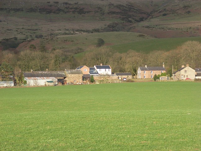
Newbiggin Fell is a picturesque area located in the county of Cumberland, in the northwestern part of England. Situated in the heart of the Lake District National Park, it is known for its breathtaking views, diverse landscapes, and rich natural beauty.

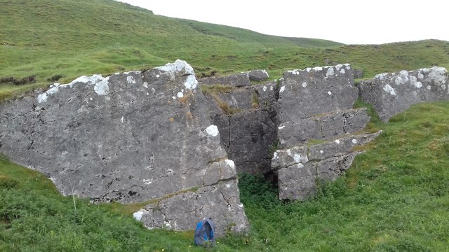
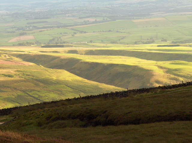
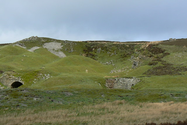
Covering a vast area of downs and moorland, Newbiggin Fell offers a unique experience for nature enthusiasts and hikers alike. The terrain is mostly hilly, with rolling slopes and rocky outcrops dotting the landscape. The fell is renowned for its tranquil atmosphere, providing a perfect escape from the hustle and bustle of city life.

The vegetation in Newbiggin Fell is varied and abundant, with heather, grasses, and wildflowers adorning the hillsides. The area is also home to a diverse range of wildlife, including birds, mammals, and insects. Visitors may spot red deer, foxes, and various bird species, adding to the allure of the natural surroundings.

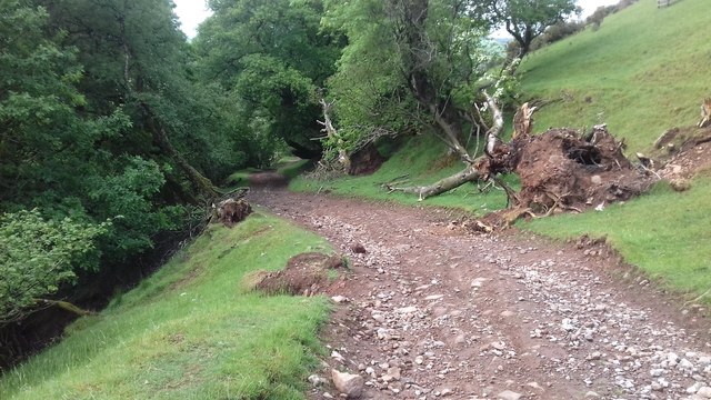
The fell is crisscrossed by a network of footpaths and trails, making it an ideal destination for outdoor activities such as walking, hiking, and mountain biking. The routes offer different levels of difficulty, catering to both novice and experienced adventurers. The summit of the fell provides panoramic views of the surrounding countryside, including nearby lakes and valleys.

Newbiggin Fell is a true gem in the Lake District National Park, offering a peaceful retreat and a chance to immerse oneself in the beauty of nature. Whether exploring its moorland, capturing stunning photographs, or simply enjoying the tranquility, visitors are sure to be captivated by the charm and serenity of this enchanting location.

If you have any feedback on the listing, please let us know in the comments section below.

Newbiggin Fell Images

Images are sourced within 2km of 54.840559/-2.653983 or Grid Reference NY5849. Thanks to Geograph Open Source API. All images are credited.

New Water Bridge
New Water Bridge
Limestone Feature Limestone feature above Croglin
Limestone Feature
Limestone feature above Croglin
Track above Newbiggin Track above Newbiggin.
Track above Newbiggin
Track above Newbiggin.
Pastures above Croglin On the bridleway crossing the moorside between Croglin and Newbiggin.
Pastures above Croglin
On the bridleway crossing the moorside between Croglin and Newbiggin.
Dod Crag A line of low, unimpressive outcrops on Newbiggin Fell.
Dod Crag
A line of low, unimpressive outcrops on Newbiggin Fell.
Newbiggin Fell An old wall above Dod Crag.
Newbiggin Fell
An old wall above Dod Crag.
Moorland above Croglin A small outcrop here is crossed by the fence and a line of grouse butts.
Moorland above Croglin
A small outcrop here is crossed by the fence and a line of grouse butts.
Newbiggin Fell The slope above Eller Beck.
Newbiggin Fell
The slope above Eller Beck.
Blotting Raise View across to Cumrew Fell.
Blotting Raise
View across to Cumrew Fell.
Blotting Raise Looking down to Holl Gill.
Blotting Raise
Looking down to Holl Gill.
Track, Croglin The western edge of the Pennines above the Eden valley. The Lakeland fells are beyond but barely visible.
Track, Croglin
The western edge of the Pennines above the Eden valley. The Lakeland fells are beyond but barely visible.
Moorland above Croglin Beside the bridleway that heads into the Croglin Water valley.
Moorland above Croglin
Beside the bridleway that heads into the Croglin Water valley.
Croglin sunset A view from the old quarries above Fieldhead.
Croglin sunset
A view from the old quarries above Fieldhead.
The New Water Crossing Point New Water joins Old Water to become The River Gelt. This crossing is impassable when the river is in spate... as I found out during last winter!
The New Water Crossing Point
New Water joins Old Water to become The River Gelt. This crossing is impassable when the river is in spate... as I found out during last winter!
Cat Cocks Limestone Quarry and Kiln Marked only as a quarry on the map, but internet research shows this is called Cat Cocks. It has 2 large lime kilns with significant building/s on the horizon.
Cat Cocks Limestone Quarry and Kiln
Marked only as a quarry on the map, but internet research shows this is called Cat Cocks. It has 2 large lime kilns with significant building/s on the horizon.
Shooting Box Very well maintained shooting hut with outside picnic tables and benches. the valley in the background is that of the New Water.
Shooting Box
Very well maintained shooting hut with outside picnic tables and benches. the valley in the background is that of the New Water.
Sheepfold overlooking New Water valley Stone sheepfold with one side open to wire-fenced grass paddock. New Water separates it from the grouse moor on Newbiggin Fell in the background - see <a href="https://www.geograph.org.uk/gridref/NY5950">NY5950</a>.
Sheepfold overlooking New Water valley
Stone sheepfold with one side open to wire-fenced grass paddock. New Water separates it from the grouse moor on Newbiggin Fell in the background - see NY5950.
Closeup of kiln in front of quarry See <span class="nowrap"><a title="http://www.cumbria-industries.org.uk/limekilns.htm" rel="nofollow ugc noopener" href="http://www.cumbria-industries.org.uk/limekilns.htm">Link</a><img style="margin-left:2px;" alt="External link" title="External link - shift click to open in new window" src="https://s1.geograph.org.uk/img/external.png" width="10" height="10"/></span>
Closeup of kiln in front of quarry
See LinkExternal link
Show me another place!

Newbiggin Fell is located at Grid Ref: NY5849 (Lat: 54.840559, Lng: -2.653983)

Administrative County: Cumbria

District: Eden

Police Authority: Cumbria

What 3 Words

///workbench.sailed.left. Near Wetheral, Cumbria

Nearby Locations

Newbiggin Fell

Related Wikis

Newbiggin, Ainstable

Newbiggin is a small hamlet in Cumbria, England. Cumrew beck flows north-west through Newbiggin eventually joining the Eden close to Armathwaite. The village...

Croglin

Croglin is the name of a village, former civil parish, beck (stream), and grange now in the parish of Ainstable, in the Westmorland and Furness district...

Cumrew

Cumrew is a small village and civil parish in north-east Cumbria, England. About 7 miles (11 km) south of Brampton and 13 miles (21 km) east of Carlisle...

Carlatton and Cumrew

Carlatton and Cumrew are civil parishes in Cumbria, England with a common parish council.The Eastern boundary of this rural parish is Cardunneth Pike in...

Nearby Amenities

Located within 500m of 54.840559,-2.653983
Mid Fell
Place: locality
Lat/Long: 54.8409259/-2.6601061
Hunting Stand
Lat/Long: 54.8415799/-2.6465006
Ford: yes
Lat/Long: 54.8419026/-2.6545926
The data included in this document is from www.openstreetmap.org. The data is made available under ODbL.

Have you been to Newbiggin Fell?

Leave your review of Newbiggin Fell below (or comments, questions and feedback).