Ouzel Moss

Downs, Moorland in Lancashire Lancaster

England

Ouzel Moss

Hungry Sheep On Hind Hill, they looked a bit cold. Taken from near Pennington Wood looking towards Tarnbrook Fell. Should be the last Geograph for Hectad SD55.
Hungry Sheep Credit: Michael Graham

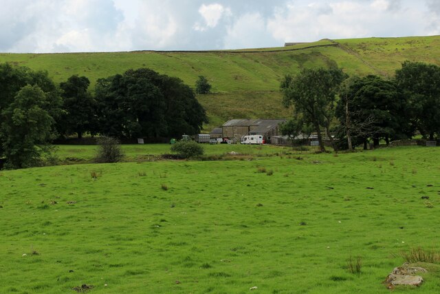
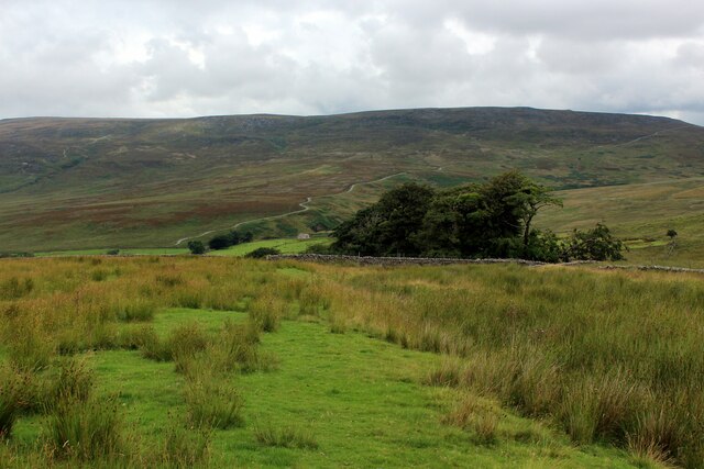
Ouzel Moss is a picturesque area located in Lancashire, England, encompassing both downs and moorland landscapes. Situated in the northern part of the county, it offers breathtaking views and a serene environment for nature enthusiasts and hikers alike.

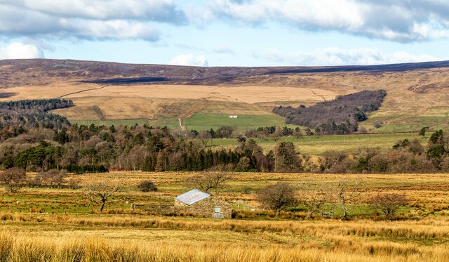
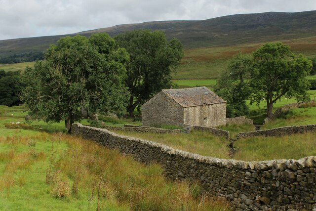
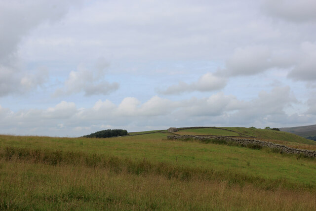
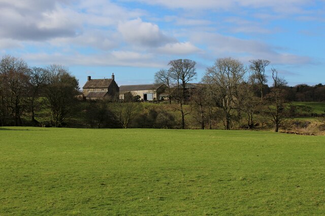
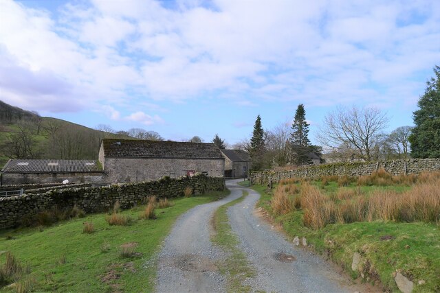
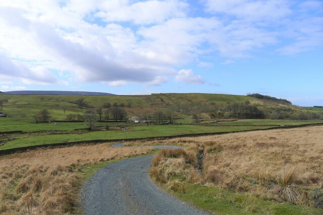
The downs of Ouzel Moss are characterized by rolling hills and grassy slopes, providing a peaceful setting for outdoor activities such as picnicking or leisurely walks. The area is home to a variety of plant species, including heather and gorse, which add vibrant colors to the landscape during the blooming seasons.

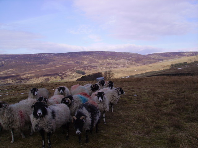
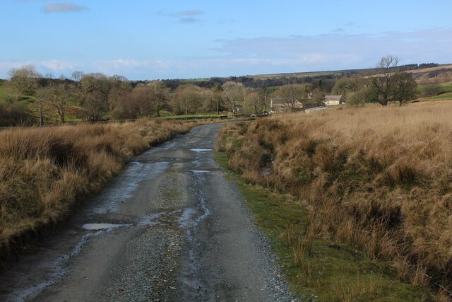
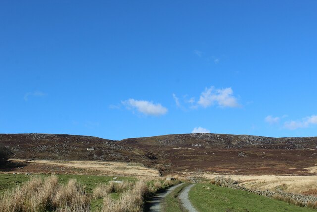
In contrast, the moorland of Ouzel Moss offers a more rugged and wild terrain, featuring vast expanses of heather-covered hills and peat bogs. This distinctive ecosystem supports a diverse array of wildlife, including red grouse, curlews, and several species of birds of prey. The moorland also harbors unique flora, such as sphagnum moss and cotton grass, which thrive in the damp and acidic conditions.

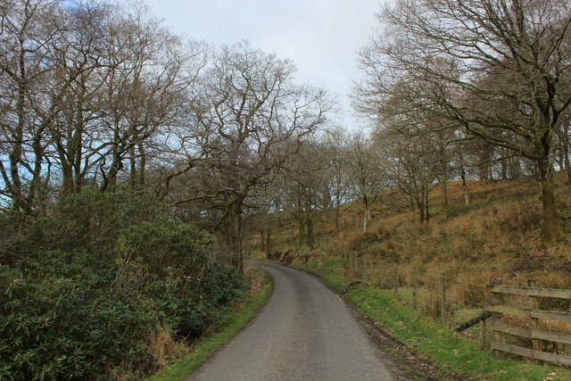
Ouzel Moss benefits from a moderate climate, with cool summers and mild winters, making it an ideal destination for outdoor enthusiasts throughout the year. The area is well-served by a network of footpaths and trails, allowing visitors to explore the downs and moorland at their leisure.

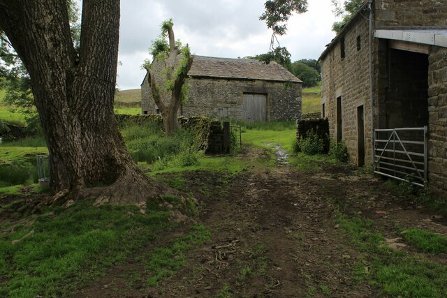
In addition to its natural beauty, Ouzel Moss offers visitors the opportunity to learn about the rich cultural and historical heritage of Lancashire. Nearby, there are several ancient archaeological sites, including burial mounds and stone circles, providing insights into the area's past.

Overall, Ouzel Moss is a captivating destination, combining stunning landscapes, diverse wildlife, and a deep-rooted history, making it a must-visit location for anyone seeking a tranquil and immersive outdoor experience in Lancashire.

If you have any feedback on the listing, please let us know in the comments section below.
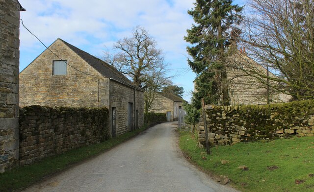
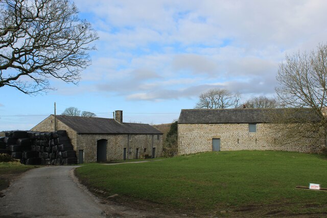
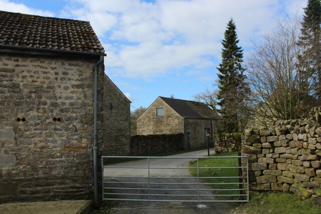
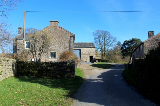
Ouzel Moss Images

Images are sourced within 2km of 53.987022/-2.6412797 or Grid Reference SD5854. Thanks to Geograph Open Source API. All images are credited.

Hungry Sheep On Hind Hill, they looked a bit cold. Taken from near Pennington Wood looking towards Tarnbrook Fell. Should be the last Geograph for Hectad SD55.
Hungry Sheep
On Hind Hill, they looked a bit cold. Taken from near Pennington Wood looking towards Tarnbrook Fell. Should be the last Geograph for Hectad SD55.
Lee Fell View of Stoneacre Barn Woodsyke Plantation.on Lee Fell.
Lee Fell
View of Stoneacre Barn Woodsyke Plantation.on Lee Fell.
Stone Barn at Spreight Clough Stone barn in the valley of the Tarnbrook Wyre. Passed by on the Wyre Way long distance footpath.
Stone Barn at Spreight Clough
Stone barn in the valley of the Tarnbrook Wyre. Passed by on the Wyre Way long distance footpath.
Spreight Clough Farm outbuildings in the secluded valley of the Tarnbrook Wyre.
Passed by on the Wyre Way long distance footpath.
Spreight Clough
Farm outbuildings in the secluded valley of the Tarnbrook Wyre. Passed by on the Wyre Way long distance footpath.
Gilberton Farm In the secluded valley of the Tarnbrook Wyre
Gilberton Farm
In the secluded valley of the Tarnbrook Wyre
Wyre Way heading towards Harry Wood The long distance footpath descending into the Upper Tarnbrook Wyre Valley
Wyre Way heading towards Harry Wood
The long distance footpath descending into the Upper Tarnbrook Wyre Valley
Field beside Harry Wood As seen from the Wyre Way long distance footpath
Field beside Harry Wood
As seen from the Wyre Way long distance footpath
On the Lane leading from Tarnbrook This is a no through road that leads to Tarnbrook, deep in the Forest of Bowland.  At this point the lane is running through Fallclough Plantation
On the Lane leading from Tarnbrook
This is a no through road that leads to Tarnbrook, deep in the Forest of Bowland. At this point the lane is running through Fallclough Plantation
Tarnbrook (1) Unspoilt hamlet on the upper reaches of the Tarnbrook Wyre served by a single no through road. Most of the land in this secluded corner of  Bowland belongs to the Abbeystead Estate, owned by the Duke of Westminster
Tarnbrook (1)
Unspoilt hamlet on the upper reaches of the Tarnbrook Wyre served by a single no through road. Most of the land in this secluded corner of Bowland belongs to the Abbeystead Estate, owned by the Duke of Westminster
Tarnbrook (2) Unspoilt hamlet on the upper reaches of the Tarnbrook Wyre served by a single no through road. Most of the land in this secluded corner of  Bowland belongs to the Abbeystead Estate, owned by the Duke of Westminster
Tarnbrook (2)
Unspoilt hamlet on the upper reaches of the Tarnbrook Wyre served by a single no through road. Most of the land in this secluded corner of Bowland belongs to the Abbeystead Estate, owned by the Duke of Westminster
Tarnbrook (3) Unspoilt hamlet on the upper reaches of the Tarnbrook Wyre served by a single no through road. Most of the land in this secluded corner of  Bowland belongs to the Abbeystead Estate, owned by the Duke of Westminster
Tarnbrook (3)
Unspoilt hamlet on the upper reaches of the Tarnbrook Wyre served by a single no through road. Most of the land in this secluded corner of Bowland belongs to the Abbeystead Estate, owned by the Duke of Westminster
Tarnbrook (4) Unspoilt hamlet on the upper reaches of the Tarnbrook Wyre served by a single no through road. Most of the land in this secluded corner of  Bowland belongs to the Abbeystead Estate, owned by the Duke of Westminster
Tarnbrook (4)
Unspoilt hamlet on the upper reaches of the Tarnbrook Wyre served by a single no through road. Most of the land in this secluded corner of Bowland belongs to the Abbeystead Estate, owned by the Duke of Westminster
Ouzel Thorn Farm Farming operation beside the Tarnbrook Wyre in the Forest of Bowland
Ouzel Thorn Farm
Farming operation beside the Tarnbrook Wyre in the Forest of Bowland
Wyre Way heading West towards Tarnbrook 45 mile long distance walking route exploring the course of the River Wyre.
The river has two sources - the Tarnbrook Wyre and the Marshaw Wyre which meet at Abbeystead. The route explores both these tributaries. It then passes through Dolphinstone and Garstang before taking a sluggish turn through The Fylde. At Shard Bridge the Wyre Way splits - one route to Fleetwood and the other to Knott End on Sea. Both these communities sit opposite each other at the mouth of the Wyre, and it is possible to connect by using a ferry.
Wyre Way heading West towards Tarnbrook
45 mile long distance walking route exploring the course of the River Wyre. The river has two sources - the Tarnbrook Wyre and the Marshaw Wyre which meet at Abbeystead. The route explores both these tributaries. It then passes through Dolphinstone and Garstang before taking a sluggish turn through The Fylde. At Shard Bridge the Wyre Way splits - one route to Fleetwood and the other to Knott End on Sea. Both these communities sit opposite each other at the mouth of the Wyre, and it is possible to connect by using a ferry.
Track beside Tarnsyke Clough
The Wyre Way approaching Tarnbrook Leaving the Open Access Land of Tarnbrook Fell
The Wyre Way approaching Tarnbrook
Leaving the Open Access Land of Tarnbrook Fell
Ouzel Bridge crossing Tarnbrook Wyre Ouzel = a blackbird. Wyre = a winding river
Ouzel Bridge crossing Tarnbrook Wyre
Ouzel = a blackbird. Wyre = a winding river
A Bowland track at Moss End Looking across to the farm 'Gilberton' by the Tarnbrook Wyre
A Bowland track at Moss End
Looking across to the farm 'Gilberton' by the Tarnbrook Wyre
Show me another place!

Ouzel Moss is located at Grid Ref: SD5854 (Lat: 53.987022, Lng: -2.6412797)

Administrative County: Lancashire

District: Lancaster

Police Authority: Lancashire

What 3 Words

///harps.originals.deflation. Near Bay Horse, Lancashire

Nearby Locations

Gifford's Wood Ouzel Moss

Related Wikis

Abbeystead House

Abbeystead House is a large country house to the east of the village of Abbeystead, Lancashire, England, some 12 km (7 miles) south-east of Lancaster....

William Molyneux, 4th Earl of Sefton

William Philip Molyneux, 4th Earl of Sefton, (14 October 1835 – 27 June 1897) was a British peer. == Biography == Born Viscount Molyneux, he was the eldest...

Grizedale Bridge

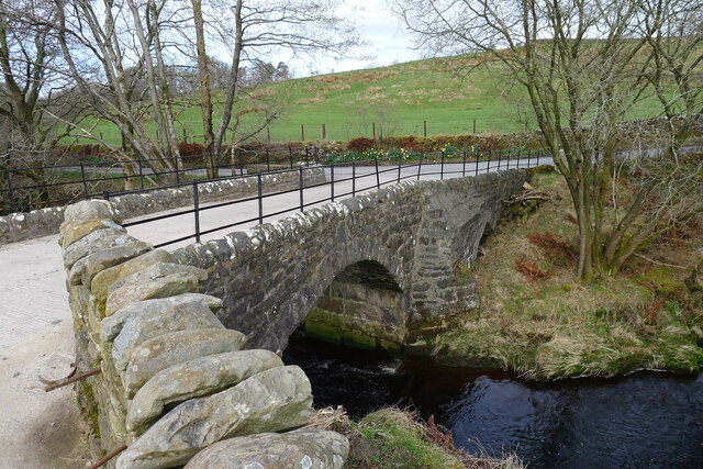
Grizedale Bridge is a Grade II listed bridge in the English parish of Over Wyresdale, Lancashire. The structure, which dates to the 19th century, carries...

Abbeystead

Abbeystead is a small hamlet located in the Forest of Bowland Area of Outstanding Natural Beauty, in Lancashire, England. Abbeystead lies close to the...

Nearby Amenities

Located within 500m of 53.987022,-2.6412797
Natural: peak
Source: NPE
Lat/Long: 53.9890954/-2.6475986
Barrier: stile
Stile: stepover
Lat/Long: 53.9885298/-2.6451206
Barrier: stile
Stile: ladder
Lat/Long: 53.9881795/-2.6451947
Barrier: stile
Stile: stepover
Lat/Long: 53.9885252/-2.645161
Barrier: stile
Stile: ladder
Lat/Long: 53.9872822/-2.6485858
Material: wood
Power: pole
Lat/Long: 53.9840214/-2.6461418
Material: wood
Power: pole
Lat/Long: 53.9837517/-2.6440082
Material: wood
Power: pole
Lat/Long: 53.9836479/-2.6431288
Material: wood
Power: pole
Lat/Long: 53.9835389/-2.6422375
Material: wood
Power: pole
Lat/Long: 53.9831771/-2.6414421
Barrier: stile
Stile: stepover
Lat/Long: 53.9899091/-2.6403028
Barrier: stile
Stile: stepover
Lat/Long: 53.9899389/-2.6401929
Description: Wyre Way footpath marker
Information: route_marker
Inscription: WW
Material: stone
Tourism: information
Lat/Long: 53.9905945/-2.6388012
The data included in this document is from www.openstreetmap.org. The data is made available under ODbL.

Have you been to Ouzel Moss?

Leave your review of Ouzel Moss below (or comments, questions and feedback).