Hamlet

Settlement in Dorset

England

Hamlet

Yetminster station
Yetminster station Credit: Roy Hughes

Hamlet is a small village located in the county of Dorset, England. Situated in the picturesque countryside, it is surrounded by rolling hills, lush green meadows, and charming rural landscapes. With a population of around 1,000 residents, Hamlet exudes a peaceful and tranquil atmosphere, making it an idyllic destination for those seeking a break from the hustle and bustle of city life.

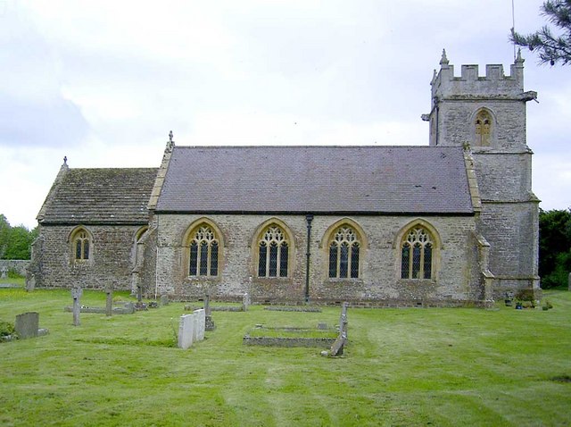
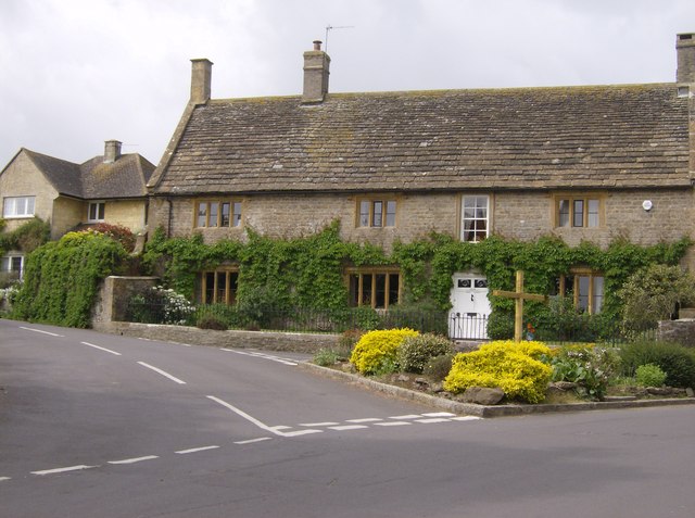
The village dates back to medieval times and has retained much of its historical charm. It boasts a few centuries-old buildings, including the St. Peter's Church, which stands as a testament to the area's rich heritage. The church features stunning architecture and houses several beautifully preserved stained glass windows.

Despite its small size, Hamlet offers a range of amenities for its residents and visitors. The village has a local pub, The Rose and Crown, where visitors can enjoy a pint of locally brewed ale and indulge in traditional British pub food. Additionally, there are a few quaint tearooms and small shops that add to the village's charm.

Surrounded by natural beauty, Hamlet provides ample opportunities for outdoor activities and exploration. The nearby countryside offers numerous walking and hiking trails, allowing visitors to enjoy the stunning landscapes and breathtaking views. The village is also close to the Jurassic Coast, a UNESCO World Heritage Site renowned for its dramatic cliffs and fossil-rich beaches.

In conclusion, Hamlet, Dorset is a peaceful village that offers a perfect blend of history, natural beauty, and tranquility. Whether one is seeking a relaxing getaway or a chance to immerse themselves in the English countryside, Hamlet is a delightful destination to explore.

If you have any feedback on the listing, please let us know in the comments section below.
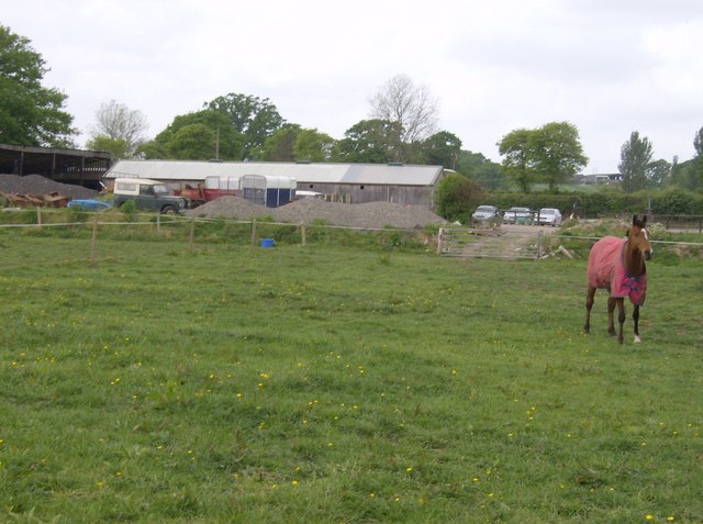
Hamlet Images

Images are sourced within 2km of 50.878154/-2.572189 or Grid Reference ST5908. Thanks to Geograph Open Source API. All images are credited.

Yetminster station
Yetminster station
Bridge over the Railway near Winterhayes Farm On the minor road between Chetnole and Yetminster.
Bridge over the Railway near Winterhayes Farm
On the minor road between Chetnole and Yetminster.
Winterhayes Farm The farmer has provided guidance in the form of a sign as to the whereabouts of the public right of way. It turns right here by the fence, and does not pass through the farm! The way around the farm is quite clearly marked, even on the 1:50,000 OS map, so there really is no excuse for trespassing.
Winterhayes Farm
The farmer has provided guidance in the form of a sign as to the whereabouts of the public right of way. It turns right here by the fence, and does not pass through the farm! The way around the farm is quite clearly marked, even on the 1:50,000 OS map, so there really is no excuse for trespassing.
Farmland near Melbury Osmund On the road south from Ryme Intrinseca, near to the A37 junction.
Farmland near Melbury Osmund
On the road south from Ryme Intrinseca, near to the A37 junction.
Paddock near Yetminster Many paddocks and stables in this area.
Paddock near Yetminster
Many paddocks and stables in this area.
Something interesting going on? The cows are all gathered around a water trough or feeding trough, near the river despite having the whole field to graze.
Something interesting going on?
The cows are all gathered around a water trough or feeding trough, near the river despite having the whole field to graze.
Field behind the Rest and Welcome Inn A footpath heads east from the A37 behind the Rest and Welcome Inn.  Unusually this field is ploughed ready from crops, unlike many of the large areas of  pasture around here.
Field behind the Rest and Welcome Inn
A footpath heads east from the A37 behind the Rest and Welcome Inn. Unusually this field is ploughed ready from crops, unlike many of the large areas of pasture around here.
North-west of Horse Hill Farm In the extreme north-west of the square, the footpath forming part of the Macmillan Way just clips the square.  This view looking south-east shows typical grazing land.
North-west of Horse Hill Farm
In the extreme north-west of the square, the footpath forming part of the Macmillan Way just clips the square. This view looking south-east shows typical grazing land.
Grazing land near Yetminster There are many small fields like this in the area south of Yetminster.  Mainly grazing land in a low-lying area that the guidebooks warn can be flooded in wet weather.  No problem with this dry spring (early May 2007).
Grazing land near Yetminster
There are many small fields like this in the area south of Yetminster. Mainly grazing land in a low-lying area that the guidebooks warn can be flooded in wet weather. No problem with this dry spring (early May 2007).
Lush grassland Ideal for easy walking, although the small fields and the many stiles make for difficult navigation.
Lush grassland
Ideal for easy walking, although the small fields and the many stiles make for difficult navigation.
Bridleway junction Woodville Lane bridleway joins the bridleway that the Macmillan Way follows.  Both are very pleasant tracks.  There is an extensive network of bridleways in this area.
Bridleway junction
Woodville Lane bridleway joins the bridleway that the Macmillan Way follows. Both are very pleasant tracks. There is an extensive network of bridleways in this area.
Next to Chetnole Withy Bed The wood is known as Chetnole Withy Bed.  Directly in the centre is a single oak outside the wood.  This performs a useful function in guide books describing the route of the footpath, which is not clear on the ground.  The footpath forms part of the 290-mile Macmillan Way, coast to coast from Lincolnshire to Dorset.
Next to Chetnole Withy Bed
The wood is known as Chetnole Withy Bed. Directly in the centre is a single oak outside the wood. This performs a useful function in guide books describing the route of the footpath, which is not clear on the ground. The footpath forms part of the 290-mile Macmillan Way, coast to coast from Lincolnshire to Dorset.
Old railway wagon Often seen in the corners of fields, used as storage sheds.  Most, including this one, have seen better days, as has the water trough.
Old railway wagon
Often seen in the corners of fields, used as storage sheds. Most, including this one, have seen better days, as has the water trough.
Chetnole Railway Station Looking North towards Yeovil
Chetnole Railway Station
Looking North towards Yeovil
Waterlogged field near Melbury Osmund A view looking NW towards New Plantation (in the distance) from very close to the A37 junction with the minor road to Yetminster
Waterlogged field near Melbury Osmund
A view looking NW towards New Plantation (in the distance) from very close to the A37 junction with the minor road to Yetminster
Macmillan Way at Drive End The Drive End presumably refers to the drive of the house of Melbury Sampford close by and where it terminated on the main Yeovil Dorchester road. This maize field is just behind the Rest and Welcome pub.
Macmillan Way at Drive End
The Drive End presumably refers to the drive of the house of Melbury Sampford close by and where it terminated on the main Yeovil Dorchester road. This maize field is just behind the Rest and Welcome pub.
Maize field near Melbury Osmund One of several fields of maize recently auctioned as a standing crop close to the Rest and Welcome pub on the A37
Maize field near Melbury Osmund
One of several fields of maize recently auctioned as a standing crop close to the Rest and Welcome pub on the A37
Countryside Near Melbury Osmund Fields just to the east of the A37 Dorchester-Yeovil road
Countryside Near Melbury Osmund
Fields just to the east of the A37 Dorchester-Yeovil road
Show me another place!

Hamlet is located at Grid Ref: ST5908 (Lat: 50.878154, Lng: -2.572189)

Unitary Authority: Dorset

Police Authority: Dorset

What 3 Words

///submerge.fruit.shippers. Near Yetminster, Dorset

Nearby Locations

Hamlet Chetnole Withy Bed

Related Wikis

Chetnole

Chetnole is a village and civil parish in the county of Dorset in southern England. It lies approximately 6 miles (9.7 km) south-southwest of Sherborne...

Chetnole railway station

Chetnole railway station is a small rural station serving the village of Chetnole, Dorset, England. The station is on the Heart of Wessex Line 21ΒΌ miles...

Yetminster Hundred

Yetminster Hundred was a hundred in the county of Dorset, England, containing the following parishes: Batcombe Clifton Maybank Melbury Bubb Melbury Osmond...

Yetminster

Yetminster is a village and civil parish in the English county of Dorset. It lies 4 miles (6.4 km) south-west of Sherborne. It is sited on the River Wriggle...

Nearby Amenities

Located within 500m of 50.878154,-2.572189
Material: wood
Power: pole
Source: bing
Lat/Long: 50.8790975/-2.5689861
Material: wood
Power: pole
Source: bing
Lat/Long: 50.8797185/-2.5677141
Material: wood
Power: pole
Source: bing
Lat/Long: 50.880111/-2.5666707
Direction: 165
Generator Method: photovoltaic
Generator Output Electricity: yes
Generator Solar Modules: 15
Generator Source: solar
Generator Type: solar_photovoltaic_panel
Location: roof
Power: generator
Lat/Long: 50.8768572/-2.5711066
Direction: 175
Generator Method: photovoltaic
Generator Output Electricity: yes
Generator Solar Modules: 10
Generator Source: solar
Generator Type: solar_photovoltaic_panel
Location: roof
Power: generator
Lat/Long: 50.8752418/-2.5701329
The data included in this document is from www.openstreetmap.org. The data is made available under ODbL.

Have you been to Hamlet?

Leave your review of Hamlet below (or comments, questions and feedback).