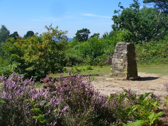
Hambledon

Settlement in Surrey Waverley

England

Hambledon

Church of St Peter
Church of St Peter Credit: Alex McGregor

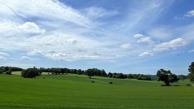
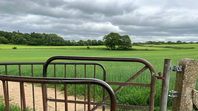
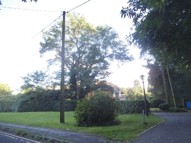
Hambledon is a picturesque village located in the county of Surrey, England. Situated on the southern slopes of the North Downs, Hambledon is surrounded by stunning countryside, making it a popular destination for nature lovers and outdoor enthusiasts.

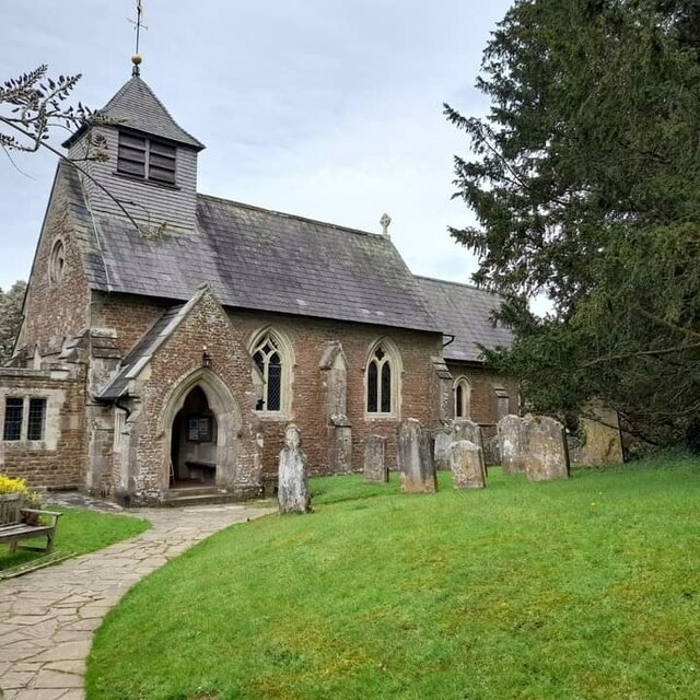
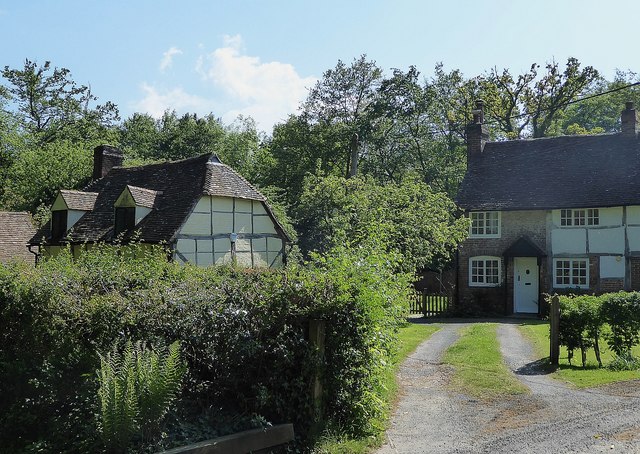
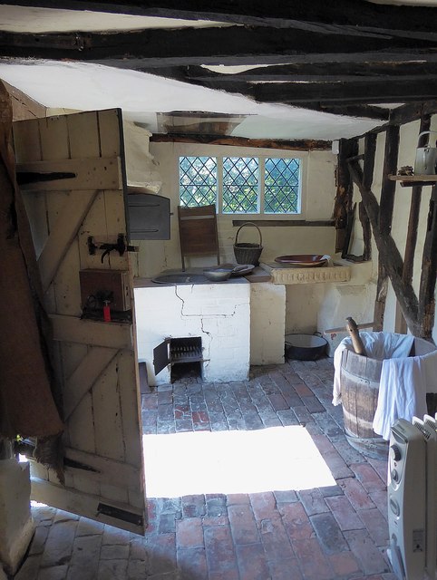
The village is known for its charming and well-preserved historic buildings, with many dating back to the 16th and 17th centuries. These include traditional thatched cottages, timber-framed houses, and a beautiful Norman church, St. Peter's, which is the centerpiece of the village. The church features a striking tower and is a prominent landmark visible from miles around.

Hambledon is also famous for its connection to the sport of cricket. It is widely regarded as the "cradle of cricket," with the Hambledon Cricket Club being one of the oldest in the country. The village has a rich cricketing heritage, and enthusiasts can explore the Hambledon Cricket Museum to learn more about the sport's history.

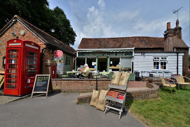
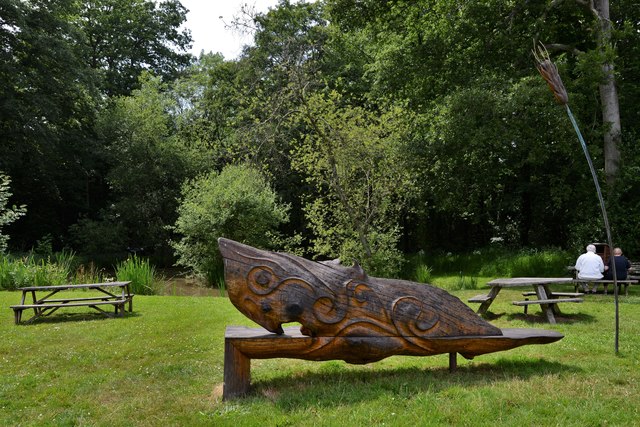
The village offers a range of amenities for its residents and visitors, including a village shop, a primary school, a pub, and a village hall. The surrounding countryside provides numerous opportunities for walking, hiking, and cycling, with several well-marked trails and footpaths.

Overall, Hambledon exudes a sense of tranquility and charm, with its idyllic setting, historic architecture, and strong ties to cricket. It is a place that showcases the beauty of rural Surrey and offers a peaceful retreat for those seeking a slice of English countryside life.

If you have any feedback on the listing, please let us know in the comments section below.

Hambledon Images

Images are sourced within 2km of 51.137694/-0.620269 or Grid Reference SU9638. Thanks to Geograph Open Source API. All images are credited.

Church of St Peter
Church of St Peter
Horses south of Little Burgate Farm
Fields south of Fourteen Acre Copse
Gate on path east of Court Farm - view to the east There's a very clear, neat path through the cultivated fields on either side of this gate.
Gate on path east of Court Farm - view to the east
There's a very clear, neat path through the cultivated fields on either side of this gate.
Shallon - Gaultheria shallon - near Hydon's Ball I've never seen this plant before. I think I've got the identification right, but I'm happy to be corrected. Shallon is a naturalised native of western North America. A member of the heather family, it grows on acid soils and is regarded as somewhat invasive. It certainly seemed to be dominant here, growing in profusion on either side of the path.
Shallon - Gaultheria shallon - near Hydon's Ball
I've never seen this plant before. I think I've got the identification right, but I'm happy to be corrected. Shallon is a naturalised native of western North America. A member of the heather family, it grows on acid soils and is regarded as somewhat invasive. It certainly seemed to be dominant here, growing in profusion on either side of the path.
Toll House, Chiddingfold What looks to be an ex-toll house. The brick fabric looks late for a toll house so may well have served the Petworth Turnpike Trust in its dying years. It would have replaced a Toll House SSE on the North side of the ford/bridge at Northbridge.

Milestone Society National ID: SY.CHI
Toll House, Chiddingfold
What looks to be an ex-toll house. The brick fabric looks late for a toll house so may well have served the Petworth Turnpike Trust in its dying years. It would have replaced a Toll House SSE on the North side of the ford/bridge at Northbridge. Milestone Society National ID: SY.CHI
Phillips of Wormley
Phillips of Wormley
Brook Road at the junction of Petworth Road
Green by Brook Road, Wormley
Hydon's Ball Viewpoint on top of a sandy Surrey hill near Godalming.
Hydon's Ball
Viewpoint on top of a sandy Surrey hill near Godalming.
A283, Wormley The A283 runs 37 miles from Milford near Guildford south to Shoreham-on-Sea across rural Surrey and West Sussex.
<span class="nowrap"><a title="https://www.sabre-roads.org.uk/wiki/index.php?title=A283" rel="nofollow ugc noopener" href="https://www.sabre-roads.org.uk/wiki/index.php?title=A283">Link</a><img style="margin-left:2px;" alt="External link" title="External link - shift click to open in new window" src="https://s1.geograph.org.uk/img/external.png" width="10" height="10"/></span>
A283, Wormley
The A283 runs 37 miles from Milford near Guildford south to Shoreham-on-Sea across rural Surrey and West Sussex. LinkExternal link
King Edward School. Wormley
A283, northbound The A283 runs 37 miles from Milford near Guildford south to Shoreham-on-Sea across rural Surrey and West Sussex.
<span class="nowrap"><a title="https://www.sabre-roads.org.uk/wiki/index.php?title=A283" rel="nofollow ugc noopener" href="https://www.sabre-roads.org.uk/wiki/index.php?title=A283">Link</a><img style="margin-left:2px;" alt="External link" title="External link - shift click to open in new window" src="https://s1.geograph.org.uk/img/external.png" width="10" height="10"/></span>
A283, northbound
The A283 runs 37 miles from Milford near Guildford south to Shoreham-on-Sea across rural Surrey and West Sussex. LinkExternal link
Hambledon - National Trust cottages The National Trust were left a number (13 I believe) of cottages in and around the village of Hambledon by local generous benefactors. Most of these cottages are now let out by the Trust on long-term leases and cannot be visited by the public - such as the one on the right in this image. However, one cottage "Oakhurst Cottage" can be viewed by prior arrangement (see <span class="nowrap"><a title="https://www.nationaltrust.org.uk/oakhurst-cottage" rel="nofollow ugc noopener" href="https://www.nationaltrust.org.uk/oakhurst-cottage">Link</a><img style="margin-left:2px;" alt="External link" title="External link - shift click to open in new window" src="https://s1.geograph.org.uk/img/external.png" width="10" height="10"/></span> ) - and this can be seen on the left here - and here <a href="https://www.geograph.org.uk/photo/5783968">SU9637 : Oakhurst Cottage, Hambledon</a>
Hambledon - National Trust cottages
The National Trust were left a number (13 I believe) of cottages in and around the village of Hambledon by local generous benefactors. Most of these cottages are now let out by the Trust on long-term leases and cannot be visited by the public - such as the one on the right in this image. However, one cottage "Oakhurst Cottage" can be viewed by prior arrangement (see LinkExternal link ) - and this can be seen on the left here - and here SU9637 : Oakhurst Cottage, Hambledon
Oakhurst Cottage, Hambledon Oakhurst Cottage is, according to our helpful guide, the second smallest National Trust property open to the public. The guided tour certainly doesn't take that long as there are just three rooms downstairs and two up.
It is a charming little cottage, thought to date from the C17th, and was lived in with virtually no mod cons until the early 1980s. 
See the cottage in its setting here <a href="https://www.geograph.org.uk/photo/5783915">SU9637 : Hambledon - National Trust cottages</a>
EH Grade II listing: <span class="nowrap"><a title="https://historicengland.org.uk/listing/the-list/list-entry/1240216" rel="nofollow ugc noopener" href="https://historicengland.org.uk/listing/the-list/list-entry/1240216">Link</a><img style="margin-left:2px;" alt="External link" title="External link - shift click to open in new window" src="https://s1.geograph.org.uk/img/external.png" width="10" height="10"/></span>
NT visitor info here: <span class="nowrap"><a title="https://www.nationaltrust.org.uk/oakhurst-cottage" rel="nofollow ugc noopener" href="https://www.nationaltrust.org.uk/oakhurst-cottage">Link</a><img style="margin-left:2px;" alt="External link" title="External link - shift click to open in new window" src="https://s1.geograph.org.uk/img/external.png" width="10" height="10"/></span>
Oakhurst Cottage, Hambledon
Oakhurst Cottage is, according to our helpful guide, the second smallest National Trust property open to the public. The guided tour certainly doesn't take that long as there are just three rooms downstairs and two up. It is a charming little cottage, thought to date from the C17th, and was lived in with virtually no mod cons until the early 1980s. See the cottage in its setting here SU9637 : Hambledon - National Trust cottages EH Grade II listing: LinkExternal link NT visitor info here: LinkExternal link
Oakhurst Cottage - Kitchen / Scullery Tiny Oakhurst Cottage (National Trust <span class="nowrap"><a title="https://www.nationaltrust.org.uk/oakhurst-cottage" rel="nofollow ugc noopener" href="https://www.nationaltrust.org.uk/oakhurst-cottage">Link</a><img style="margin-left:2px;" alt="External link" title="External link - shift click to open in new window" src="https://s1.geograph.org.uk/img/external.png" width="10" height="10"/></span> ) only has three downstairs room (and only two upstairs). There is the living room, a larder and the room seen here which is the kitchen-cum-scullery. The small metal black door seen swung open behind the outside door on the left is to the large bread oven built into the corner wall of the kitchen and extending out as a projection into the back garden. The (cracked) white structure around a grate to the bread oven's right is the old "copper" where water was boiled in large quantities for e.g. washing clothes.
See the cottage (external views)  <a href="https://www.geograph.org.uk/photo/5783915">SU9637 : Hambledon - National Trust cottages</a> & <a href="https://www.geograph.org.uk/photo/5783968">SU9637 : Oakhurst Cottage, Hambledon</a>
EH Grade II listing: <span class="nowrap"><a title="https://historicengland.org.uk/listing/the-list/list-entry/1240216" rel="nofollow ugc noopener" href="https://historicengland.org.uk/listing/the-list/list-entry/1240216">Link</a><img style="margin-left:2px;" alt="External link" title="External link - shift click to open in new window" src="https://s1.geograph.org.uk/img/external.png" width="10" height="10"/></span>
NT visitor info here: <span class="nowrap"><a title="https://www.nationaltrust.org.uk/oakhurst-cottage" rel="nofollow ugc noopener" href="https://www.nationaltrust.org.uk/oakhurst-cottage">Link</a><img style="margin-left:2px;" alt="External link" title="External link - shift click to open in new window" src="https://s1.geograph.org.uk/img/external.png" width="10" height="10"/></span>
Oakhurst Cottage - Kitchen / Scullery
Tiny Oakhurst Cottage (National Trust LinkExternal link ) only has three downstairs room (and only two upstairs). There is the living room, a larder and the room seen here which is the kitchen-cum-scullery. The small metal black door seen swung open behind the outside door on the left is to the large bread oven built into the corner wall of the kitchen and extending out as a projection into the back garden. The (cracked) white structure around a grate to the bread oven's right is the old "copper" where water was boiled in large quantities for e.g. washing clothes. See the cottage (external views) SU9637 : Hambledon - National Trust cottages & SU9637 : Oakhurst Cottage, Hambledon EH Grade II listing: LinkExternal link NT visitor info here: LinkExternal link
Hambledon: Community shop, post office and tea room
Hambledon:  Wooden sculpture by the community shop
Hambledon: Wooden sculpture by the community shop
Show me another place!

Hambledon is located at Grid Ref: SU9638 (Lat: 51.137694, Lng: -0.620269)

Administrative County: Surrey

District: Waverley

Police Authority: Surrey

What 3 Words

///dislikes.enjoy.pulses. Near Wormley, Surrey

Nearby Locations

Beech Hill Hambledon

Related Wikis

Hambledon, Surrey

Hambledon is a rural scattered village in the Waverley borough of Surrey, situated south of Guildford. It is dominated by a buffer zone of fields and woodland...

St Dominic's School

St. Dominic's School in Hambledon, Surrey, England is a co-educational day school, one of the oldest special schools in the United Kingdom. It specialises...
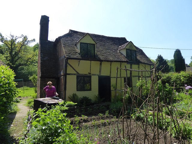
Oakhurst Cottage

Oakhurst Cottage is a tiny 16th or 17th-century cottage in Hambledon, Surrey, in the United Kingdom. It is a Grade II listed building.The cottage was given...

Tigbourne Court

Tigbourne Court is an Arts and Crafts style country house in Wormley, Surrey, England, 1 mile (1.6 km) south of Witley. It was designed by architect Edwin...

Hydon's Ball

Hydon's Ball is a 179-metre-high (587 ft) hill covering most of Hydon Heath in Hydestile, Surrey, England. == Description == The hill on Hydon Heath, Hydestile...

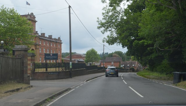
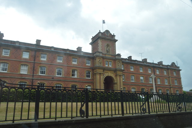
King Edward's School, Witley

King Edward's Witley is a private co-educational boarding and day school, founded in 1553 by King Edward VI and Nicholas Ridley, Bishop of London and Westminster...

Wormley, Surrey

Wormley is a village in Surrey, England in the parish of Witley, around Witley station, off the A283 Petworth Road about 5 km (3.1 mi) SSW of Godalming...

Witley railway station

Witley railway station is a station on the Portsmouth Direct Line in Surrey, England. It is 38 miles 36 chains (61.9 km) down the line from London Waterloo...

Nearby Amenities

Located within 500m of 51.137694,-0.620269
Hambledon
Is In: Surrey
Place: village
Lat/Long: 51.1378306/-0.6208748
Barrier: kissing_gate
Lat/Long: 51.1398896/-0.6171502
Addr City: Hambledon
Lat/Long: 51.1374613/-0.6195796
Addr City: Hambledon
Lat/Long: 51.1364233/-0.6189668
Bus Stop
Operator: Stagecoach
Shelter: no
Lat/Long: 51.1364569/-0.6249203
Post Box
Lat/Long: 51.1377704/-0.6205051
Barrier: stile
Bicycle: no
Foot: yes
Horse: no
Motor Vehicle: no
Lat/Long: 51.1389677/-0.6184871
The data included in this document is from www.openstreetmap.org. The data is made available under ODbL.

Have you been to Hambledon?

Leave your review of Hambledon below (or comments, questions and feedback).