Baronwood Park

Downs, Moorland in Cumberland Eden

England

Baronwood Park

Crossing the Settle-Carlisle line This is where Fiddler’s Lane crosses the line. A winter view taken on a mid-December afternoon.
Crossing the Settle-Carlisle line Credit: Mary and Angus Hogg

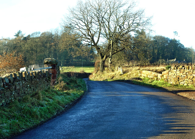
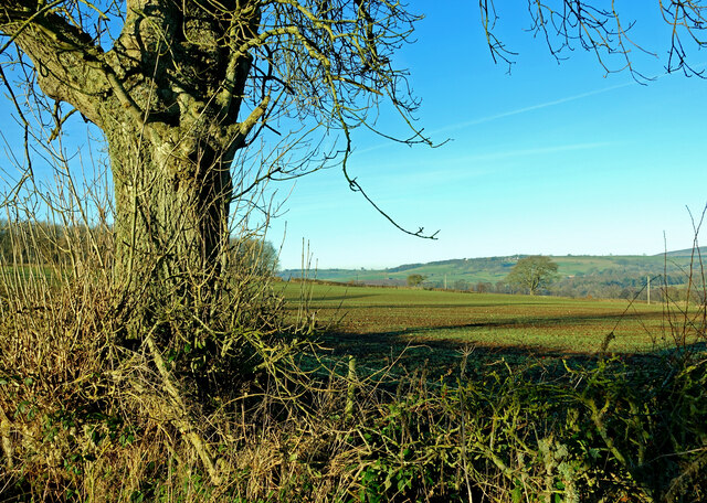
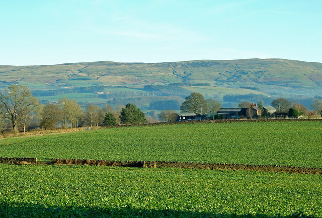
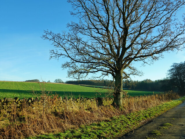
Baronwood Park is a picturesque and expansive natural reserve located in Cumberland, a county in the northwest of England. Nestled amidst the Cumberland Downs and Moorland, it spans over an impressive area of approximately 500 acres. The park is known for its diverse and abundant wildlife, making it a popular destination for nature enthusiasts and birdwatchers.

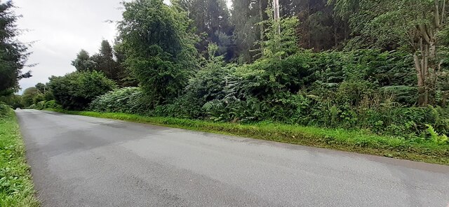
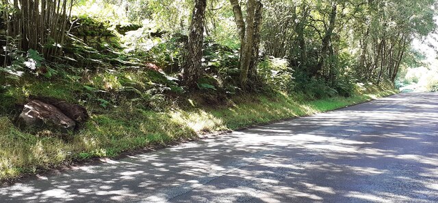
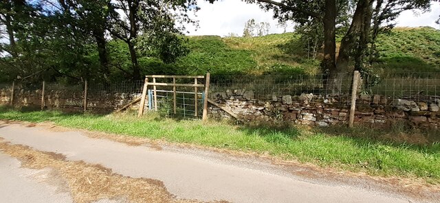
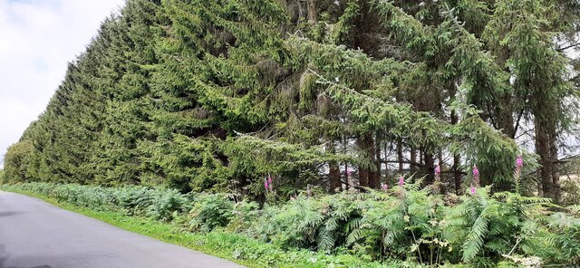
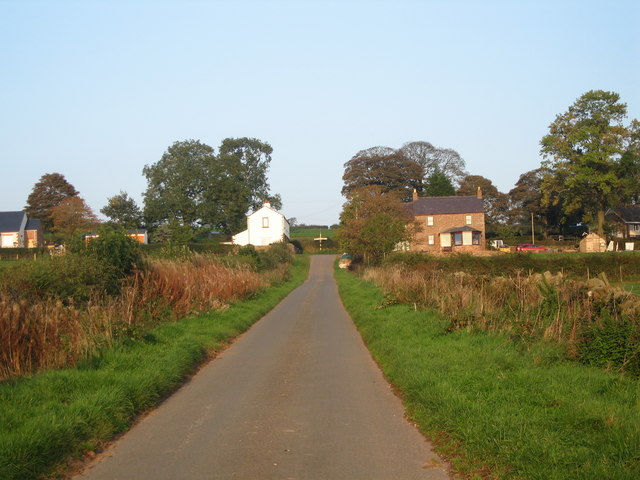
The landscape of Baronwood Park is characterized by rolling hills, lush green meadows, and dense woodlands, providing a stunning backdrop for outdoor activities and exploration. The park boasts several well-maintained walking trails that wind through the various habitats, offering visitors the opportunity to discover the rich biodiversity this area has to offer.

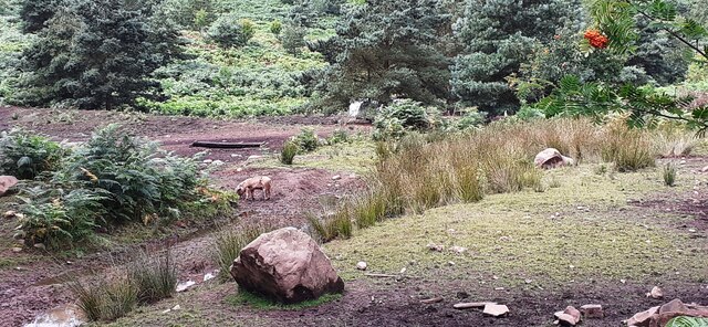
Wildlife enthusiasts will delight in the chance to spot a wide range of species. The park is home to an array of bird species, including the rare black grouse, peregrine falcons, and various species of owls. Mammals such as red deer, badgers, and foxes can also be observed in their natural habitats.

For those seeking a more active adventure, Baronwood Park provides ample opportunities for outdoor recreation. Visitors can enjoy horseback riding, cycling, and picnicking in designated areas. Additionally, the park features a small lake where fishing is permitted, adding to the diverse range of activities available.

With its breathtaking scenery, abundant wildlife, and recreational opportunities, Baronwood Park is a true gem in the heart of Cumberland. Whether one seeks relaxation, wildlife observation, or outdoor adventure, this natural reserve offers an unforgettable experience for all who visit.

If you have any feedback on the listing, please let us know in the comments section below.

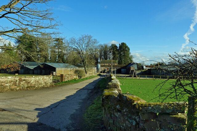
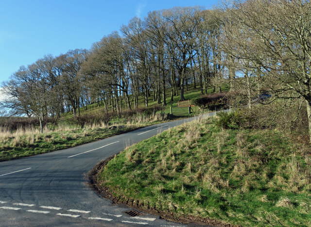
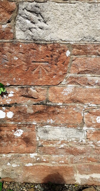
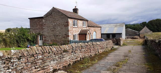
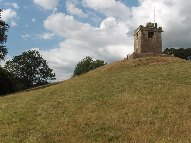
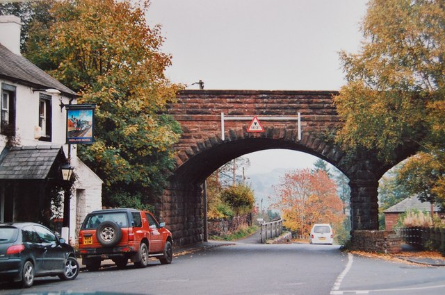
Baronwood Park Images

Images are sourced within 2km of 54.767303/-2.7350686 or Grid Reference NY5241. Thanks to Geograph Open Source API. All images are credited.

Crossing the Settle-Carlisle line This is where Fiddler’s Lane crosses the line. A winter view taken on a mid-December afternoon.
Crossing the Settle-Carlisle line
This is where Fiddler’s Lane crosses the line. A winter view taken on a mid-December afternoon.
Cote Hill farmland view This large field has been planted during the autumn for next year’s crop.
Cote Hill farmland view
This large field has been planted during the autumn for next year’s crop.
Towards Cote Hill Farm Viewed looking across winter feeding land.
Towards Cote Hill Farm
Viewed looking across winter feeding land.
Eden Valley farmland A roadside view taken in mid-December.
Eden Valley farmland
A roadside view taken in mid-December.
Old Hall Farm A mid-March view of this busy farm near Kirkoswald.
Old Hall Farm
A mid-March view of this busy farm near Kirkoswald.
Fields at Staffield Good grazing land in the Eden Valley.
Fields at Staffield
Good grazing land in the Eden Valley.
This way to Ruckcroft Nunnery House is shown in the background and in the next square.
This way to Ruckcroft
Nunnery House is shown in the background and in the next square.
Nunnery House view Viewed from the road junction in the next square on a lovely mid-March afternoon.
Nunnery House view
Viewed from the road junction in the next square on a lovely mid-March afternoon.
Towards Ruckcroft The road climbs up the valley side towards Ruckcroft and Ainstable.
Towards Ruckcroft
The road climbs up the valley side towards Ruckcroft and Ainstable.
Benchmark on Cragnook Farm House Ordnance Survey cut mark benchmark levelled at 146.069m above Newlyn Datum verified 1972
Benchmark on Cragnook Farm House
Ordnance Survey cut mark benchmark levelled at 146.069m above Newlyn Datum verified 1972
Cragnook Farm farm house and access road There is an Ordnance Survey benchmark <a href="https://www.geograph.org.uk/photo/7245210">NY5340 : Benchmark on Cragnook Farm House</a> on the near corner, right hand face, of the farmhouse
Cragnook Farm farm house and access road
There is an Ordnance Survey benchmark NY5340 : Benchmark on Cragnook Farm House on the near corner, right hand face, of the farmhouse
Rural road through forestry NW of Crag Nook Ordnance Survey documents indicate that a benchmark levelled at 151.197m above Newlyn Datum was verified in 1972 on the side of the road here
Rural road through forestry NW of Crag Nook
Ordnance Survey documents indicate that a benchmark levelled at 151.197m above Newlyn Datum was verified in 1972 on the side of the road here
Entrance gateway for access to farmland of Lazonby Estate from NW side of road Ordnance Survey records indicate that a benchmark levelled at 153.568m above Newlyn Datum was verified in 1974 on a gatepost closer to the public road than the present gateway
Entrance gateway for access to farmland of Lazonby Estate from NW side of road
Ordnance Survey records indicate that a benchmark levelled at 153.568m above Newlyn Datum was verified in 1974 on a gatepost closer to the public road than the present gateway
Benchmark on rock on south side of road at Bleaberry Hill Ordnance Survey pivot benchmark levelled at 166.819m above Newlyn Datum verified 1974
Benchmark on rock on south side of road at Bleaberry Hill
Ordnance Survey pivot benchmark levelled at 166.819m above Newlyn Datum verified 1974
Rural road passing through woodland at Bleaberry Hill There is an Ordnance Survey benchmark <a href="https://www.geograph.org.uk/photo/7245601">NY5141 : Benchmark on rock on south side of road at Bleaberry Hill</a> on the rock in the roadside verge near the left hand edge of the image
Rural road passing through woodland at Bleaberry Hill
There is an Ordnance Survey benchmark NY5141 : Benchmark on rock on south side of road at Bleaberry Hill on the rock in the roadside verge near the left hand edge of the image
Gate into Castlerigg Plantation from road to Castlerigg Farm
Woodland strip on NE side of rural road NW of Crag Nook
Pigs in rough field on SW side of road near Bleaberry Hill
Show me another place!

Baronwood Park is located at Grid Ref: NY5241 (Lat: 54.767303, Lng: -2.7350686)

Administrative County: Cumbria

District: Eden

Police Authority: Cumbria

What 3 Words

///reefs.newsreel.spreads. Near Penrith, Cumbria

Nearby Locations

Baronwood Park

Related Wikis

Armathwaite Nunnery

Armathwaite Nunnery was a Benedictine nunnery in Cumbria, England. It was situated near the confluence of the rivers Croglin Water and Eden in the southern...

Staffield

Staffield is a hamlet and former civil parish 12 miles (19 km) from Carlisle, now in the parish of Kirkoswald, in the Eden district, in the county of Cumbria...

Ruckcroft

Ruckcroft is a hamlet in the English county of Cumbria. It neighbours the larger settlements of Armathwaite and Ainstable. In the past Ruckcroft had a...

Kirkoswald, Cumbria

Kirkoswald is a village, civil parish, and former market town located in Westmorland and Furness, England, about 9 miles (14 km) from Penrith. The village...

Lazonby & Kirkoswald railway station

Lazonby & Kirkoswald is a railway station on the Settle and Carlisle Line, which runs between Carlisle and Leeds via Settle. The station, which is situated...

Lazonby

Lazonby is a village and civil parish in the Lower Eden Valley of Cumbria; it is located about 8 miles (13 km) north-north-east of Penrith and 24 miles...

Dale, Cumbria

Dale is a hamlet in Cumbria, England. == References ==

Kirkoswald Castle

Kirkoswald Castle is located to the southeast of the village of Kirkoswald, Cumbria, England. It is built from Penrith red sandstone and is still partially...

Nearby Amenities

Located within 500m of 54.767303,-2.7350686
Power: pole
Lat/Long: 54.768967/-2.7279418
Power: pole
Lat/Long: 54.7695589/-2.7287405
Power: pole
Lat/Long: 54.7702445/-2.7303089
Power: pole
Lat/Long: 54.7709314/-2.7318458
The data included in this document is from www.openstreetmap.org. The data is made available under ODbL.

Have you been to Baronwood Park?

Leave your review of Baronwood Park below (or comments, questions and feedback).