Blea Moss

Downs, Moorland in Westmorland Eden

England

Blea Moss

Narrow Gill near Sleddale Hall Unnamed stream running down to Sleddale Beck in a narrow gill.
Narrow Gill near Sleddale Hall Credit: David Robinson

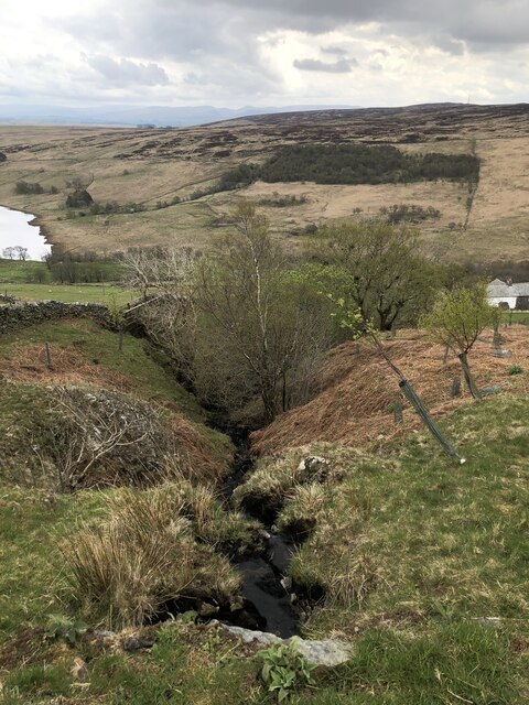
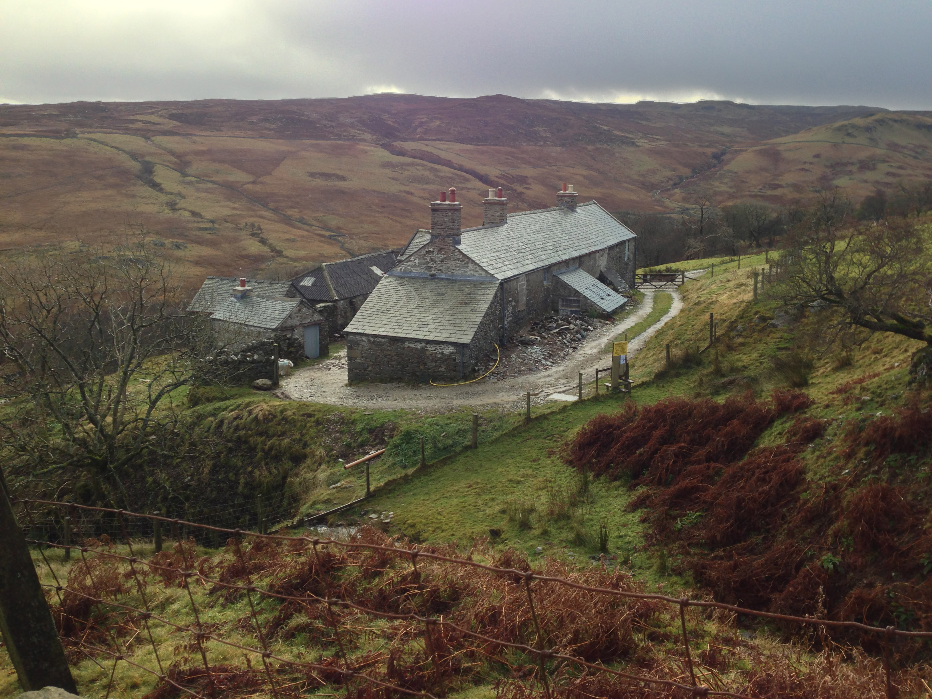
Blea Moss is a picturesque area located in the county of Westmorland, England. Nestled amidst the stunning landscape of the Lake District National Park, it offers visitors a unique experience of the region's natural beauty. Blea Moss is characterized by its expansive downs and moorland, providing a diverse habitat for a wide variety of flora and fauna.

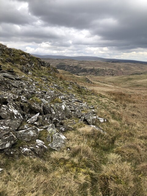
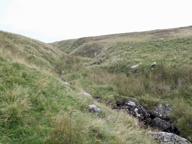
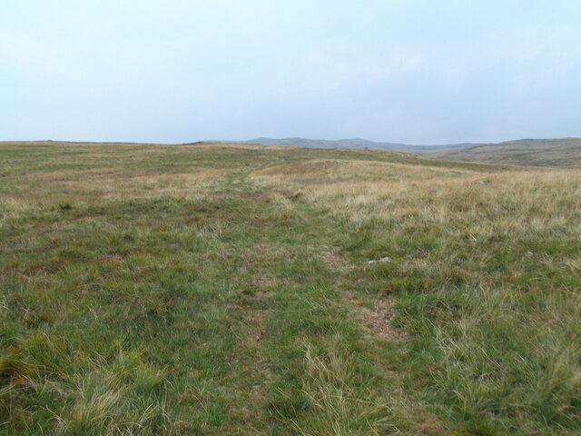
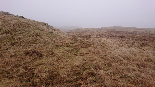
The downs of Blea Moss are notable for their rolling hills and lush green meadows. These open spaces are perfect for leisurely walks, picnicking, or simply immersing oneself in the tranquility of the surrounding countryside. The moorland, on the other hand, features a more rugged terrain, with heather-covered hills and scattered rocky outcrops. It is a haven for wildlife enthusiasts, as it is home to numerous species of birds, including the elusive curlew and the majestic golden eagle.

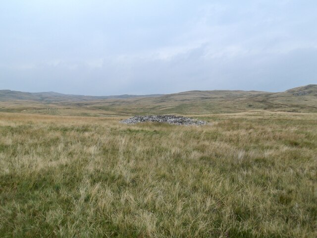
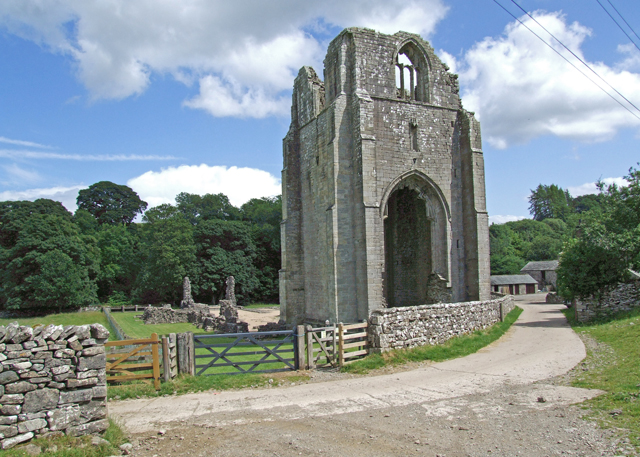
In addition to its natural attractions, Blea Moss boasts a rich historical heritage. The area is dotted with ancient stone circles, burial mounds, and remnants of old settlements, providing a glimpse into the lives of its past inhabitants. Visitors can explore these archaeological sites and learn about the area's fascinating history.

Blea Moss also offers a range of outdoor activities for adventure seekers. Hiking, mountain biking, and horse riding are popular ways to explore the area's diverse landscapes. The nearby lakes and rivers provide opportunities for fishing, boating, and even wild swimming.

Overall, Blea Moss is a haven for nature lovers, history enthusiasts, and outdoor adventurers alike. Its stunning downs and moorland, coupled with its rich heritage and recreational offerings, make it a must-visit destination in Westmorland.

If you have any feedback on the listing, please let us know in the comments section below.

Blea Moss Images

Images are sourced within 2km of 54.507239/-2.7320897 or Grid Reference NY5212. Thanks to Geograph Open Source API. All images are credited.

Narrow Gill near Sleddale Hall Unnamed stream running down to Sleddale Beck in a narrow gill.
Narrow Gill near Sleddale Hall
Unnamed stream running down to Sleddale Beck in a narrow gill.
Cairns on the summit of Seat Robert
Outcrops below Glede Howe
Gouthercrag Gill
Gouthercrag Gill
Truss Gap house, Swindale Former farm buildings in Swindale, now a residential property.
Truss Gap house, Swindale
Former farm buildings in Swindale, now a residential property.
Bridleway to Sleddale Bridleway on rough farm track above Sleddale Beck, between Mosedale and Sleddale Hall.
Bridleway to Sleddale
Bridleway on rough farm track above Sleddale Beck, between Mosedale and Sleddale Hall.
Peathill Gill
Peathill Gill
New stile at the head of Mirk Gill The gill is fenced off to discourage sheep from getting into the narrow gorge a little further down
New stile at the head of Mirk Gill
The gill is fenced off to discourage sheep from getting into the narrow gorge a little further down
An old cairn, Ralfland Forest
Southward path on Ralfland Forest A well marked path on the map but rather vague on the ground
Southward path on Ralfland Forest
A well marked path on the map but rather vague on the ground
Track from Mosedale Cottage to Shap Recent OS maps confidently show a track heading across the moorland between Wet Sleddale and Swindale. It's more of a quad bike track, and needs to be followed carefully especially on a misty day like this one.
Track from Mosedale Cottage to Shap
Recent OS maps confidently show a track heading across the moorland between Wet Sleddale and Swindale. It's more of a quad bike track, and needs to be followed carefully especially on a misty day like this one.
Moorland below Seat Robert The right of way from Truss Gap to Wet Sleddale roughly follows the mid-distance skyline.
Moorland below Seat Robert
The right of way from Truss Gap to Wet Sleddale roughly follows the mid-distance skyline.
Looking towards Great Ladstones The 'track' shown on recent OS maps is visible here - it's a spongy thing, probably from farm quad-bike use, but perfectly practical to follow on foot.
Looking towards Great Ladstones
The 'track' shown on recent OS maps is visible here - it's a spongy thing, probably from farm quad-bike use, but perfectly practical to follow on foot.
Swindale The bridleway from Naddle farm below Bewbarrow Crag
Swindale
The bridleway from Naddle farm below Bewbarrow Crag
Gouther crag
Gouther crag
Swindale Looking towards High Katelade and Langhowe Pike from the road. Dog Rose in flower in the hedge.
Swindale
Looking towards High Katelade and Langhowe Pike from the road. Dog Rose in flower in the hedge.
Swindale Foot The farm house is empty but everything else appears ship shape.
Swindale Foot
The farm house is empty but everything else appears ship shape.
Swindale Foot From the ridge above Swear Gill
Swindale Foot
From the ridge above Swear Gill
Show me another place!

Blea Moss is located at Grid Ref: NY5212 (Lat: 54.507239, Lng: -2.7320897)

Administrative County: Cumbria

District: Eden

Police Authority: Cumbria

What 3 Words

///outnumber.cried.transmits. Near Shap, Cumbria

Nearby Locations

Glede Howe Blea Moss

Related Wikis

Nearby Amenities

Located within 500m of 54.507239,-2.7320897
Rowantree Crag
Place: locality
Lat/Long: 54.508943/-2.7309667
Stone Howe
Place: locality
Lat/Long: 54.5051052/-2.7355144
White Cap
Place: locality
Lat/Long: 54.5086309/-2.7259657
Ford: yes
Lat/Long: 54.5044721/-2.7310892
Ford: yes
Lat/Long: 54.5043712/-2.7346572
Ford: yes
Lat/Long: 54.5048015/-2.7342418
Ford: yes
Lat/Long: 54.5037402/-2.7278508
The data included in this document is from www.openstreetmap.org. The data is made available under ODbL.

Have you been to Blea Moss?

Leave your review of Blea Moss below (or comments, questions and feedback).