Wyes Wood Common

Downs, Moorland in Monmouthshire

Wales

Wyes Wood Common

Public right of way A springtime public right of way at Parkhouse.
Public right of way Credit: Philip Halling

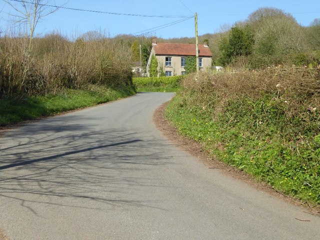
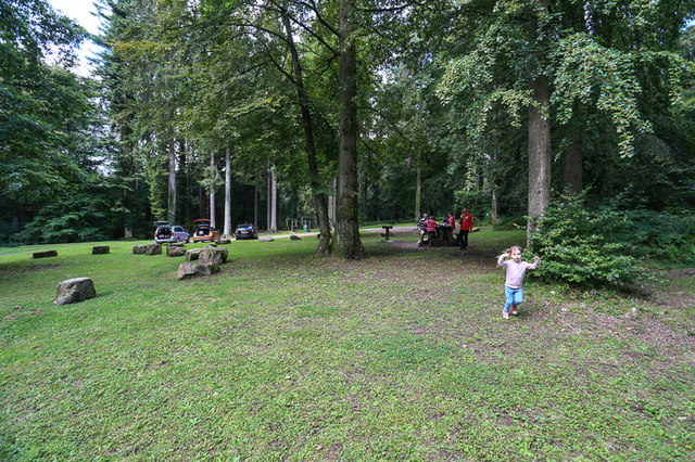
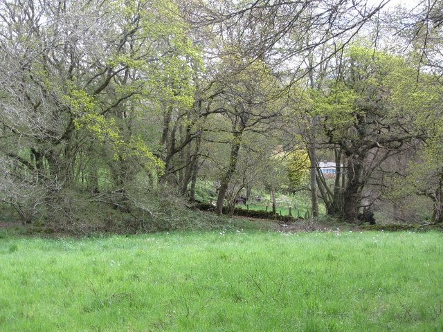
Wyes Wood Common is a picturesque area located in Monmouthshire, Wales. It is known for its diverse range of natural features, including downs and moorland landscapes. Spanning over a vast area, the common offers visitors an opportunity to immerse themselves in the beauty of nature.

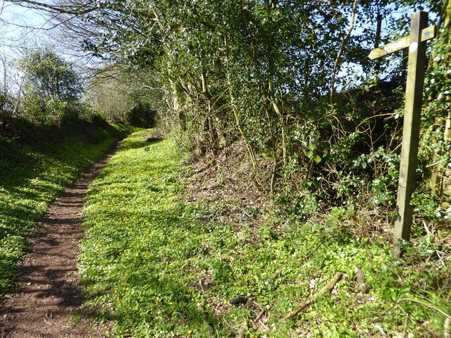
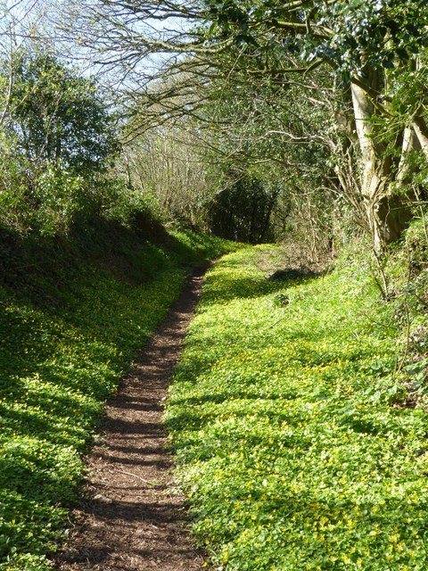
The common is characterized by rolling downs, which provide stunning panoramic views of the surrounding countryside. The lush green grasslands are interspersed with patches of heather and gorse, adding a touch of vibrant color to the landscape. The downs also support a variety of wildflowers, creating a vibrant and visually appealing environment.

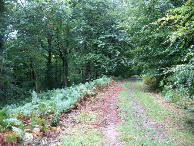
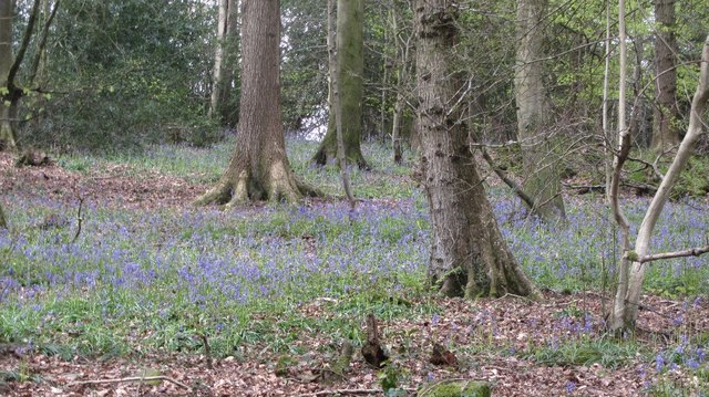
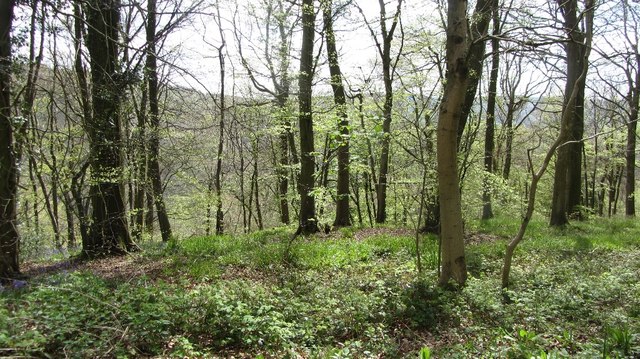
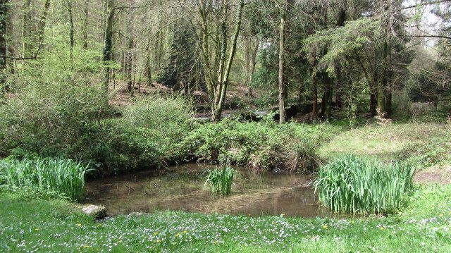
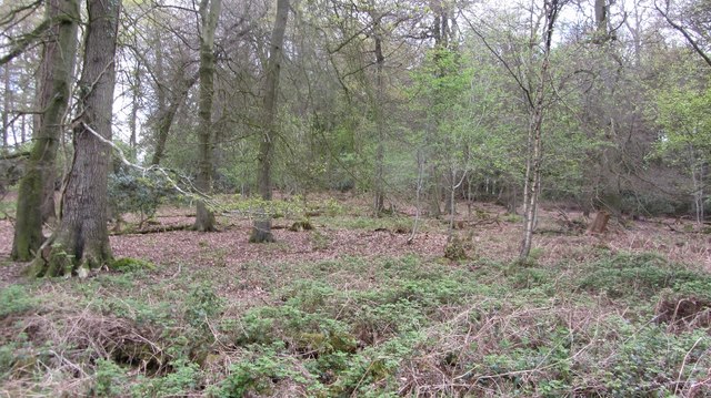
In addition to the downs, Wyes Wood Common is home to expansive moorland areas. These moors are covered in heather and grasses, creating a unique and rugged terrain. The moorland is dotted with small pools and streams, enhancing the natural beauty of the area. It is a haven for wildlife, including rare bird species such as curlews and skylarks.

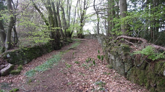
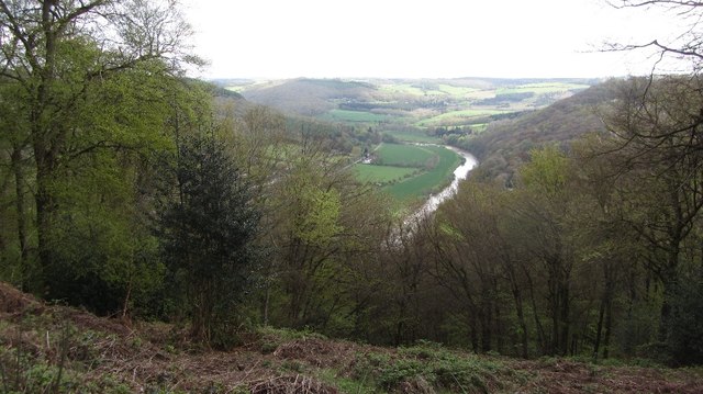
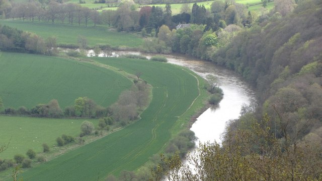
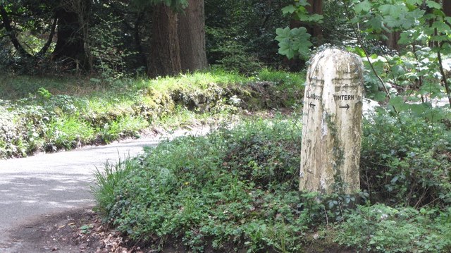
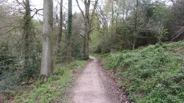
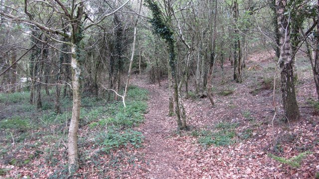
Visitors to Wyes Wood Common can enjoy a range of activities, including walking, hiking, and birdwatching. There are numerous well-maintained trails that wind through the downs and moorland, allowing visitors to explore the area at their own pace. The common also offers breathtaking views of the River Wye, adding to its allure.

Overall, Wyes Wood Common in Monmouthshire is a natural gem, offering a diverse range of landscapes and a wonderful opportunity to experience the beauty of nature. It is a must-visit destination for nature enthusiasts and those seeking a peaceful escape from the hustle and bustle of everyday life.

If you have any feedback on the listing, please let us know in the comments section below.

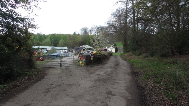
Wyes Wood Common Images

Images are sourced within 2km of 51.718568/-2.7049859 or Grid Reference SO5102. Thanks to Geograph Open Source API. All images are credited.

Public right of way A springtime public right of way at Parkhouse.
Public right of way
A springtime public right of way at Parkhouse.
Public right of way Springtime public right of way at Parkhouse.
Public right of way
Springtime public right of way at Parkhouse.
House in Parkhouse
House in Parkhouse
Llwybr yn gadael hewl / Path exiting a road Llwybr yn gadael heol fach ger anhedd-dy o'r enw Parkhouse.

A path exiting a minor road near a property called Parkhouse.
Llwybr yn gadael hewl / Path exiting a road
Llwybr yn gadael heol fach ger anhedd-dy o'r enw Parkhouse. A path exiting a minor road near a property called Parkhouse.
The Wye Valley Walk in Coed Beddick Descending towards Brockweir.
The Wye Valley Walk in Coed Beddick
Descending towards Brockweir.
Picnic area in Bargain Wood, Llandogo This is the picnic area mentioned in <a href="https://www.geograph.org.uk/photo/494194">SO5202 : Whitestone amenity area</a> which in 2014 had a permanent BBQ. It is so "off-the-beaten-track" that one day in August, at the height of the holiday season, we were the only people there.
Picnic area in Bargain Wood, Llandogo
This is the picnic area mentioned in SO5202 : Whitestone amenity area which in 2014 had a permanent BBQ. It is so "off-the-beaten-track" that one day in August, at the height of the holiday season, we were the only people there.
Old road, Cleddon The walls suggest that this was once a more important route than today's path.
Old road, Cleddon
The walls suggest that this was once a more important route than today's path.
A view down the Wye View from the plateau edge in Bargain Wood.
A view down the Wye
View from the plateau edge in Bargain Wood.
River Wye View down from Bargain Wood.
River Wye
View down from Bargain Wood.
Bluebells, Bargain Wood
Bargain Wood Near the steep slope down to the Wye.
Bargain Wood
Near the steep slope down to the Wye.
Pond, Bargain Wood Beside the car park.
Pond, Bargain Wood
Beside the car park.
Signpost, Bargain Wood
Path, Creigiau Wood
Path, Creigiau Wood
Road to Whyte Lye
Road to Whyte Lye
Wyes Wood
Wyes Wood
Woodland, Whitelye
Woodland, Whitelye
Field near Price's Bridge A clearing in a mostly wooded landscape.
Field near Price's Bridge
A clearing in a mostly wooded landscape.
Show me another place!

Wyes Wood Common is located at Grid Ref: SO5102 (Lat: 51.718568, Lng: -2.7049859)

Unitary Authority: Monmouthshire

Police Authority: Gwent

What 3 Words

///tanked.hoops.outreach. Near Tintern, Monmouthshire

Related Wikis

Catbrook

Catbrook (Welsh: Catffrwd) is a village in Monmouthshire, south east Wales, United Kingdom. The population in 2011 was 412. == Location == Catbrook is...

Cleddon Bog

Cleddon Bog (grid reference SO509039) is a bog in the vice-county of Monmouthshire which has been notified as a biological Site of Special Scientific Interest...

Botany Bay, Monmouthshire

Botany Bay, Monmouthshire is an area in the Wye Valley in Wales, above the village of Tintern. It is the location of a Gwent Scouts camp site covering...

Cleddon Hall

Cleddon Hall, formerly known as Ravenscroft, is a 19th-century Victorian country house in Trellech, Monmouthshire, Wales. In the later 19th century it...

Llandogo

Llandogo (Welsh: Llaneuddogwy) is a small village in Monmouthshire, south Wales, between Monmouth and Chepstow in the lower reaches of the Wye Valley AONB...

Llandogo Halt railway station

Llandogo Halt was a request stop on the former Wye Valley Railway. It was opened on 9 March 1927 to serve the village of Llandogo. It was closed in 1959...

The Hudnalls

The Hudnalls (SO533030 & SO540042 & SO545046 ) is a 94.4-hectare (233-acre) biological Site of Special Scientific Interest in Gloucestershire, notified...

Sylvan House Barn

Sylvan House Barn (grid reference SO534023) is a 0.005-hectare (0.012-acre) stone built barn near the village of St Briavels, in the Forest of Dean, Gloucestershire...

Nearby Amenities

Located within 500m of 51.718568,-2.7049859
Catbrook
Place: village
Wikidata: Q5051622
Lat/Long: 51.7220183/-2.7088877
Silver Circle Distillery
Addr City: Chepstow
Addr Housename: Pleasant View Barn
Addr Postcode: NP16 6UL
Addr Street: Catbrook
Craft: distillery
Opening Hours: Mo-Sa 11:00-18:00
Website: https://silvercircledistillery.com/
Lat/Long: 51.721436/-2.7033697
Man Made: water_well
Pump: no
Lat/Long: 51.7206582/-2.7057443
Direction: 145
Generator Method: photovoltaic
Generator Output Electricity: yes
Generator Solar Modules: 11
Generator Source: solar
Generator Type: solar_photovoltaic_panel
Location: roof
Power: generator
Lat/Long: 51.7148286/-2.7076793
Direction: WSW
Generator Method: photovoltaic
Generator Output Electricity: yes
Generator Solar Modules: 18
Generator Source: solar
Generator Type: solar_photovoltaic_panel
Location: roof
Power: generator
Lat/Long: 51.7159753/-2.7102408
Direction: 125
Generator Method: photovoltaic
Generator Output Electricity: yes
Generator Solar Modules: 10
Generator Source: solar
Generator Type: solar_photovoltaic_panel
Location: roof
Power: generator
Lat/Long: 51.7223536/-2.7065112
Direction: SSE
Generator Method: photovoltaic
Generator Output Electricity: yes
Generator Solar Modules: 16
Generator Source: solar
Generator Type: solar_photovoltaic_panel
Location: roof
Power: generator
Lat/Long: 51.7216366/-2.7070463
Direction: SSE
Generator Method: photovoltaic
Generator Output Electricity: yes
Generator Solar Modules: 16
Generator Source: solar
Generator Type: solar_photovoltaic_panel
Location: roof
Power: generator
Lat/Long: 51.7216042/-2.7093261
Direction: 170
Generator Method: photovoltaic
Generator Output Electricity: yes
Generator Solar Modules: 15
Generator Source: solar
Generator Type: solar_photovoltaic_panel
Location: roof
Power: generator
Lat/Long: 51.7212478/-2.7061558
Direction: 165
Generator Method: photovoltaic
Generator Output Electricity: yes
Generator Solar Modules: 8
Generator Source: solar
Generator Type: solar_photovoltaic_panel
Location: roof
Power: generator
Lat/Long: 51.7218618/-2.7065702
Direction: 215
Generator Method: photovoltaic
Generator Output Electricity: yes
Generator Solar Modules: 16
Generator Source: solar
Generator Type: solar_photovoltaic_panel
Location: roof
Power: generator
Lat/Long: 51.7221592/-2.7064039
Direction: 215
Generator Method: photovoltaic
Generator Output Electricity: yes
Generator Solar Modules: 15
Generator Source: solar
Generator Type: solar_photovoltaic_panel
Location: roof
Power: generator
Lat/Long: 51.7218551/-2.7056904
Direction: SSE
Generator Method: photovoltaic
Generator Output Electricity: yes
Generator Solar Modules: 14
Generator Source: solar
Generator Type: solar_photovoltaic_panel
Location: roof
Power: generator
Lat/Long: 51.721355/-2.7056797
Direction: 170
Generator Method: photovoltaic
Generator Output Electricity: yes
Generator Solar Modules: 18
Generator Source: solar
Generator Type: solar_photovoltaic_panel
Location: roof
Power: generator
Lat/Long: 51.7209712/-2.7062537
Direction: S
Generator Method: photovoltaic
Generator Output Electricity: yes
Generator Solar Modules: 12
Generator Source: solar
Generator Type: solar_photovoltaic_panel
Location: roof
Power: generator
Lat/Long: 51.7211365/-2.7099551
The data included in this document is from www.openstreetmap.org. The data is made available under ODbL.

Have you been to Wyes Wood Common?

Leave your review of Wyes Wood Common below (or comments, questions and feedback).