Todd Fell

Downs, Moorland in Westmorland South Lakeland

England

Todd Fell

St Mary's Church Longsleddale Deep into Longsledderdale, sandwiched between remnant ribbons of semi-ancient woodland along the valley floor, an earlier chapel of 1712 was replaced with an endowment from Lady Howard of Leven’s Hall, who held the manorial rights. A range of even earlier artefacts survive, mainly furnishings, but some elements have been built in, such as the aumbry cupboard door of 1662. Indeed, it is the furnishings and internal features that bring to life that which would otherwise be rather plain: the pulpit, unusually accessed by a rear door from the Vestry; the chancel arch inscription; the east window suspended stained glass pendant of the church’s chalice (of 1571, safeguarded off-site); wall-paintings; chests, etc.
St Mary's Church Longsleddale Credit: Colin Kinnear

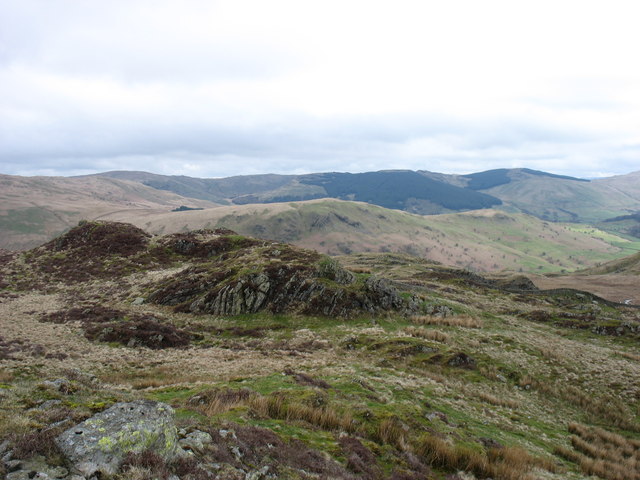
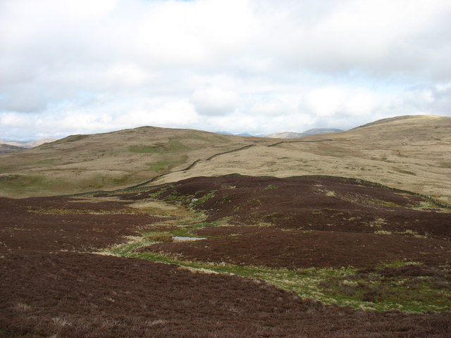
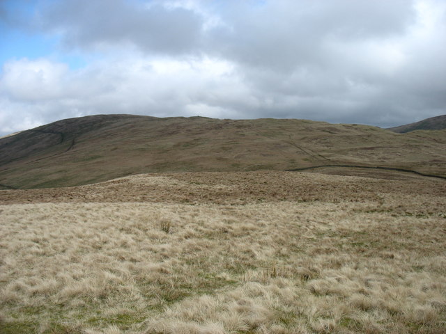
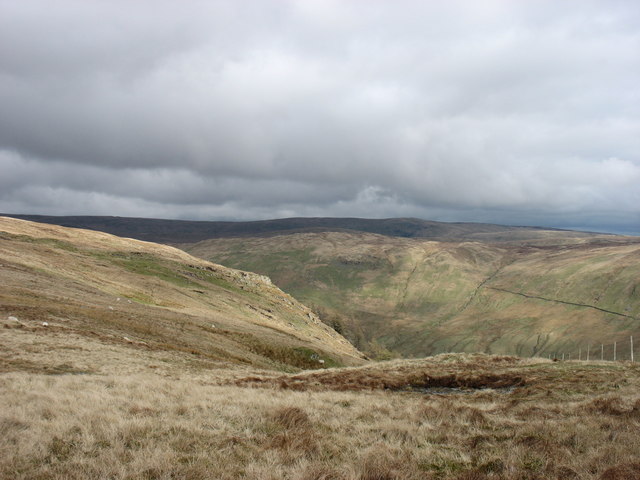
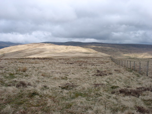
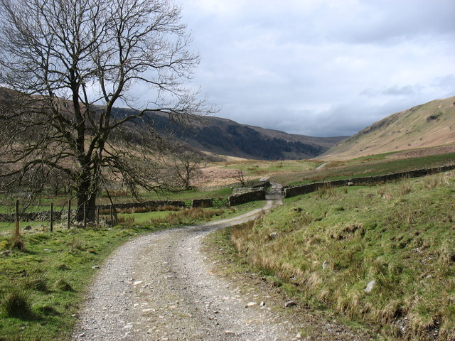
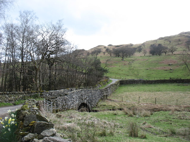
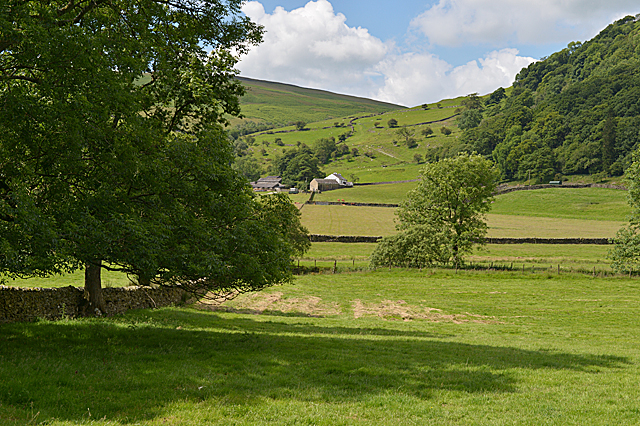
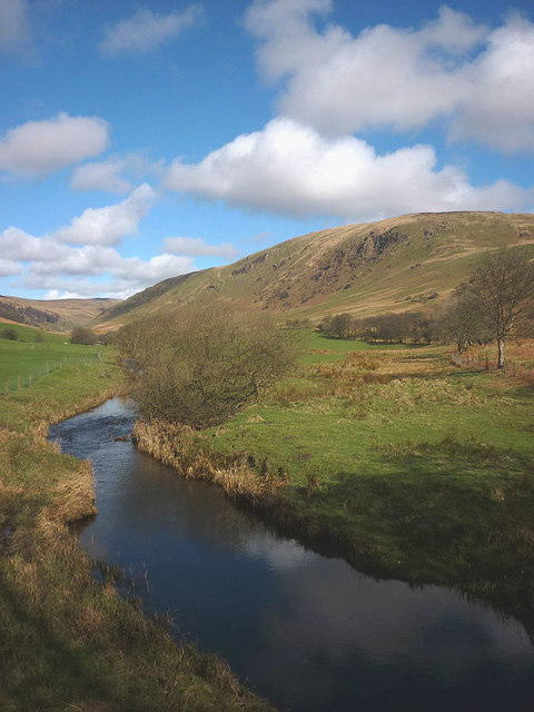
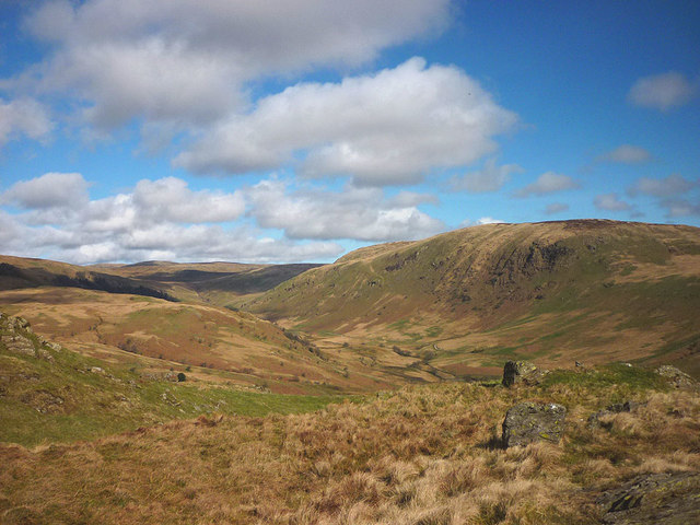
Todd Fell is a stunning geographical feature located in the county of Westmorland, England. Positioned in the heart of the Westmorland Dales, this natural wonder is a captivating blend of downs and moorland landscapes. With its diverse range of flora and fauna, it offers a haven for nature enthusiasts and outdoor enthusiasts alike.

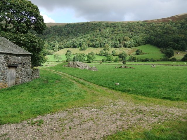
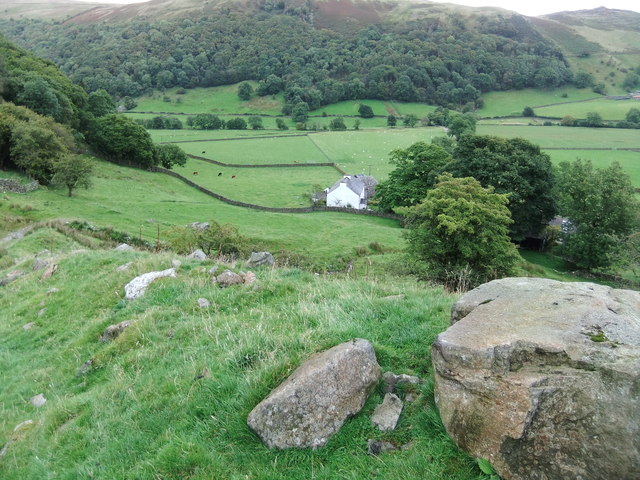
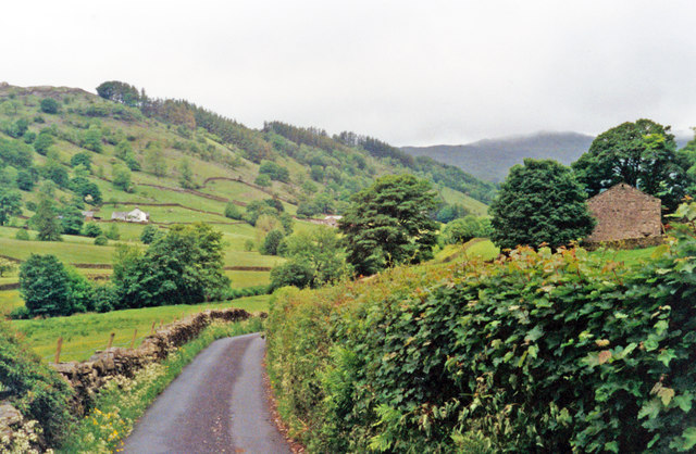
The terrain of Todd Fell is characterized by rolling hills covered in lush green grasslands, providing a picturesque backdrop against the dramatic skyline. The area is interspersed with patches of heather and bracken, adding vibrant colors to the landscape, especially during the summer months. The fell is dotted with ancient stone walls, a testament to the rich history of the region.

The wildlife in Todd Fell is abundant and varied, making it an ideal destination for birdwatchers and wildlife photographers. Visitors may be fortunate enough to spot species such as red grouse, curlews, lapwings, and skylarks, soaring through the skies or nesting in the grassy meadows. The diverse plant life includes hardy heathers, bilberries, and cotton grass, which thrive in the moorland environment.

Outdoor activities are popular in Todd Fell, with numerous walking trails and hiking routes crisscrossing the area. These trails offer panoramic views of the surrounding countryside, providing a truly memorable experience for visitors. The fell is also a favorite spot for picnics and relaxing amidst the tranquil surroundings.

Overall, Todd Fell is a captivating natural landscape that showcases the beauty and diversity of Westmorland. Its rolling downs and moorland, rich wildlife, and breathtaking views make it a must-visit destination for nature lovers and those seeking a peaceful escape in the heart of England's countryside.

If you have any feedback on the listing, please let us know in the comments section below.
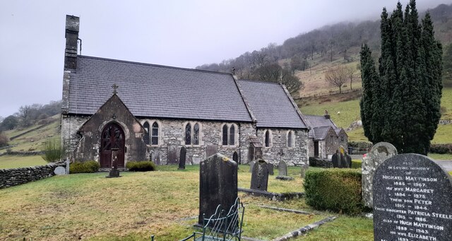
Todd Fell Images

Images are sourced within 2km of 54.411058/-2.752608 or Grid Reference NY5101. Thanks to Geograph Open Source API. All images are credited.

St Mary's Church Longsleddale Deep into Longsledderdale, sandwiched between remnant ribbons of semi-ancient woodland along the valley floor, an earlier chapel of 1712 was replaced with an endowment from Lady Howard of Leven’s Hall, who held the manorial rights. A range of even earlier artefacts survive, mainly furnishings, but some elements have been built in, such as the aumbry cupboard door of 1662. Indeed, it is the furnishings and internal features that bring to life that which would otherwise be rather plain: the pulpit, unusually accessed by a rear door from the Vestry; the chancel arch inscription; the east window suspended stained glass pendant of the church’s chalice (of 1571, safeguarded off-site); wall-paintings; chests, etc.
St Mary's Church Longsleddale
Deep into Longsledderdale, sandwiched between remnant ribbons of semi-ancient woodland along the valley floor, an earlier chapel of 1712 was replaced with an endowment from Lady Howard of Leven’s Hall, who held the manorial rights. A range of even earlier artefacts survive, mainly furnishings, but some elements have been built in, such as the aumbry cupboard door of 1662. Indeed, it is the furnishings and internal features that bring to life that which would otherwise be rather plain: the pulpit, unusually accessed by a rear door from the Vestry; the chancel arch inscription; the east window suspended stained glass pendant of the church’s chalice (of 1571, safeguarded off-site); wall-paintings; chests, etc.
Rock outcrops near the eponymous Kilnstones house
Dockernook Farm
Dockernook Farm
NW up Long Sleddale The view is near Yewbarrow Hall, with Harter Fell (2,509 ft.) ahead. This road goes no further than the head of the valley, but in the 1840s it nearly became the route of the Lancaster & Carlisle Railway - part of the present West Coast Main Line; instead, it is followed by the pipeline to Manchester from Haweswater Reservoir.
NW up Long Sleddale
The view is near Yewbarrow Hall, with Harter Fell (2,509 ft.) ahead. This road goes no further than the head of the valley, but in the 1840s it nearly became the route of the Lancaster & Carlisle Railway - part of the present West Coast Main Line; instead, it is followed by the pipeline to Manchester from Haweswater Reservoir.
The view from Whiteside Pike Whiteside Pike is the first hill on the Bannisdale Horseshoe.
The view from Whiteside Pike
Whiteside Pike is the first hill on the Bannisdale Horseshoe.
Moorland below Whiteside Pike Looking towards Todd Fell (left) and Capplebarrow (right), the next hills on the Bannisdale Horseshoe.
Moorland below Whiteside Pike
Looking towards Todd Fell (left) and Capplebarrow (right), the next hills on the Bannisdale Horseshoe.
Moorland north of Todd Fell On the way to Capplebarrow, on the Bannisdale Horseshoe.
Moorland north of Todd Fell
On the way to Capplebarrow, on the Bannisdale Horseshoe.
A steep drop into Bannisdale Seen from the Bannisdale Horseshoe.
A steep drop into Bannisdale
Seen from the Bannisdale Horseshoe.
The Bannisdale Horseshoe continues Looking towards Swinklebank Crag Top from Capplebarrow.
The Bannisdale Horseshoe continues
Looking towards Swinklebank Crag Top from Capplebarrow.
The Bannisdale track Taken after descending from the Bannisdale Horseshoe.
The Bannisdale track
Taken after descending from the Bannisdale Horseshoe.
Dryhowe Bridge From here, there is just 2 kilometres of country lane to complete the Bannisdale Horseshoe.
Dryhowe Bridge
From here, there is just 2 kilometres of country lane to complete the Bannisdale Horseshoe.
Fields around Docker Nook
Long Sleddale parish church of St. Mary's
Toilets, Long Sleddale Immaculate community-run toilets.
Toilets, Long Sleddale
Immaculate community-run toilets.
Long Sleddale Community Hall
St Mary's Church, Longsleddale
Bannisdale Beck Standing on Dryhowe Bridge looking up the dale. The craggy flank of Capplefall is about as exciting as the scenery gets in this very quiet corner of the Lake District. I saw few other walkers all day - two on the tops and two strolling along the valley track. Definitely a place to get far from the madding crowd.
Bannisdale Beck
Standing on Dryhowe Bridge looking up the dale. The craggy flank of Capplefall is about as exciting as the scenery gets in this very quiet corner of the Lake District. I saw few other walkers all day - two on the tops and two strolling along the valley track. Definitely a place to get far from the madding crowd.
Minor top above Bannisdale A few small outcrops dot the top of this knoll east of the summit of Whiteside Pike. Looking north into the sequestered valley of Bannisdale with the craggy flank of Capplefall prominent.
Minor top above Bannisdale
A few small outcrops dot the top of this knoll east of the summit of Whiteside Pike. Looking north into the sequestered valley of Bannisdale with the craggy flank of Capplefall prominent.
Show me another place!

Todd Fell is located at Grid Ref: NY5101 (Lat: 54.411058, Lng: -2.752608)

Administrative County: Cumbria

District: South Lakeland

Police Authority: Cumbria

What 3 Words

///fallen.pictured.driveways. Near Staveley, Cumbria

Nearby Locations

Low House Wood Todd Fell

Related Wikis

River Sprint

The River Sprint is a river in Cumbria, England with its source high up on the south-facing side of Harter Fell. It flows into the River Kent just to...

Longsleddale

Longsleddale () is a valley and civil parish in the South Lakeland district of Cumbria, England. It includes the hamlet of Sadgill. The parish has a population...

Bannisdale Horseshoe

The Bannisdale Horseshoe is an upland area in Cumbria, England, near the eastern boundary of the Lake District National Park, surrounding the valley of...

Lowbridge Estate

The Lowbridge Estate is a country estate of approximately 2000 acres in the Lake District region of England that was in the continuous ownership of the...

Nearby Amenities

Located within 500m of 54.411058,-2.752608
Grubbings Wood
Natural: wood
Lat/Long: 54.4115143/-2.7600721
Todd Crag
Place: locality
Lat/Long: 54.4091566/-2.7552839
Todd Fell
Ele: 401
Natural: peak
Lat/Long: 54.4116621/-2.7529993
The data included in this document is from www.openstreetmap.org. The data is made available under ODbL.

Have you been to Todd Fell?

Leave your review of Todd Fell below (or comments, questions and feedback).