Borrowdale Moss

Downs, Moorland in Westmorland South Lakeland

England

Borrowdale Moss

Moorland below Ancrow Brow Seen from the Bannisdale Horseshoe, which creeps into hectad NY40 by just a few metres.
Moorland below Ancrow Brow Credit: David Purchase

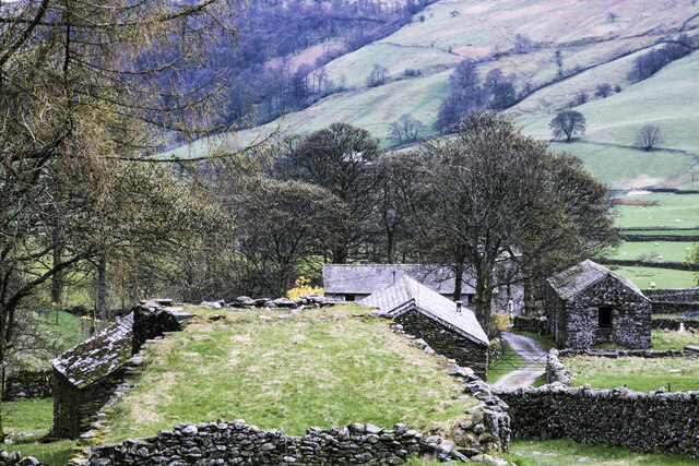
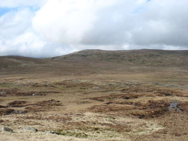
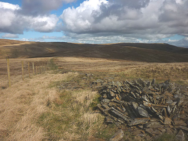
Borrowdale Moss is a scenic area located in Westmorland, a historic county in the northwest of England. Nestled within the stunning landscape of the Lake District National Park, this region is renowned for its natural beauty and diverse ecosystems.

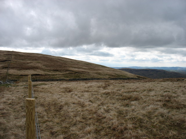
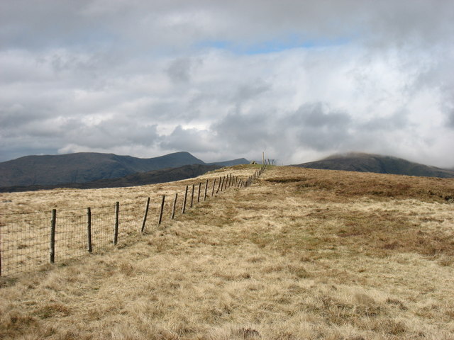
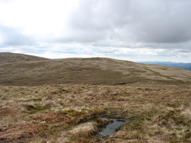
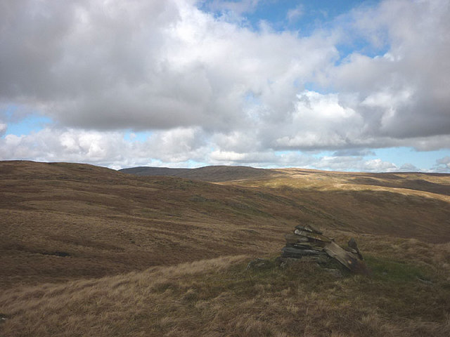
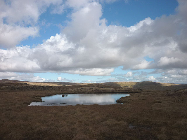
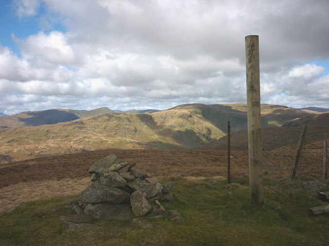
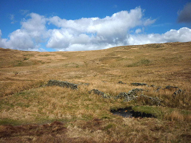
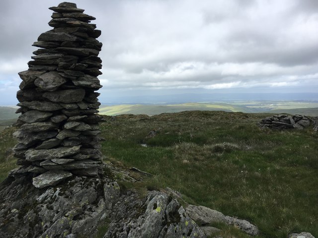
Borrowdale Moss encompasses a mix of downs, moorland, and wetlands, creating a unique and varied environment that attracts both tourists and nature enthusiasts. The downs are characterized by rolling hills covered in lush grasses and heather, offering panoramic views of the surrounding countryside. The moorland, on the other hand, is dominated by expansive stretches of open, rugged terrain, dotted with patches of heath and shrubs.

The area is home to a rich array of flora and fauna, with wildflowers such as harebells, orchids, and yellow flag iris dotting the landscape. Various species of birds, including curlews, lapwings, and golden plovers, can be spotted soaring above the moorland, while the wetlands provide a habitat for water-loving creatures like otters and water voles.

Borrowdale Moss also boasts several hiking trails, allowing visitors to explore the area's natural wonders up close. The moss is crisscrossed by footpaths that wind through its diverse habitats, providing ample opportunities for wildlife observation and peaceful walks in nature.

Overall, Borrowdale Moss is a captivating destination that showcases the stunning beauty and biodiversity of Westmorland. It offers a tranquil retreat for those seeking to immerse themselves in the splendor of the Lake District's natural landscape.

If you have any feedback on the listing, please let us know in the comments section below.

Borrowdale Moss Images

Images are sourced within 2km of 54.448907/-2.7578055 or Grid Reference NY5006. Thanks to Geograph Open Source API. All images are credited.

Moorland below Ancrow Brow Seen from the Bannisdale Horseshoe, which creeps into hectad NY40 by just a few metres.
Moorland below Ancrow Brow
Seen from the Bannisdale Horseshoe, which creeps into hectad NY40 by just a few metres.
Lime kiln and other buildings in Stockdale The view is across the top of the disused kiln towards other buildings in the small settlement of Stockdale in Longsleddale.
Lime kiln and other buildings in Stockdale
The view is across the top of the disused kiln towards other buildings in the small settlement of Stockdale in Longsleddale.
On Lord's Seat Looking down Borrowdale
On Lord's Seat
Looking down Borrowdale
Swinklebank Crag Top The highest point on the Bannisdale Horseshoe.
Swinklebank Crag Top
The highest point on the Bannisdale Horseshoe.
Ancrow Brow from its North top Swinklebank Crag Top is to the left. The Bannisdale Horseshoe crosses all these hills.
Ancrow Brow from its North top
Swinklebank Crag Top is to the left. The Bannisdale Horseshoe crosses all these hills.
Borrowdale Moss from Long Crag Sleddale Fell is on the horizon. This photo is taken from the spot that Wainwright identified as Long Crag on the Bannisdale Horseshoe, not the 493m point which is the highest point of Bannisdale Fell.
Borrowdale Moss from Long Crag
Sleddale Fell is on the horizon. This photo is taken from the spot that Wainwright identified as Long Crag on the Bannisdale Horseshoe, not the 493m point which is the highest point of Bannisdale Fell.
The wall across White Howe The Bannisdale Horseshoe follows this wall before veering right to the summit of White Howe.
The wall across White Howe
The Bannisdale Horseshoe follows this wall before veering right to the summit of White Howe.
Harrop Pike
Harrop Pike
Small cairn on minor top south of Swinklebank Crag An anonymous pile on an anonymous knoll.
Small cairn on minor top south of Swinklebank Crag
An anonymous pile on an anonymous knoll.
Unnamed tarn on Swinklebank Crag Needless to say, the ground here is very boggy unlike the drier going over the summit just to the north.
Unnamed tarn on Swinklebank Crag
Needless to say, the ground here is very boggy unlike the drier going over the summit just to the north.
Summit of Swinklebank Crag A sturdy new fence post adorns the top suggesting that a new fence may be in the offing? The summit gives a good view of the more rugged fells around the heads of Longsleddale and Kentmere.
Summit of Swinklebank Crag
A sturdy new fence post adorns the top suggesting that a new fence may be in the offing? The summit gives a good view of the more rugged fells around the heads of Longsleddale and Kentmere.
Fence and old wall, Ancrow Brow If the wall ever stood upright it has been virtually obliterated now.
Fence and old wall, Ancrow Brow
If the wall ever stood upright it has been virtually obliterated now.
Ruined fold, Bannisdale Beck Judging by its location beside the beck it would appear to have been a washfold.
Ruined fold, Bannisdale Beck
Judging by its location beside the beck it would appear to have been a washfold.
Harrop Pike Summit Cairn of Harrop Pike
Harrop Pike
Summit Cairn of Harrop Pike
Walls on Bannisdale Fell
Mere Crag
Mere Crag
Ancient wall near Ancrow Brow
Un-named cairn above Swinklebank Crag No name but the highest point in the circuit of Bannisdale
Un-named cairn above Swinklebank Crag
No name but the highest point in the circuit of Bannisdale
Show me another place!

Borrowdale Moss is located at Grid Ref: NY5006 (Lat: 54.448907, Lng: -2.7578055)

Administrative County: Cumbria

District: South Lakeland

Police Authority: Cumbria

What 3 Words

///plodding.words.pointed. Near Staveley, Cumbria

Nearby Locations

Borrowdale Moss

Related Wikis

Grey Crag

Grey Crag is a fell in the English Lake District. It stands to the east of Longsleddale in the Far Eastern Fells. == Topography == North of Sadgill, the...

Crookdale Horseshoe

The Crookdale Horseshoe is a group of hills on the eastern edge of the English Lake District, in Cumbria, west of the A6 road. They are the subject of...

Tarn Crag (Far Eastern Fells)

Tarn Crag is a fell in the English Lake District. It stands to the east of Longsleddale in the Far Eastern Fells. == Topography == North of Sadgill, the...

Sadgill

Sadgill is a hamlet in Longsleddale, Cumbria, England. It is a divided settlement, also containing Low Sadgill. == References ==

Nearby Amenities

Located within 500m of 54.448907,-2.7578055
Borrowdale Hole
Place: locality
Lat/Long: 54.44999/-2.7628731
The data included in this document is from www.openstreetmap.org. The data is made available under ODbL.

Have you been to Borrowdale Moss?

Leave your review of Borrowdale Moss below (or comments, questions and feedback).