Buckstone Moss

Downs, Moorland in Roxburghshire

Scotland

Buckstone Moss

Hermitage Castle
Hermitage Castle Credit: Kevin Waterhouse

Buckstone Moss is a picturesque area located in Roxburghshire, a historic county in the Scottish Borders region of Scotland. Stretching across the downs and moorland, it offers a serene and captivating landscape for visitors to immerse themselves in.

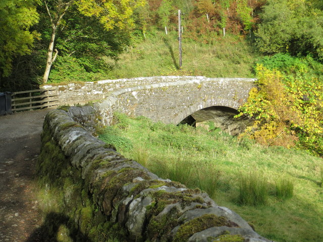
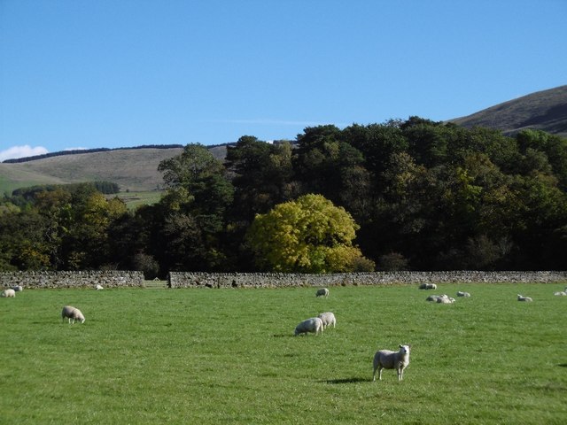
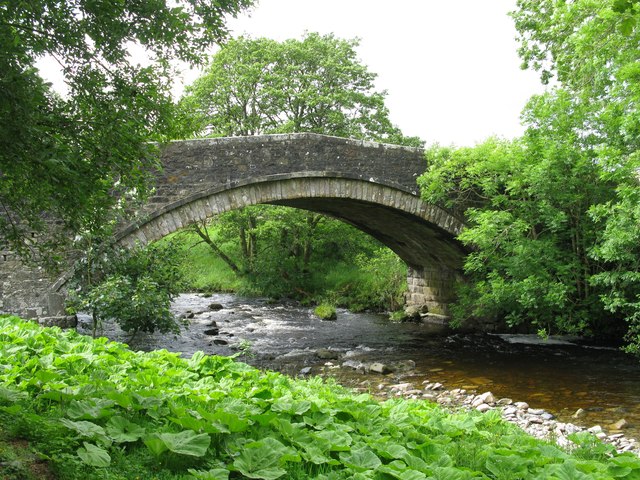
The moss is characterized by its vast expanse of open countryside, adorned with heather-covered hills and meandering streams. The rolling downs provide a stunning backdrop, with their gentle slopes and lush greenery. This natural beauty attracts many outdoor enthusiasts, including hikers, birdwatchers, and nature photographers.

The area is home to a diverse range of flora and fauna, with various species thriving in this unique ecosystem. Visitors may catch glimpses of red grouse, curlews, and other bird species that call Buckstone Moss their home. The moss is also known for its vibrant display of wildflowers during the summer months, creating a tapestry of colors across the landscape.

For those seeking tranquility and solitude, Buckstone Moss offers a peaceful retreat away from the hustle and bustle of everyday life. The surroundings provide ample opportunities for walking, picnicking, and simply appreciating the unspoiled beauty of nature.

Visitors to Buckstone Moss can access the area via well-maintained paths and trails that wind through the countryside. The moss is easily accessible by car and public transport, making it a popular destination for day trips or longer stays.

In summary, Buckstone Moss in Roxburghshire provides a picturesque escape into the heart of Scotland's downs and moorland. With its breathtaking scenery, abundant wildlife, and tranquil atmosphere, it is a must-visit destination for nature lovers and those seeking a peaceful retreat.

If you have any feedback on the listing, please let us know in the comments section below.

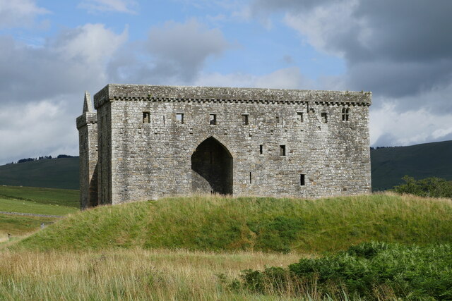
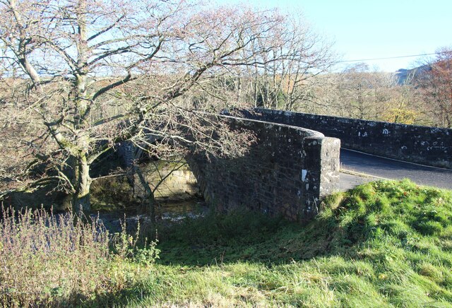
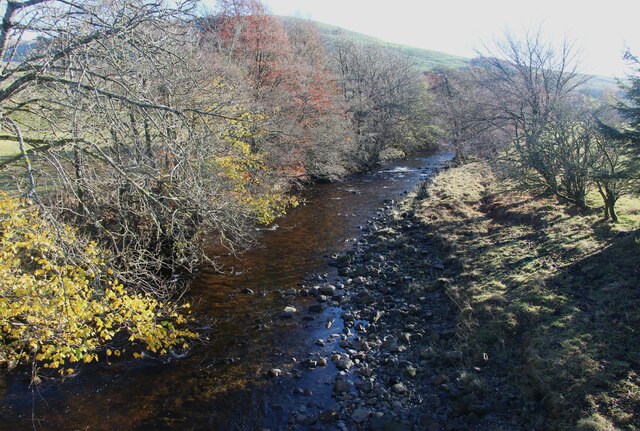
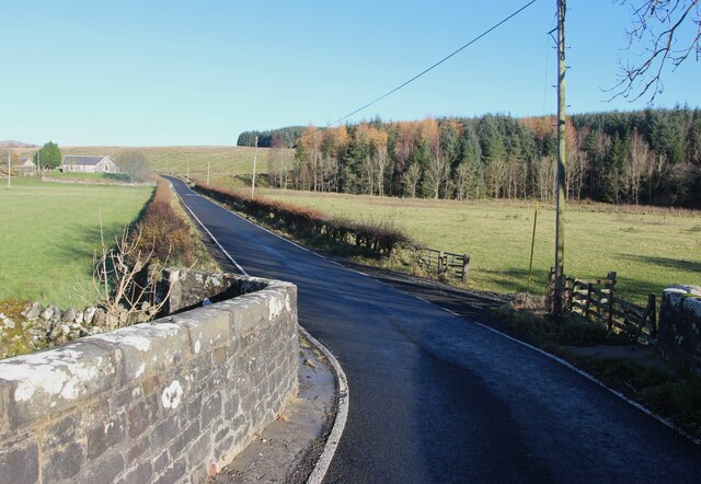
Buckstone Moss Images

Images are sourced within 2km of 55.259184/-2.7824848 or Grid Reference NY5096. Thanks to Geograph Open Source API. All images are credited.

Hermitage Castle
Hermitage Castle
Hermitage Castle under a threatening sky This view of Hermitage Castle captures the building under a threatening August sky.  Unfortunately, due to ongoing surveying, Heras fencing has been erected around parts of the structure.

This photograph was taken during the Coronavirus (COVID-19) pandemic of 2020/21/22.
Hermitage Castle under a threatening sky
This view of Hermitage Castle captures the building under a threatening August sky. Unfortunately, due to ongoing surveying, Heras fencing has been erected around parts of the structure. This photograph was taken during the Coronavirus (COVID-19) pandemic of 2020/21/22.
Whitrope Burn south of Whitropefoot The Whitrope Burn viewed from a bridge carrying the B6399, south of Whitropefoot.

This photograph was taken during the Coronavirus (COVID-19) pandemic of 2020/21/22.
Whitrope Burn south of Whitropefoot
The Whitrope Burn viewed from a bridge carrying the B6399, south of Whitropefoot. This photograph was taken during the Coronavirus (COVID-19) pandemic of 2020/21/22.
A bridge over the Whitrope Burn north of Hermitage The bridge carries the B6399 over the Whitrope Burn near Hermitage.

This photograph was taken during the Coronavirus (COVID-19) pandemic of 2020/21/22.
A bridge over the Whitrope Burn north of Hermitage
The bridge carries the B6399 over the Whitrope Burn near Hermitage. This photograph was taken during the Coronavirus (COVID-19) pandemic of 2020/21/22.
Road bridge over Hermitage Water
Hermitage Water From the B6399 bridge.
Hermitage Water
From the B6399 bridge.
On the B6399 at Hermitage Water
Ordnance Survey Flush Bracket 1435 This can be found on the wall of a private dwelling at Whitropefoot.
For more detail see : <span class="nowrap"><a title="http://www.bench-marks.org.uk/bm1558" rel="nofollow ugc noopener" href="http://www.bench-marks.org.uk/bm1558">Link</a><img style="margin-left:2px;" alt="External link" title="External link - shift click to open in new window" src="https://s1.geograph.org.uk/img/external.png" width="10" height="10"/></span>
Ordnance Survey Flush Bracket 1435
This can be found on the wall of a private dwelling at Whitropefoot. For more detail see : LinkExternal link
Ordnance Survey Flush Bracket 1434 This can be found on the wall of a building at Hermitage.
For more detail see : <span class="nowrap"><a title="http://www.bench-marks.org.uk/bm1557" rel="nofollow ugc noopener" href="http://www.bench-marks.org.uk/bm1557">Link</a><img style="margin-left:2px;" alt="External link" title="External link - shift click to open in new window" src="https://s1.geograph.org.uk/img/external.png" width="10" height="10"/></span>
Ordnance Survey Flush Bracket 1434
This can be found on the wall of a building at Hermitage. For more detail see : LinkExternal link
Bridge over Whitrope Burn at Hermitage Looking north-eastward from the farm track to the B6399 road.
Bridge over Whitrope Burn at Hermitage
Looking north-eastward from the farm track to the B6399 road.
Sheep, Toftholm Haugh beside the Hermitage Water.
Sheep, Toftholm
Haugh beside the Hermitage Water.
Hermitage road A single track road linking the A7 (Ewesdale) and B6399 (Liddesdale).
Hermitage road
A single track road linking the A7 (Ewesdale) and B6399 (Liddesdale).
Silage clamp Now disused: beside the Hermitage road
Silage clamp
Now disused: beside the Hermitage road
B6399 dropping down the valley of the Whitrope Burn Just south of where the road emerges from the forest that cloaks the watershed.
B6399 dropping down the valley of the Whitrope Burn
Just south of where the road emerges from the forest that cloaks the watershed.
Looking up Hermitage Hill from the valley of the Whitrope Burn
The B6399 This road sometimes has a lane in each direction, sometimes it also has passing places, showing that it is not quite as wide as you think.
The B6399
This road sometimes has a lane in each direction, sometimes it also has passing places, showing that it is not quite as wide as you think.
Road Bridge over the Whitrope Burn The Whitrope Burn is a tributary of Hermitage Water which is a tributary of Liddel Water and finally a tributary of the River Esk.
Road Bridge over the Whitrope Burn
The Whitrope Burn is a tributary of Hermitage Water which is a tributary of Liddel Water and finally a tributary of the River Esk.
Road Bridge over Hermitage Water at Hermitage The bridge carries the B6399 across Hermitage Water which is a tributary of Liddel Water which in turn is a tributary of the River Esk.
Road Bridge over Hermitage Water at Hermitage
The bridge carries the B6399 across Hermitage Water which is a tributary of Liddel Water which in turn is a tributary of the River Esk.
Show me another place!

Buckstone Moss is located at Grid Ref: NY5096 (Lat: 55.259184, Lng: -2.7824848)

Unitary Authority: The Scottish Borders

Police Authority: The Lothians and Scottish Borders

What 3 Words

///piglets.relations.officer. Near Teviothead, Scottish Borders

Nearby Locations

Buck Stone Buckstone Moss

Related Wikis

Nearby Amenities

Located within 500m of 55.259184,-2.7824848
Power: pole
Lat/Long: 55.2559142/-2.7770757
Power: pole
Lat/Long: 55.2566054/-2.7770525
Power: pole
Lat/Long: 55.2573333/-2.7771427
Power: pole
Lat/Long: 55.2581624/-2.7772534
Power: pole
Lat/Long: 55.2589034/-2.7773667
Power: pole
Lat/Long: 55.2596708/-2.7774542
Power: pole
Lat/Long: 55.2604309/-2.7775547
Power: pole
Lat/Long: 55.2611954/-2.7776396
Power: pole
Lat/Long: 55.2619672/-2.7777504
Power: pole
Lat/Long: 55.2627272/-2.7778353
The data included in this document is from www.openstreetmap.org. The data is made available under ODbL.

Have you been to Buckstone Moss?

Leave your review of Buckstone Moss below (or comments, questions and feedback).