Brae of Bogie

Downs, Moorland in Aberdeenshire

Scotland

Brae of Bogie

Minor road towards Rhynie
Minor road towards Rhynie Credit: Steven Brown

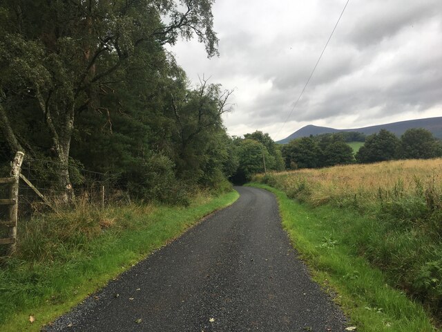
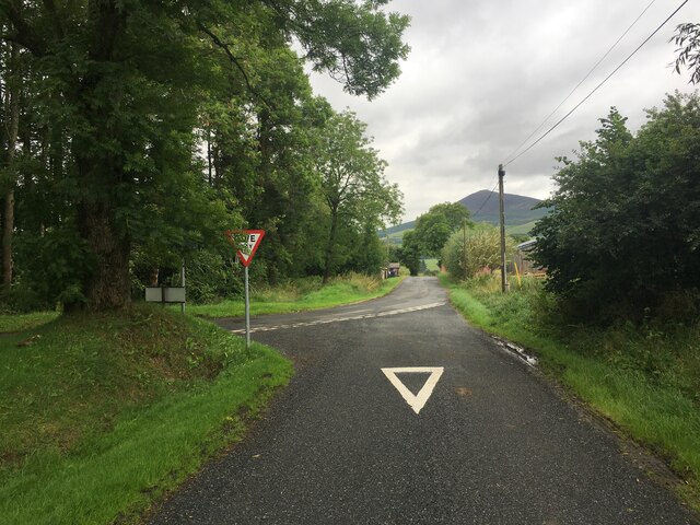
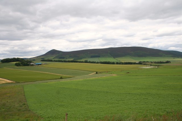
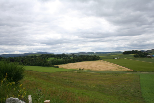
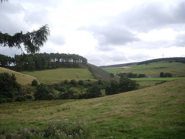
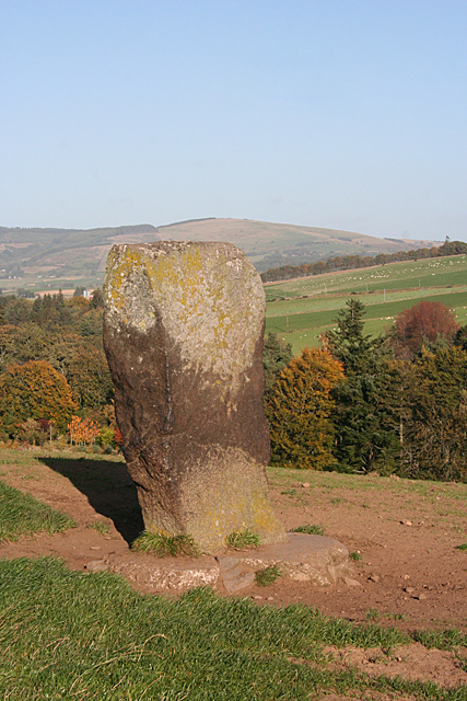
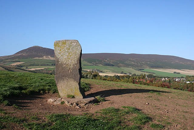
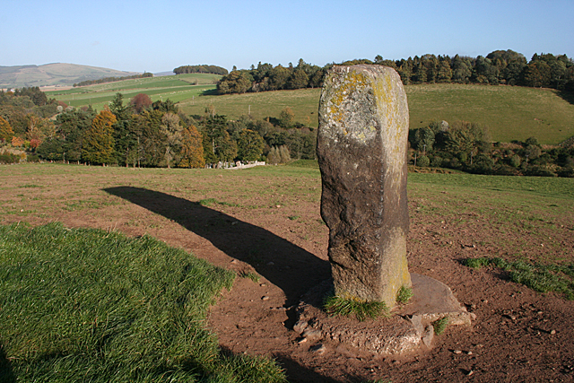
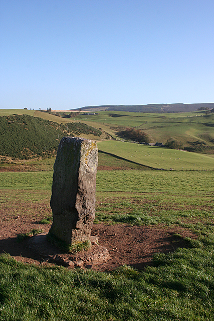
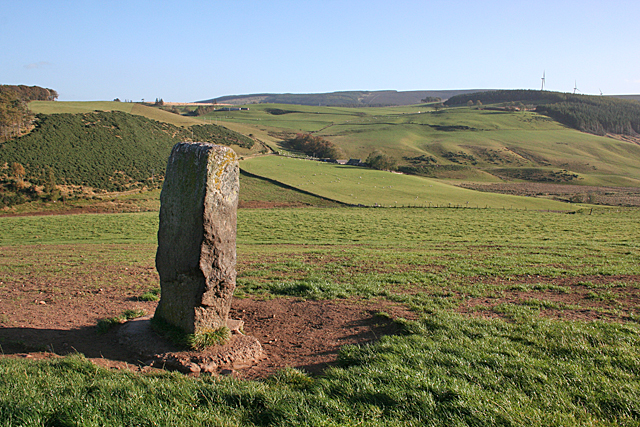
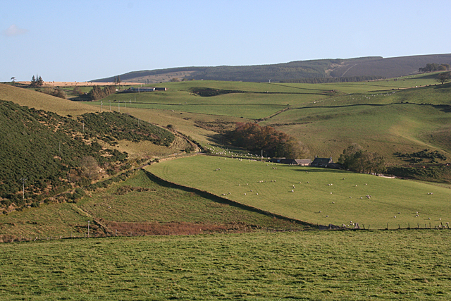
Brae of Bogie is a picturesque area located in Aberdeenshire, Scotland. Situated on the downs and moorland, it offers stunning natural beauty and a tranquil atmosphere. The area is known for its rolling hills, heather-covered moors, and panoramic views of the surrounding countryside.

Brae of Bogie is characterized by its diverse flora and fauna, making it a popular destination for nature enthusiasts and wildlife lovers. The downs are home to a variety of bird species, including the iconic red grouse and golden plover. Visitors can also spot deer, hares, and the occasional red squirrel roaming freely across the moorland.

The landscape of Brae of Bogie is shaped by the harsh Scottish weather, with strong winds and unpredictable weather patterns. Despite this, the area remains a haven for outdoor activities such as hiking, cycling, and birdwatching. The well-maintained trails and pathways offer opportunities for exploration and discovery, with breathtaking views at every turn.

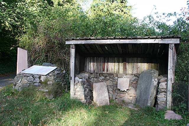
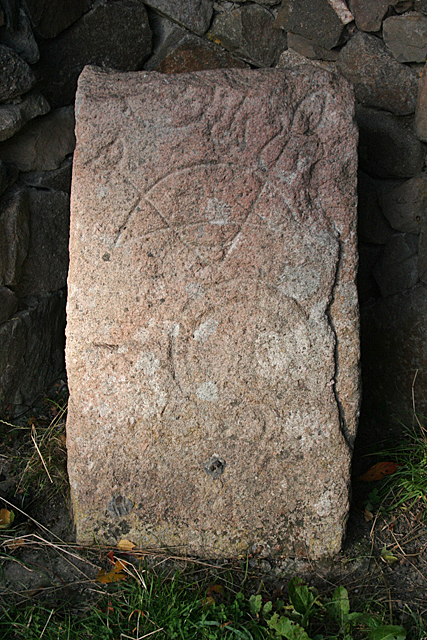
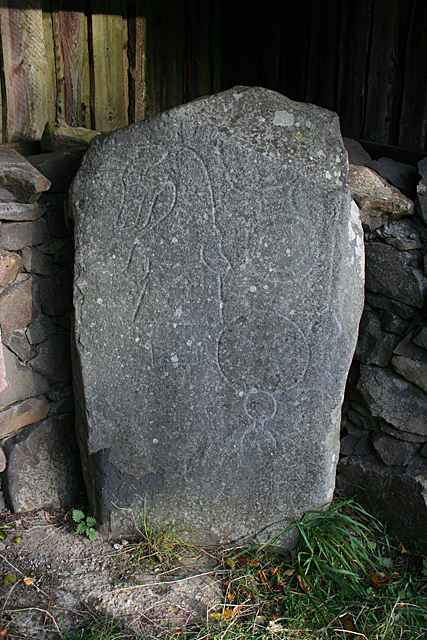
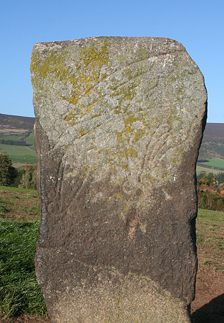
In addition to its natural beauty, Brae of Bogie is dotted with historical landmarks. The area is rich in archaeological sites, including ancient burial mounds and standing stones, providing a glimpse into the region's past.

Overall, Brae of Bogie in Aberdeenshire is a captivating destination that combines stunning natural landscapes, abundant wildlife, and a touch of history. Whether you are seeking serenity in nature or an outdoor adventure, this area has something to offer for everyone.

If you have any feedback on the listing, please let us know in the comments section below.

Brae of Bogie Images

Images are sourced within 2km of 57.330836/-2.8290004 or Grid Reference NJ5027. Thanks to Geograph Open Source API. All images are credited.

Minor road towards Rhynie
Road junction near Rhynie
Kearn Fields Farmland by Bridge of Kearn with Tap o Noth taken from the Clatt Road by Gartnoch Hill.
Kearn Fields
Farmland by Bridge of Kearn with Tap o Noth taken from the Clatt Road by Gartnoch Hill.
Bridge of Kearn and Druminor Farmland by Bridge of Kearn and Druminor Woods.
Bridge of Kearn and Druminor
Farmland by Bridge of Kearn and Druminor Woods.
Tap o' Noth Looking WNW from a point on the A97 between Milton of Noth and Mill of Noth".
Tap o' Noth
Looking WNW from a point on the A97 between Milton of Noth and Mill of Noth".
The southern end of Drum Wood Seen from near Rhynie cemetery. The wind turbine on right hand skyline is on Cairn More <a href="https://www.geograph.org.uk/gridref/NJ5024">NJ5024</a>.
The southern end of Drum Wood
Seen from near Rhynie cemetery. The wind turbine on right hand skyline is on Cairn More NJ5024.
Semi-detached bungalows On the Bogie Road out of Rhynie.
Semi-detached bungalows
On the Bogie Road out of Rhynie.
The A97 crosses the Ord Burn at Mill of Noth
Rhynie Symbol Stones These are three of eight incised symbol stones found around Rhynie. They are house in an open shed beside the car park below the cemetery. See <a href="https://www.geograph.org.uk/photo/4712493">NJ4926 : Rhynie Symbol Stone No 5</a> and <a href="https://www.geograph.org.uk/photo/4712501">NJ4926 : Rhynie Symbol Stone No 6</a> for cloe-ups of two of the stones. The carving on the middle one was too worn and the photograph was indistinct.
Rhynie Symbol Stones
These are three of eight incised symbol stones found around Rhynie. They are house in an open shed beside the car park below the cemetery. See NJ4926 : Rhynie Symbol Stone No 5 and NJ4926 : Rhynie Symbol Stone No 6 for cloe-ups of two of the stones. The carving on the middle one was too worn and the photograph was indistinct.
Rhynie Symbol Stone No 5 The description of this stone at <span class="nowrap"><a title="http://canmore.org.uk/site/17194/rhynie-st-luags-church-churchyard-rhynie-no-5" rel="nofollow ugc noopener" href="http://canmore.org.uk/site/17194/rhynie-st-luags-church-churchyard-rhynie-no-5">Link</a><img style="margin-left:2px;" alt="External link" title="External link - shift click to open in new window" src="https://s1.geograph.org.uk/img/external.png" width="10" height="10"/></span> is a bit confusing. It shows two different stones under the same heading. This one is definitely pink granite, and I can make out a 'crescent and V-rod' and 'mirror' symbols. This is the one on the left in <a href="https://www.geograph.org.uk/photo/4712489">NJ4926 : Rhynie Symbol Stones</a>.
Rhynie Symbol Stone No 5
The description of this stone at LinkExternal link is a bit confusing. It shows two different stones under the same heading. This one is definitely pink granite, and I can make out a 'crescent and V-rod' and 'mirror' symbols. This is the one on the left in NJ4926 : Rhynie Symbol Stones.
Rhynie Symbol Stone No 6 The description of this stone at <span class="nowrap"><a title="http://canmore.org.uk/site/319702/rhynie-st-luags-church-churchyard-rhynie-no-6" rel="nofollow ugc noopener" href="http://canmore.org.uk/site/319702/rhynie-st-luags-church-churchyard-rhynie-no-6">Link</a><img style="margin-left:2px;" alt="External link" title="External link - shift click to open in new window" src="https://s1.geograph.org.uk/img/external.png" width="10" height="10"/></span> is a bit confusing. It shows two different stones under the same heading. This one is definitely grey whinstone, and I can make out a 'dog's head, 'double disc and z-rod' and 'mirror' symbols. It is supposed to have a 'comb' but if it is there it is very indistinct. This is the one on the right in <a href="https://www.geograph.org.uk/photo/4712489">NJ4926 : Rhynie Symbol Stones</a>.
Rhynie Symbol Stone No 6
The description of this stone at LinkExternal link is a bit confusing. It shows two different stones under the same heading. This one is definitely grey whinstone, and I can make out a 'dog's head, 'double disc and z-rod' and 'mirror' symbols. It is supposed to have a 'comb' but if it is there it is very indistinct. This is the one on the right in NJ4926 : Rhynie Symbol Stones.
Craw Stane (1) The Craw Stane is thought to be the most important of the eight symbol stones found around Rhynie. It stands on a low hill south of the village. See <span class="nowrap"><a title="http://canmore.org.uk/site/17199/rhynie-craw-stane" rel="nofollow ugc noopener" href="http://canmore.org.uk/site/17199/rhynie-craw-stane">Link</a><img style="margin-left:2px;" alt="External link" title="External link - shift click to open in new window" src="https://s1.geograph.org.uk/img/external.png" width="10" height="10"/></span> for more information. <a href="https://www.geograph.org.uk/photo/4712678">NJ4926 : Craw Stane (2)</a>
Craw Stane (1)
The Craw Stane is thought to be the most important of the eight symbol stones found around Rhynie. It stands on a low hill south of the village. See LinkExternal link for more information. NJ4926 : Craw Stane (2)
Craw Stane (2) The Craw Stane is thought to be the most important of the eight symbol stones found around Rhynie. It stands on a low hill south of the village. See <span class="nowrap"><a title="http://canmore.org.uk/site/17199/rhynie-craw-stane" rel="nofollow ugc noopener" href="http://canmore.org.uk/site/17199/rhynie-craw-stane">Link</a><img style="margin-left:2px;" alt="External link" title="External link - shift click to open in new window" src="https://s1.geograph.org.uk/img/external.png" width="10" height="10"/></span> for more information. The village is just visible at right and in the distance is Tap o' Noth in NJ4829. <a href="https://www.geograph.org.uk/photo/4712679">NJ4926 : Craw Stane (3)</a>
Craw Stane (2)
The Craw Stane is thought to be the most important of the eight symbol stones found around Rhynie. It stands on a low hill south of the village. See LinkExternal link for more information. The village is just visible at right and in the distance is Tap o' Noth in NJ4829. NJ4926 : Craw Stane (3)
Craw Stane (3) The Craw Stane is thought to be the most important of the eight symbol stones found around Rhynie. It stands on a low hill south of the village. In this close-up view you can see the incised 'fish' and 'elephant' symbols on the south face of the stone. See <span class="nowrap"><a title="http://canmore.org.uk/site/17199/rhynie-craw-stane" rel="nofollow ugc noopener" href="http://canmore.org.uk/site/17199/rhynie-craw-stane">Link</a><img style="margin-left:2px;" alt="External link" title="External link - shift click to open in new window" src="https://s1.geograph.org.uk/img/external.png" width="10" height="10"/></span> for more information. <a href="https://www.geograph.org.uk/photo/4712685">NJ4926 : Craw Stane (4)</a>
Craw Stane (3)
The Craw Stane is thought to be the most important of the eight symbol stones found around Rhynie. It stands on a low hill south of the village. In this close-up view you can see the incised 'fish' and 'elephant' symbols on the south face of the stone. See LinkExternal link for more information. NJ4926 : Craw Stane (4)
Craw Stane (4) The Craw Stane is thought to be the most important of the eight symbol stones found around Rhynie. It stands on a low hill south of the village. This is the west face of the stone, with the corner of the cemetery just in view among the trees to the left, below the long shadow. See <span class="nowrap"><a title="http://canmore.org.uk/site/17199/rhynie-craw-stane" rel="nofollow ugc noopener" href="http://canmore.org.uk/site/17199/rhynie-craw-stane">Link</a><img style="margin-left:2px;" alt="External link" title="External link - shift click to open in new window" src="https://s1.geograph.org.uk/img/external.png" width="10" height="10"/></span> for more information. <a href="https://www.geograph.org.uk/photo/4712687">NJ4926 : Craw Stane (5)</a>
Craw Stane (4)
The Craw Stane is thought to be the most important of the eight symbol stones found around Rhynie. It stands on a low hill south of the village. This is the west face of the stone, with the corner of the cemetery just in view among the trees to the left, below the long shadow. See LinkExternal link for more information. NJ4926 : Craw Stane (5)
Craw Stane (5) The Craw Stane is thought to be the most important of the eight symbol stones found around Rhynie. It stands on a low hill south of the village. This is the back of the stone from the north-west. See <span class="nowrap"><a title="http://canmore.org.uk/site/17199/rhynie-craw-stane" rel="nofollow ugc noopener" href="http://canmore.org.uk/site/17199/rhynie-craw-stane">Link</a><img style="margin-left:2px;" alt="External link" title="External link - shift click to open in new window" src="https://s1.geograph.org.uk/img/external.png" width="10" height="10"/></span> for more information.  <a href="https://www.geograph.org.uk/photo/4712688">NJ4926 : Craw Stane (6)</a>
Craw Stane (5)
The Craw Stane is thought to be the most important of the eight symbol stones found around Rhynie. It stands on a low hill south of the village. This is the back of the stone from the north-west. See LinkExternal link for more information. NJ4926 : Craw Stane (6)
Craw Stane (6) The Craw Stane is thought to be the most important of the eight symbol stones found around Rhynie. It stands on a low hill south of the village, with a fine view to the south-east. See <span class="nowrap"><a title="http://canmore.org.uk/site/17199/rhynie-craw-stane" rel="nofollow ugc noopener" href="http://canmore.org.uk/site/17199/rhynie-craw-stane">Link</a><img style="margin-left:2px;" alt="External link" title="External link - shift click to open in new window" src="https://s1.geograph.org.uk/img/external.png" width="10" height="10"/></span> for more information. <a href="https://www.geograph.org.uk/photo/4712674">NJ4926 : Craw Stane (1)</a>
Craw Stane (6)
The Craw Stane is thought to be the most important of the eight symbol stones found around Rhynie. It stands on a low hill south of the village, with a fine view to the south-east. See LinkExternal link for more information. NJ4926 : Craw Stane (1)
Across the Bogie Water This is the view from beside the <a href="https://www.geograph.org.uk/photo/4712674">NJ4926 : Craw Stane (1)</a>. The Water of Bogie runs through the floor of the valley. Beyond it, the nearest farm is Barflat, which is just in the next square. Above and to the left is Bankhead (not to be confused with other places of the same name; this one is in the parish of Rhynie). The intervening farm, Sandholes, is hidden by the lie of the land.
Across the Bogie Water
This is the view from beside the NJ4926 : Craw Stane (1). The Water of Bogie runs through the floor of the valley. Beyond it, the nearest farm is Barflat, which is just in the next square. Above and to the left is Bankhead (not to be confused with other places of the same name; this one is in the parish of Rhynie). The intervening farm, Sandholes, is hidden by the lie of the land.
Show me another place!

Brae of Bogie is located at Grid Ref: NJ5027 (Lat: 57.330836, Lng: -2.8290004)

Unitary Authority: Aberdeenshire

Police Authority: North East

What 3 Words

///blunt.regret.guarded. Near Huntly, Aberdeenshire

Related Wikis

Rhynie, Aberdeenshire

Rhynie () (Scottish Gaelic: Roinnidh) is a village in Aberdeenshire, Scotland. It is on the A97 road, 14 miles (23 km) northwest of Alford. The Rhynie...
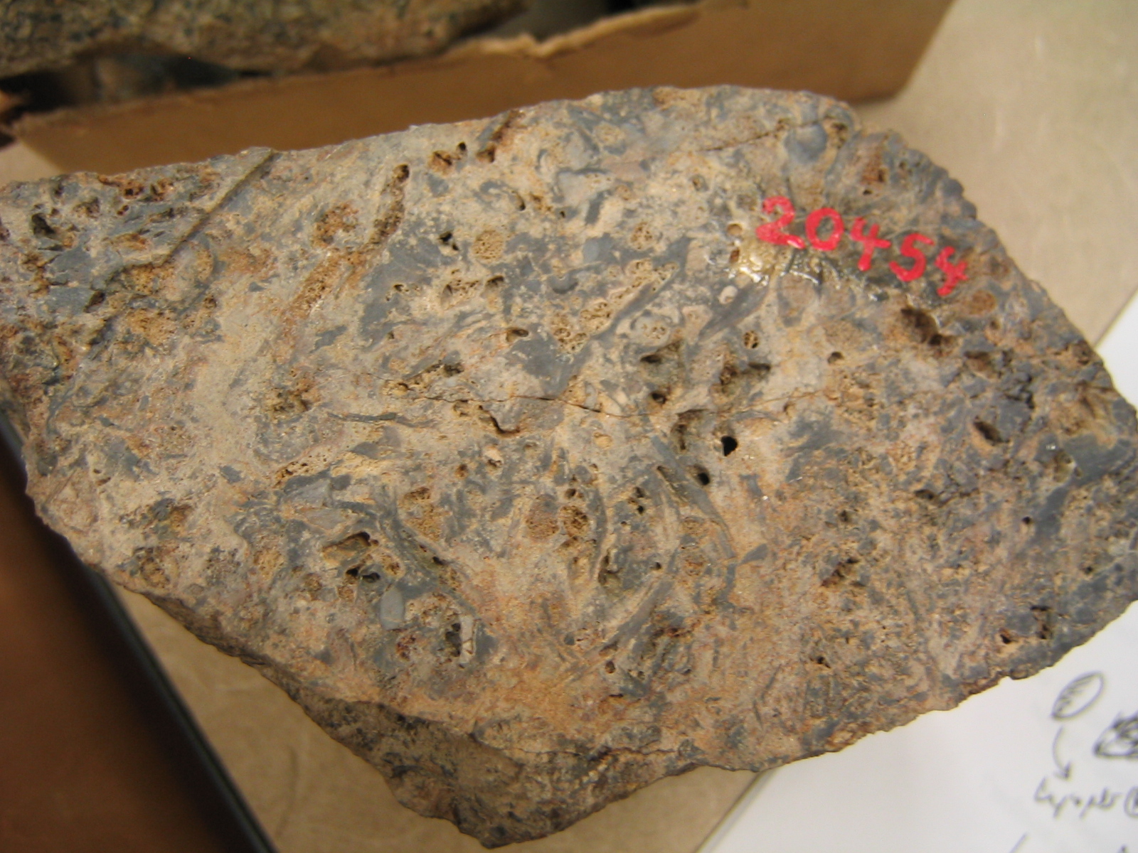
Rhynie chert

The Rhynie chert is a Lower Devonian sedimentary deposit exhibiting extraordinary fossil detail or completeness (a Lagerstätte). It is exposed near the...

Druminnor Castle

Druminnor Castle is an L-plan castle, dating from the early 15th century, about two miles east of Rhynnie, in a steep valley by the Keron burn, in Aberdeenshire...

A97 road

The A97 is a major road in Aberdeenshire, Scotland. A very short section of the road is within Moray == Route == It runs south from Banff on the north...

Tap o' Noth

The Tap o' Noth is a hill and fort, 8 miles south of Huntly in Aberdeenshire, Scotland at grid reference NJ485293. It is the second highest fort in Scotland...

Lesmoir Castle

Lesmoir Castle was a 16th-century castle, about 2.0 miles (3.2 km) west of Rhynie, Aberdeenshire, Scotland, south-west of Tap o' Noth, at Mains of Lesmoir...

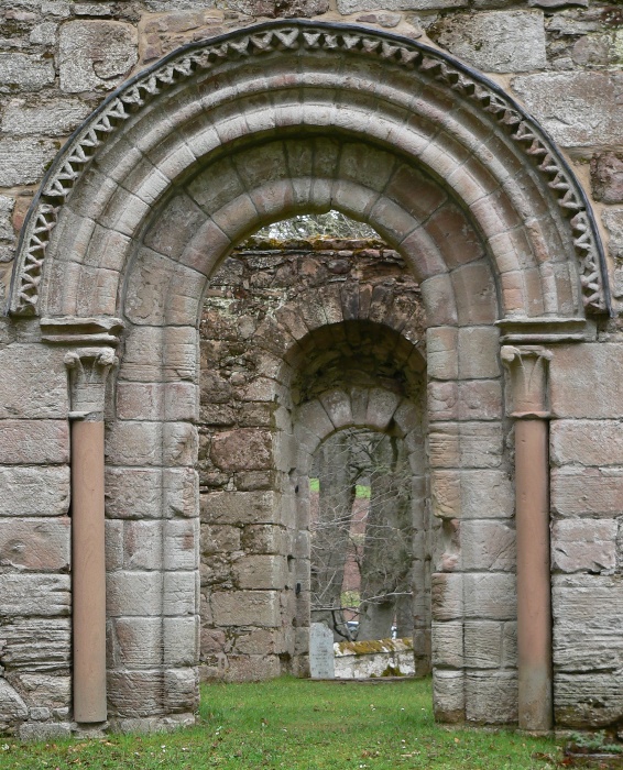
St Mary's Kirk, Auchindoir

St Mary's Kirk at Auchindoir, between Rhynie and Lumsden, in Aberdeenshire, Scotland, is one of the country's finest surviving medieval parish kirks. The...

Clatt

Clatt (Gaelic cleithe, 'concealed'), is a village in Aberdeenshire, Scotland. The remains of a morthouse are located in the cemetery of the old church...

Nearby Amenities

Located within 500m of 57.330836,-2.8290004
Pub
Gordon Arms
Lat/Long: 57.3325107/-2.8328043
Post Office
Rhynie Post Office
Brand: Post Office
Brand Wikidata: Q1783168
Check Date: 2023-09-27
Operator: The Corner Shop
Ref Pol Id: 96709
Lat/Long: 57.3319084/-2.8335338
Rhynie
Is In: Aberdeenshire
Name Gd: Roinnidh
Place: village
Wikidata: Q3774591
Wikipedia: en:Rhynie, Aberdeenshire
Lat/Long: 57.3319132/-2.8347464
Rhynie and Kearn War Memorial
Heritage Operator: Historic Environment Scotland
Heritage Website: https://portal.historicenvironment.scot/designation/LB49310
Historic: memorial
Listed Status: Category B
Material: stone
Memorial: war_memorial
Ref GB Hs: LB49310
Start Date: 1920
Tourism: artwork
Wikidata: Q17778659
Lat/Long: 57.3318927/-2.8346538
The Corner Shop
Shop: convenience
Lat/Long: 57.3318683/-2.8335019
Recycling
Lat/Long: 57.3324677/-2.835873
Bench
Lat/Long: 57.3320479/-2.8351683
Telephone
Booth: KX100
Covered: booth
Lat/Long: 57.3323201/-2.8352373
Power: pole
Lat/Long: 57.3336015/-2.8235617
Power: pole
Lat/Long: 57.3326158/-2.8233835
Power: pole
Lat/Long: 57.3300027/-2.8367401
Power: pole
Lat/Long: 57.3297994/-2.8357808
Power: pole
Lat/Long: 57.3295807/-2.8347666
Power: pole
Lat/Long: 57.3296536/-2.8330882
Power: pole
Lat/Long: 57.3297434/-2.8322278
Power: pole
Lat/Long: 57.3300019/-2.8310613
Power: pole
Lat/Long: 57.3302816/-2.8297645
Power: pole
Lat/Long: 57.3304273/-2.8291177
Power: pole
Lat/Long: 57.3306604/-2.8299419
Power: pole
Lat/Long: 57.3308324/-2.8305338
Power: pole
Lat/Long: 57.3310104/-2.8311587
Power: pole
Lat/Long: 57.3312392/-2.8319547
Power: pole
Lat/Long: 57.3315791/-2.8326769
Power: pole
Lat/Long: 57.3320172/-2.8317945
Power: pole
Lat/Long: 57.3264819/-2.8308478
Power: pole
Lat/Long: 57.3271864/-2.8300159
Power: pole
Lat/Long: 57.3277247/-2.8293545
Power: pole
Lat/Long: 57.328388/-2.8285583
Power: pole
Lat/Long: 57.3290348/-2.8277646
Power: pole
Lat/Long: 57.3297117/-2.826946
Power: pole
Lat/Long: 57.3304621/-2.8260586
Power: pole
Lat/Long: 57.3312124/-2.8251319
Power: pole
Lat/Long: 57.3319366/-2.8242779
Power: pole
Lat/Long: 57.3286269/-2.8218155
Power: pole
Lat/Long: 57.3291351/-2.8229941
Power: pole
Lat/Long: 57.329631/-2.8241575
Power: pole
Lat/Long: 57.3300219/-2.8250635
Post Box
Post Box Design: type_n
Post Box Type: lamp
Lat/Long: 57.3319634/-2.8334751
Bus Stop
MacKay Court
Bus: yes
Naptan AtcoCode: 630045782
Naptan Bearing: SW
Naptan CommonName: MacKay Court
Naptan Indicator: opp
Naptan NaptanCode: 23629348
Naptan Street: Main Street
Naptan Verified: no
Public Transport: platform
Source: naptan;bing;naptan_compare_tool
Lat/Long: 57.3334953/-2.8317589
Bus Stop
MacKay Court
Bus: yes
Naptan AtcoCode: 630045781
Naptan Bearing: NE
Naptan CommonName: MacKay Court
Naptan Indicator: adj
Naptan NaptanCode: 23629343
Naptan Street: Main Street
Naptan Verified: no
Public Transport: platform
Source: naptan;bing;naptan_compare_tool
Lat/Long: 57.3328351/-2.8327475
Bus Stop
The Square
Bus: yes
Naptan AtcoCode: 630032081
Naptan Bearing: NE
Naptan CommonName: The Square
Naptan Indicator: N bound
Naptan NaptanCode: 23623438
Naptan Street: Main Street
Naptan Verified: no
Public Transport: platform
Source: naptan;bing;naptan_compare_tool
Lat/Long: 57.3315976/-2.8341315
Manse
Place: isolated_dwelling
Lat/Long: 57.3272763/-2.8331177
The data included in this document is from www.openstreetmap.org. The data is made available under ODbL.

Have you been to Brae of Bogie?

Leave your review of Brae of Bogie below (or comments, questions and feedback).