Godney Moor

Downs, Moorland in Somerset Mendip

England

Godney Moor

White's Drove Followed by Restricted Byway WS 5/19, with overhanging ashes and other trees. Seen from where it leaves North Chine Drove.
White's Drove Credit: Derek Harper

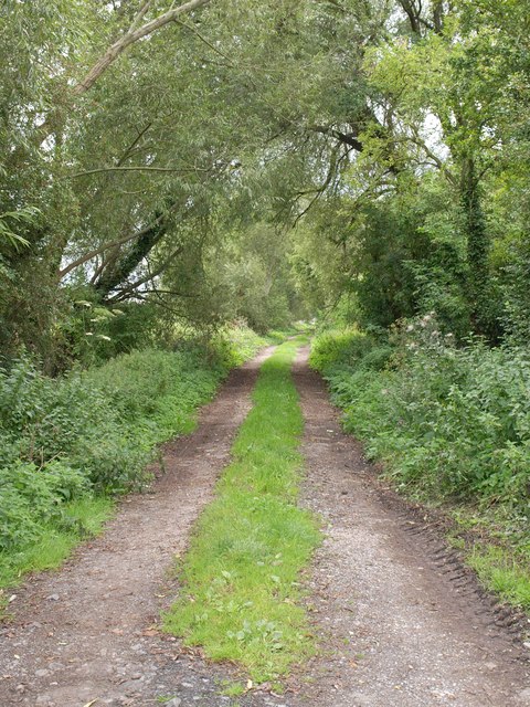
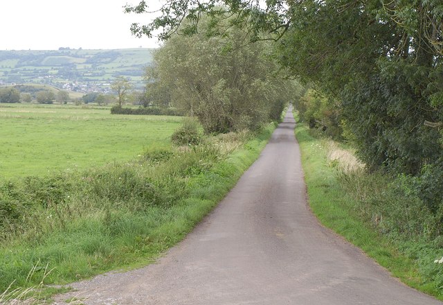
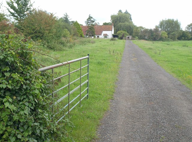
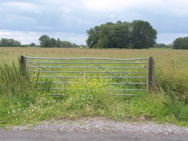
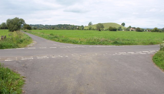
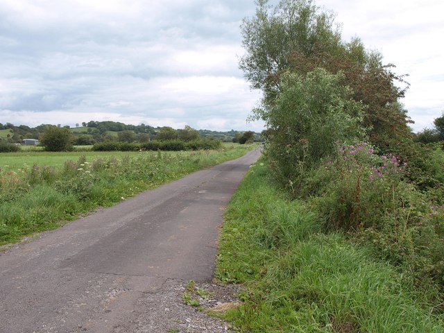
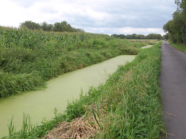
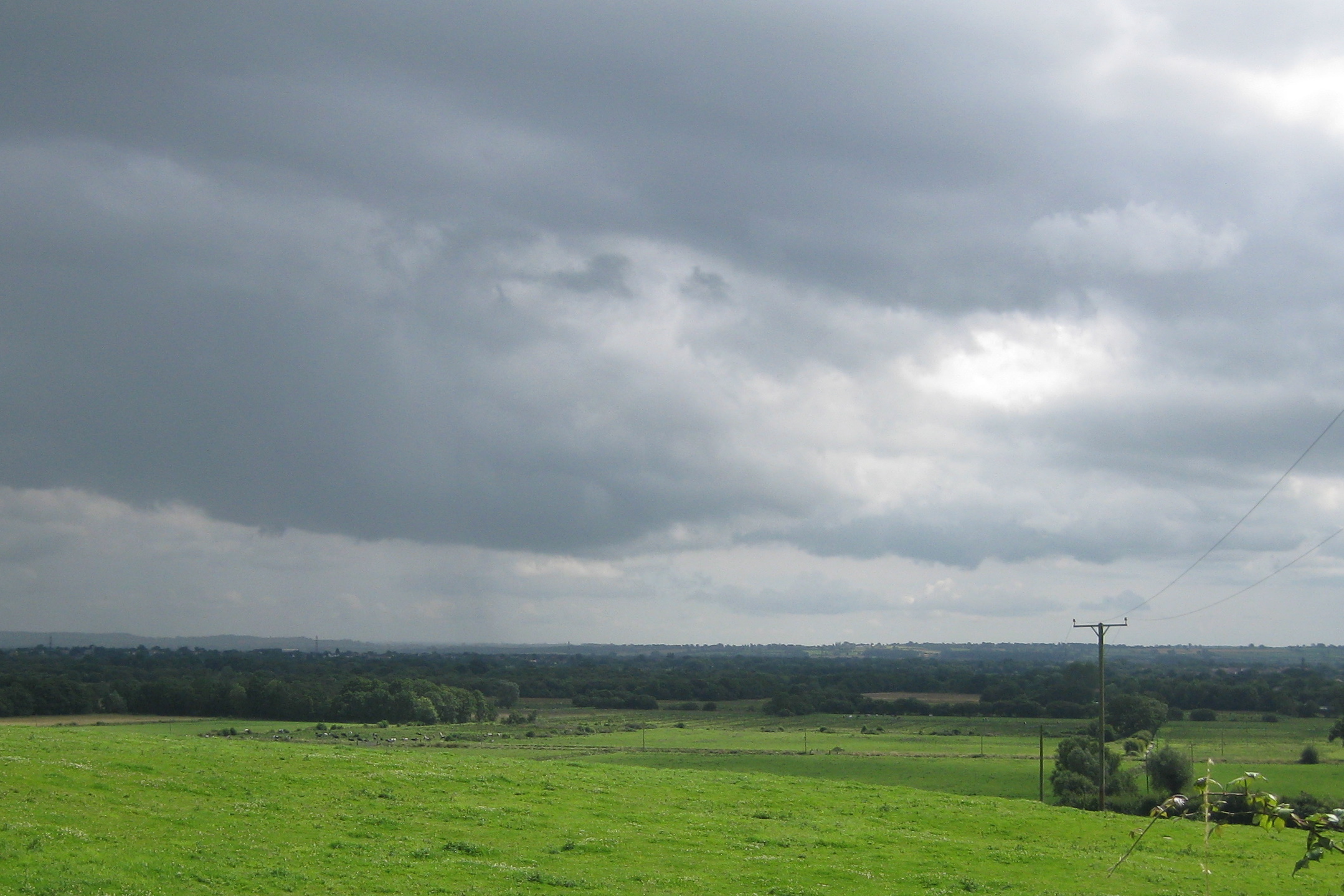
Godney Moor is a picturesque expanse of open land located in Somerset, England. Situated on the Somerset Levels, this area is known for its unique natural beauty and rich ecological diversity. Spanning approximately 300 acres, Godney Moor is characterized by its gently undulating terrain, dotted with patches of moorland and lush grasslands.

The moorland of Godney Moor is a significant feature of the landscape, with its distinctive vegetation comprising heather, gorse, and various types of grasses. This habitat provides a sanctuary for a variety of wildlife, including birds such as skylarks, lapwings, and meadow pipits. In addition, the moorland is home to several species of small mammals, such as voles and shrews, as well as reptiles like adders and slow worms.

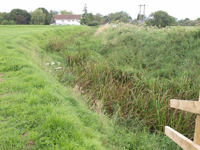
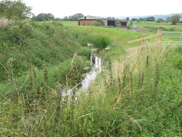
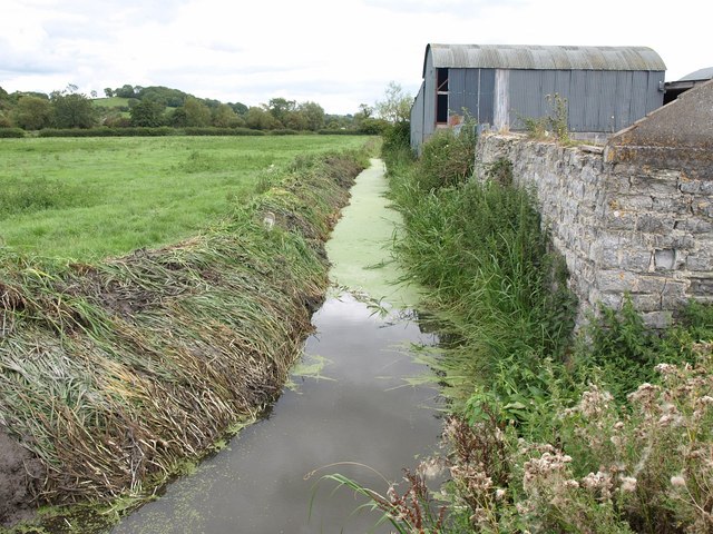
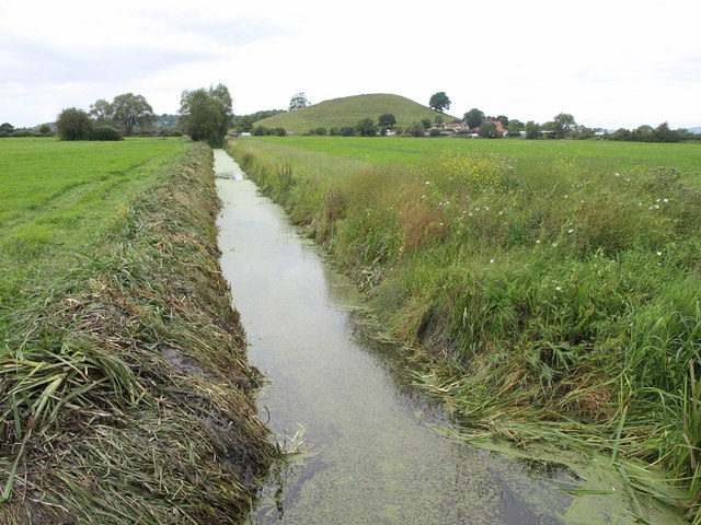
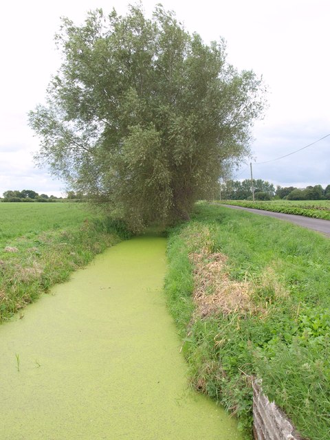
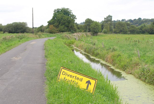
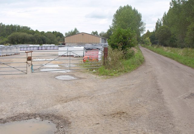
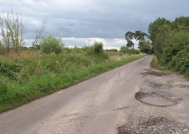
The area is crisscrossed by numerous drainage ditches, a characteristic feature of the Somerset Levels, which serve to manage the water levels in the region. These ditches also contribute to the unique charm and character of Godney Moor.

Aside from its natural beauty, Godney Moor also holds historical significance. The moor is believed to have been inhabited since prehistoric times, with evidence of Bronze Age and Iron Age settlements in the area. Additionally, the moor was historically used for grazing livestock, a tradition that continues to this day.

Overall, Godney Moor is a captivating landscape that showcases the natural beauty and ecological diversity of Somerset. Its moorland, grasslands, and historical significance make it a place of interest for nature enthusiasts, historians, and visitors seeking to immerse themselves in the timeless charm of the English countryside.

If you have any feedback on the listing, please let us know in the comments section below.

Godney Moor Images

Images are sourced within 2km of 51.192681/-2.7496188 or Grid Reference ST4743. Thanks to Geograph Open Source API. All images are credited.

White's Drove Followed by Restricted Byway WS 5/19, with overhanging ashes and other trees. Seen from where it leaves North Chine Drove.
White's Drove
Followed by Restricted Byway WS 5/19, with overhanging ashes and other trees. Seen from where it leaves North Chine Drove.
Lower River Axe The river, really a former irrigation channel and millstream, flows (there's water in there somewhere) towards the camera heading for Panborough Moor, where it meets the real River Axe. In the background is Scotland House. View from Knowle Moor Drove.
Lower River Axe
The river, really a former irrigation channel and millstream, flows (there's water in there somewhere) towards the camera heading for Panborough Moor, where it meets the real River Axe. In the background is Scotland House. View from Knowle Moor Drove.
Lower River Axe See <a href="https://www.geograph.org.uk/photo/2588558">ST4845 : Lower River Axe</a>; this view, looking downstream from the same spot, demonstrates there is water in the channel.
Lower River Axe
See ST4845 : Lower River Axe; this view, looking downstream from the same spot, demonstrates there is water in the channel.
Knowle Moor Drove Looking along the start of the straight stretch of the drove described in <a href="https://www.geograph.org.uk/photo/2588503">ST4845 : Knowle Moor Drove</a>, from the same spot as <a href="https://www.geograph.org.uk/photo/2588558">ST4845 : Lower River Axe</a> and <a href="https://www.geograph.org.uk/photo/2588604">ST4845 : Lower River Axe</a>, with the Mendips across the levels on the left.
Knowle Moor Drove
Looking along the start of the straight stretch of the drove described in ST4845 : Knowle Moor Drove, from the same spot as ST4845 : Lower River Axe and ST4845 : Lower River Axe, with the Mendips across the levels on the left.
Reed Farm Looking up the drive to the farm from the B3139.
Reed Farm
Looking up the drive to the farm from the B3139.
Rhyne near Bleadney A view from Tilley's Drove along a rhyne past some farm buildings.
Rhyne near Bleadney
A view from Tilley's Drove along a rhyne past some farm buildings.
Rhyne near Bleadney Looking in the other direction from the spot where <a href="https://www.geograph.org.uk/photo/2588714">ST4745 : Rhyne near Bleadney</a> was taken, on the other side of Tilley's Drove. Ahead is <a href="https://www.geograph.org.uk/photo/93989">ST4745 : Panborough Hill</a> - mapped as Barrow Hill - with Barrow House Farm at its foot.
Rhyne near Bleadney
Looking in the other direction from the spot where ST4745 : Rhyne near Bleadney was taken, on the other side of Tilley's Drove. Ahead is ST4745 : Panborough Hill - mapped as Barrow Hill - with Barrow House Farm at its foot.
Gate and field, Yeap's Drove <a href="https://www.geograph.org.uk/photo/89431">ST4844 : The Road down to Godney</a> was taken further down this road to the left. This looks across it and across a meadow beyond. The prominent clump of trees and the distant Brook Farm to its left are both in <a href="https://www.geograph.org.uk/gridref/ST4744">ST4744</a>.
Gate and field, Yeap's Drove
ST4844 : The Road down to Godney was taken further down this road to the left. This looks across it and across a meadow beyond. The prominent clump of trees and the distant Brook Farm to its left are both in ST4744.
Crossroads on the levels Yeap's Drove gives way to Tilley's Drove. Ahead is Barrow Hill, in <a href="https://www.geograph.org.uk/gridref/ST4745">ST4745</a>.
Crossroads on the levels
Yeap's Drove gives way to Tilley's Drove. Ahead is Barrow Hill, in ST4745.
North Chine Drove A lane across the levels, with Yarley Hill visible ahead.
North Chine Drove
A lane across the levels, with Yarley Hill visible ahead.
Panborough Drain Diversion Seen from North Chine Drove; on the right is Lewis's Drove.
Panborough Drain Diversion
Seen from North Chine Drove; on the right is Lewis's Drove.
North Chine Drove and Rhyne This is taken from the same junction as <a href="https://www.geograph.org.uk/photo/2588921">ST4645 : Panborough Drain Diversion</a>, and it look as if traffic is being encouraged to divert, not into Panborough Drain Diversion, but into the unnamed rhyne alongside the drove.
North Chine Drove and Rhyne
This is taken from the same junction as ST4645 : Panborough Drain Diversion, and it look as if traffic is being encouraged to divert, not into Panborough Drain Diversion, but into the unnamed rhyne alongside the drove.
Panborough Drain Diversion The rhyne runs beside Lewis's Drove, here approaching Laurel Farm. I fell off the bike here; look, I hadn't ridden one for thirteen years, okay? Luckily I didn't end up in the rhyne. Maize on the left.
Panborough Drain Diversion
The rhyne runs beside Lewis's Drove, here approaching Laurel Farm. I fell off the bike here; look, I hadn't ridden one for thirteen years, okay? Luckily I didn't end up in the rhyne. Maize on the left.
Works by Lewis's Drove Part of a peat works north of the junction with Westhay Moor Drove.
Works by Lewis's Drove
Part of a peat works north of the junction with Westhay Moor Drove.
Lewis's Drove Looking in the other direction from the spot where <a href="https://www.geograph.org.uk/photo/2589308">ST4643 : Works by Lewis's Drove</a> was taken. A tractor and trailer from the peat works has just reached the T-junction with Westhay Moor Drove near the pine trees.
Lewis's Drove
Looking in the other direction from the spot where ST4643 : Works by Lewis's Drove was taken. A tractor and trailer from the peat works has just reached the T-junction with Westhay Moor Drove near the pine trees.
Levels near Godney A view from Westhay Moor Drive towards Lower Godney, with a rhyne in the foreground.
Levels near Godney
A view from Westhay Moor Drive towards Lower Godney, with a rhyne in the foreground.
Crossroads near Lower Godney Westhay Moor Drove (foreground) meets Tilley's Drove and continues ahead as Tripps Drove.
Crossroads near Lower Godney
Westhay Moor Drove (foreground) meets Tilley's Drove and continues ahead as Tripps Drove.
Tilley's Drove Approaching Lower Godney, which is strung out between a road and the River Sheppey.
Tilley's Drove
Approaching Lower Godney, which is strung out between a road and the River Sheppey.
Show me another place!

Godney Moor is located at Grid Ref: ST4743 (Lat: 51.192681, Lng: -2.7496188)

Administrative County: Somerset

District: Mendip

Police Authority: Avon and Somerset

What 3 Words

///canny.careful.eggshell. Near Glastonbury, Somerset

Nearby Locations

Godney Godney Moor

Related Wikis

Godney

Godney is a village and civil parish near Glastonbury on the River Sheppey on the Somerset Levels in the Mendip district of Somerset, England. == History... ==

Holy Trinity Church, Godney

Holy Trinity Church is a former Church of England church in Godney, Somerset, England. Designed by George Phillips Manners, it was built in 1839–41 and...

Westhay Moor

Westhay Moor (sometimes, historically, referred to as West Hay Moor) is a 513.7-hectare (1,269-acre) biological Site of Special Scientific Interest 2.5...

Christ Church, Theale

Christ Church is a Church of England church in Theale, Somerset, England. It was built in 1826–28 to the design of Richard Carver and is a Grade II listed...

Meare Pool

Meare Pool (also known as Ferlingmere, Ferran Mere or Meare fish pool) was a lake in the Somerset Levels in South West England. Lake villages existed there...

Galton's Canal

Galton's Canal was a 1-mile 3 furlong (2.2 km) canal with one lock, crossing Westhay Moor in Somerset, England, and connecting the River Brue to the North...

The Abbot's Fish House, Meare

The Abbot's Fish House in Meare, Somerset, England, was built in the 14th century and has been designated as a Grade I listed building and Scheduled Ancient...

Manor Farmhouse, Meare

The Manor Farmhouse in Meare, Somerset, England, was built in the 14th century as the summer residence of the Abbots from Glastonbury Abbey and is now...

Nearby Amenities

Located within 500m of 51.192681,-2.7496188
The data included in this document is from www.openstreetmap.org. The data is made available under ODbL.

Have you been to Godney Moor?

Leave your review of Godney Moor below (or comments, questions and feedback).