Sunderland Moor

Downs, Moorland in Selkirkshire

Scotland

Sunderland Moor

Flood defence wall near Linglie footbridge, Selkirk The footbridge is now open as shown via the ramp. Flood defence walls are being built along the Ettrick Water to protect properties in Bannerfield and the Riverside Industrial Estate.
Flood defence wall near Linglie footbridge, Selkirk Credit: Jim Barton

Sunderland Moor is a vast expanse of moorland located in Selkirkshire, Scotland. Covering an area of approximately 500 acres, it is situated just south of the town of Selkirk and is a popular destination for nature enthusiasts and outdoor adventurers.

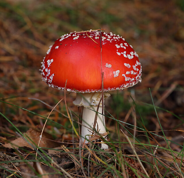
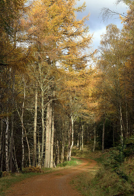
The moorland terrain of Sunderland Moor is characterized by its undulating hills, heather-covered expanses, and scattered patches of woodland. The area is known for its stunning natural beauty and offers breathtaking views of the surrounding countryside. Visitors can expect to witness a variety of wildlife, including birds of prey, deer, and various species of small mammals.

The moorland is traversed by several well-maintained footpaths and trails, making it an ideal location for walking, hiking, and birdwatching. The solitude and tranquility offered by Sunderland Moor make it a perfect retreat for those seeking respite from the hustle and bustle of urban life.

Despite its remote location, the moorland is easily accessible by road, with ample parking facilities available nearby. Additionally, there are picnic areas and benches scattered across the moorland, providing visitors with the opportunity to relax and enjoy a meal amidst the picturesque surroundings.

Sunderland Moor is also steeped in history, with archaeological remains dating back to the Bronze Age. The area is dotted with ancient burial mounds and standing stones, adding an intriguing element to the natural landscape.

Overall, Sunderland Moor in Selkirkshire offers a captivating mix of natural beauty, outdoor activities, and historical significance, making it a must-visit destination for nature lovers and history enthusiasts alike.

If you have any feedback on the listing, please let us know in the comments section below.

Sunderland Moor Images

Images are sourced within 2km of 55.571989/-2.847437 or Grid Reference NT4631. Thanks to Geograph Open Source API. All images are credited.

Flood defence wall near Linglie footbridge, Selkirk The footbridge is now open as shown via the ramp. Flood defence walls are being built along the Ettrick Water to protect properties in Bannerfield and the Riverside Industrial Estate.
Flood defence wall near Linglie footbridge, Selkirk
The footbridge is now open as shown via the ramp. Flood defence walls are being built along the Ettrick Water to protect properties in Bannerfield and the Riverside Industrial Estate.
Flood defences on the Ettrick Water, Selkirk Flood defence walls under construction, seen from the Linglie footbridge.
Flood defences on the Ettrick Water, Selkirk
Flood defence walls under construction, seen from the Linglie footbridge.
Footpath to Selkirk A pleasant path through the light industrial area and former textile mills to the SE of the Ettrick Water. This is probably following the former line of the railway branch from Galashiels.
Footpath to Selkirk
A pleasant path through the light industrial area and former textile mills to the SE of the Ettrick Water. This is probably following the former line of the railway branch from Galashiels.
Ordnance Survey Flush Bracket G367 This can be found on the wall of a house at Linglie.
For more detail see : <span class="nowrap"><a title="http://www.bench-marks.org.uk/bm15594" rel="nofollow ugc noopener" href="http://www.bench-marks.org.uk/bm15594">Link</a><img style="margin-left:2px;" alt="External link" title="External link - shift click to open in new window" src="https://s1.geograph.org.uk/img/external.png" width="10" height="10"/></span>
Ordnance Survey Flush Bracket G367
This can be found on the wall of a house at Linglie. For more detail see : LinkExternal link
Linglie Road at Cat's Whiskers Boarding Kennels Looking north-eastward.
Linglie Road at Cat's Whiskers Boarding Kennels
Looking north-eastward.
Selkirk Flood Protection Scheme A section of completed flood defences at Riverside Road, Selkirk.
Selkirk Flood Protection Scheme
A section of completed flood defences at Riverside Road, Selkirk.
Selkirk Flood Protection Scheme near South Riverside Business Park The flood protection wall and path by the Ettrick Water.
Selkirk Flood Protection Scheme near South Riverside Business Park
The flood protection wall and path by the Ettrick Water.
Flood defences near Linglie footbridge The flood protection wall with tree planting at the S end of the footbridge to the Linglie side of the Ettrick Water.
Flood defences near Linglie footbridge
The flood protection wall with tree planting at the S end of the footbridge to the Linglie side of the Ettrick Water.
Flood protection wall, Selkirk Part of the flood defences where the Ettrick Water flows past the industrial area of the town.
Flood protection wall, Selkirk
Part of the flood defences where the Ettrick Water flows past the industrial area of the town.
Yarn bombing at Selkirk The Selkirk Stormers have decorated a car at the Belmont Kia Garage at Riverside Park, Dunsdale Haugh, Selkirk
Yarn bombing at Selkirk
The Selkirk Stormers have decorated a car at the Belmont Kia Garage at Riverside Park, Dunsdale Haugh, Selkirk
Yarn bombing at Selkirk The Selkirk Stormers have decorated a car at the Belmont Kia Garage at Riverside Park, Dunsdale Haugh, Selkirk
Yarn bombing at Selkirk
The Selkirk Stormers have decorated a car at the Belmont Kia Garage at Riverside Park, Dunsdale Haugh, Selkirk
Recycling centre, Selkirk Householders disposing of waste and recyclable material at the local centre next to the sewage works.
Recycling centre, Selkirk
Householders disposing of waste and recyclable material at the local centre next to the sewage works.
A fly agaric mushroom (Amanita muscaria) This mushroom which is usually associated with birch and pine trees is one of the easiest species to recognise.
A fly agaric mushroom (Amanita muscaria)
This mushroom which is usually associated with birch and pine trees is one of the easiest species to recognise.
Glistening ink cap mushrooms (Coprinellus micaceus) This edible species is usually associated with dead tree stumps or buried wood. The photograph was taken in Lindinny Wood.
Glistening ink cap mushrooms (Coprinellus micaceus)
This edible species is usually associated with dead tree stumps or buried wood. The photograph was taken in Lindinny Wood.
A forestry track in Howlands Plantation
Former Suzuki dealership, Selkirk A garage and Suzuki dealership on Dunsdale Haugh, now closed.
Former Suzuki dealership, Selkirk
A garage and Suzuki dealership on Dunsdale Haugh, now closed.
Rink Hill from Eildon Mid Hill The small circular plantation on Rink Hill is the site of an Iron Age hillfort. This telephoto shot was taken from the summit of Eildon Mid Hill during a December sunrise. For two closer views of the small plantation on Rink Hill, see <a href="https://www.geograph.org.uk/photo/2347041">NT4832 : The Rink Hill Fort</a> and <a href="https://www.geograph.org.uk/photo/1758293">NT4732 : Rink Hill</a>.
Rink Hill from Eildon Mid Hill
The small circular plantation on Rink Hill is the site of an Iron Age hillfort. This telephoto shot was taken from the summit of Eildon Mid Hill during a December sunrise. For two closer views of the small plantation on Rink Hill, see NT4832 : The Rink Hill Fort and NT4732 : Rink Hill.
Show me another place!

Sunderland Moor is located at Grid Ref: NT4631 (Lat: 55.571989, Lng: -2.847437)

Unitary Authority: The Scottish Borders

Police Authority: The Lothians and Scottish Borders

What 3 Words

///nightcap.ladders.indeed. Near Selkirk, Scottish Borders

Related Wikis

Lindean railway station

Lindean railway station served the village of Lindean, Scottish Borders, Scotland, from 1856 to 1964 on the Selkirk and Galashiels Railway. == History... ==

Yair, Scottish Borders

Yair, also known as The Yair, is an estate in the Scottish Borders. It stands by the River Tweed in the former county of Selkirkshire, 2.5 miles (4.0 km...

Yair Bridge

The Yair Bridge or Fairnilee Bridge is a bridge across the River Tweed at Yair, near Galashiels in the Scottish Borders. == History == It was built in...

Bridgelands

Bridgelands is a village and an 18th-century house in the Scottish Borders area of Scotland, in the parish of Selkirk. Sir Henry Raeburn's wife came from...

Nearby Amenities

Located within 500m of 55.571989,-2.847437
Power: pole
Lat/Long: 55.5748108/-2.8468751
Power: pole
Lat/Long: 55.5739764/-2.846722
Power: pole
Lat/Long: 55.5731442/-2.8465693
Power: pole
Lat/Long: 55.5723313/-2.8464202
Power: pole
Lat/Long: 55.5714398/-2.8462566
Power: pole
Lat/Long: 55.5707535/-2.8461307
Power: pole
Lat/Long: 55.5698411/-2.8459633
Power: pole
Lat/Long: 55.5690466/-2.8458175
Power: pole
Lat/Long: 55.5678981/-2.8456068
Power: pole
Lat/Long: 55.5678837/-2.8457952
Power: pole
Lat/Long: 55.5690284/-2.8460045
Power: pole
Lat/Long: 55.5707084/-2.8463117
Power: pole
Lat/Long: 55.571508/-2.8464579
Power: pole
Lat/Long: 55.5723271/-2.8466077
Power: pole
Lat/Long: 55.5730884/-2.8467469
Power: pole
Lat/Long: 55.5740016/-2.8469139
Power: pole
Lat/Long: 55.5748007/-2.8470601
Power: pole
Lat/Long: 55.5755836/-2.8472032
Power: pole
Lat/Long: 55.5697969/-2.846145
The data included in this document is from www.openstreetmap.org. The data is made available under ODbL.

Have you been to Sunderland Moor?

Leave your review of Sunderland Moor below (or comments, questions and feedback).