Halton Gill

Settlement in Yorkshire Craven

England

Halton Gill

Trig point at Horse Head with view to Plover Hill & Pen-y-ghent
Trig point at Horse Head with view to Plover Hill & Pen-y-ghent Credit: Colin Park

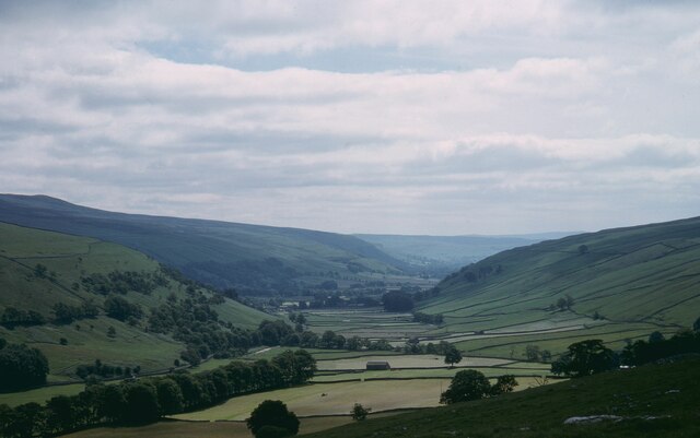
Halton Gill is a small village nestled in the beautiful Yorkshire Dales National Park in North Yorkshire, England. Located approximately 11 miles northwest of the market town of Settle, it is a tranquil and picturesque place that attracts visitors seeking a peaceful retreat in the countryside.

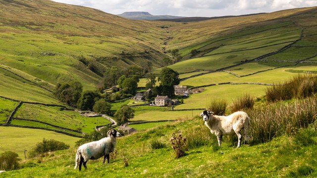
Surrounded by rolling hills, lush green fields, and breathtaking landscapes, Halton Gill is an ideal destination for outdoor enthusiasts. The village is known for its excellent hiking trails, offering stunning views of the Dales and the opportunity to spot local wildlife, such as red grouse and peregrine falcons. The Pennine Way, a long-distance footpath, passes close by, making it a popular starting point for hikers.

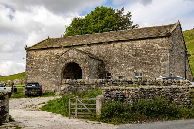
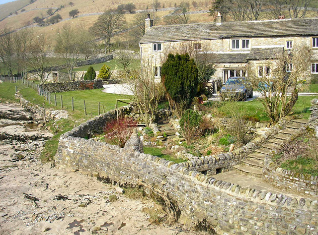
Although small in size, Halton Gill boasts a close-knit community and a rich history. The village is home to a charming church, St. John's, which dates back to the 19th century and holds regular services. The local pub, The Buck Inn, offers a warm welcome to visitors, serving traditional British pub fare and locally brewed ales.

The area around Halton Gill is also known for its farming heritage, with sheep farming being a prominent industry. The village's scenic location and unspoiled charm have made it a popular choice for artists and photographers who are drawn to its natural beauty.

Overall, Halton Gill offers a tranquil escape from the hustle and bustle of city life, providing visitors with an opportunity to immerse themselves in the stunning scenery and rural charm that Yorkshire has to offer.

If you have any feedback on the listing, please let us know in the comments section below.

Halton Gill Images

Images are sourced within 2km of 54.183674/-2.183965 or Grid Reference SD8876. Thanks to Geograph Open Source API. All images are credited.

Trig point at Horse Head with view to Plover Hill & Pen-y-ghent
Halton Gill from Stainforth Road Later see <a title="https://www.geograph.org.uk/photo/1990974" href="https://www.geograph.org.uk/photo/1990974">Link</a>
Halton Gill from Stainforth Road
Later see Link
Littondale spectacular view
Halton Gill Panorama in 2000 View north to the hamlet with Horse Head Moor above
Halton Gill Panorama in 2000
View north to the hamlet with Horse Head Moor above
Halton Gill Sheep alongside the River Skirfare seen from Halton Gill Bridge.
Halton Gill
Sheep alongside the River Skirfare seen from Halton Gill Bridge.
Halton Gill Farmer at work above Halton Gill
Halton Gill
Farmer at work above Halton Gill
Foxup The farm and houses at Foxup with the valley of Foxup Beck cutting through Foxup Moor in the background.  In the far distance, over the horizon, is the distinctive outline of Ingleborough.
Foxup
The farm and houses at Foxup with the valley of Foxup Beck cutting through Foxup Moor in the background. In the far distance, over the horizon, is the distinctive outline of Ingleborough.
River Skirfare Looking down the valley of the River Skirfare.
River Skirfare
Looking down the valley of the River Skirfare.
Horse Head At Horse Head looking towards Horse Head Gate.
Horse Head
At Horse Head looking towards Horse Head Gate.
Horse Head
Horse Head
Horse Head View from Horse Head, Whernside in the distance.
Horse Head
View from Horse Head, Whernside in the distance.
Horse Head Bridleway leading up to Horse Head.
Horse Head
Bridleway leading up to Horse Head.
Halton Gill Beck Byway crossing one of the tributaries to Halton Gill Beck.
Halton Gill Beck
Byway crossing one of the tributaries to Halton Gill Beck.
Halton Gill
Halton Gill
Manor Farm Impressive barn in Halton Gill.
Manor Farm
Impressive barn in Halton Gill.
Hesleden Burge Sheep sitting in amongst the limestone.
Hesleden Burge
Sheep sitting in amongst the limestone.
Halton Gill Gateway on the byway up from Halton Gill to Horse Head.
Halton Gill
Gateway on the byway up from Halton Gill to Horse Head.
Halton Gill
Halton Gill
Show me another place!

Halton Gill is located at Grid Ref: SD8876 (Lat: 54.183674, Lng: -2.183965)

Division: West Riding

Administrative County: North Yorkshire

District: Craven

Police Authority: North Yorkshire

What 3 Words

///zone.turkey.carbonate. Near Settle, North Yorkshire

Nearby Locations

Halton Gill

Related Wikis

Halton Gill

Halton Gill is a hamlet and civil parish in Littondale in the Yorkshire Dales in North Yorkshire, England. It is situated 2 miles (3.2 km) up Littondale...

Foxup

Foxup is a hamlet in the Yorkshire Dales in the Craven district of North Yorkshire, England. The hamlet is near Halton Gill and Litton and is 13 miles...

Ewecross

The historical area of Ewecross or Ewcross is a district in the West Riding of Yorkshire, England. It included the parishes of Bentham, Clapham, Horton...

Hesleden, North Yorkshire

Hesleden is a hamlet in Littondale in the Yorkshire Dales in England. It lies within the civil parish of Halton Gill in the Craven district of North Yorkshire...

Widdale

Widdale is a small side dale on the south side of Wensleydale in North Yorkshire, England. The dale lies to the east of Great Knoutberry Hill (also known...

Litton, North Yorkshire

Litton is a village and civil parish in Littondale in the Yorkshire Dales in England. It lies in the Craven District of North Yorkshire, 1.5 miles (2...

Plover Hill

Plover Hill is an area of moorland lying to the north of Pen-y-ghent in the Yorkshire Dales and connected to it by an unbroken area of high ground. Whilst...

Yockenthwaite

Yockenthwaite is a hamlet in the Craven district of North Yorkshire, England. It lies in the Langstrothdale valley in the Yorkshire Dales National Park...

Nearby Amenities

Located within 500m of 54.183674,-2.183965
Halton Gill
Is In: UK, England, Yorkshire, North Yorkshire, Yorkshire Dales, Littondale
Is In Country Code: GB
Is In County: North Yorkshire
Is In Historic County: Yorkshire
Is In Municipality: Craven
Place: hamlet
Lat/Long: 54.1845534/-2.185009
Note: MRA stops at Cow Farm on the Silverdale Road and does not start again until the north side of the Halton Gill Beck bridge. Google earth show no restrictions. Is this an OSM or MRA problem.
Lat/Long: 54.1822115/-2.1853632
Barrier: stile
Material: stone
Source: survey;gps
Stile: squeezer
Lat/Long: 54.1820491/-2.1855661
Natural: spring
Source: OS 1:25k
Lat/Long: 54.1824884/-2.1774123
Parking
Lat/Long: 54.1838378/-2.1843706
Barrier: cattle_grid
Source: survey
Lat/Long: 54.181858/-2.185975
Telephone
Booth: K6
Covered: booth
Listed Status: Grade II
Source: survey
Lat/Long: 54.1845006/-2.1850859
Bench
Source: survey;gps
Lat/Long: 54.1841252/-2.1842302
Bench
Source: survey;gps
Lat/Long: 54.1841418/-2.1843648
Barrier: stile
Material: stone
Source: survey;gps
Stile: squeezer
Lat/Long: 54.1820905/-2.1856447
Material: wood
Power: pole
Lat/Long: 54.179248/-2.1844386
Power: pole
Lat/Long: 54.1800304/-2.1851316
Power: pole
Lat/Long: 54.1807783/-2.1858615
Power: pole
Lat/Long: 54.1816599/-2.186412
Power: pole
Lat/Long: 54.1820425/-2.1866062
Power: pole
Lat/Long: 54.1832688/-2.186729
Power: pole
Lat/Long: 54.1840369/-2.1868412
Power: pole
Lat/Long: 54.1842417/-2.1827438
Power: pole
Lat/Long: 54.1848619/-2.186888
Power: pole
Lat/Long: 54.1850295/-2.1827273
Power: pole
Lat/Long: 54.1853507/-2.1829881
Power: pole
Lat/Long: 54.1855575/-2.1869829
Power: pole
Lat/Long: 54.1855686/-2.1848721
Power: pole
Lat/Long: 54.1855765/-2.1858589
Power: pole
Lat/Long: 54.1855822/-2.1836273
Power: pole
Lat/Long: 54.1856413/-2.1883599
Power: pole
Lat/Long: 54.1857139/-2.18969
Ford: yes
Lat/Long: 54.1845748/-2.1785981
The data included in this document is from www.openstreetmap.org. The data is made available under ODbL.

Have you been to Halton Gill?

Leave your review of Halton Gill below (or comments, questions and feedback).