Halton

Settlement in Cheshire

England

Halton

Walled Garden at Norton Priory The exit through the gardener's cottage
Walled Garden at Norton Priory Credit: Kevin Waterhouse

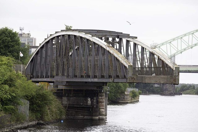
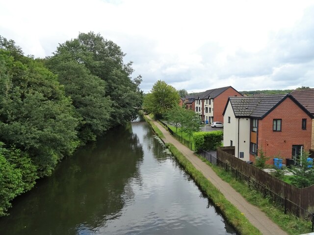
Halton is a small village located in the ceremonial county of Cheshire, in the northwest of England. Situated on the southern bank of the River Mersey, it is part of the borough of Halton and lies approximately 3 miles east of Runcorn and 14 miles southeast of Liverpool.

With a history dating back to at least the Norman Conquest in the 11th century, Halton is known for its rich heritage and historical landmarks. One of its notable features is Halton Castle, a medieval fortification that sits atop a hill overlooking the village. The castle, which dates back to the 11th century, offers panoramic views of the surrounding area and is a popular tourist attraction.

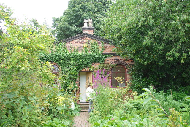
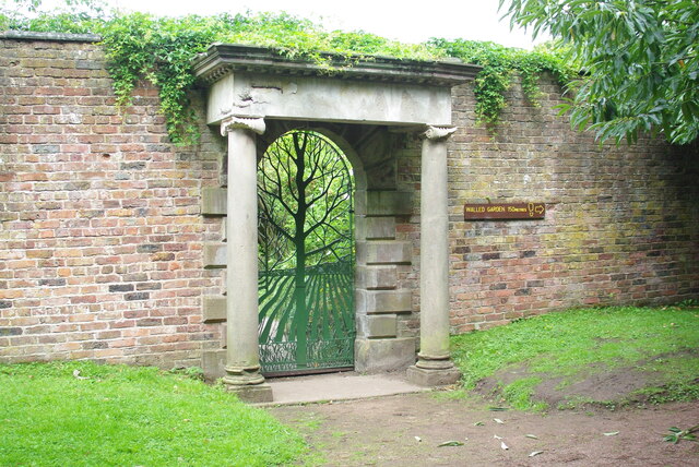
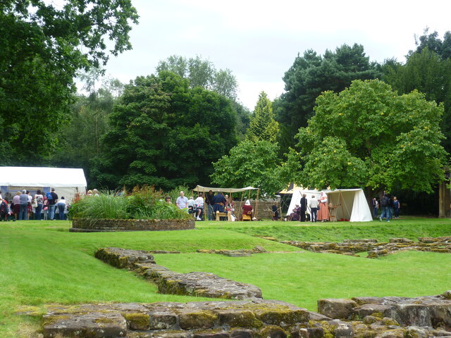
Halton is primarily a residential area, with a mix of traditional and modern housing developments. The village has a close-knit community and offers a range of amenities to its residents, including shops, schools, and recreational facilities. The nearby Norton Priory Museum and Gardens, one of the most significant monastic sites in the country, provides further cultural and historical interest for locals and visitors alike.

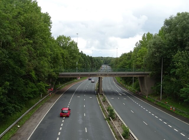
Transport links in Halton are well-established, with easy access to major roads such as the M56 and A533, providing connections to larger cities in the region. The village also benefits from regular bus services and is in close proximity to Runcorn railway station, offering convenient transportation options for commuters.

Overall, Halton is a charming village with a rich history, picturesque surroundings, and a strong sense of community. Its location, amenities, and historical attractions make it an attractive place to live or visit in Cheshire.

If you have any feedback on the listing, please let us know in the comments section below.

Halton Images

Images are sourced within 2km of 53.3327/-2.6972 or Grid Reference SJ5381. Thanks to Geograph Open Source API. All images are credited.

Walled Garden at Norton Priory The exit through the gardener's cottage
Walled Garden at Norton Priory
The exit through the gardener's cottage
Walled Garden at Norton Priory The original entrance portico, with modern fixed gate of the Tree of Life
Walled Garden at Norton Priory
The original entrance portico, with modern fixed gate of the Tree of Life
Outer Entrance to the Ice House On the outside of the walled garden at Norton Priory. There is another gate before the pit of the ice house after this passageway entrance door
Outer Entrance to the Ice House
On the outside of the walled garden at Norton Priory. There is another gate before the pit of the ice house after this passageway entrance door
Garden Loggia In the grounds of Norton Priory
Garden Loggia
In the grounds of Norton Priory
Old Quay Bridge ** Old Quay Bridge is a swing bridge across the Manchester Ship Canal from Runcorn to Wigg Island. The bridge was built circa 1894. It took its name from the Old Quay Canal, which is more commonly known as the Runcorn to Latchford Canal.
** Courtesy Wikipedia
Old Quay Bridge
** Old Quay Bridge is a swing bridge across the Manchester Ship Canal from Runcorn to Wigg Island. The bridge was built circa 1894. It took its name from the Old Quay Canal, which is more commonly known as the Runcorn to Latchford Canal. ** Courtesy Wikipedia
Walled garden at Norton Priory The pergola along the north wall
Walled garden at Norton Priory
The pergola along the north wall
Medieval re-enactment at Norton Priory A special event for the new museum opening
Medieval re-enactment at Norton Priory
A special event for the new museum opening
Warrington Road beside Haddock's Wood
Daresbury Expressway (A558)
The Bridgewater Canal
St Augustine's Catholic Church
Houses on Castlefields Avenue North
Castlefields Avenue North
Footbridge over Astmoor Road
Astmoor Road Approaching Mersey Gateway (A533) bridge.
Astmoor Road
Approaching Mersey Gateway (A533) bridge.
Innovation Leisure, Runcorn
Astmoor Road towards the A558
Bridgewater Expressway (A558) bridge over Astmoor Road
Show me another place!

Halton is located at Grid Ref: SJ5381 (Lat: 53.3327, Lng: -2.6972)

Unitary Authority: Halton

Police Authority: Cheshire

What 3 Words

///clarifies.officer.willing. Near Halton, Cheshire

Related Wikis

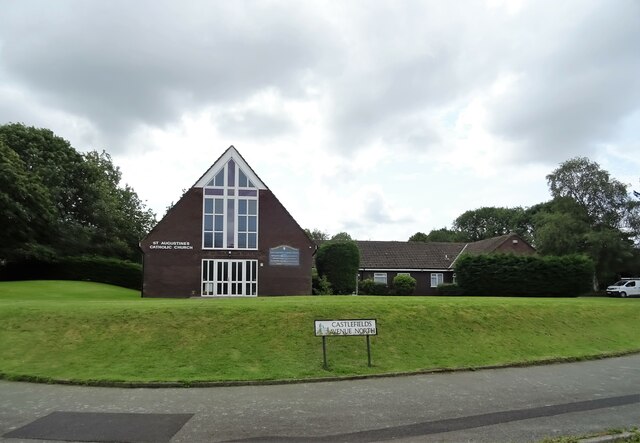
St Mary's Church, Halton

St Mary's Church is in Halton, which was formerly a separate village, but is now part of the town of Runcorn, Cheshire, England. It is an active Anglican...
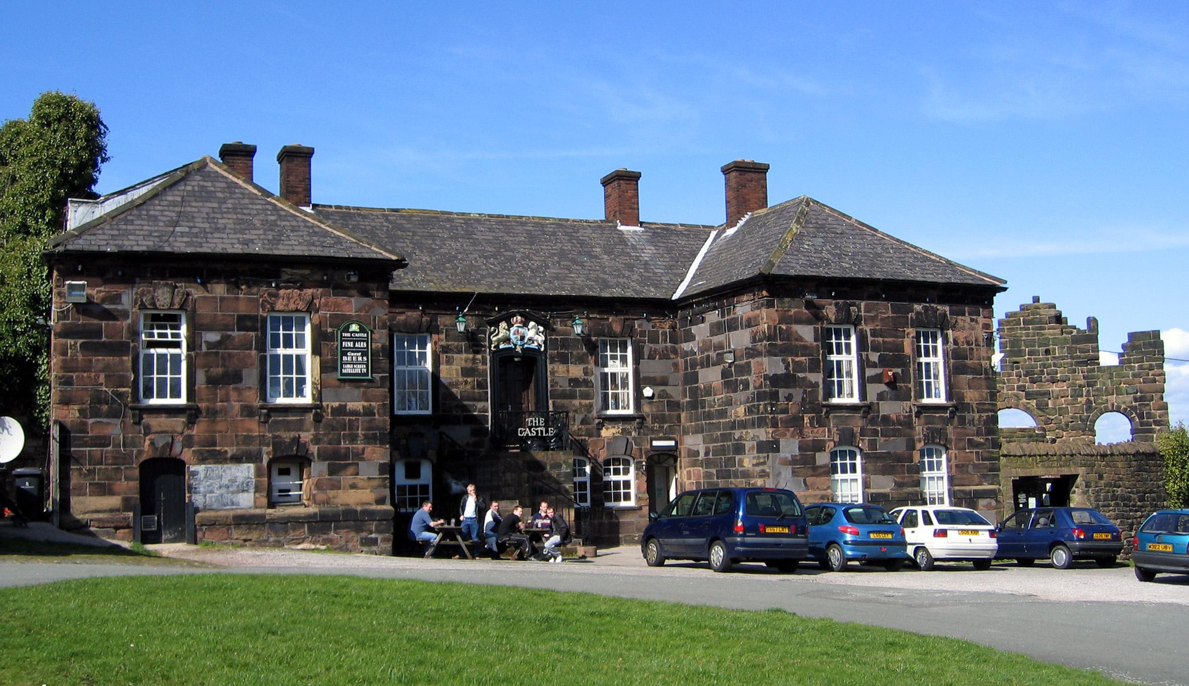
The Castle, Halton

The Castle, formerly known as The Castle Hotel, is a public house and former Georgian courthouse on Halton Hill in Halton, Runcorn, Cheshire, England....
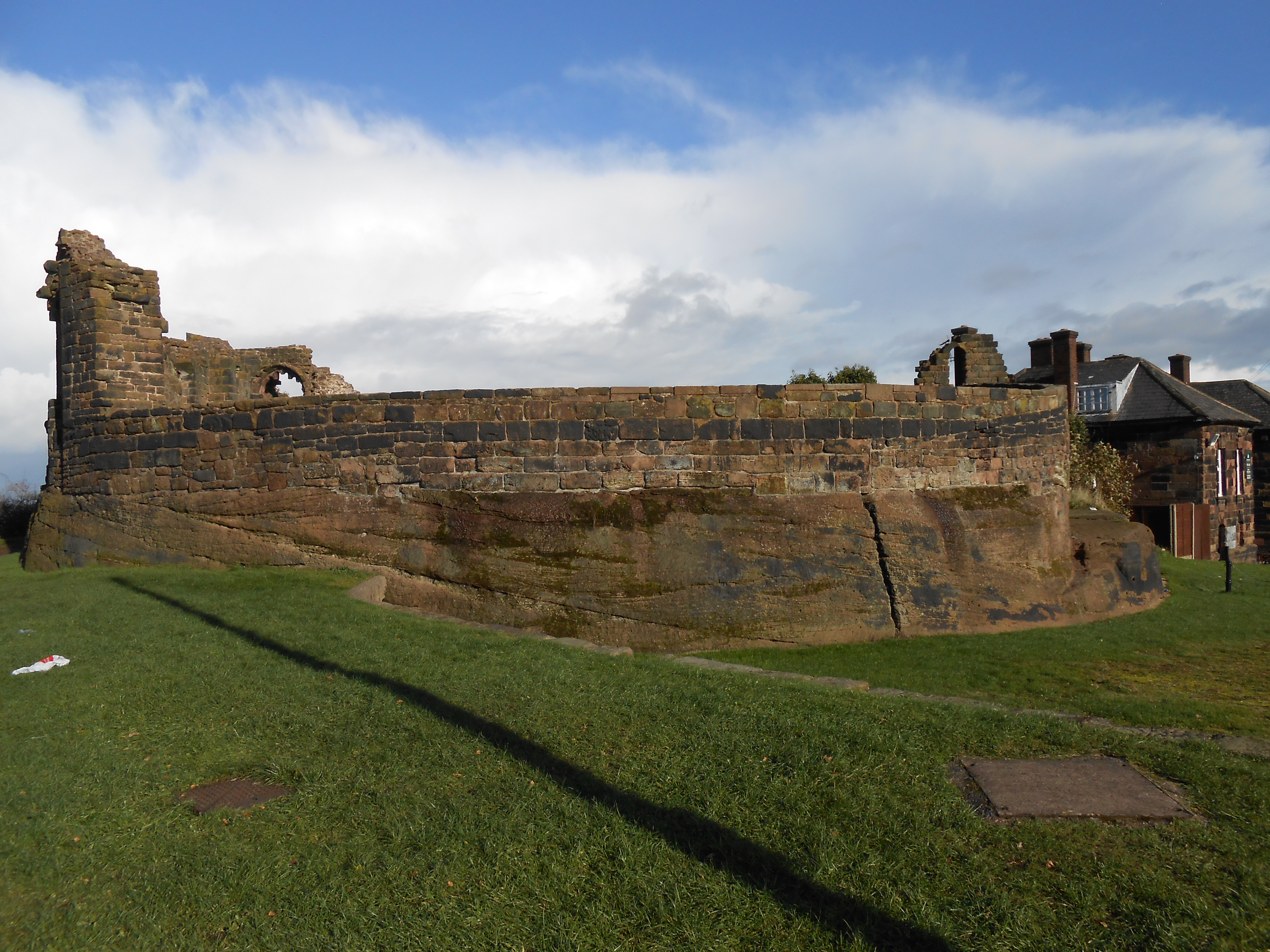
Halton Castle

Halton Castle is a castle in the village of Halton, part of the town of Runcorn, Cheshire, England. The castle is on the top of Halton Hill, a sandstone...

Halton Vicarage

Halton Vicarage is in Castle Road, Halton in the town of Runcorn, Cheshire, England. It is recorded in the National Heritage List for England as a designated...

Nearby Amenities

Located within 500m of 53.3327,-2.6972
Motorway Junction
Runcorn Spur Road Roundabout
Alt Name: Halton Lea Junction
Lat/Long: 53.3335976/-2.7039777
Crossing
Crossing: unmarked
Crossing Island: yes
Tactile Paving: yes
Lat/Long: 53.3291993/-2.6989782
Crossing
Crossing: marked
Crossing Island: no
Tactile Paving: yes
Lat/Long: 53.3291746/-2.6997326
Barrier: bollard
Bicycle: yes
Cyclestreets Id: 90681
Foot: yes
Motor Vehicle: no
Url: https://www.cyclestreets.net/location/90681/
Lat/Long: 53.3290216/-2.6941629
Halton
Place: suburb
Source: npemap.org.uk, landsat
Lat/Long: 53.3311995/-2.6931726
Traffic Signals
Traffic Signals: crossing
Lat/Long: 53.3302701/-2.6983733
Leisure: playground
Lat/Long: 53.3311536/-2.7016365
Barrier: lift_gate
Lat/Long: 53.3297404/-2.697489
Post Box
Ref: WA7 68
Lat/Long: 53.3341596/-2.7005379
War Memorial
Historic: memorial
Lat/Long: 53.3324145/-2.6955458
Tourism: viewpoint
Lat/Long: 53.333134/-2.69654
Bus Stop
Hollybank Road
Bus: yes
Departures Board: no
Public Transport: platform
Shelter: no
Lat/Long: 53.3324733/-2.697169
Bus Stop
Lodge Lane
Bus: yes
Departures Board: timetable
Public Transport: platform
Shelter: no
Lat/Long: 53.3316602/-2.6968763
Parking
Parking: surface
Lat/Long: 53.3317827/-2.696162
Post Box
Ref: WA7 9
Lat/Long: 53.3328694/-2.6943563
Bus Stop
Bus: yes
Naptan AtcoCode: 068000000053
Naptan NaptanCode: haladawa
Public Transport: platform
Lat/Long: 53.3345876/-2.7011102
Bus Stop
Bus: yes
Public Transport: platform
Lat/Long: 53.3346201/-2.7008134
Traffic Calming: choker
Lat/Long: 53.3321115/-2.6953525
Entrance: main
Level: 1
Lat/Long: 53.3284135/-2.6971971
Bench
Lat/Long: 53.330118/-2.6956752
Bench
Lat/Long: 53.3300857/-2.6955389
Barrier: bollard
Bicycle: yes
Bollard: removable
Cyclestreets Id: 90744
Foot: yes
Motor Vehicle: no
Url: https://www.cyclestreets.net/location/90744/
Lat/Long: 53.336108/-2.6949333
Steps
Lat/Long: 53.3342931/-2.698135
Crossing
Button Operated: yes
Crossing: traffic_signals
Crossing Island: no
Crossing Markings: dots
Crossing Ref: puffin
Tactile Paving: yes
Lat/Long: 53.3302318/-2.6983356
Crossing
Button Operated: yes
Crossing: traffic_signals
Crossing Island: no
Crossing Markings: dots
Crossing Ref: puffin
Tactile Paving: yes
Lat/Long: 53.3302461/-2.6986576
Barrier: block
Lat/Long: 53.3293239/-2.6990765
Barrier: bollard
Foot: yes
Lat/Long: 53.336367/-2.693794
Barrier: bollard
Foot: yes
Lat/Long: 53.3285814/-2.6942389
Post Box
Ref: WA7 10
Lat/Long: 53.3364013/-2.7008989
Crossing
Crossing: unmarked
Crossing Island: yes
Kerb: lowered
Tactile Paving: no
Lat/Long: 53.3290266/-2.6942413
Crossing
Crossing: unmarked
Crossing Island: yes
Kerb: lowered
Tactile Paving: no
Lat/Long: 53.3290388/-2.6943279
Entrance: yes
Lat/Long: 53.328642/-2.6969922
Entrance: yes
Level: 1
Lat/Long: 53.3287485/-2.6982672
Entrance: yes
Lat/Long: 53.3287612/-2.6968839
Bus Stop
British Legion
Bus: yes
Departures Board: timetable
Public Transport: platform
Shelter: yes
Lat/Long: 53.3306788/-2.6942035
Bus Stop
British Legion
Bus: yes
Departures Board: timetable
Public Transport: platform
Shelter: yes
Lat/Long: 53.3307406/-2.693984
Steps
Lat/Long: 53.3318618/-2.6904218
Barrier: cycle_barrier
Bicycle: yes
Cyclestreets Id: 90761
Foot: yes
Motor Vehicle: no
Url: https://www.cyclestreets.net/location/90761/
Lat/Long: 53.3362429/-2.6997677
Halton Castle
Natural: peak
Lat/Long: 53.3331221/-2.6958387
Crossing
Crossing: marked
Crossing Island: no
Tactile Paving: yes
Lat/Long: 53.3299945/-2.6989291
Bus Station
Bus Stop
Halton Lea North
Bus: yes
Naptan AtcoCode: 068000000701
Naptan Bearing: E
Naptan CommonName: Halton Lea North
Naptan Landmark: Halton Lea North
Naptan LocalityName: Palace Fields
Naptan NaptanCode: halagdmd
Naptan ShortCommonName: Halton Lea North
Naptan Street: Busway
Operator: Halton Borough Council
Public Transport: station
Source: naptan_import
Lat/Long: 53.3286694/-2.6972805
Door: yes
Level: 1
Lat/Long: 53.3287004/-2.698281
Entrance: main
Level: 1
Lat/Long: 53.3285212/-2.698475
Barrier: cycle_barrier
Bicycle: yes
Foot: yes
Horse: no
Motor Vehicle: no
Lat/Long: 53.3338595/-2.7035711
Traffic Signals
Traffic Signals: signal
Lat/Long: 53.3312747/-2.7031201
Traffic Signals
Traffic Signals: signal
Lat/Long: 53.3312371/-2.7032529
Generator Method: photovoltaic
Generator Output Electricity: yes
Generator Source: solar
Generator Type: solar_photovoltaic_panel
Location: roof
Power: generator
Lat/Long: 53.3371421/-2.6983705
Generator Method: photovoltaic
Generator Output Electricity: yes
Generator Source: solar
Generator Type: solar_photovoltaic_panel
Location: roof
Power: generator
Lat/Long: 53.3371053/-2.6983141
Generator Method: photovoltaic
Generator Output Electricity: yes
Generator Source: solar
Generator Type: solar_photovoltaic_panel
Location: roof
Power: generator
Lat/Long: 53.33703/-2.6987433
Generator Method: photovoltaic
Generator Output Electricity: yes
Generator Source: solar
Generator Type: solar_photovoltaic_panel
Location: roof
Power: generator
Lat/Long: 53.3369835/-2.698695
Generator Method: photovoltaic
Generator Output Electricity: yes
Generator Source: solar
Generator Type: solar_photovoltaic_panel
Location: roof
Power: generator
Lat/Long: 53.3369435/-2.6986494
Generator Method: photovoltaic
Generator Output Electricity: yes
Generator Source: solar
Generator Type: solar_photovoltaic_panel
Location: roof
Power: generator
Lat/Long: 53.3368618/-2.6989418
Generator Method: photovoltaic
Generator Output Electricity: yes
Generator Source: solar
Generator Type: solar_photovoltaic_panel
Location: roof
Power: generator
Lat/Long: 53.3368298/-2.6990249
Generator Method: photovoltaic
Generator Output Electricity: yes
Generator Source: solar
Generator Type: solar_photovoltaic_panel
Location: roof
Power: generator
Lat/Long: 53.3367994/-2.6991
Generator Method: photovoltaic
Generator Output Electricity: yes
Generator Source: solar
Generator Type: solar_photovoltaic_panel
Location: roof
Power: generator
Lat/Long: 53.3367737/-2.6991563
Generator Method: photovoltaic
Generator Output Electricity: yes
Generator Source: solar
Generator Type: solar_photovoltaic_panel
Location: roof
Power: generator
Lat/Long: 53.3357759/-2.698864
Generator Method: photovoltaic
Generator Output Electricity: yes
Generator Source: solar
Generator Type: solar_photovoltaic_panel
Location: roof
Power: generator
Lat/Long: 53.3357615/-2.6989257
Generator Method: photovoltaic
Generator Output Electricity: yes
Generator Source: solar
Generator Type: solar_photovoltaic_panel
Location: roof
Power: generator
Lat/Long: 53.3343377/-2.6977133
Generator Method: photovoltaic
Generator Output Electricity: yes
Generator Source: solar
Generator Type: solar_photovoltaic_panel
Location: roof
Power: generator
Lat/Long: 53.3336412/-2.6990341
Cafe
Asda Café
Brand: Asda
Brand Wikidata: Q297410
Brand Wikipedia: en:Asda
Contact Phone: +44 1928 790030
Contact Website: https://storelocator.asda.com/north-west/runcorn/west-lane/cafe
Cuisine: coffee_shop
Drinking Water Refill: yes
Drinking Water Refill Network: Refill
Fixme: Location not accurate
Internet Access: wlan
Internet Access Fee: no
Opening Hours Covid19: Mo-Su off
Operator: Asda Stores Ltd
Takeaway: yes
Lat/Long: 53.3295403/-2.7012903
Crossing
Crossing: marked
Crossing Island: no
Tactile Paving: yes
Lat/Long: 53.33012/-2.6992936
Crossing
Crossing: marked
Crossing Island: no
Tactile Paving: no
Lat/Long: 53.3301488/-2.6992104
Crossing
Crossing: uncontrolled
Crossing Ref: zebra
Lat/Long: 53.3298807/-2.6989033
Give Way
Direction: forward
Lat/Long: 53.3300266/-2.702242
Entrance: yes
Lat/Long: 53.3290678/-2.6972542
Bus Stop
The Calvers
Bus: yes
Departures Board: timetable
Naptan AtcoCode: 068000000741
Naptan NaptanCode: halagdwp
Public Transport: platform
Shelter: no
Lat/Long: 53.3365323/-2.7010781
Bus Stop
The Brow
Bus: yes
Departures Board: timetable
Naptan AtcoCode: 068000000743
Naptan NaptanCode: halagjad
Public Transport: platform
Shelter: no
Lat/Long: 53.3358224/-2.6978521
Bus Stop
The Brow
Bus: yes
Departures Board: timetable
Naptan AtcoCode: 068000000744
Naptan NaptanCode: halagjag
Public Transport: platform
Shelter: yes
Lat/Long: 53.3357846/-2.6980756
Bus Stop
Norton Arms
Bus: yes
Departures Board: timetable
Naptan AtcoCode: 068000000745
Naptan NaptanCode: halagjaj
Public Transport: platform
Shelter: no
Lat/Long: 53.3342201/-2.696164
Bus Stop
Norton Arms
Bus: yes
Departures Board: timetable
Public Transport: platform
Shelter: no
Lat/Long: 53.3339329/-2.6966451
Bus Stop
Pump Lane
Bus: yes
Departures Board: timetable
Naptan AtcoCode: 068000000751
Naptan NaptanCode: halagjda
Public Transport: platform
Shelter: no
Lat/Long: 53.3306065/-2.6929051
Crossing
Crossing: unmarked
Crossing Island: yes
Tactile Paving: yes
Lat/Long: 53.3288673/-2.6993996
Crossing
Crossing: unmarked
Crossing Island: yes
Tactile Paving: yes
Lat/Long: 53.3288024/-2.6994599
Barrier: kerb
Kerb: lowered
Tactile Paving: yes
Lat/Long: 53.3290528/-2.7003214
Crossing
Crossing: marked
Crossing Island: no
Tactile Paving: yes
Lat/Long: 53.3290795/-2.7003998
Barrier: kerb
Kerb: lowered
Tactile Paving: yes
Lat/Long: 53.3289773/-2.7000981
Crossing
Crossing: marked
Crossing Island: no
Tactile Paving: yes
Lat/Long: 53.32896/-2.7000452
Barrier: kerb
Kerb: lowered
Tactile Paving: yes
Lat/Long: 53.3289432/-2.6999941
Crossing
Crossing: unmarked
Crossing Island: yes
Tactile Paving: yes
Lat/Long: 53.32968/-2.6986156
Crossing
Crossing: unmarked
Crossing Island: yes
Tactile Paving: yes
Lat/Long: 53.3296163/-2.6986801
Traffic Signals
Traffic Signals: crossing
Lat/Long: 53.3302169/-2.6986157
Crossing
Crossing: unmarked
Crossing Island: no
Tactile Paving: yes
Lat/Long: 53.3297549/-2.6989511
Crossing
Crossing: unmarked
Lat/Long: 53.3301277/-2.6994502
Crossing
Crossing: unmarked
Crossing Island: no
Tactile Paving: yes
Lat/Long: 53.3300658/-2.699578
Crossing
Crossing: unmarked
Crossing Island: yes
Tactile Paving: yes
Lat/Long: 53.3291556/-2.6988552
Crossing
Crossing: marked
Crossing Island: no
Tactile Paving: no
Lat/Long: 53.3296751/-2.6991607
The Brow
Place: suburb
Lat/Long: 53.3350419/-2.7011418
Information: guidepost
Tourism: information
Lat/Long: 53.3297121/-2.6966111
Information: guidepost
Tourism: information
Lat/Long: 53.3302764/-2.6982637
Information: guidepost
Tourism: information
Lat/Long: 53.3302151/-2.6987552
Community Shop Runcorn
Description: Local discounted foods store.
Shop: convenience
Lat/Long: 53.3289505/-2.6953683
Post Box
Operator: Royal Mail
Operator Wikidata: Q638098
Post Box Type: wall
Ref: WA7 19
Royal Cypher: EIIR
Lat/Long: 53.3305244/-2.6936035
The data included in this document is from www.openstreetmap.org. The data is made available under ODbL.

Have you been to Halton?

Leave your review of Halton below (or comments, questions and feedback).