Marsh Moss

Downs, Moorland in Lancashire West Lancashire

England

Marsh Moss

The Mere, Martin Mere Wetlands Centre The lake, Martin Mere, was formed at the end of the last Ice Age when water filled a depression in the glacial drift. Until the late seventeenth century, this lake was the largest body of freshwater in England (5 miles in diameter, 20 miles circumference – three times the size of Windermere). Christopher Saxton's map from 1579 <span class="nowrap"><a title="http://en.wikipedia.org/wiki/Christopher_Saxton" rel="nofollow ugc noopener" href="http://en.wikipedia.org/wiki/Christopher_Saxton">Link</a><img style="margin-left:2px;" alt="External link" title="External link - shift click to open in new window" src="https://s1.geograph.org.uk/img/external.png" width="10" height="10"/></span>  shows the original giant lake stretching from Rufford in the east, to Churchtown (then known as North Meols) in the west.
The Mere, Martin Mere Wetlands Centre Credit: David Dixon

Marsh Moss is a picturesque area located in the county of Lancashire, England. It is known for its diverse landscape, consisting of marshes, downs, and moorland. Covering an expansive area, Marsh Moss offers visitors a unique blend of natural beauty and tranquility.

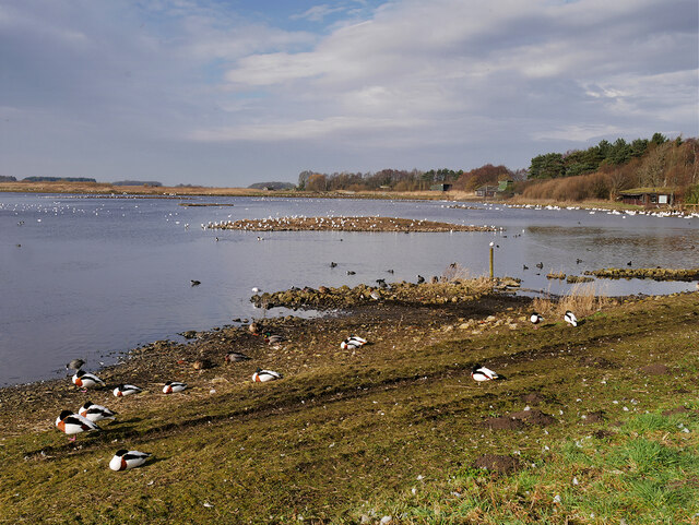
The marshes of Marsh Moss are characterized by their wetland vegetation, including reeds, rushes, and sedges. These marshes are home to a variety of bird species, such as herons, lapwings, and curlews, making it a popular destination for birdwatchers. The marshes also provide an important habitat for various amphibians and insects.

As visitors venture further into Marsh Moss, they will discover the rolling downs that dominate the landscape. These grassy hills offer stunning panoramic views of the surrounding countryside. Many visitors choose to hike or cycle along the well-maintained trails that crisscross the downs, taking in the fresh air and enjoying the peacefulness of the area.

At the heart of Marsh Moss lies its moorland, characterized by vast expanses of heather and gorse. This rugged terrain is home to a variety of wildlife, including red grouse, hares, and adders. The moorland is also dotted with ancient stone formations, adding an element of mystery and history to the landscape.

In addition to its natural beauty, Marsh Moss offers visitors a range of recreational activities. Fishing enthusiasts can enjoy angling in the area's rivers and lakes, while nature lovers can participate in guided walks and educational programs organized by local conservation groups.

Overall, Marsh Moss, Lancashire, offers a diverse and captivating landscape, showcasing the beauty of marshes, downs, and moorland. It is a haven for wildlife and a perfect destination for those seeking a peaceful and immersive experience in nature.

If you have any feedback on the listing, please let us know in the comments section below.
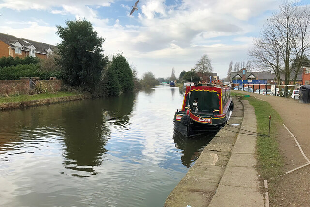
Marsh Moss Images

Images are sourced within 2km of 53.614549/-2.85606 or Grid Reference SD4313. Thanks to Geograph Open Source API. All images are credited.

The Mere, Martin Mere Wetlands Centre The lake, Martin Mere, was formed at the end of the last Ice Age when water filled a depression in the glacial drift. Until the late seventeenth century, this lake was the largest body of freshwater in England (5 miles in diameter, 20 miles circumference – three times the size of Windermere). Christopher Saxton's map from 1579 <span class="nowrap"><a title="http://en.wikipedia.org/wiki/Christopher_Saxton" rel="nofollow ugc noopener" href="http://en.wikipedia.org/wiki/Christopher_Saxton">Link</a><img style="margin-left:2px;" alt="External link" title="External link - shift click to open in new window" src="https://s1.geograph.org.uk/img/external.png" width="10" height="10"/></span>  shows the original giant lake stretching from Rufford in the east, to Churchtown (then known as North Meols) in the west.
The Mere, Martin Mere Wetlands Centre
The lake, Martin Mere, was formed at the end of the last Ice Age when water filled a depression in the glacial drift. Until the late seventeenth century, this lake was the largest body of freshwater in England (5 miles in diameter, 20 miles circumference – three times the size of Windermere). Christopher Saxton's map from 1579 LinkExternal link shows the original giant lake stretching from Rufford in the east, to Churchtown (then known as North Meols) in the west.
Mallard in Eclipse Plumage I think this is a male mallard in its eclipse plumage. It is on the edge of the mere outside the Discovery Hide at the Martin Mere Wetlands Centre.

Male ducks (drakes) require their colourful plumage in spring to attract a mate during the breeding season. After the breeding season, the males begin to moult, replacing the old worn-out feathers with new ones. During this period, they are largely flightless and so are more vulnerable to predators; to provide some protection the brightly coloured body feathers are replaced by duller brown ones, similar to those of the females. This is known as the eclipse plumage and is worn by the drakes until their flight feathers have regrown and a second moult occurs when the male will once again grow back into his full colours.
Mallard in Eclipse Plumage
I think this is a male mallard in its eclipse plumage. It is on the edge of the mere outside the Discovery Hide at the Martin Mere Wetlands Centre. Male ducks (drakes) require their colourful plumage in spring to attract a mate during the breeding season. After the breeding season, the males begin to moult, replacing the old worn-out feathers with new ones. During this period, they are largely flightless and so are more vulnerable to predators; to provide some protection the brightly coloured body feathers are replaced by duller brown ones, similar to those of the females. This is known as the eclipse plumage and is worn by the drakes until their flight feathers have regrown and a second moult occurs when the male will once again grow back into his full colours.
The Mere, viewed from a hide A view of the mere from one of the small hides/shelters on the path along the eastern side of the lake.
The Mere, viewed from a hide
A view of the mere from one of the small hides/shelters on the path along the eastern side of the lake.
Carum Field, Martin Mere Wetland Centre WWT Martin Mere is a wetland nature reserve managed by the Wildfowl and Wetlands Trust (WWT). Situated on the West Lancashire Coastal Plain, it is one of nine reserves managed by the WWT, and it is designated as a Site of Special Scientific Interest (SSSI), an SPA (Special Protection Area) and a Ramsar Site <span class="nowrap"><a title="http://en.wikipedia.org/wiki/Ramsar_Site" rel="nofollow ugc noopener" href="http://en.wikipedia.org/wiki/Ramsar_Site">Link</a><img style="margin-left:2px;" alt="External link" title="External link - shift click to open in new window" src="https://s1.geograph.org.uk/img/external.png" width="10" height="10"/></span> .

The centre takes its name from the mere on the west side of the reserve which has been provided with eleven observation hides. On the east side of the reserve there are a number of pens providing habitats for birds from Africa, Australasia, North America, South America, Siberia, and Asia.

The lake, Martin Mere, was formed at the end of the last Ice Age, when water filled a depression in the glacial drift. Until the late seventeenth century, this lake was the largest body of fresh water in England (5 miles in diameter, 20 miles circumference – three times the size of Windermere). Christopher Saxton's map from 1579 <span class="nowrap"><a title="http://en.wikipedia.org/wiki/Christopher_Saxton" rel="nofollow ugc noopener" href="http://en.wikipedia.org/wiki/Christopher_Saxton">Link</a><img style="margin-left:2px;" alt="External link" title="External link - shift click to open in new window" src="https://s1.geograph.org.uk/img/external.png" width="10" height="10"/></span>  shows the original giant lake stretching from Rufford in the east, to Churchtown (then known as North Meols) in the west. 

Active management of the mere began in 1692 when the first drainage channel was dug, and further attempts to drain it were made in the 1780s, but effective drainage was only achieved in the mid-19th century with the introduction of steam pumping. Farms and market gardens were established on the rich soils of the reclaimed land. 

The first 363 acres of the site, known as Holcroft's Farm, were purchased in 1972 through local fundraising and the site was opened to the public in 1975 by Sir Peter Scott, founder of the WWT. Since then the reserve has been extended and is now one of Britain's most important wetland sites, visited by thousands of migrating wildfowl in the autumn and winter. It is also home to 100 species of tame birds, many on the endangered list and part of breeding programmes.

<span class="nowrap"><a title="http://www.wwt.org.uk/wetland-centres/martin-mere/" rel="nofollow ugc noopener" href="http://www.wwt.org.uk/wetland-centres/martin-mere/">Link</a><img style="margin-left:2px;" alt="External link" title="External link - shift click to open in new window" src="https://s1.geograph.org.uk/img/external.png" width="10" height="10"/></span>  WWT Martin Mere Wetland Centre website
<span class="nowrap"><a title="http://www.rspb.org.uk/groups/Liverpool/places/343075/" rel="nofollow ugc noopener" href="http://www.rspb.org.uk/groups/Liverpool/places/343075/">Link</a><img style="margin-left:2px;" alt="External link" title="External link - shift click to open in new window" src="https://s1.geograph.org.uk/img/external.png" width="10" height="10"/></span>  RSPB Liverpool group
<span class="nowrap"><a title="http://en.wikipedia.org/wiki/WWT_Martin_Mere" rel="nofollow ugc noopener" href="http://en.wikipedia.org/wiki/WWT_Martin_Mere">Link</a><img style="margin-left:2px;" alt="External link" title="External link - shift click to open in new window" src="https://s1.geograph.org.uk/img/external.png" width="10" height="10"/></span>  Wikipedia
Carum Field, Martin Mere Wetland Centre
WWT Martin Mere is a wetland nature reserve managed by the Wildfowl and Wetlands Trust (WWT). Situated on the West Lancashire Coastal Plain, it is one of nine reserves managed by the WWT, and it is designated as a Site of Special Scientific Interest (SSSI), an SPA (Special Protection Area) and a Ramsar Site LinkExternal link . The centre takes its name from the mere on the west side of the reserve which has been provided with eleven observation hides. On the east side of the reserve there are a number of pens providing habitats for birds from Africa, Australasia, North America, South America, Siberia, and Asia. The lake, Martin Mere, was formed at the end of the last Ice Age, when water filled a depression in the glacial drift. Until the late seventeenth century, this lake was the largest body of fresh water in England (5 miles in diameter, 20 miles circumference – three times the size of Windermere). Christopher Saxton's map from 1579 LinkExternal link shows the original giant lake stretching from Rufford in the east, to Churchtown (then known as North Meols) in the west. Active management of the mere began in 1692 when the first drainage channel was dug, and further attempts to drain it were made in the 1780s, but effective drainage was only achieved in the mid-19th century with the introduction of steam pumping. Farms and market gardens were established on the rich soils of the reclaimed land. The first 363 acres of the site, known as Holcroft's Farm, were purchased in 1972 through local fundraising and the site was opened to the public in 1975 by Sir Peter Scott, founder of the WWT. Since then the reserve has been extended and is now one of Britain's most important wetland sites, visited by thousands of migrating wildfowl in the autumn and winter. It is also home to 100 species of tame birds, many on the endangered list and part of breeding programmes. LinkExternal link WWT Martin Mere Wetland Centre website LinkExternal link RSPB Liverpool group LinkExternal link Wikipedia
Feeding amongst the berries A number of feeding stations have been installed in the area outside the Janet Kear Hide, to attract perching birds from the nearby trees. When I visited, there were lots of small birds, mainly finches, taking seeds from the feeders but this one was perched on a branch a few metres away. Judging by the red stain on its beak, I think it must have preferred the berries.
Feeding amongst the berries
A number of feeding stations have been installed in the area outside the Janet Kear Hide, to attract perching birds from the nearby trees. When I visited, there were lots of small birds, mainly finches, taking seeds from the feeders but this one was perched on a branch a few metres away. Judging by the red stain on its beak, I think it must have preferred the berries.
Goldfinch on a feeder at Martin Mere A number of feeding stations have been installed in the area outside the Janet Kear Hide, to attract perching birds from the nearby trees. When I visited, there were lots of small birds, mainly finches, taking seeds from the feeders but this goldfinch was easily the most colourful.
Goldfinch on a feeder at Martin Mere
A number of feeding stations have been installed in the area outside the Janet Kear Hide, to attract perching birds from the nearby trees. When I visited, there were lots of small birds, mainly finches, taking seeds from the feeders but this goldfinch was easily the most colourful.
The Pat Wisniewski Reedbeds, Martin Mere Wetland Centre The Harrier Hide at the southern end of the reserve looks out across the Pat Wisniewski reed beds, an area of land which was bought from a local farm.  This land, which had previously been intensively cultivated, was converted into 62 acres of reed bed and 44 acres of wet grassland, wet woodland, dry grassland, hedgerow and copse. It is hoped that, as the new wetland matures, the extremely diverse habitat will attract bitterns, bearded tits and marsh harriers. (<span class="nowrap"><a title="http://www.rspb.org.uk/groups/Liverpool/places/343075/" rel="nofollow ugc noopener" href="http://www.rspb.org.uk/groups/Liverpool/places/343075/">Link</a><img style="margin-left:2px;" alt="External link" title="External link - shift click to open in new window" src="https://s1.geograph.org.uk/img/external.png" width="10" height="10"/></span>  RSPB Liverpool group).

The area, which was officially opened in May 2013, was named in tribute to the late Centre Manager, Pat Wisniewski (<span class="nowrap"><a title="https://www.wwt.org.uk/news-and-stories/news/wwt-martin-mere-pays-tribute-to-late-pat-wisniewski/" rel="nofollow ugc noopener" href="https://www.wwt.org.uk/news-and-stories/news/wwt-martin-mere-pays-tribute-to-late-pat-wisniewski/">Link</a><img style="margin-left:2px;" alt="External link" title="External link - shift click to open in new window" src="https://s1.geograph.org.uk/img/external.png" width="10" height="10"/></span> WWT)
The Pat Wisniewski Reedbeds, Martin Mere Wetland Centre
The Harrier Hide at the southern end of the reserve looks out across the Pat Wisniewski reed beds, an area of land which was bought from a local farm. This land, which had previously been intensively cultivated, was converted into 62 acres of reed bed and 44 acres of wet grassland, wet woodland, dry grassland, hedgerow and copse. It is hoped that, as the new wetland matures, the extremely diverse habitat will attract bitterns, bearded tits and marsh harriers. (LinkExternal link RSPB Liverpool group). The area, which was officially opened in May 2013, was named in tribute to the late Centre Manager, Pat Wisniewski (LinkExternal link WWT)
Nature Trail, Martin Mere Wetlands Centre Nature trail and path to the hides.
Nature Trail, Martin Mere Wetlands Centre
Nature trail and path to the hides.
Martin Mere Wetlands Centre, Ron Barker Hide WWT Martin Mere is a wetland nature reserve managed by the Wildfowl and Wetlands Trust (WWT). Situated on the West Lancashire Coastal Plain, it is one of nine reserves managed by the WWT, and it is designated as a Site of Special Scientific Interest (SSSI), an SPA (Special Protection Area) and a Ramsar Site <span class="nowrap"><a title="http://en.wikipedia.org/wiki/Ramsar_Site" rel="nofollow ugc noopener" href="http://en.wikipedia.org/wiki/Ramsar_Site">Link</a><img style="margin-left:2px;" alt="External link" title="External link - shift click to open in new window" src="https://s1.geograph.org.uk/img/external.png" width="10" height="10"/></span> .

The centre takes its name from the mere on the west side of the reserve which has been provided with eleven observation hides. On the east side of the reserve there are a number of pens providing habitats for birds from Africa, Australasia, North America, South America, Siberia, and Asia.

The lake, Martin Mere, was formed at the end of the last Ice Age, when water filled a depression in the glacial drift. Until the late seventeenth century, this lake was the largest body of fresh water in England (5 miles in diameter, 20 miles circumference – three times the size of Windermere). Christopher Saxton's map from 1579 <span class="nowrap"><a title="http://en.wikipedia.org/wiki/Christopher_Saxton" rel="nofollow ugc noopener" href="http://en.wikipedia.org/wiki/Christopher_Saxton">Link</a><img style="margin-left:2px;" alt="External link" title="External link - shift click to open in new window" src="https://s1.geograph.org.uk/img/external.png" width="10" height="10"/></span>  shows the original giant lake stretching from Rufford in the east, to Churchtown (then known as North Meols) in the west. 

Active management of the mere began in 1692 when the first drainage channel was dug, and further attempts to drain it were made in the 1780s, but effective drainage was only achieved in the mid-19th century with the introduction of steam pumping. Farms and market gardens were established on the rich soils of the reclaimed land. 

The first 363 acres of the site, known as Holcroft's Farm, were purchased in 1972 through local fundraising and the site was opened to the public in 1975 by Sir Peter Scott, founder of the WWT. Since then the reserve has been extended and is now one of Britain's most important wetland sites, visited by thousands of migrating wildfowl in the autumn and winter. It is also home to 100 species of tame birds, many on the endangered list and part of breeding programmes.

<span class="nowrap"><a title="http://www.wwt.org.uk/wetland-centres/martin-mere/" rel="nofollow ugc noopener" href="http://www.wwt.org.uk/wetland-centres/martin-mere/">Link</a><img style="margin-left:2px;" alt="External link" title="External link - shift click to open in new window" src="https://s1.geograph.org.uk/img/external.png" width="10" height="10"/></span>  WWT Martin Mere Wetland Centre website
<span class="nowrap"><a title="http://www.rspb.org.uk/groups/Liverpool/places/343075/" rel="nofollow ugc noopener" href="http://www.rspb.org.uk/groups/Liverpool/places/343075/">Link</a><img style="margin-left:2px;" alt="External link" title="External link - shift click to open in new window" src="https://s1.geograph.org.uk/img/external.png" width="10" height="10"/></span>  RSPB Liverpool group
<span class="nowrap"><a title="http://en.wikipedia.org/wiki/WWT_Martin_Mere" rel="nofollow ugc noopener" href="http://en.wikipedia.org/wiki/WWT_Martin_Mere">Link</a><img style="margin-left:2px;" alt="External link" title="External link - shift click to open in new window" src="https://s1.geograph.org.uk/img/external.png" width="10" height="10"/></span>  Wikipedia
Martin Mere Wetlands Centre, Ron Barker Hide
WWT Martin Mere is a wetland nature reserve managed by the Wildfowl and Wetlands Trust (WWT). Situated on the West Lancashire Coastal Plain, it is one of nine reserves managed by the WWT, and it is designated as a Site of Special Scientific Interest (SSSI), an SPA (Special Protection Area) and a Ramsar Site LinkExternal link . The centre takes its name from the mere on the west side of the reserve which has been provided with eleven observation hides. On the east side of the reserve there are a number of pens providing habitats for birds from Africa, Australasia, North America, South America, Siberia, and Asia. The lake, Martin Mere, was formed at the end of the last Ice Age, when water filled a depression in the glacial drift. Until the late seventeenth century, this lake was the largest body of fresh water in England (5 miles in diameter, 20 miles circumference – three times the size of Windermere). Christopher Saxton's map from 1579 LinkExternal link shows the original giant lake stretching from Rufford in the east, to Churchtown (then known as North Meols) in the west. Active management of the mere began in 1692 when the first drainage channel was dug, and further attempts to drain it were made in the 1780s, but effective drainage was only achieved in the mid-19th century with the introduction of steam pumping. Farms and market gardens were established on the rich soils of the reclaimed land. The first 363 acres of the site, known as Holcroft's Farm, were purchased in 1972 through local fundraising and the site was opened to the public in 1975 by Sir Peter Scott, founder of the WWT. Since then the reserve has been extended and is now one of Britain's most important wetland sites, visited by thousands of migrating wildfowl in the autumn and winter. It is also home to 100 species of tame birds, many on the endangered list and part of breeding programmes. LinkExternal link WWT Martin Mere Wetland Centre website LinkExternal link RSPB Liverpool group LinkExternal link Wikipedia
Martin Mere Wetlands Centre, Boat House Sluice WWT Martin Mere is a wetland nature reserve managed by the Wildfowl and Wetlands Trust (WWT). Situated on the West Lancashire Coastal Plain, it is one of nine reserves managed by the WWT, and it is designated as a Site of Special Scientific Interest (SSSI), an SPA (Special Protection Area) and a Ramsar Site <span class="nowrap"><a title="http://en.wikipedia.org/wiki/Ramsar_Site" rel="nofollow ugc noopener" href="http://en.wikipedia.org/wiki/Ramsar_Site">Link</a><img style="margin-left:2px;" alt="External link" title="External link - shift click to open in new window" src="https://s1.geograph.org.uk/img/external.png" width="10" height="10"/></span> .

The centre takes its name from the mere on the west side of the reserve which has been provided with eleven observation hides. On the east side of the reserve there are a number of pens providing habitats for birds from Africa, Australasia, North America, South America, Siberia, and Asia.

The lake, Martin Mere, was formed at the end of the last Ice Age, when water filled a depression in the glacial drift. Until the late seventeenth century, this lake was the largest body of fresh water in England (5 miles in diameter, 20 miles circumference – three times the size of Windermere). Christopher Saxton's map from 1579 <span class="nowrap"><a title="http://en.wikipedia.org/wiki/Christopher_Saxton" rel="nofollow ugc noopener" href="http://en.wikipedia.org/wiki/Christopher_Saxton">Link</a><img style="margin-left:2px;" alt="External link" title="External link - shift click to open in new window" src="https://s1.geograph.org.uk/img/external.png" width="10" height="10"/></span>  shows the original giant lake stretching from Rufford in the east, to Churchtown (then known as North Meols) in the west. 

Active management of the mere began in 1692 when the first drainage channel was dug, and further attempts to drain it were made in the 1780s, but effective drainage was only achieved in the mid-19th century with the introduction of steam pumping. Farms and market gardens were established on the rich soils of the reclaimed land. 

The first 363 acres of the site, known as Holcroft's Farm, were purchased in 1972 through local fundraising and the site was opened to the public in 1975 by Sir Peter Scott, founder of the WWT. Since then the reserve has been extended and is now one of Britain's most important wetland sites, visited by thousands of migrating wildfowl in the autumn and winter. It is also home to 100 species of tame birds, many on the endangered list and part of breeding programmes.

<span class="nowrap"><a title="http://www.wwt.org.uk/wetland-centres/martin-mere/" rel="nofollow ugc noopener" href="http://www.wwt.org.uk/wetland-centres/martin-mere/">Link</a><img style="margin-left:2px;" alt="External link" title="External link - shift click to open in new window" src="https://s1.geograph.org.uk/img/external.png" width="10" height="10"/></span>  WWT Martin Mere Wetland Centre website
<span class="nowrap"><a title="http://www.rspb.org.uk/groups/Liverpool/places/343075/" rel="nofollow ugc noopener" href="http://www.rspb.org.uk/groups/Liverpool/places/343075/">Link</a><img style="margin-left:2px;" alt="External link" title="External link - shift click to open in new window" src="https://s1.geograph.org.uk/img/external.png" width="10" height="10"/></span>  RSPB Liverpool group
<span class="nowrap"><a title="http://en.wikipedia.org/wiki/WWT_Martin_Mere" rel="nofollow ugc noopener" href="http://en.wikipedia.org/wiki/WWT_Martin_Mere">Link</a><img style="margin-left:2px;" alt="External link" title="External link - shift click to open in new window" src="https://s1.geograph.org.uk/img/external.png" width="10" height="10"/></span>  Wikipedia
Martin Mere Wetlands Centre, Boat House Sluice
WWT Martin Mere is a wetland nature reserve managed by the Wildfowl and Wetlands Trust (WWT). Situated on the West Lancashire Coastal Plain, it is one of nine reserves managed by the WWT, and it is designated as a Site of Special Scientific Interest (SSSI), an SPA (Special Protection Area) and a Ramsar Site LinkExternal link . The centre takes its name from the mere on the west side of the reserve which has been provided with eleven observation hides. On the east side of the reserve there are a number of pens providing habitats for birds from Africa, Australasia, North America, South America, Siberia, and Asia. The lake, Martin Mere, was formed at the end of the last Ice Age, when water filled a depression in the glacial drift. Until the late seventeenth century, this lake was the largest body of fresh water in England (5 miles in diameter, 20 miles circumference – three times the size of Windermere). Christopher Saxton's map from 1579 LinkExternal link shows the original giant lake stretching from Rufford in the east, to Churchtown (then known as North Meols) in the west. Active management of the mere began in 1692 when the first drainage channel was dug, and further attempts to drain it were made in the 1780s, but effective drainage was only achieved in the mid-19th century with the introduction of steam pumping. Farms and market gardens were established on the rich soils of the reclaimed land. The first 363 acres of the site, known as Holcroft's Farm, were purchased in 1972 through local fundraising and the site was opened to the public in 1975 by Sir Peter Scott, founder of the WWT. Since then the reserve has been extended and is now one of Britain's most important wetland sites, visited by thousands of migrating wildfowl in the autumn and winter. It is also home to 100 species of tame birds, many on the endangered list and part of breeding programmes. LinkExternal link WWT Martin Mere Wetland Centre website LinkExternal link RSPB Liverpool group LinkExternal link Wikipedia
Wild wetland area of Martin Mere WWT
Burscough Bridge, Leeds and Liverpool Canal The Leeds and Liverpool Canal is the longest canal in Northern England at 127 miles long. The first of the trans-Pennine canals it took 46 years to build at a cost of five times the original budget, mainly because of the length and complexity of the route. It passes through 91 locks with a summit level of 487 feet at Foulridge near Nelson and Colne. It was originally conceived in the 18th century to carry woollen goods from Leeds and Bradford and limestone from Skipton but in its 19th century heyday it carried stone, coal and many other goods. The impact of the railways was not as great as with other canals and commercial traffic continued along the main canal until 1964. Regular work stopped in 1972 when the movement of coal to Wigan Power Station ceased. In the latter part of the 20th century the leisure potential of the canal was developed and it is now a popular destination for cruising, fishing, walking and cycling. See <span class="nowrap"><a title="http://www.penninewaterways.co.uk/ll/index.htm" rel="nofollow ugc noopener" href="http://www.penninewaterways.co.uk/ll/index.htm">Link</a><img style="margin-left:2px;" alt="External link" title="External link - shift click to open in new window" src="https://s1.geograph.org.uk/img/external.png" width="10" height="10"/></span> for detailed information.
Burscough Bridge, Leeds and Liverpool Canal
The Leeds and Liverpool Canal is the longest canal in Northern England at 127 miles long. The first of the trans-Pennine canals it took 46 years to build at a cost of five times the original budget, mainly because of the length and complexity of the route. It passes through 91 locks with a summit level of 487 feet at Foulridge near Nelson and Colne. It was originally conceived in the 18th century to carry woollen goods from Leeds and Bradford and limestone from Skipton but in its 19th century heyday it carried stone, coal and many other goods. The impact of the railways was not as great as with other canals and commercial traffic continued along the main canal until 1964. Regular work stopped in 1972 when the movement of coal to Wigan Power Station ceased. In the latter part of the 20th century the leisure potential of the canal was developed and it is now a popular destination for cruising, fishing, walking and cycling. See LinkExternal link for detailed information.
Leeds and Liverpool Canal at Burscough Bridge The Leeds and Liverpool Canal is the longest canal in Northern England at 127 miles long. The first of the trans-Pennine canals it took 46 years to build at a cost of five times the original budget, mainly because of the length and complexity of the route. It passes through 91 locks with a summit level of 487 feet at Foulridge near Nelson and Colne. It was originally conceived in the 18th century to carry woollen goods from Leeds and Bradford and limestone from Skipton but in its 19th century heyday it carried stone, coal and many other goods. The impact of the railways was not as great as with other canals and commercial traffic continued along the main canal until 1964. Regular work stopped in 1972 when the movement of coal to Wigan Power Station ceased. In the latter part of the 20th century the leisure potential of the canal was developed and it is now a popular destination for cruising, fishing, walking and cycling. See <span class="nowrap"><a title="http://www.penninewaterways.co.uk/ll/index.htm" rel="nofollow ugc noopener" href="http://www.penninewaterways.co.uk/ll/index.htm">Link</a><img style="margin-left:2px;" alt="External link" title="External link - shift click to open in new window" src="https://s1.geograph.org.uk/img/external.png" width="10" height="10"/></span> for detailed information.
Leeds and Liverpool Canal at Burscough Bridge
The Leeds and Liverpool Canal is the longest canal in Northern England at 127 miles long. The first of the trans-Pennine canals it took 46 years to build at a cost of five times the original budget, mainly because of the length and complexity of the route. It passes through 91 locks with a summit level of 487 feet at Foulridge near Nelson and Colne. It was originally conceived in the 18th century to carry woollen goods from Leeds and Bradford and limestone from Skipton but in its 19th century heyday it carried stone, coal and many other goods. The impact of the railways was not as great as with other canals and commercial traffic continued along the main canal until 1964. Regular work stopped in 1972 when the movement of coal to Wigan Power Station ceased. In the latter part of the 20th century the leisure potential of the canal was developed and it is now a popular destination for cruising, fishing, walking and cycling. See LinkExternal link for detailed information.
Black-headed Gull at Martin Mere Wetlands Centre A black-headed gull perched on a fence post at the side of the Mere.
Black-headed Gull at Martin Mere Wetlands Centre
A black-headed gull perched on a fence post at the side of the Mere.
The Mere, Martin Mere Wetlands Centre WWT Martin Mere is a wetland nature reserve managed by the Wildfowl and Wetlands Trust (WWT). Situated on the West Lancashire Coastal Plain, it is one of nine reserves managed by the WWT, and it is designated as a Site of Special Scientific Interest (SSSI), an SPA (Special Protection Area) and a Ramsar Site <span class="nowrap"><a title="http://en.wikipedia.org/wiki/Ramsar_Site" rel="nofollow ugc noopener" href="http://en.wikipedia.org/wiki/Ramsar_Site">Link</a><img style="margin-left:2px;" alt="External link" title="External link - shift click to open in new window" src="https://s1.geograph.org.uk/img/external.png" width="10" height="10"/></span> .

The centre takes its name from the mere on the west side of the reserve which has been provided with eleven observation hides. On the east side of the reserve there are a number of pens providing habitats for birds from Africa, Australasia, North America, South America, Siberia, and Asia.

The lake, Martin Mere, was formed at the end of the last Ice Age, when water filled a depression in the glacial drift. Until the late seventeenth century, this lake was the largest body of fresh water in England (5 miles in diameter, 20 miles circumference – three times the size of Windermere). Christopher Saxton's map from 1579 <span class="nowrap"><a title="http://en.wikipedia.org/wiki/Christopher_Saxton" rel="nofollow ugc noopener" href="http://en.wikipedia.org/wiki/Christopher_Saxton">Link</a><img style="margin-left:2px;" alt="External link" title="External link - shift click to open in new window" src="https://s1.geograph.org.uk/img/external.png" width="10" height="10"/></span>  shows the original giant lake stretching from Rufford in the east, to Churchtown (then known as North Meols) in the west. 

Active management of the mere began in 1692 when the first drainage channel was dug, and further attempts to drain it were made in the 1780s, but effective drainage was only achieved in the mid-19th century with the introduction of steam pumping. Farms and market gardens were established on the rich soils of the reclaimed land. 

The first 363 acres of the site, known as Holcroft's Farm, were purchased in 1972 through local fundraising and the site was opened to the public in 1975 by Sir Peter Scott, founder of the WWT. Since then the reserve has been extended and is now one of Britain's most important wetland sites, visited by thousands of migrating wildfowl in the autumn and winter. It is also home to 100 species of tame birds, many on the endangered list and part of breeding programmes.

<span class="nowrap"><a title="http://www.wwt.org.uk/wetland-centres/martin-mere/" rel="nofollow ugc noopener" href="http://www.wwt.org.uk/wetland-centres/martin-mere/">Link</a><img style="margin-left:2px;" alt="External link" title="External link - shift click to open in new window" src="https://s1.geograph.org.uk/img/external.png" width="10" height="10"/></span>  WWT Martin Mere Wetland Centre website
<span class="nowrap"><a title="http://www.rspb.org.uk/groups/Liverpool/places/343075/" rel="nofollow ugc noopener" href="http://www.rspb.org.uk/groups/Liverpool/places/343075/">Link</a><img style="margin-left:2px;" alt="External link" title="External link - shift click to open in new window" src="https://s1.geograph.org.uk/img/external.png" width="10" height="10"/></span>  RSPB Liverpool group
<span class="nowrap"><a title="http://en.wikipedia.org/wiki/WWT_Martin_Mere" rel="nofollow ugc noopener" href="http://en.wikipedia.org/wiki/WWT_Martin_Mere">Link</a><img style="margin-left:2px;" alt="External link" title="External link - shift click to open in new window" src="https://s1.geograph.org.uk/img/external.png" width="10" height="10"/></span>  Wikipedia
The Mere, Martin Mere Wetlands Centre
WWT Martin Mere is a wetland nature reserve managed by the Wildfowl and Wetlands Trust (WWT). Situated on the West Lancashire Coastal Plain, it is one of nine reserves managed by the WWT, and it is designated as a Site of Special Scientific Interest (SSSI), an SPA (Special Protection Area) and a Ramsar Site LinkExternal link . The centre takes its name from the mere on the west side of the reserve which has been provided with eleven observation hides. On the east side of the reserve there are a number of pens providing habitats for birds from Africa, Australasia, North America, South America, Siberia, and Asia. The lake, Martin Mere, was formed at the end of the last Ice Age, when water filled a depression in the glacial drift. Until the late seventeenth century, this lake was the largest body of fresh water in England (5 miles in diameter, 20 miles circumference – three times the size of Windermere). Christopher Saxton's map from 1579 LinkExternal link shows the original giant lake stretching from Rufford in the east, to Churchtown (then known as North Meols) in the west. Active management of the mere began in 1692 when the first drainage channel was dug, and further attempts to drain it were made in the 1780s, but effective drainage was only achieved in the mid-19th century with the introduction of steam pumping. Farms and market gardens were established on the rich soils of the reclaimed land. The first 363 acres of the site, known as Holcroft's Farm, were purchased in 1972 through local fundraising and the site was opened to the public in 1975 by Sir Peter Scott, founder of the WWT. Since then the reserve has been extended and is now one of Britain's most important wetland sites, visited by thousands of migrating wildfowl in the autumn and winter. It is also home to 100 species of tame birds, many on the endangered list and part of breeding programmes. LinkExternal link WWT Martin Mere Wetland Centre website LinkExternal link RSPB Liverpool group LinkExternal link Wikipedia
WWT Martin Mere, the Mere WWT Martin Mere is a wetland nature reserve managed by the Wildfowl and Wetlands Trust (WWT). Situated on the West Lancashire Coastal Plain, it is one of nine reserves managed by the WWT, and it is designated as a Site of Special Scientific Interest (SSSI), an SPA (Special Protection Area) and a Ramsar Site <span class="nowrap"><a title="http://en.wikipedia.org/wiki/Ramsar_Site" rel="nofollow ugc noopener" href="http://en.wikipedia.org/wiki/Ramsar_Site">Link</a><img style="margin-left:2px;" alt="External link" title="External link - shift click to open in new window" src="https://s1.geograph.org.uk/img/external.png" width="10" height="10"/></span> .

The centre takes its name from the mere on the west side of the reserve which has been provided with eleven observation hides. On the east side of the reserve there are a number of pens providing habitats for birds from Africa, Australasia, North America, South America, Siberia, and Asia.

The lake, Martin Mere, was formed at the end of the last Ice Age, when water filled a depression in the glacial drift. Until the late seventeenth century, this lake was the largest body of fresh water in England (5 miles in diameter, 20 miles circumference – three times the size of Windermere). Christopher Saxton's map from 1579 <span class="nowrap"><a title="http://en.wikipedia.org/wiki/Christopher_Saxton" rel="nofollow ugc noopener" href="http://en.wikipedia.org/wiki/Christopher_Saxton">Link</a><img style="margin-left:2px;" alt="External link" title="External link - shift click to open in new window" src="https://s1.geograph.org.uk/img/external.png" width="10" height="10"/></span>  shows the original giant lake stretching from Rufford in the east, to Churchtown (then known as North Meols) in the west. 

Active management of the mere began in 1692 when the first drainage channel was dug, and further attempts to drain it were made in the 1780s, but effective drainage was only achieved in the mid-19th century with the introduction of steam pumping. Farms and market gardens were established on the rich soils of the reclaimed land. 

The first 363 acres of the site, known as Holcroft's Farm, were purchased in 1972 through local fundraising and the site was opened to the public in 1975 by Sir Peter Scott, founder of the WWT. Since then the reserve has been extended and is now one of Britain's most important wetland sites, visited by thousands of migrating wildfowl in the autumn and winter. It is also home to 100 species of tame birds, many on the endangered list and part of breeding programmes.

<span class="nowrap"><a title="http://www.wwt.org.uk/wetland-centres/martin-mere/" rel="nofollow ugc noopener" href="http://www.wwt.org.uk/wetland-centres/martin-mere/">Link</a><img style="margin-left:2px;" alt="External link" title="External link - shift click to open in new window" src="https://s1.geograph.org.uk/img/external.png" width="10" height="10"/></span>  WWT Martin Mere Wetland Centre website
<span class="nowrap"><a title="http://www.rspb.org.uk/groups/Liverpool/places/343075/" rel="nofollow ugc noopener" href="http://www.rspb.org.uk/groups/Liverpool/places/343075/">Link</a><img style="margin-left:2px;" alt="External link" title="External link - shift click to open in new window" src="https://s1.geograph.org.uk/img/external.png" width="10" height="10"/></span>  RSPB Liverpool group
<span class="nowrap"><a title="http://en.wikipedia.org/wiki/WWT_Martin_Mere" rel="nofollow ugc noopener" href="http://en.wikipedia.org/wiki/WWT_Martin_Mere">Link</a><img style="margin-left:2px;" alt="External link" title="External link - shift click to open in new window" src="https://s1.geograph.org.uk/img/external.png" width="10" height="10"/></span>  Wikipedia
WWT Martin Mere, the Mere
WWT Martin Mere is a wetland nature reserve managed by the Wildfowl and Wetlands Trust (WWT). Situated on the West Lancashire Coastal Plain, it is one of nine reserves managed by the WWT, and it is designated as a Site of Special Scientific Interest (SSSI), an SPA (Special Protection Area) and a Ramsar Site LinkExternal link . The centre takes its name from the mere on the west side of the reserve which has been provided with eleven observation hides. On the east side of the reserve there are a number of pens providing habitats for birds from Africa, Australasia, North America, South America, Siberia, and Asia. The lake, Martin Mere, was formed at the end of the last Ice Age, when water filled a depression in the glacial drift. Until the late seventeenth century, this lake was the largest body of fresh water in England (5 miles in diameter, 20 miles circumference – three times the size of Windermere). Christopher Saxton's map from 1579 LinkExternal link shows the original giant lake stretching from Rufford in the east, to Churchtown (then known as North Meols) in the west. Active management of the mere began in 1692 when the first drainage channel was dug, and further attempts to drain it were made in the 1780s, but effective drainage was only achieved in the mid-19th century with the introduction of steam pumping. Farms and market gardens were established on the rich soils of the reclaimed land. The first 363 acres of the site, known as Holcroft's Farm, were purchased in 1972 through local fundraising and the site was opened to the public in 1975 by Sir Peter Scott, founder of the WWT. Since then the reserve has been extended and is now one of Britain's most important wetland sites, visited by thousands of migrating wildfowl in the autumn and winter. It is also home to 100 species of tame birds, many on the endangered list and part of breeding programmes. LinkExternal link WWT Martin Mere Wetland Centre website LinkExternal link RSPB Liverpool group LinkExternal link Wikipedia
Martin Mere Wetland Centre WWT Martin Mere is a wetland nature reserve managed by the Wildfowl and Wetlands Trust (WWT). Situated on the West Lancashire Coastal Plain, it is one of nine reserves managed by the WWT, and it is designated as a Site of Special Scientific Interest (SSSI), an SPA (Special Protection Area) and a Ramsar Site <span class="nowrap"><a title="http://en.wikipedia.org/wiki/Ramsar_Site" rel="nofollow ugc noopener" href="http://en.wikipedia.org/wiki/Ramsar_Site">Link</a><img style="margin-left:2px;" alt="External link" title="External link - shift click to open in new window" src="https://s1.geograph.org.uk/img/external.png" width="10" height="10"/></span> .

The centre takes its name from the mere on the west side of the reserve which has been provided with eleven observation hides. On the east side of the reserve there are a number of pens providing habitats for birds from Africa, Australasia, North America, South America, Siberia, and Asia.

The lake, Martin Mere, was formed at the end of the last Ice Age, when water filled a depression in the glacial drift. Until the late seventeenth century, this lake was the largest body of fresh water in England (5 miles in diameter, 20 miles circumference – three times the size of Windermere). Christopher Saxton's map from 1579 <span class="nowrap"><a title="http://en.wikipedia.org/wiki/Christopher_Saxton" rel="nofollow ugc noopener" href="http://en.wikipedia.org/wiki/Christopher_Saxton">Link</a><img style="margin-left:2px;" alt="External link" title="External link - shift click to open in new window" src="https://s1.geograph.org.uk/img/external.png" width="10" height="10"/></span>  shows the original giant lake stretching from Rufford in the east, to Churchtown (then known as North Meols) in the west. 

Active management of the mere began in 1692 when the first drainage channel was dug, and further attempts to drain it were made in the 1780s, but effective drainage was only achieved in the mid-19th century with the introduction of steam pumping. Farms and market gardens were established on the rich soils of the reclaimed land. 

The first 363 acres of the site, known as Holcroft's Farm, were purchased in 1972 through local fundraising and the site was opened to the public in 1975 by Sir Peter Scott, founder of the WWT. Since then the reserve has been extended and is now one of Britain's most important wetland sites, visited by thousands of migrating wildfowl in the autumn and winter. It is also home to 100 species of tame birds, many on the endangered list and part of breeding programmes.

<span class="nowrap"><a title="http://www.wwt.org.uk/wetland-centres/martin-mere/" rel="nofollow ugc noopener" href="http://www.wwt.org.uk/wetland-centres/martin-mere/">Link</a><img style="margin-left:2px;" alt="External link" title="External link - shift click to open in new window" src="https://s1.geograph.org.uk/img/external.png" width="10" height="10"/></span>  WWT Martin Mere Wetland Centre website
<span class="nowrap"><a title="http://www.rspb.org.uk/groups/Liverpool/places/343075/" rel="nofollow ugc noopener" href="http://www.rspb.org.uk/groups/Liverpool/places/343075/">Link</a><img style="margin-left:2px;" alt="External link" title="External link - shift click to open in new window" src="https://s1.geograph.org.uk/img/external.png" width="10" height="10"/></span>  RSPB Liverpool group
<span class="nowrap"><a title="http://en.wikipedia.org/wiki/WWT_Martin_Mere" rel="nofollow ugc noopener" href="http://en.wikipedia.org/wiki/WWT_Martin_Mere">Link</a><img style="margin-left:2px;" alt="External link" title="External link - shift click to open in new window" src="https://s1.geograph.org.uk/img/external.png" width="10" height="10"/></span>  Wikipedia
Martin Mere Wetland Centre
WWT Martin Mere is a wetland nature reserve managed by the Wildfowl and Wetlands Trust (WWT). Situated on the West Lancashire Coastal Plain, it is one of nine reserves managed by the WWT, and it is designated as a Site of Special Scientific Interest (SSSI), an SPA (Special Protection Area) and a Ramsar Site LinkExternal link . The centre takes its name from the mere on the west side of the reserve which has been provided with eleven observation hides. On the east side of the reserve there are a number of pens providing habitats for birds from Africa, Australasia, North America, South America, Siberia, and Asia. The lake, Martin Mere, was formed at the end of the last Ice Age, when water filled a depression in the glacial drift. Until the late seventeenth century, this lake was the largest body of fresh water in England (5 miles in diameter, 20 miles circumference – three times the size of Windermere). Christopher Saxton's map from 1579 LinkExternal link shows the original giant lake stretching from Rufford in the east, to Churchtown (then known as North Meols) in the west. Active management of the mere began in 1692 when the first drainage channel was dug, and further attempts to drain it were made in the 1780s, but effective drainage was only achieved in the mid-19th century with the introduction of steam pumping. Farms and market gardens were established on the rich soils of the reclaimed land. The first 363 acres of the site, known as Holcroft's Farm, were purchased in 1972 through local fundraising and the site was opened to the public in 1975 by Sir Peter Scott, founder of the WWT. Since then the reserve has been extended and is now one of Britain's most important wetland sites, visited by thousands of migrating wildfowl in the autumn and winter. It is also home to 100 species of tame birds, many on the endangered list and part of breeding programmes. LinkExternal link WWT Martin Mere Wetland Centre website LinkExternal link RSPB Liverpool group LinkExternal link Wikipedia
Feeding Time at the Mere A large number of water birds (mostly Whooper swans, Shelducks and Mallards) gathered outside the Discovery Hide waiting for their afternoon feed. The Whooper swans will soon be leaving the Mere; having overwintered here, they will return to their breeding grounds in Iceland at the end of February/beginning of March.
Feeding Time at the Mere
A large number of water birds (mostly Whooper swans, Shelducks and Mallards) gathered outside the Discovery Hide waiting for their afternoon feed. The Whooper swans will soon be leaving the Mere; having overwintered here, they will return to their breeding grounds in Iceland at the end of February/beginning of March.
Show me another place!

Marsh Moss is located at Grid Ref: SD4313 (Lat: 53.614549, Lng: -2.85606)

Administrative County: Lancashire

District: West Lancashire

Police Authority: Lancashire

What 3 Words

///jelly.variety.picturing. Near Burscough, Lancashire

Nearby Locations

Marsh Moss

Related Wikis

Tarlscough

Tarlscough () is a hamlet in the West Lancashire district, in the English county of Lancashire. It is roughly 1+3⁄4 miles (2.8 km) (by road) north of the...

New Lane railway station

New Lane railway station serves the town of Burscough in West Lancashire, in England. It is served and managed by Northern Trains and is situated near...

Martin Mere

Martin Mere is a mere near Burscough, in Lancashire, England, on the West Lancashire Coastal Plain. The mere is a vast marsh, around grid reference SD...

WWT Martin Mere

WWT Martin Mere is a wetland nature reserve and wildfowl collection managed by the Wildfowl and Wetlands Trust at Tarlscough, Burscough, Lancashire, England...

Formby F.C.

Formby Football Club is an English football club based in Formby, Merseyside. They played in the Liverpool County Premier League Division One for the 2022...

Burscough F.C.

Burscough Football Club is an English football club based in Burscough, Lancashire. The club is a member of the North West Counties League, and competes...

Burscough Bridge railway station

Burscough Bridge railway station (pronounced Burs/co Bridge) is one of two railway stations which serves the town of Burscough in Lancashire, England....

Burscough Methodist Church

Burscough Methodist Church, formally Wesleyan Chapel at Burscough Bridge, is situated in Burscough and is part of the Lancashire West Methodist Circuit...

Nearby Amenities

Located within 500m of 53.614549,-2.85606
Bench
Backrest: yes
Lat/Long: 53.6126933/-2.8498038
The data included in this document is from www.openstreetmap.org. The data is made available under ODbL.

Have you been to Marsh Moss?

Leave your review of Marsh Moss below (or comments, questions and feedback).